Real Estate & Lifestyle Posts in WNC

June 7, 2026

Living in Murphy, NC: The Complete Guide (2026)

Living in Murphy, NC: The Complete Guide (2026)

By Jon Tharp, Broker  ·  June 7, 2026

Quick Answer: Murphy is the county seat of Cherokee County and the westernmost town of any size in North Carolina, sitting where the Hiwassee and Valley Rivers meet at about 1,540 feet, roughly two hours and the closest WNC town to metro Atlanta. It is the affordable, full-service hub of the far west: homes sold for a median around $300,000 over the past year, with a deep, land-rich inventory where nearly half of the active listings are raw land. Murphy pairs real services, a hospital, a community college, a casino, and a historic downtown, with TVA lakes, folk-art culture, and some of the lowest home prices in the mountains, which is why it draws so many Georgia and Florida relocation and retiree buyers.

Murphy at a Glance

Population About 1,608 in town (2020 Census); the hub of Cherokee County (~29,000)
Elevation ~1,540 feet, a mild far-western valley at the GA/TN corner
Median home price ~$300,000 sold over the past year; active homes list near $378,800, land near $45,000 (as of June 2026)
Land market Nearly half of active listings are raw land or lots, a deep build-or-bank market
Time on market Roughly 92 days, a deep but not frantic market
Property tax Cherokee County $0.61 per $100; about $1.03 combined inside town limits
Drive to Atlanta / Asheville ~2 hr to Atlanta (closest WNC town); ~2 hr to Asheville
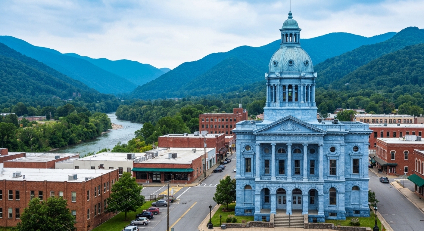
Locally famous for The blue-marble 1927 courthouse, the John C. Campbell Folk School, Harrah's Valley River Casino, and TVA lakes

What is it actually like to live in Murphy?

Living in Murphy means affordable, full-service mountain life in the far-western tip of North Carolina, closer to Atlanta, Chattanooga, and Knoxville than to Asheville, with real services, deep land inventory, and some of the lowest prices in the region. It is a working county seat that markets itself, honestly, as a value place to relocate or retire.

Murphy has what many small mountain towns lack: a hospital, a community college, county offices, a casino resort, and a genuine downtown anchored by a landmark blue-marble courthouse, all in a town you can comfortably afford full-time. It sits where the Hiwassee River and the Valley River meet, with TVA's Hiwassee and Apalachia Lakes nearby for boating and fishing. The culture leans practical and artsy at once: the historic square, the nationally known John C. Campbell Folk School just out in Brasstown, and the Harrah's Cherokee Valley River Casino for entertainment and jobs. The market matches the personality, a roughly $300,000 median sale with abundant, cheap land, and the headline that no other WNC town can claim: you can be in metro Atlanta in about two hours.

This guide is written for the buyer Murphy actually fits, the value-minded retiree, the relocation buyer from Georgia or Florida, and the land buyer: the affordable, land-rich market, the Atlanta proximity, the lakes-and-folk-art lifestyle, the flood and rural-property realities, and who Murphy suits.

Table of Contents

- What kind of town is Murphy? - What is the Murphy real estate market like? - What are the areas and communities around Murphy? - Why is Murphy known for marble, the Folk School, and the casino? - What outdoor recreation is around Murphy? - How far is Murphy from Atlanta, Asheville, and other places? - What internet and utilities can you get in Murphy? - How did Hurricane Helene affect Murphy? - What should buyers know about property here? - What are the property taxes in Murphy? - What are the schools and healthcare like? - How does Murphy compare to nearby towns? - Is Murphy right for you? - Frequently Asked Questions

What kind of town is Murphy?

Murphy is a real, working, year-round county seat, the full-service hub of Cherokee County and the westernmost town of any size in North Carolina. That far-western, full-service character is the key to understanding it.

The Murphy site along the Hiwassee was long part of Cherokee homelands, and the town carries hard history: in 1836 the U.S. Army built Fort Butler here as a main collection stockade for the forced Cherokee removal on the Trail of Tears, a fact the town acknowledges honestly. Murphy was named for the early North Carolina education reformer Archibald Murphey (a clerk's misspelling dropped the "e"), became the Cherokee County seat in 1851, and grew on marble and the railroad. Today it is a town of about 1,608 people serving a county of roughly 29,000, with a downtown built around the striking 1927 Cherokee County Courthouse, faced in locally quarried blue marble, one of only a few U.S. courthouses built from marble quarried in its own county.

Day to day, Murphy is practical and far-flung: people work, shop, and retire here year-round, the Georgia and Tennessee lines are minutes away, and the pace is deeply rural despite the full slate of services. It is the kind of place where you can have mountain life, a real hospital, and Atlanta in two hours, all at once.

See what is on the market in Murphy

See Homes for Sale in Murphy

What is the Murphy real estate market like?

Murphy is an affordable, deep, land-rich market, the largest and most active of the far-western towns. Homes sold for a median around $300,000 over the past year, with abundant inventory and cheap land.

Over the past year roughly 975 properties sold across the Murphy area (a large search radius that covers much of far-western NC), with homes at a median near $300,000, while days on market ran about 92 (as of June 2026). The active market is deep: of about 1,114 listings, roughly 504, about 45%, are raw land or lots, with land asking a median near $45,000, while homes ask a median list near $378,800. That combination, a $300K median sale and a deep, cheap land supply, makes Murphy a standout value market for retirees, relocation buyers, and anyone who wants to build or hold acreage. The roughly 92-day market gives buyers genuine selection and room to negotiate, especially on land, and the far-western location keeps prices well below central WNC.

Looking in Murphy? Homes under $300K or Land and acreage.

With this much inventory and so much land, knowing the lake areas and rural communities pays off. Start with current Murphy listings, and if you also want to weigh the Lake Chatuge market, compare Hayesville homes for sale about twenty minutes east.

What are the areas and communities around Murphy?

Murphy proper is small, so most of the market is the surrounding Cherokee County communities and the TVA lake areas. Here is a read on the main ones.

Area Direction Character Typical property Water
Downtown Murphy center Historic walkable core, town services Older in-town homes, cottages Town water/sewer
Hiwassee Lake areas W/NW Lakeside coves, second homes, cabins Lake-access and view homes, lots Mostly well/septic
Apalachia Lake areas W Remote lakeshore, forest-bordered Cabins, recreational lots Well/septic
Marble N (~10 mi) Former marble-quarry community, rural Rural homes, acreage Well/septic
Brasstown SE (~10-12 min) Folk School community, arts and small farms Cottages, small farms Well/septic
Peachtree E/NE Suburban-rural, near Tri-County College Subdivisions and homes on land Mix; verify

The pattern: downtown is the convenient, walkable choice on town water and sewer, the Hiwassee and Apalachia Lake areas are second-home and cabin country (mostly on wells), and the rural communities of Marble, Brasstown, and Peachtree mix farms, acreage, and homes. Murphy is a town-and-rural-and-lake market with deep land inventory rather than a town of gated golf communities. For land and acreage, browse land and lots around Murphy.

Why is Murphy known for marble, the Folk School, and the casino?

Because all three are real, visible parts of local life: a courthouse built of local blue marble, the oldest folk school in the country just outside town, and a tribal casino resort that anchors the entertainment economy. Together they give a small town an outsized cultural footprint.

The Cherokee County Courthouse (1927) is faced in blue-toned marble quarried in the nearby community of Marble, a genuine local landmark on the National Register. Out in Brasstown, about ten minutes from downtown, the John C. Campbell Folk School, founded in 1925, is the oldest folk school in the United States, offering year-round classes in craft, music, dance, blacksmithing, and woodworking, and its fall festival is a major regional draw. And Harrah's Cherokee Valley River Casino & Hotel, owned by the Eastern Band of Cherokee Indians just outside town, brought a 300-room hotel, gaming, and dining, plus hundreds of jobs. Downtown rounds it out with the restored 1901 L&N Depot, the Cherokee County Historical Museum, and a walkable square with spots like Valley River Brewery (confirm current hours, as small-town businesses turn over).

What outdoor recreation is around Murphy?

Murphy is built around water and forest, with two TVA lakes, two rivers, and the Nantahala National Forest at the doorstep, plus folk-art and scenic-byway draws. For boaters, anglers, and hikers, the access is excellent and affordable.

Hiwassee Lake, impounded by the 307-foot Hiwassee Dam (the highest overspill dam east of the Mississippi), offers about 6,000 acres and 180 miles of shoreline for boating and fishing, with Apalachia Lake just downstream for quieter paddling. The Hiwassee and Valley Rivers run right through and around town for fishing and paddling. The Cherohala Skyway, a National Scenic Byway climbing above 5,400 feet, is reachable to the north via Robbinsville, and Brasstown Bald, Georgia's highest point at 4,784 feet, sits a short drive south across the line. Add the John C. Campbell Folk School's gardens and nature trails, the quirky Fields of the Wood biblical park, area gem mining, and endless Nantahala National Forest trails and waterfalls, and a small town delivers a remarkable amount to do.

How far is Murphy from Atlanta, Asheville, and other places?

Murphy's signature fact is its location: it is the closest WNC town to metro Atlanta, about two hours, and it is actually closer to Atlanta, Chattanooga, and Knoxville than to Asheville. Mountain roads make some drives longer than the mileage suggests.

From Murphy to Distance Drive time
Andrews, NC ~13 mi ~20 min
Hayesville, NC ~18 mi ~25 min
Hiawassee, GA ~30 mi ~45 min
Blue Ridge, GA ~40 mi ~55 min
Robbinsville, NC ~35 mi ~50 min
Chattanooga, TN ~91 mi ~1 hr 45 min
Atlanta, GA (and ATL airport) ~118 mi ~2 hr (ATL ~2 hr 20 min)
Asheville, NC (and AVL airport) ~110 mi ~2 hr (AVL ~1 hr 50 min)
Knoxville, TN ~115 mi ~2 hr
Greenville-Spartanburg, SC (GSP) ~140 mi ~2 hr 45 min

(Distances and times as of June 2026, via mapping calculators; some are approximate.) That Atlanta-in-two-hours position is the practical foundation of Murphy's Georgia-buyer pipeline, close enough for a weekend mountain run, far enough to feel like the mountains. Note that for some specialty healthcare, Chattanooga and Atlanta are closer than Asheville.

What internet and utilities can you get in Murphy?

Internet in Murphy is solid in town with cable and growing fiber, and thinner up the coves and ridges where satellite fills the gap, so confirm service at the exact address before counting on it for remote work.

Provider Type Coverage in Murphy Top speed Notes (as of mid-2026)
Frontier DSL / fiber broad in the county up to multi-gig where fiber reaches the dominant wireline provider
Murphy Cable Cable in town high the in-town cable option
Blue Ridge Mountain EMC Fiber parts of the county up to ~1 Gbps electric co-op fiber, expanding
Starlink Satellite anywhere ~25-100 Mbps typical the realistic default for rural lake and ridge lots

(Coverage from broadband aggregators, mid-2026; treat as directional and re-check at the address.) In-town addresses generally have good cable and growing fiber, while lake and ridge parcels often rely on fixed wireless or satellite, so any remote-work buyer should verify the specific address. On utilities, in-town homes are typically on Murphy municipal water and sewer, while rural and lakeside properties are usually on private wells and septic, so budget for a well test and septic inspection on rural land. Cell coverage can drop in the coves.

How did Hurricane Helene affect Murphy?

Murphy and Cherokee County were largely spared the catastrophic flooding that devastated central and eastern Western North Carolina in Hurricane Helene (September 2024). The storm's track shifted east overnight, and far-western NC came through with comparatively light impacts.

In Cherokee County, Helene brought wind and rain but far less destruction than the Asheville, Spruce Pine, and Chimney Rock areas, with power outages uncommon though cell service was down for several days, and the county soon shifted from its own recovery to helping harder-hit areas. That comparative resilience is a genuine talking point for the far west versus central WNC. The lasting buyer lesson is still specific: the Hiwassee and Valley Rivers and the creek bottoms can flood, and TVA draws its lakes down seasonally, so any river-front, creek-bottom, or lakefront parcel deserves a careful flood-zone check (the FEMA Flood Map Service Center and the North Carolina flood maps are the tools), a look at flood-insurance cost, and attention to TVA shoreline and flowage easements on the lakes.

What should buyers know about property here?

Six things shape a smart Murphy purchase: the affordability-and-land advantage, lake-and-TVA realities, well-and-septic on rural parcels, fire-district taxes, the far-western distance to some services, and manufactured homes in the lower tiers. Most are easy to navigate with the right help.

First, the upside: deep, cheap inventory and a roughly 92-day market give buyers genuine room to choose and negotiate, which suits value-retiree, relocation, and land buyers well. Then the diligence items. On the lakes, understand TVA shoreline rules and flowage easements, seasonal drawdown that changes the waterline, and exactly what "lake access" conveys on a given parcel. Most rural and lakeside properties are on private wells and septic with shared private-road access, so budget for a well test, a septic inspection, and a recorded Road Maintenance Agreement, which lenders require. Outside town, a fire-district levy is added to the county rate, so confirm the parcel's district. In the lower price tiers, manufactured and mobile homes are common, so understand the home-versus-land value and the financing implications. And weigh the far-western distance: some specialty care means Chattanooga, Atlanta, or Asheville. In an affordable, land-rich market like Murphy, good guidance is what turns a deep menu into the right purchase.

What are the property taxes in Murphy?

Murphy sits in Cherokee County, where the property tax rate is $0.61 per $100 of assessed value for 2025-26, with the Town of Murphy adding its own rate inside city limits. A property outside town pays the county rate plus any fire district.

The Town of Murphy municipal rate is $0.42 per $100, so inside town limits the combined county-plus-town rate is about $1.03 per $100. A property outside town in a fire district pays the county rate plus a fire levy (roughly 3 to 10 cents per $100 depending on the district). On a $300,000 home, the in-town rate works out to roughly $3,090 a year, while the same home outside town on the county rate alone is closer to $1,830 plus the fire levy, so the town-versus-county distinction matters here. Confirm the exact figures and fire district by parcel.

On the state side, North Carolina is favorable for retirees: Social Security is not taxed, government and military pensions can be exempt under the Bailey settlement, and there is no estate tax. There is no special $35,000 senior exemption (that is a Georgia benefit, not North Carolina); other retirement income is taxed at the state's flat rate (3.99% in 2026). This is general information, not tax advice, so confirm the current town and fire-district figures with Cherokee County and the Town of Murphy, and your situation with a CPA.

What are the schools and healthcare like?

Murphy is served by Cherokee County Schools and by Erlanger Western Carolina Hospital, plus a community college in town. For a far-western town, the institutions are solid.

For schools, Cherokee County Schools runs the county's campuses, with Murphy High School and the Murphy elementary and middle schools serving the town (the district kept its three separate high schools after reversing a consolidation plan in 2023), and Tri-County Community College in the Peachtree area serves Cherokee, Clay, and Graham counties with transfer and career programs. For healthcare, Erlanger Western Carolina Hospital in Murphy (formerly Murphy Medical Center, part of Chattanooga's Erlanger system since 2018) is a 25-bed critical-access hospital with a 24-hour emergency department, and for higher-acuity care, Erlanger's main campus in Chattanooga is about an hour and forty-five minutes west while Mission Hospital in Asheville is about two hours east. Having a hospital, an ER, and a community college in a town this size is a meaningful advantage for retirees.

How does Murphy compare to nearby towns?

Murphy is the affordable, full-service hub of the far west, distinct from the smaller towns and lakes around it. Here is the honest head-to-head.

- Why buyers choose Murphy over Hayesville: Murphy is the larger town with more services, a hospital, and a community college, and a deeper overall market, while Hayesville (Clay County, about twenty minutes east) is smaller and centered on Lake Chatuge. Choose Murphy for services and a deep market; choose Hayesville for lake life on the Georgia line. - Why buyers choose Murphy over Robbinsville or Andrews: Murphy is far more built-up and service-rich than Robbinsville (remote Graham County, no hospital) or nearby Andrews (a smaller rail town). Choose Murphy for the full slate of town amenities; choose the smaller towns for more remoteness and lower prices. - Why buyers choose Murphy as a base: From Murphy you have TVA lakes, two rivers, the Folk School, a casino, a hospital, and a community college, plus the closest drive to Atlanta of any WNC town, all at prices well below central WNC. It is the practical value hub of far-western North Carolina.

Is Murphy right for you?

Murphy is a strong fit for a value-minded retiree, a Georgia or Florida relocation buyer, or a land buyer who wants affordable, full-service mountain living with real services, low home prices, lakes, and an easy Atlanta drive. If you want a full-time mountain home you can actually afford, with a hospital and a college in town and the lakes and the Folk School close by, Murphy delivers more for the money than almost anywhere in the region.

It is not the right fit for someone seeking a prestige resort address with golf clubs and a designer Main Street (that is Highlands or Cashiers), a high-elevation cool-summer retreat (Murphy is lower and milder), or quick access to a major medical center and airport (those are a real drive). And lake, well-and-septic, and rural-property diligence is part of buying here.

If affordable, far-western, full-service mountain living near Atlanta is what you are after, reach out and I will help you sort the lake areas and rural communities, check flood, TVA shoreline, and well-and-septic on rural parcels, and find the right home in this practical, welcoming town.

Frequently Asked Questions

Is Murphy, NC a good place to live? For a year-round, value-minded buyer, yes. Murphy is Cherokee County's affordable, full-service county seat at about 1,540 feet, with a hospital, a community college, a casino, a historic downtown, and TVA lakes nearby, and it is the closest WNC town to metro Atlanta at about two hours. It has a deep, land-rich housing market with a roughly $300,000 median sale and abundant cheap land. It fits primary-residence buyers, budget retirees, and Georgia or Florida relocation buyers far better than someone seeking a prestige resort address.

How much does it cost to buy a home in Murphy? It is affordable with lots of choice. Over the past year about 975 properties sold across the area, with homes at a median near $300,000, while the active market is large, around 1,114 listings, about 45% of them raw land or lots, with land asking a median near $45,000 and homes asking a median list near $378,800 (as of June 2026). The deep inventory gives buyers real room to negotiate, so ask me for a current, area-specific read before making an offer.

How far is Murphy from Atlanta? About 118 miles and roughly two hours, which makes Murphy the closest WNC town to metro Atlanta and the foundation of its strong Georgia-buyer market. Hartsfield-Jackson airport is about two hours and twenty minutes. Murphy is actually closer to Atlanta, Chattanooga (about an hour and forty-five minutes), and Knoxville (about two hours) than it is to Asheville, which is also about two hours east.

What are the property taxes in Murphy? Cherokee County's rate is $0.61 per $100 of assessed value for 2025-26, and the Town of Murphy adds $0.42, for about $1.03 combined inside city limits (roughly $3,090 a year on a $300,000 home). A property outside town pays the county rate plus a fire-district levy. North Carolina does not tax Social Security and has a flat income tax (3.99% in 2026); there is no $35,000 senior exemption (that is Georgia), though government and military pensions can be exempt under the Bailey settlement.

What is Murphy known for? Three things stand out: the blue-marble 1927 Cherokee County Courthouse (built of marble quarried in the nearby Marble community), the John C. Campbell Folk School in Brasstown (the oldest folk school in the country), and Harrah's Cherokee Valley River Casino. Add TVA's Hiwassee and Apalachia Lakes, the Hiwassee and Valley Rivers, and the Cherohala Skyway, and Murphy packs a lot of culture and recreation into an affordable far-western town.

Does Murphy have a hospital? Yes. Erlanger Western Carolina Hospital in Murphy (formerly Murphy Medical Center, now part of Chattanooga's Erlanger system) is a 25-bed critical-access hospital with a 24-hour emergency department, the only hospital in NC west of Bryson City and Franklin. For higher-acuity care, Erlanger's main campus in Chattanooga is about an hour and forty-five minutes away and Mission Hospital in Asheville about two hours, so weigh the distance to specialty care if that matters to you.

Did Murphy flood during Hurricane Helene? Far less than central and eastern WNC. Cherokee County was largely spared Helene's catastrophic 2024 flooding, with wind, rain, and a few days of cell outages but nothing like the Asheville-area damage, a genuine resilience point for the far west. Still, the Hiwassee and Valley Rivers and creek bottoms can flood, and TVA draws its lakes down seasonally, so check the FEMA flood maps and TVA shoreline rules on any river or lakefront parcel.

Is Murphy or Hayesville better? They fit different buyers. Murphy (Cherokee County) is the larger, full-service hub with a hospital, a community college, a casino, and a deeper market, while Hayesville (Clay County, about twenty minutes east) is smaller and built around Lake Chatuge with a strong retiree and Georgia second-home character. Choose Murphy for services and a deep, affordable market; choose Hayesville for lake life on the Georgia line. Many buyers tour both.

About the Author

Jon Tharp is a licensed NC real estate broker with Keller Williams. He's helped buyers and sellers across Western North Carolina for over 10 years, specializing in mountain homes, land, and short-term rental investments, with offices throughout WNC covering all mountainous areas. If something in this post has you thinking about a move, he's easy to reach — (828) 347-9055 or smokymountainhomes4sale.com or Jon@jontharphomes.com.

Ready to Find Your Mountain Home Near Murphy?

Whether you're looking to buy, considering a short-term rental investment, or ready to sell, the Jon Tharp Team brings deep local knowledge and marketing that puts your home in front of 50,000+ buyers in the first 30 days.

Search available homes across Western NC or call Jon directly at (828) 347-9055.

Talk to Jon

What Our Clients Say

43 five-star Google reviews  —  read them all on Google

★★★★★

"Jon is hands down the most dedicated and knowledgeable realtor that I have ever worked with. His expertise made the entire process of selling my home and finding a new one a smooth process."

Amy Davis  ·  2025

★★★★★

"Jon & his team are the greatest! Very professional, friendly like your neighbor, and always get back to your texts, phone calls & emails within minutes or same day, not days or weeks."

Cynthia Oelschlager  ·  2025

★★★★★

"I can’t say enough good things about Jon and his team. I was looking for investment properties and Jon spent time researching where would be a good place for an Airbnb — he found 2 beautiful properties."

Diane Cogswell  ·  2025

More from the Blog
The Waterfall on the NC Side of the Smokies That Most Tourists Never Find

The Waterfall on the NC Side of the Smokies That Most Tourists Never Find

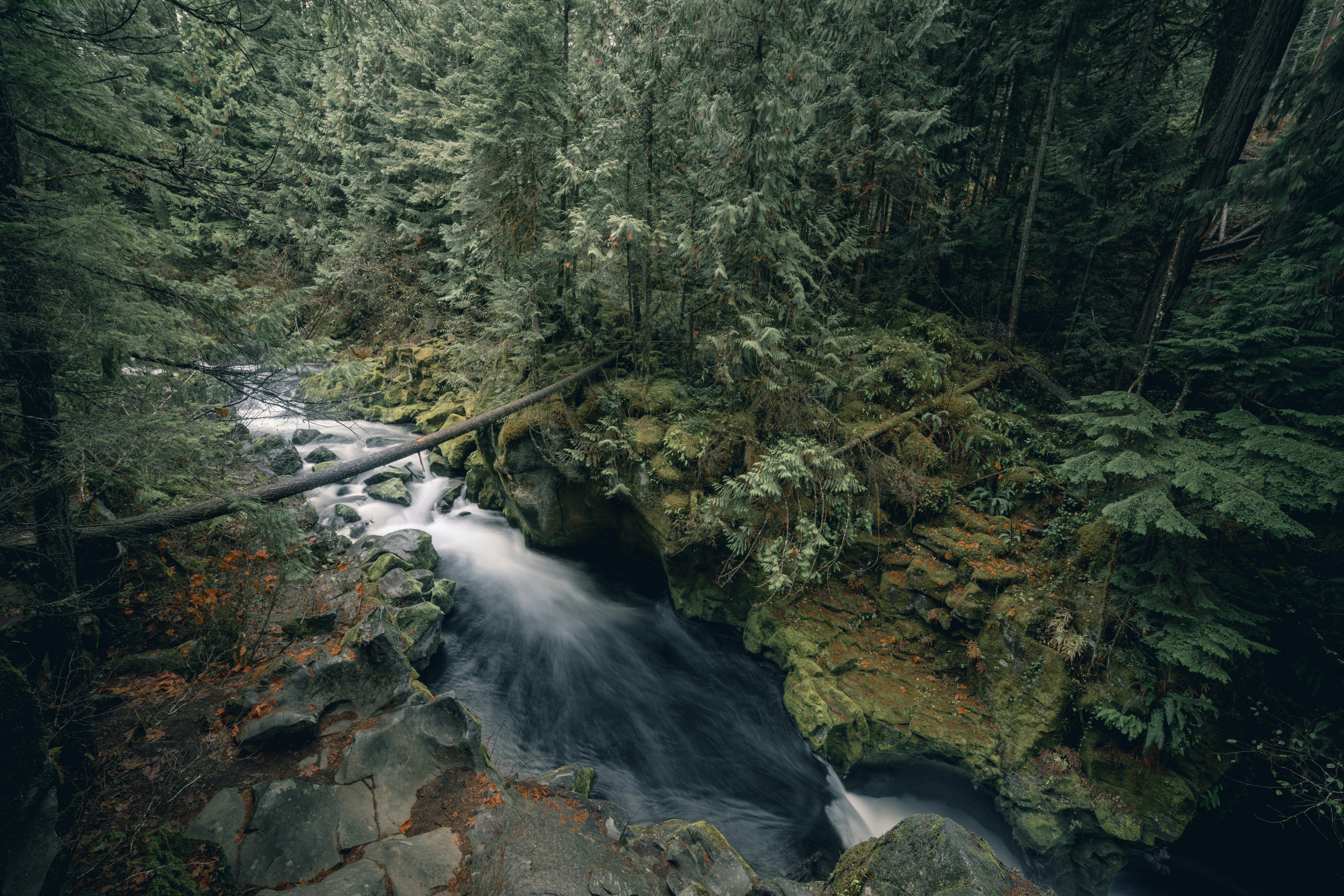
Mouse Creek Falls sits just over two miles up Big Creek Trail and sees a fraction of the foot traffic that Laurel Falls and Abrams Falls draw.

Read More →
Western NC Fishing Guides and Lodges Just Ranked Among the 10 Best in the Country

Western NC Fishing Guides and Lodges Just Ranked Among the 10 Best in the Country

The Tuckasegee, Nantahala, and Davidson rivers draw serious anglers from across the country — and the guides and lodges built around them just got national recognition.

Read More →
Franklin Is Redesigning Main Street and Wants Your Input Before It Happens

Franklin Is Redesigning Main Street and Wants Your Input Before It Happens

The Town of Franklin has two public meetings set for late May where residents can shape a major Main Street transformation plan.

Read More →

Posted in Community Guides
June 7, 2026

Living in Almond, NC: The Complete Guide (2026)

Living in Almond, NC: The Complete Guide (2026)

By Jon Tharp, Broker  ·  June 7, 2026

Quick Answer: Almond is a tiny, unincorporated Swain County community near the southwest end of Fontana Lake and the mouth of the Nantahala Gorge, about 15 to 20 minutes from Bryson City. This is not an everyday-housing market; it is a niche, higher-end lake-and-cabin market built around water and outdoor access, where about half of the active listings are raw land and homes carry a Fontana Lake and Nantahala premium. Most of the old town of Almond actually lies underwater, flooded when Fontana Dam created the lake in the 1940s. Buyers here are cabin owners, boaters, anglers, and whitewater lovers who want isolation and lake or river access over convenience, with Bryson City's restaurants and hospital a short drive northeast.

Almond at a Glance

What it is A tiny unincorporated Swain County community on Fontana Lake at the mouth of the Nantahala Gorge
Population Very small; no town government, mostly cabins, lots, and lake-access parcels
Market Niche and higher-end: ~half of active listings are land; homes list near $550,000 on a thin sample (as of June 2026)
History Most of the original town of Almond lies under Fontana Lake, flooded by Fontana Dam in the 1940s
Property tax Swain County $0.41 per $100; no municipal rate (unincorporated)
Drive to Bryson City / Nantahala Gorge ~15-20 min to Bryson City; ~5-10 min to the Nantahala Outdoor Center
Internet Thin; expect Starlink satellite at most lake and cabin lots
Locally famous for Fontana Lake, the Nantahala Gorge whitewater, Tsali mountain-bike trails, and the submerged-towns history

What is it actually like to live in Almond?

Living in Almond means trading town convenience for water and wilderness: a cabin or lake-access lot where you keep a boat on Fontana, raft the Nantahala in the afternoon, and watch the sun drop over the Smokies in deep mountain quiet. It is off-grid country, and that is exactly the point for the buyers it fits.

Almond is not a town, a subdivision, or an everyday-housing market. It is a rural Swain County place name near the southwest end of Fontana Lake and the mouth of the Nantahala Gorge, along the US-19/74 corridor. The everyday character is cabins, lots, lakefront and view parcels, a marina, and quick reach to whitewater and national forest. The history runs deep and literally underwater: most of the original town of Almond was flooded when Fontana Dam filled the lake in the 1940s, part of the same submerged-towns story that shapes this whole corner of the Smokies. The market matches the setting, a small, higher-end mix of cabins and raw land where half the buyers are building or banking a lot rather than buying turnkey.

This guide is written honestly for the buyer Almond actually fits, the second-home and cabin owner, the Fontana boater and angler, and the whitewater or mountain-bike lover who wants isolation and lake or river access: the niche market, the lifestyle, the lake-level and flood realities, the off-grid infrastructure, and who Almond suits.

Table of Contents

- What kind of place is Almond? - What is the Almond real estate market like? - What are the areas around Almond? - Why is most of old Almond underwater? - What outdoor recreation is around Almond? - How far is Almond from Bryson City and other towns? - What internet and utilities can you get in Almond? - How did Hurricane Helene affect the area? - What should buyers know about property here? - What are the property taxes in Almond? - What are the schools and healthcare like? - How does Almond compare to nearby places? - Is Almond right for you? - Frequently Asked Questions

What kind of place is Almond?

Almond is a tiny, unincorporated community in Swain County, clustered near the southwest end of Fontana Lake and the mouth of the Nantahala Gorge. It has no town government and no downtown; its identity is water, forest, and outdoor access.

The community took its name from Bud Almond, who provided the land, and its post office opened in 1886 on the old railroad line. The defining event in its history came in the 1940s, when the Tennessee Valley Authority built Fontana Dam and the rising reservoir submerged most of the original town, moving the post office, school, and depot. Today Almond is a scatter of cabins, lake-access parcels, and the Almond Boat & RV Park marina, set along the US-19/74 corridor where NC-28 splits off toward Stecoah and Fontana Dam. Who lives and buys here are second-home and cabin owners, Fontana boaters and anglers, whitewater and mountain-bike lovers, and a smaller number of full-time residents who want isolation and lake or river access over convenience.

Day to day, Almond is off-grid mountain quiet: expect satellite internet, spotty cell service, and a drive for groceries, medical care, and schools, in exchange for the lake, the gorge, and the national forest at your door. This is niche-buyer territory, and being honest about that is the kindest thing a guide can do.

See what is on the market in Almond

See Homes for Sale in Almond

What is the Almond real estate market like?

Almond is a small, higher-end, niche lake-and-cabin market, not a deep everyday-housing market, and it deserves an honest read. Homes list at a premium for the lake and gorge access, and about half of the active inventory is raw land.

The numbers are thin, so treat them as directional. Over the past year only about 10 properties sold in the wider Almond area, with homes (excluding land) at a median near $399,000, while days on market on those few sales ran about 48 (as of June 2026). The active market is small but telling: of about 66 listings, roughly 33, about half, are raw land or lots, with land asking a median near $136,000, while the single-family homes ask a median near $550,000. Those elevated prices reflect Fontana Lake and Nantahala Gorge cabin and view premiums on a small sample, not a broad, affordable housing supply. The high land share tells you what kind of market this is: many buyers here are building or banking a cabin lot, not buying turnkey, and inventory turns slowly given the niche buyer pool. Position your expectations accordingly and lean on local guidance, because in a thin market, a sharp read on any single property matters more than the medians.

Looking near Fontana Lake? Waterfront and lake-access or Land and acreage.

With a small, premium, land-heavy market, knowing the lake, the shoreline rules, and the access realities pays off. Start with current Almond listings, and compare the everyday-services hub of Bryson City just northeast.

What are the areas around Almond?

There are no incorporated neighborhoods in Almond, so its "areas" are informal: the roadside core, the lakeside cabin pockets along Fontana's arms, the Nantahala-side gorge corridor, and the marina vicinity. House counts are rough estimates, not platted subdivisions, and most parcels are cabins or lots.

Area Character Typical property Water
Almond core / US-19-74 corridor Roadside community near the NC-28 split; marina access Older homes, cabins, some lots Near lake/river, mostly not waterfront
Lakeside cabin areas (Fontana arms) Wooded, steep, private, boat-oriented Cabins, view homes, lake-access lots Lake-access or lakefront (TVA shoreline rules apply)
Nantahala-side (gorge) Along the river and gorge corridor River-influence cabins, smaller lots Nantahala River corridor
Almond Boat & RV Park vicinity Marina and RV hub, rentals RV sites, rentals, nearby cabins Lake Fontana

The practical way to picture Almond is by water access: roadside parcels near the marina, steep wooded cabin lots on the Fontana arms, and river-influenced lots along the Nantahala. Lakefront and lake-access parcels come with TVA shoreline rules that govern docks and structures, so access and permitting matter as much as the house itself. Because there are no confirmed large subdivisions here, the right move is to evaluate specific parcels for their water access, shoreline rights, road access, and utilities. For land, browse land and lots around Almond.

Why is most of old Almond underwater?

Because the Tennessee Valley Authority built Fontana Dam during World War II, and the reservoir it created flooded the original town. The submerged-towns story is the emotional spine of this whole area, and it explains the landscape buyers see today.

Fontana Dam, at 480 feet the tallest dam in the eastern United States, began construction in 1942 just weeks after Pearl Harbor, and water started filling the reservoir in 1944. When Fontana Lake rose, most of Almond went under, and its post office, school, and depot were moved. Almond was one of a string of communities erased or displaced by the lake, alongside Bushnell, Forney, Judson, Proctor, and others, and across the whole project more than 1,300 families were displaced, Swain County lost roughly a quarter of its population, and dozens of cemeteries were relocated. That history is why so much of the shoreline backs up to the road-less North Shore of Great Smoky Mountains National Park, reachable today only by boat, and why this area carries the same "road to nowhere" weight that draws visitors to nearby Bryson City. For buyers, it is part of the place's character, an entire community, railroad, and farms lying beneath the water you boat on.

What outdoor recreation is around Almond?

Outdoor recreation is Almond's entire identity, with Fontana Lake, the Nantahala Gorge whitewater, and the Tsali bike trails all at the doorstep. For boaters, anglers, paddlers, and bikers, few places pack this much access into one spot.

Fontana Lake offers boating, fishing, and paddling, and the Almond Boat & RV Park marina provides pontoon and boat rentals, kayak and paddleboard rentals, boat storage, bait, fishing licenses, and cabin and RV rentals. Minutes away on US-19/74, the Nantahala Outdoor Center runs the classic Class II-III dam-released whitewater rafting trip on the Nantahala River, plus ziplining and riverside dining, drawing more than a million guests a year. The Tsali Recreation Area in the Nantahala National Forest, just across the lake, is nationally ranked for mountain biking, with about 40 miles of singletrack across four loops plus a lakeside campground. The Appalachian Trail crosses Fontana Dam to the west, the remote North Shore of the national park is reachable by boat, and the dam-controlled Nantahala and Fontana arms are regional trout draws. If your life centers on water and trails, Almond puts all of it within minutes.

How far is Almond from Bryson City and other towns?

Almond is remote by design: minutes from the Nantahala Gorge and Bryson City, but a real drive from larger towns and airports. Mountain and gorge roads make some trips slower than the mileage suggests.

From Almond to Distance Drive time
Nantahala Outdoor Center / Gorge ~3-6 mi ~5-10 min
Bryson City, NC ~10 mi ~15-20 min
Cherokee, NC ~20 mi ~30 min
Fontana Dam (via NC-28) ~25 mi ~35-45 min
Sylva, NC ~26 mi ~35-40 min
Robbinsville, NC ~28 mi ~40-50 min
Waynesville, NC ~45 mi ~50-60 min
Asheville, NC (and AVL airport) ~75 mi ~1 hr 30 min
Greenville-Spartanburg, SC (GSP) ~120 mi ~2 hr 30 min
Atlanta, GA ~175 mi ~3 hr 30 min

(Distances and times as of June 2026, via mapping calculators; some are approximate.) The trade is clear: you are five to ten minutes from world-class whitewater and fifteen to twenty from Bryson City's restaurants and hospital, but groceries, advanced healthcare, and the airport are a genuine drive. For the buyers Almond fits, that isolation is a feature, not a flaw.

What internet and utilities can you get in Almond?

Internet in Almond is rural and thin, and satellite is the realistic default at most lake and cabin lots, so never assume wired service, check the exact address before counting on it for remote work.

Provider Type Coverage in Almond Top speed Notes (as of mid-2026)
Frontier DSL roughly half the area, patchy up to ~115 Mbps where available address-specific and inconsistent
Starlink Satellite anywhere with sky view ~25-100 Mbps typical the practical choice for most cabin and lake lots
Viasat Satellite broad ~100 Mbps legacy satellite backup
Spectrum Cable parts of the broader county high unlikely to reach remote lake and gorge lots

(Coverage from broadband aggregators, mid-2026; treat as directional and re-check at the address.) Do not assume wired internet here; check the exact parcel on the FCC National Broadband Map and expect Starlink as the most reliable option for most cabin and lakefront lots, with cell coverage also spotty in the gorge and on the lake. On utilities, Almond is unincorporated, so most properties are on private wells and septic, with no municipal water or sewer, so budget for a well test and septic inspection, and confirm lake access and any TVA shoreline permitting on waterfront parcels.

How did Hurricane Helene affect the area?

The Almond, Nantahala, and Bryson City area fared comparatively well in Hurricane Helene (September 2024) versus the catastrophic damage to the east, with main routes staying open and the outdoor economy reopening quickly. Lake-level dynamics, not storm damage, are the bigger ongoing waterfront consideration here.

Reporting noted that Swain County, Bryson City, and the railroad avoided significant impacts, and the Nantahala Outdoor Center came through without damage and reopened for rafting, while US-74, the main route in, stayed open both directions. Several dozen households across Swain County were displaced by flooding along the rivers, and the Tuckasegee at Bryson City peaked near 14.9 feet, but this corner avoided the scale of destruction seen farther east. For waterfront buyers, the more constant factor is that TVA controls Fontana's lake levels, which swing seasonally and can leave docks high and dry during winter drawdown, so confirm lake access and dock realities before buying. As always, check any river-corridor or cove parcel against the FEMA Flood Map Service Center and the North Carolina flood maps, and confirm TVA shoreline permitting for any dock or shoreline structure.

What should buyers know about property here?

Six things shape a smart Almond purchase: the niche, thin market, lake access and TVA shoreline rules, seasonal lake-level swings, well-and-septic and private-road realities, off-grid internet, and the build-versus-buy question. None are dealbreakers for the right buyer, but all deserve diligence.

First, set expectations: this is a small, premium, slow-moving market, so a single property's value and access matter far more than any median, and patient, well-advised buyers do best. On waterfront, confirm exactly what "lake access" means for the parcel, deeded access, a path, a dock permit, and understand that TVA shoreline and Section 26a permitting govern docks and structures, while seasonal drawdown can change the water line dramatically. Most parcels are on private wells and septic with shared private-road access, so budget for a well test, a septic inspection, and a recorded Road Maintenance Agreement, which lenders require. Plan for satellite internet and spotty cell at most lots. And because half the market is land, decide up front whether you are buying a turnkey cabin or a lot to build on, since building here means reckoning with slope, access, and utility reach. In a market this specialized, local guidance on access and shoreline rights is what protects your purchase.

What are the property taxes in Almond?

Almond sits in Swain County, which taxes property at $0.41 per $100 of assessed value for 2025-26, with no municipal rate because the community is unincorporated. A rural parcel may carry a county fire-district levy on top of the base rate.

On a $400,000 cabin, the Swain County rate works out to roughly $1,640 a year, moderate by mountain standards, with a possible fire-district add-on depending on the parcel, so confirm the exact figure and any special-district levy by address with the Swain County Tax Office. There is no town tax to add, which keeps the all-in rate simple.

On the state side, North Carolina is favorable for retirees: Social Security is not taxed, government and military pensions can be exempt under the Bailey settlement, and there is no estate tax. There is no special $35,000 senior exemption (that is a Georgia benefit, not North Carolina); other retirement income is taxed at the state's flat rate (3.99% in 2026). This is general information, not tax advice, so confirm the current county and fire-district figures with Swain County, and your situation with a CPA.

What are the schools and healthcare like?

Almond is served by Swain County Schools, and its healthcare is the rural reality of this corner: basic and emergency care about fifteen to twenty minutes away in Bryson City, with deeper care farther out.

For schools, Almond is in Swain County Schools, with the county's two consolidated elementaries (Swain East and Swain West, both near Bryson City) feeding Swain County Middle and High School; given Almond's location on Highway 19 West, the West Elementary assignment is the likely one, but confirm it by address with the district, and note that bus rides from this rural corner are long. For healthcare, Swain Community Hospital in Bryson City (a critical-access hospital with a 24/7 ER) is about fifteen to twenty minutes northeast, the larger Harris Regional Hospital in Sylva offers more depth, and Mission Hospital in Asheville is the tertiary referral center about an hour and a half away. Rural distance to care is a genuine factor to weigh, especially for retirees.

How does Almond compare to nearby places?

Almond is the quiet lake-and-gorge fringe, distinct from the everyday-services towns nearby. Here is the honest read.

- Why buyers choose Almond over Bryson City: Almond trades town convenience for water and isolation, a boat slip on Fontana, whitewater minutes away, and no neighbors, while Bryson City about fifteen to twenty minutes northeast gives you a walkable downtown, restaurants, and a hospital. Choose Almond for the lake and the quiet; choose Bryson City for services and town life. - Why buyers choose Almond for the lake: If Fontana Lake and the Nantahala Gorge are the whole reason you are moving, Almond puts you right at the marina and the whitewater, with the road-less North Shore of the national park across the water. It is purpose-built for boaters, anglers, and paddlers. - Why buyers choose Almond as a cabin base: From Almond you are minutes from Tsali biking, the Nantahala Outdoor Center, and Fontana Lake, and within reach of Bryson City and Cherokee, making it a strong second-home and cabin base for an outdoor-centered life, as long as you accept the off-grid trade-offs.

Is Almond right for you?

Almond is a strong fit for a second-home or cabin buyer, a Fontana boater or angler, or a whitewater and mountain-bike lover who wants isolation and lake or river access and is comfortable with off-grid realities. If your ideal is a cabin with a boat on Fontana, whitewater five minutes away, and deep mountain quiet, Almond delivers a lifestyle that very few places can, and the submerged-towns history gives it a character all its own.

It is not the right fit for someone who wants town convenience, walkability, or reliable wired internet (Bryson City or Sylva fit better), an affordable everyday-housing market (Almond is small, premium, and land-heavy), or quick access to shopping and advanced healthcare. And lake-access, TVA shoreline, well-and-septic, and flood diligence are all part of buying here.

If a quiet Fontana Lake and Nantahala cabin life is what you are after, reach out and I will help you sort lake access and shoreline rights, weigh the cabin-versus-land options, check well-and-septic and flood realities, and find the right place in this special little corner of the Smokies.

Frequently Asked Questions

Is Almond, NC a good place to live? For an outdoor-centered, off-grid-comfortable buyer, yes. Almond is a tiny Fontana Lake and Nantahala Gorge community in Swain County, minutes from world-class whitewater and Tsali mountain biking, with a marina on the lake and Bryson City's restaurants and hospital fifteen to twenty minutes away. It is a niche, higher-end lake-and-cabin market, not an everyday-housing market, so it fits second-home owners, boaters, anglers, and quiet-seeking retirees far better than someone wanting town convenience.

How much does it cost to buy a home in Almond? It is a small, premium market, so treat the numbers as directional. Over the past year only about 10 properties sold, with homes at a median near $399,000, while the active market of about 66 listings is roughly half raw land, with land asking a median near $136,000 and homes asking a median near $550,000 (as of June 2026), reflecting Fontana Lake and gorge premiums. Because the market is thin, ask me for a property-specific read before making an offer.

Why is most of Almond underwater? Because the Tennessee Valley Authority built Fontana Dam during World War II, and the reservoir that formed Fontana Lake flooded the original town in the 1940s, moving its post office, school, and depot. Almond was one of several communities erased or displaced by the lake, and more than 1,300 families across the project were relocated. That submerged-towns history is part of the area's character, and it is why so much of the shoreline backs up to the road-less North Shore of the national park.

What are the property taxes in Almond? Almond is in Swain County, taxed at $0.41 per $100 of assessed value for 2025-26, with no municipal rate because it is unincorporated, though a rural parcel may carry a county fire-district levy. On a $400,000 cabin, the county rate is roughly $1,640 a year. North Carolina does not tax Social Security and has a flat income tax (3.99% in 2026); there is no $35,000 senior exemption (that is Georgia), though government and military pensions can be exempt under the Bailey settlement. Confirm the exact figure and any fire-district levy by address.

What internet can you get in Almond? Plan on satellite. Almond is rural, with patchy Frontier DSL reaching maybe half the area and cable unlikely at remote lake and gorge lots, so Starlink is the practical default for most cabins and lakefront parcels. Cell service is also spotty in the gorge and on the lake. Never assume wired internet here, check the exact address on the FCC National Broadband Map before buying, especially if you need to work from home.

What should I know about buying waterfront on Fontana Lake? Two big things: lake access and lake levels. Confirm exactly what "lake access" means for the parcel (deeded access, a path, or a dock permit), and understand that TVA controls Fontana's water level, which drops in winter drawdown and can leave docks high and dry. Any dock or shoreline structure needs TVA shoreline and Section 26a permitting. Check the parcel against the FEMA flood maps too. A local agent who knows Fontana's shoreline rules is worth a lot here.

How far is Almond from Bryson City? About 10 miles and 15 to 20 minutes northeast along US-19/74. Bryson City is where you find restaurants, groceries, and Swain Community Hospital, while the Nantahala Outdoor Center and the gorge whitewater are just 5 to 10 minutes the other direction. Cherokee is about 30 minutes northeast, Sylva about 35 to 40 minutes, and Asheville about an hour and a half.

Is Almond a good place for a vacation cabin or rental? It can be, for the right owner. Almond's whole draw is Fontana Lake, the Nantahala whitewater, and Tsali biking, which makes it appealing for an outdoor-focused second home or cabin, and about half the market is land for those who want to build. Just go in clear-eyed about the off-grid realities, satellite internet, spotty cell, well and septic, seasonal lake levels, and long drives to services, and check short-term-rental rules and access carefully before you buy.

About the Author

Jon Tharp is a licensed NC real estate broker with Keller Williams. He's helped buyers and sellers across Western North Carolina for over 10 years, specializing in mountain homes, land, and short-term rental investments, with offices throughout WNC covering all mountainous areas. If something in this post has you thinking about a move, he's easy to reach — (828) 347-9055 or smokymountainhomes4sale.com or Jon@jontharphomes.com.

Ready to Make Western NC Your Home Base?

Whether you're looking to buy, considering a short-term rental investment, or ready to sell, the Jon Tharp Team brings deep local knowledge and marketing that puts your home in front of 50,000+ buyers in the first 30 days.

Search available homes across Western NC or call Jon directly at (828) 347-9055.

Talk to Jon

What Our Clients Say

43 five-star Google reviews  —  read them all on Google

★★★★★

"Jon is hands down the most dedicated and knowledgeable realtor that I have ever worked with. His expertise made the entire process of selling my home and finding a new one a smooth process."

Amy Davis  ·  2025

★★★★★

"Jon & his team are the greatest! Very professional, friendly like your neighbor, and always get back to your texts, phone calls & emails within minutes or same day, not days or weeks."

Cynthia Oelschlager  ·  2025

★★★★★

"I can’t say enough good things about Jon and his team. I was looking for investment properties and Jon spent time researching where would be a good place for an Airbnb — he found 2 beautiful properties."

Diane Cogswell  ·  2025

More from the Blog
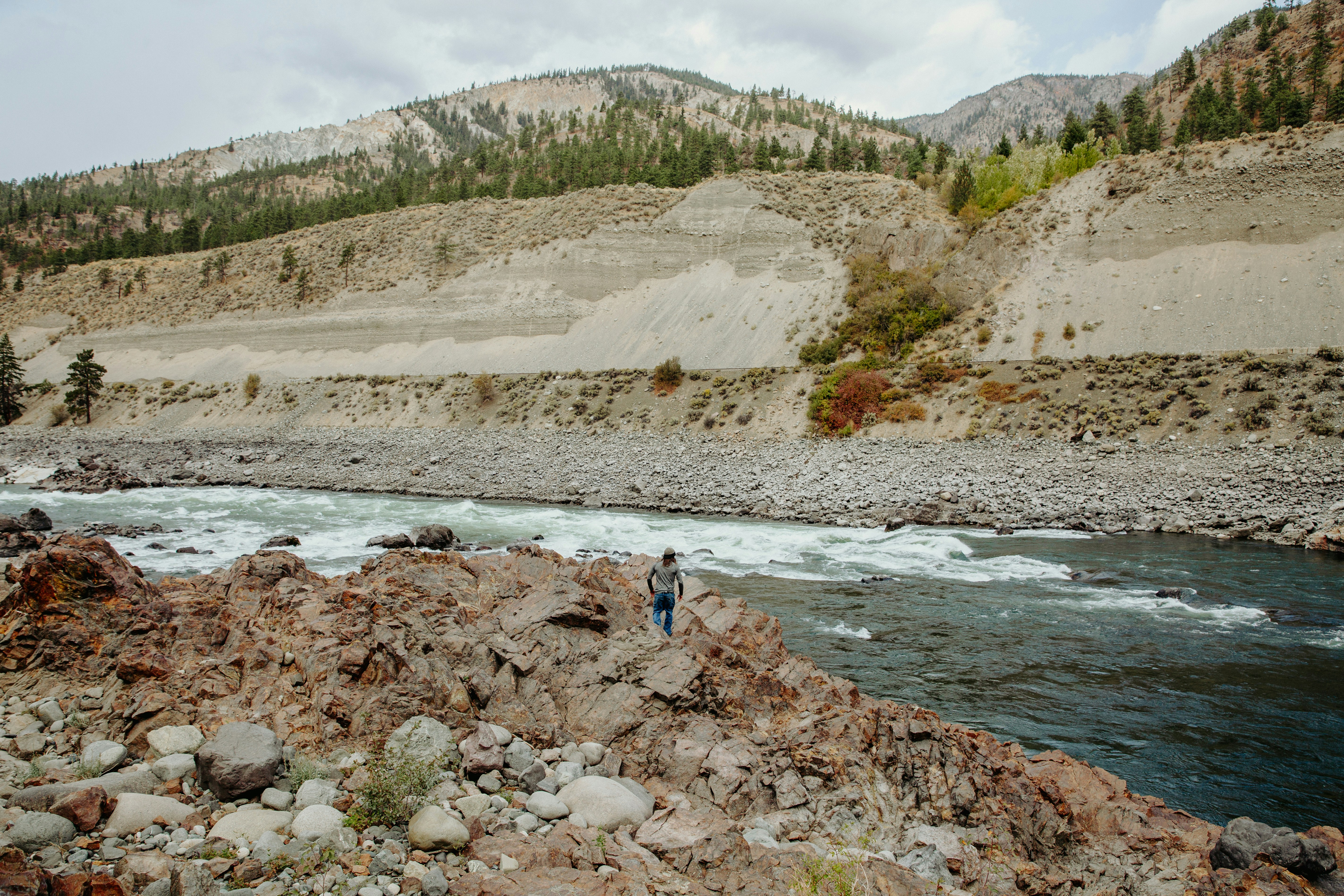
The Waterfall on the NC Side of the Smokies That Most Tourists Never Find

The Waterfall on the NC Side of the Smokies That Most Tourists Never Find

Mouse Creek Falls sits just over two miles up Big Creek Trail and sees a fraction of the foot traffic that Laurel Falls and Abrams Falls draw.

Read More →
Western NC Fishing Guides and Lodges Just Ranked Among the 10 Best in the Country

Western NC Fishing Guides and Lodges Just Ranked Among the 10 Best in the Country

The Tuckasegee, Nantahala, and Davidson rivers draw serious anglers from across the country — and the guides and lodges built around them just got national recognition.

Read More →
Franklin Is Redesigning Main Street and Wants Your Input Before It Happens

Franklin Is Redesigning Main Street and Wants Your Input Before It Happens

The Town of Franklin has two public meetings set for late May where residents can shape a major Main Street transformation plan.

Read More →

Posted in Community Guides
June 7, 2026

Living in Whittier, NC: The Complete Guide (2026)

Living in Whittier, NC: The Complete Guide (2026)

By Jon Tharp, Broker  ·  June 7, 2026

Quick Answer: Whittier is a rural, unincorporated community along the Tuckasegee River that straddles the Swain/Jackson county line, sitting about 15 minutes from Bryson City, Sylva, and Cherokee all at once. It is the affordable, in-between-the-hubs value market of this stretch of Western North Carolina: homes sold for a median around $275,500 over the past year, and nearly half of the active inventory is raw land, which makes it a favorite for build-your-own and land-banking buyers. The single most important thing to know is that a Whittier address can fall in either Swain or Jackson County depending on the exact parcel, and that changes your schools and your property tax rate, so you verify by address, not by ZIP.

Whittier at a Glance

Population About 5,800 in the 28789 ZIP area (the historic core CDP is tiny); rural and residential
Elevation ~1,926 feet, a mild low-valley setting on the Tuckasegee River
Median home price ~$275,500 sold over the past year; active homes list near $395,000, land near $56,100 (as of June 2026)
Land market Nearly half of active listings are raw land or lots, a deep build-or-bank market
Time on market Roughly 123 days, a patient, buyer-friendly market
County-line split A Whittier address can be in Swain ($0.41/$100) OR Jackson ($0.31/$100); verify by parcel
Drive to Bryson City / Sylva / Cherokee ~15 min to each
Locally famous for Being equidistant from three hubs, the Tuckasegee River, and Sequoyah National Golf Club

What is it actually like to live in Whittier?

Living in Whittier means owning affordable, often land-rich property in a quiet river valley that puts three towns, Bryson City, Sylva, and Cherokee, each about fifteen minutes away. It is rural and central at the same time, and that combination is its whole appeal.

Whittier is not a town with its own government; it is a rural, unincorporated community spread across the 28789 area along the Tuckasegee River, with the US-74 Great Smoky Mountains Expressway as its spine. You trade in-town prices and walkability for space, land, and a central location: a sold-home median around $275,500 undercuts Bryson City and Sylva proper, and nearly half the market is lots and acreage. The one thing that defines living here is the Swain/Jackson county line, which runs through the community. Which side of it your parcel sits on determines your schools, your county tax rate, and your county services, so it is the first thing a smart buyer checks. Get that right, and Whittier is one of the best values in the region.

This guide is written for the buyer Whittier actually fits, the value-minded retiree, the second-home or land buyer, and anyone who wants to build: the affordable, land-heavy market, the all-important county-line split, the river-and-trout lifestyle, the flood and rural-property realities, and who Whittier suits.

Table of Contents

- What kind of place is Whittier? - What is the Whittier real estate market like? - What are the areas around Whittier? - Why does the Swain/Jackson county line matter so much? - What outdoor recreation is around Whittier? - How far is Whittier from Bryson City, Sylva, and Cherokee? - What internet and utilities can you get in Whittier? - How did Hurricane Helene affect Whittier? - What should buyers know about property here? - What are the property taxes in Whittier? - What are the schools and healthcare like? - How does Whittier compare to nearby towns? - Is Whittier right for you? - Frequently Asked Questions

What kind of place is Whittier?

Whittier is a rural, unincorporated community straddling the Swain and Jackson county line, set in the Tuckasegee River valley between Bryson City, Sylva, and Cherokee. It is residential, spread out, and defined by land and location rather than a downtown.

The community was founded in 1881 by Dr. Clarke Whittier, who bought roughly 60,000 acres across the two counties along the river, and it was named in honor of his relative, the Quaker poet John Greenleaf Whittier. It grew as a timber-and-railroad town after the Murphy Branch rail line arrived in the early 1890s, was an incorporated town from 1887 to 1933, and lost its charter during the Great Depression, so it is unincorporated today. Just to the west along the Tuckasegee sits Kituwah, the Cherokee Mother Town, repurchased by the Eastern Band of Cherokee Indians in 1996, and the Qualla Boundary begins just north. What you get living here is a quiet rural area at the center of everything, with longtime mountain families, tribal members near the Boundary, and a growing share of retirees and second-home owners.

Day to day, Whittier is land, river, and proximity. There is no walkable Main Street; instead there is space, lower prices than the surrounding towns, and a fifteen-minute drive to whichever hub you need that day.

See what is on the market in Whittier

See Homes for Sale in Whittier

What is the Whittier real estate market like?

Whittier is an affordable, land-heavy, patient market, the value option between three towns. Homes sold for a median around $275,500 over the past year, and nearly half of what is for sale is raw land and lots.

Over the past year roughly 114 properties sold in the Whittier area, with homes (excluding land) at a median near $275,500 and land at a median around $90,000, while days on market ran about 123 (as of June 2026). The active market is large and land-rich: of about 207 listings, roughly 97, about 47%, are raw land or lots, with land asking a median near $56,100, while the single-family homes ask a median near $395,000. That deep land share is the headline; Whittier is a primary target for buyers who want to build a mountain home or bank acreage, minutes from Bryson City, Sylva, and Cherokee. The longer days on market reflect the rural, land-heavy mix, so price and patience both matter here, and patient buyers have room to negotiate.

Looking in Whittier? Homes under $300K or Land and acreage.

With nearly half the market in land and parcels spread across two counties, knowing the areas and, above all, the county line pays off. Start with current Whittier listings, and compare the nearby hubs of Bryson City and Sylva to see the price difference for being in town.

What are the areas around Whittier?

Whittier is genuinely rural, so its "areas" are really the Swain side, the Jackson side, and a handful of named creek valleys, not platted subdivisions. Here is a read on how the community breaks down.

Area Direction Character Typical property County
Whittier core / Main St center Historic hamlet, the post office, older homes Established homes, small lots line runs near here
Conleys Creek north/northwest Creek-valley rural; flooded in Helene Homes and land, creek frontage Swain
Barkers Creek east toward Dillsboro Rural, Tuckasegee frontage along US-74 Homes and land Jackson
Swain side (28789) north/west Rural residential, closer to Bryson City and the Boundary Homes and a heavy land share Swain
Jackson side (28789) south/east Rural residential, closer to Dillsboro and Sylva Homes and a heavy land share Jackson

The honest way to picture Whittier is as the Swain side versus the Jackson side, plus the creek drainages like Conleys Creek and Barkers Creek. Most parcels outside the small historic core are on private wells and septic, and the land share is high throughout. Because precise house counts by area are not reliably published and the county line weaves through, the practical move is to look at specific parcels and confirm their county, water source, and access. For land and acreage, browse land and lots around Whittier.

Why does the Swain/Jackson county line matter so much?

Because the line runs right through Whittier, and which side your parcel is on changes your schools, your property tax rate, and your county services. Two homes a few hundred yards apart can be in different counties. This is the single most important fact for a Whittier buyer.

On the Swain County side, children attend Swain County Schools (the Whittier area has historically fed Swain East Elementary, on to Swain County Middle and High in Bryson City), and the county property tax rate is $0.41 per $100. On the Jackson County side, children attend Jackson County Public Schools (Smokey Mountain Elementary is the Whittier-area school), and the county rate is $0.31 per $100. That tax spread is real: on a $300,000 home the county levy is roughly $1,230 in Swain versus about $930 in Jackson. So before you fall in love with a Whittier property, confirm its county by the parcel, and if schools matter to your family, confirm the assigned schools by the street address with the county school office. This is exactly the kind of local detail a good agent checks for you up front.

What outdoor recreation is around Whittier?

Whittier sits in the middle of some of the best river, trout, and golf access in the mountains, with the Tuckasegee at its center and the national park, Fontana Lake, and a championship golf course all close by.

The Tuckasegee River is the centerpiece, with fishing, tubing, and paddling, and Jackson County brands itself the NC Trout Capital; the river's famous Delayed Harvest section just east toward Sylva and Webster is stocked with close to 50,000 fish a year, and the WNC Fly Fishing Trail strings 15 areas across 20 streams nearby. A genuine Whittier-address amenity is Sequoyah National Golf Club, a tribally owned (Eastern Band of Cherokee Indians) Robert Trent Jones II championship course on Cahons Road that is open to public play, one of the most scenic rounds in the region. Beyond that, the Deep Creek area near Bryson City (tubing, waterfalls, and hiking) is a short drive west, the Cherokee park entrance and Great Smoky Mountains National Park are just north, and Fontana Lake is reachable to the west for boating and fishing. For an affordable rural community, the outdoor menu is hard to beat.

How far is Whittier from Bryson City, Sylva, and Cherokee?

Whittier's defining feature is that it sits roughly fifteen minutes from three different hubs, with the regional airports a bit over an hour away. Mountain roads make some drives longer than the mileage suggests.

From Whittier to Distance Drive time
Bryson City, NC ~10 mi ~15 min W
Cherokee / Qualla Boundary ~10 mi ~15 min N
Dillsboro, NC ~8 mi ~10-15 min E
Sylva, NC (Harris Regional Hospital) ~10 mi ~15 min E
Cullowhee / WCU ~16 mi ~25-30 min SE
Waynesville, NC ~28 mi ~35-40 min E
Asheville, NC (and AVL airport) ~58 mi ~1 hr 15 min E
Greenville-Spartanburg, SC (GSP) ~105 mi ~2 hr SE
Atlanta, GA ~160 mi ~3 hr S
Charlotte, NC ~160 mi ~3 hr E

(Distances and times as of June 2026, via mapping calculators; some are approximate.) The central position is the selling point: you can have Bryson City's national-park gateway, Sylva's downtown and hospital, and Cherokee's casino and culture all within about fifteen minutes, while paying rural prices to live between them.

What internet and utilities can you get in Whittier?

Internet in Whittier varies dramatically by exact address, with DSL the broadest option, limited cable, and satellite filling the rural gaps, so confirm service at the specific parcel before counting on it for remote work.

Provider Type Coverage in Whittier Top speed Notes (as of mid-2026)
Frontier DSL broad (~88% of homes) ~10-115 Mbps by address the main wired option for most parcels
Spectrum Cable limited (~6% of homes) up to ~1,000 Mbps where available great where it reaches, but it does not reach far
Fixed wireless Wireless parts of the area varies line-of-sight dependent
Starlink Satellite anywhere ~25-100 Mbps typical the rural go-to where wired service is thin

(Coverage from broadband aggregators, mid-2026; treat as directional and re-check at the address.) Whittier coverage changes street by street, a parcel a mile from a neighbor may have cable while the neighbor has only DSL or Starlink, so any remote-work buyer should check the specific address with each provider before closing. On utilities, the small historic core has some public water, but most rural parcels are on private wells and septic, so budget for a well test and septic inspection on rural land. Cell coverage can drop in the coves.

How did Hurricane Helene affect Whittier?

Whittier and the surrounding Swain and Jackson counties fared comparatively well in Hurricane Helene (September 2024) versus the catastrophic damage to the east, with the worst local impacts along the rivers and creeks. Lower elevation helped.

Helene flooded parts of the Tuckasegee corridor, and locally Conleys Creek in Whittier was among the roads made impassable by standing water, with nearby Hyatt Creek Road and a stretch of Highway 19 also affected and several dozen households along Swain County rivers displaced. Just east, Dillsboro saw historic flooding on Front Street. But the broader area avoided the scale of destruction seen in Buncombe and the harder-hit counties, and main roads reopened relatively quickly. The lasting buyer lesson is specific: river and creek frontage in Whittier is beautiful, but low-lying parcels along the Tuckasegee, Conleys Creek, and Hyatt Creek can flood, so any waterfront lot deserves a careful flood-zone check (the FEMA Flood Map Service Center and the North Carolina flood maps are the tools) and a look at flood-insurance cost, while homes up off the water are a different profile.

What should buyers know about property here?

Six things shape a smart Whittier purchase: the county-line split, the land-and-affordability advantage, flood risk on the rivers, well-and-septic on rural parcels, private-road access, and the patient pace. Most are easy to navigate with the right help.

First and most important, confirm the county. The Swain/Jackson line changes schools, taxes, and services by parcel, so never assume from the ZIP, verify the county and the assigned schools by the exact address. Then the upside: deep land inventory and a roughly 123-day market give buyers genuine room to choose and negotiate, which suits value-retiree, build-it, and land-banking buyers well. Then the diligence items: river and creek parcels carry real flood exposure (see Helene above), so pull the flood map on any waterfront lot; most rural properties are on private wells and septic, so budget for a well test, a septic inspection, and a recorded Road Maintenance Agreement on shared private roads, which lenders require; and on steep or wooded land, check slope, driveway grade, buildability, and utility reach before you commit. In a land-heavy, two-county market like Whittier, good guidance, starting with which county you are actually in, is what turns choice into the right choice.

What are the property taxes in Whittier?

It depends on your county. A Whittier home is taxed by either Swain County at $0.41 per $100 of assessed value or Jackson County at $0.31 per $100 (both for 2025-26), depending on which side of the line the parcel sits, and rural parcels may carry a fire-district levy on top of the county rate.

That spread is meaningful: on a $300,000 home, the county levy alone is roughly $1,230 in Swain versus about $930 in Jackson, before any fire-district add-on. Because Whittier is unincorporated, there is no separate town rate, but you should confirm the exact county and any special-district levies by the parcel before you buy. This is one more reason the county line is the first thing to check on any Whittier property.

On the state side, North Carolina is favorable for retirees: Social Security is not taxed, government and military pensions can be exempt under the Bailey settlement, and there is no estate tax. There is no special $35,000 senior exemption (that is a Georgia benefit, not North Carolina); other retirement income is taxed at the state's flat rate (3.99% in 2026). This is general information, not tax advice, so confirm the current county and fire-district figures with Swain or Jackson County, and your situation with a CPA.

What are the schools and healthcare like?

Whittier's schools depend on the county line, but its healthcare access is excellent for a rural community, with two hospitals roughly fifteen minutes away in either direction.

For schools, a Swain-side address feeds Swain County Schools (historically Swain East Elementary, on to Swain County Middle and High in Bryson City), while a Jackson-side address feeds Jackson County Public Schools (Smokey Mountain Elementary and on through the JCPS middle and high schools), so confirm the assigned schools by the exact street address. For healthcare, Harris Regional Hospital in Sylva (an 86-bed acute-care hospital) is about fifteen minutes east, and Swain Community Hospital in Bryson City (a critical-access hospital with a 24/7 ER) is about fifteen minutes west, with Mission Hospital in Asheville about an hour away for higher-acuity care. Being roughly equidistant from two hospitals is an uncommon advantage for a rural mountain address and a real plus for retirees.

How does Whittier compare to nearby towns?

Whittier is the affordable, rural, land-heavy in-between, distinct from the towns it sits among. Here is the honest head-to-head.

- Why buyers choose Whittier over Bryson City or Sylva: Whittier is more affordable and far deeper in land, and it is centrally placed between three hubs, while Bryson City and Sylva are walkable towns with hospitals, shopping, and dining at higher in-town prices. Choose Whittier for value, land, and a central location; choose the towns for walkability and services. - Why buyers choose Whittier near Cherokee: Whittier is the closest fee-simple option to the Qualla Boundary, so buyers who want to be next to Cherokee's casino, culture, and the national-park gateway, but who cannot buy on tribal trust land, look to Whittier and the surrounding communities to own. - Why buyers choose Whittier as a base: From Whittier you are about fifteen minutes from Bryson City, Sylva, Dillsboro, and Cherokee, with the Tuckasegee River, trout water, and a public championship golf course close by, all at rural prices. It is the value center of this stretch of the Smokies, as long as you mind the county line.

Is Whittier right for you?

Whittier is a strong fit for a value-minded retiree, a second-home or land buyer, or anyone who wants to build, who values an affordable, central, rural setting with land and river access and two hospitals close by. If you want acreage or a home you can actually afford within fifteen minutes of three towns and Cherokee, Whittier delivers more land and location for the money than almost anywhere nearby, provided you confirm which county you are in.

It is not the right fit for someone who wants a walkable downtown at their doorstep (Bryson City or Sylva fit better), a turnkey luxury home (the market skews affordable and land-heavy), or a single clear set of schools and services without checking the county line first. And river-floodplain, well-and-septic, and private-road diligence is part of buying here.

If affordable, central, land-rich mountain living is what you are after, reach out and I will help you confirm the county and schools by parcel, sort the areas and property types, check flood and well-and-septic on rural land, and find the right place in this well-located community.

Frequently Asked Questions

Is Whittier, NC a good place to live? For a value-minded, rural-leaning buyer, yes. Whittier is an affordable, land-rich community on the Tuckasegee River that sits about fifteen minutes from Bryson City, Sylva, and Cherokee all at once, with two hospitals close by and a public championship golf course at a Whittier address. Homes sold for a median around $275,500 over the past year, and nearly half the market is land. The one thing to master is the Swain/Jackson county line, which sets your schools and taxes, so verify it by parcel.

Why does the county line matter in Whittier? Because the Swain/Jackson line runs through the community, and your parcel's county determines your schools, your property tax rate, and your county services. A Swain-side home feeds Swain County Schools and is taxed at $0.41 per $100; a Jackson-side home feeds Jackson County Public Schools and is taxed at $0.31 per $100. Two homes a few hundred yards apart can be in different counties, so always confirm the county and assigned schools by the exact address before buying.

How much does it cost to buy a home in Whittier? It is affordable with a deep land selection. Over the past year about 114 properties sold, with homes at a median near $275,500 and land near $90,000, while days on market ran about 123 (as of June 2026). The active market is large and land-heavy, around 207 listings, about 47% of them raw land or lots, with land asking a median near $56,100 and homes asking a median near $395,000. Ask me for a current, area-specific read, and a county check, before making an offer.

What are the property taxes in Whittier? It depends on your county. Swain County is $0.41 per $100 of assessed value and Jackson County is $0.31 per $100 (both 2025-26), so a $300,000 home is taxed roughly $1,230 in Swain versus about $930 in Jackson, before any fire-district levy. Whittier is unincorporated, so there is no town rate. North Carolina does not tax Social Security and has a flat income tax (3.99% in 2026); there is no $35,000 senior exemption (that is Georgia), though government and military pensions can be exempt under the Bailey settlement.

What schools serve Whittier? It depends on the county line. A Swain-side address feeds Swain County Schools, historically Swain East Elementary on to Swain County Middle and High in Bryson City, while a Jackson-side address feeds Jackson County Public Schools, with Smokey Mountain Elementary as the Whittier-area school. Because assignment is by parcel, families relocating for a specific school should confirm the assigned schools by the exact street address with the county school office before buying.

Is there flooding in Whittier? The river and creek bottoms can flood. Whittier fared comparatively well in Hurricane Helene (September 2024) versus areas to the east, but Conleys Creek and parts of the Tuckasegee corridor flooded, and some households were displaced. For any river or creek-front property, pull the FEMA flood-zone determination and weigh flood-insurance cost; homes up off the water are a different profile. The lower valley setting is generally a year-round-living advantage.

How far is Whittier from Bryson City and Sylva? About fifteen minutes to each, in opposite directions along US-74. Bryson City (and its Swain Community Hospital and the national-park gateway) is roughly 10 miles west, and Sylva (and Harris Regional Hospital) is roughly 10 miles east, with Dillsboro just before Sylva and Cherokee about fifteen minutes north. That central position, three hubs within about fifteen minutes, is Whittier's biggest selling point.

Can you golf in Whittier? Yes. Sequoyah National Golf Club, a tribally owned (Eastern Band of Cherokee Indians) Robert Trent Jones II championship course on Cahons Road, carries a Whittier address and is open to public play, with tee times by phone or online. It is one of the most scenic rounds in the region and a genuine local amenity, alongside the Tuckasegee River trout water and the WNC Fly Fishing Trail.

About the Author

Jon Tharp is a licensed NC real estate broker with Keller Williams. He's helped buyers and sellers across Western North Carolina for over 10 years, specializing in mountain homes, land, and short-term rental investments, with offices throughout WNC covering all mountainous areas. If something in this post has you thinking about a move, he's easy to reach — (828) 347-9055 or smokymountainhomes4sale.com or Jon@jontharphomes.com.

Ready to Make Western NC Your Home Base?

Whether you're looking to buy, considering a short-term rental investment, or ready to sell, the Jon Tharp Team brings deep local knowledge and marketing that puts your home in front of 50,000+ buyers in the first 30 days.

Search available homes across Western NC or call Jon directly at (828) 347-9055.

Talk to Jon

What Our Clients Say

43 five-star Google reviews  —  read them all on Google

★★★★★

"Jon is hands down the most dedicated and knowledgeable realtor that I have ever worked with. His expertise made the entire process of selling my home and finding a new one a smooth process."

Amy Davis  ·  2025

★★★★★

"Jon & his team are the greatest! Very professional, friendly like your neighbor, and always get back to your texts, phone calls & emails within minutes or same day, not days or weeks."

Cynthia Oelschlager  ·  2025

★★★★★

"I can’t say enough good things about Jon and his team. I was looking for investment properties and Jon spent time researching where would be a good place for an Airbnb — he found 2 beautiful properties."

Diane Cogswell  ·  2025

More from the Blog
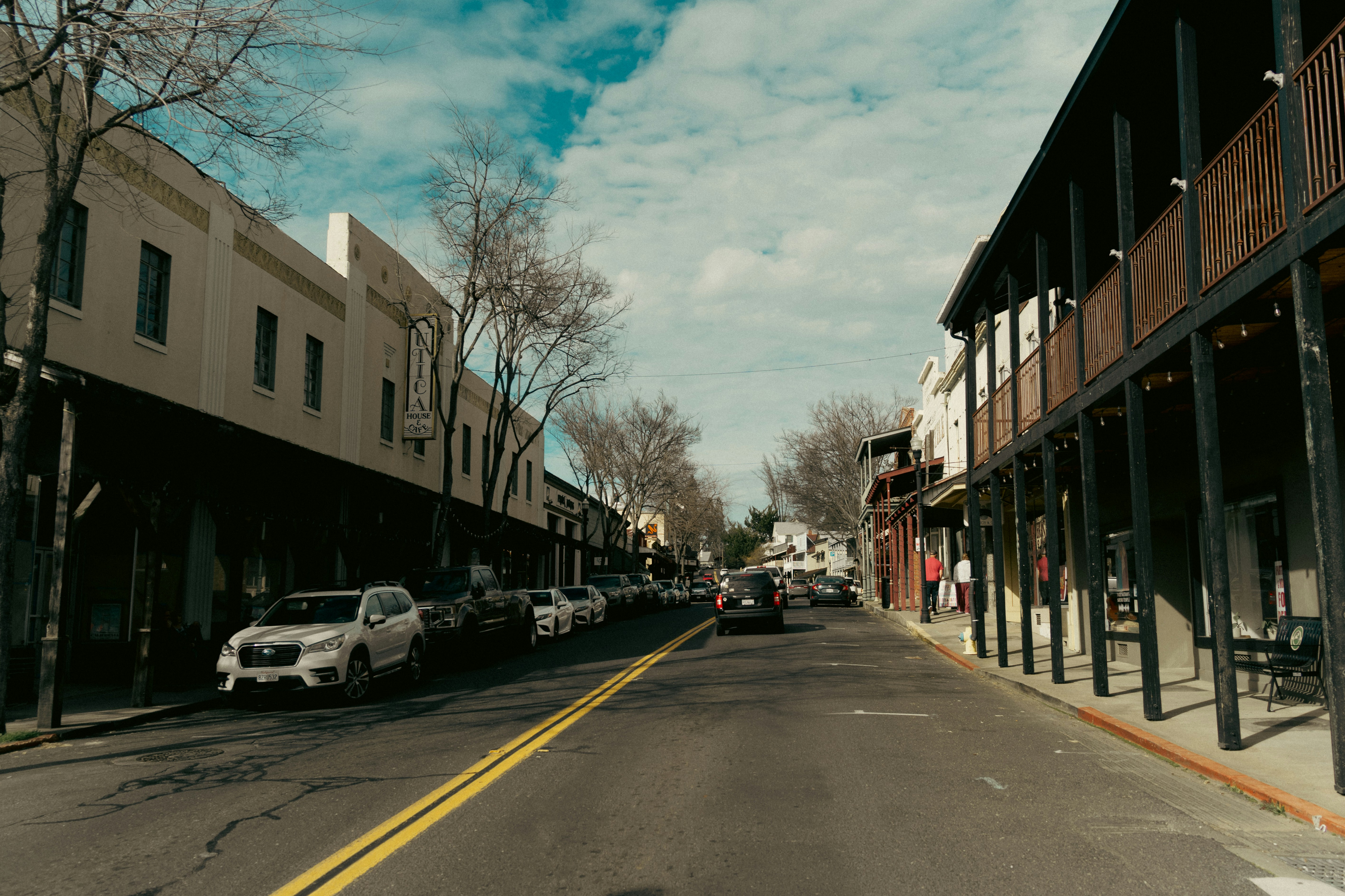
The Waterfall on the NC Side of the Smokies That Most Tourists Never Find

The Waterfall on the NC Side of the Smokies That Most Tourists Never Find

Mouse Creek Falls sits just over two miles up Big Creek Trail and sees a fraction of the foot traffic that Laurel Falls and Abrams Falls draw.

Read More →
Western NC Fishing Guides and Lodges Just Ranked Among the 10 Best in the Country

Western NC Fishing Guides and Lodges Just Ranked Among the 10 Best in the Country

The Tuckasegee, Nantahala, and Davidson rivers draw serious anglers from across the country — and the guides and lodges built around them just got national recognition.

Read More →
Franklin Is Redesigning Main Street and Wants Your Input Before It Happens

Franklin Is Redesigning Main Street and Wants Your Input Before It Happens

The Town of Franklin has two public meetings set for late May where residents can shape a major Main Street transformation plan.

Read More →

Posted in Community Guides
June 7, 2026

Living in Cherokee, NC and the Qualla Boundary: A Buyer's Guide (2026)

Living in Cherokee, NC and the Qualla Boundary: A Buyer's Guide (2026)

By Jon Tharp, Broker  ·  June 7, 2026

Quick Answer: Cherokee, North Carolina is the capital of the Eastern Band of Cherokee Indians (EBCI) and sits on the Qualla Boundary, land held in federal trust for the tribe. This is not a normal real estate market. Most land on the Boundary is tribal trust land held as possessory holdings that, by law, can only be held by enrolled EBCI members, so a non-member generally cannot buy a home or land in Cherokee itself. That is by design, protecting Cherokee land for Cherokee people. What you can do is own fee-simple property in the towns that ring the Boundary, Bryson City, Whittier, Sylva, Dillsboro, and Cullowhee, and enjoy everything Cherokee offers as a neighbor: Harrah's Cherokee, the southern gateway to Great Smoky Mountains National Park, the Oconaluftee River and its elk, and one of the richest living Native cultures in the country.

Cherokee & the Qualla Boundary at a Glance

Who governs it The Eastern Band of Cherokee Indians (EBCI), a sovereign, federally recognized tribe of about 16,000 enrolled members
What the land is The Qualla Boundary, land the tribe purchased and holds in federal trust, not a government-created reservation
Can a non-member buy here? Generally no. Boundary land is held as possessory holdings limited to enrolled members
Where you buy instead Fee-simple homes and land in Bryson City, Whittier, Sylva, Dillsboro, and Cullowhee
National park Cherokee is the NC gateway to Great Smoky Mountains National Park (Oconaluftee Visitor Center, 2 miles north)
Drive to Bryson City / Asheville ~15 min to Bryson City; ~1.5 hr to Asheville
Locally famous for Harrah's Cherokee, the Museum of the Cherokee People, "Unto These Hills," Oconaluftee elk, and stocked trout waters

What is it actually like to live near Cherokee?

Living near Cherokee means owning a home in one of the fee-simple towns around the Qualla Boundary and having a sovereign Native nation, a national park, and a major resort as your neighbors. It is one of the most culturally and naturally rich corners of Western North Carolina, and understanding how the land works here is the first step.

The town of Cherokee is the capital of the Eastern Band of Cherokee Indians, the seat of a self-governing nation with its own government, courts, schools, hospital, and police. It sits in the Oconaluftee River valley at the southern doorstep of Great Smoky Mountains National Park, anchored by Harrah's Cherokee Casino Resort, the Museum of the Cherokee People, and the Oconaluftee elk fields. Because the land is held in trust for the tribe, you do not buy property on the Boundary itself; instead you own in the surrounding towns and live minutes from the casino, the museum, the river, and the park. This guide is written to explain that ownership reality honestly, then point you to where you actually buy and what life is like as a neighbor to the Boundary.

It is written for the buyer drawn to this area: the retiree, the second-home owner, and the outdoor and culture lover who wants to be near Cherokee. We will cover why you cannot buy on the Boundary, where you can buy fee-simple nearby, the culture and the casino, the national park and the rivers, and the practical facts on schools, healthcare, and taxes.

Table of Contents

- What are Cherokee and the Qualla Boundary? - Can you buy a home or land in Cherokee? - Where do buyers actually purchase near Cherokee? - What is the culture like in Cherokee? - What outdoor recreation is around Cherokee? - How far is Cherokee from Bryson City, Asheville, and other towns? - What internet and utilities can you get nearby? - How did Hurricane Helene affect the area? - What are the property taxes near Cherokee? - What are the schools and healthcare like? - How does the Cherokee area compare to nearby towns? - Is the Cherokee area right for you? - Frequently Asked Questions

What are Cherokee and the Qualla Boundary?

Cherokee is the capital of the Eastern Band of Cherokee Indians, and the Qualla Boundary is the tribe's homeland, land the tribe purchased and holds in federal trust. Understanding that this is a sovereign nation, not a town in the ordinary sense, is the key to everything else.

The EBCI descends primarily from Cherokee who remained in or returned to the North Carolina mountains rather than being forced west on the Trail of Tears in 1838 and 1839. A core group along the remote Oconaluftee River avoided removal, and together with others who already held land they formed the nucleus of today's Eastern Band, now about 16,000 enrolled members. The Qualla Boundary is not a traditional reservation created by the government; the tribe purchased this land in the 1800s, and it was later placed under federal protective trust. Just to the west, along the Tuckasegee River, sits Kituwah, the Cherokee Mother Town and origin place, which the tribe re-acquired in 1996 after 138 years. Cherokee today is a living capital with its own government, hospital, schools, and newspaper, not a tourist theme.

For anyone considering a move to this area, that sovereignty is the context. You are looking to live alongside a Native nation, and the land rules that follow flow directly from it.

See what is on the market in Bryson City

See Fee-Simple Homes Near Cherokee

Can you buy a home or land in Cherokee?

Generally, no. If you are not an enrolled member of the Eastern Band of Cherokee Indians, you cannot buy a home or land on the Qualla Boundary, because the land is held in federal trust for the tribe. This is the single most important thing to understand, and it is by design.

Land on the Boundary is trust land, and interests in it are held as possessory holdings that, by law, only enrolled EBCI members (or the child of a member) may hold. A possessory holding is a right to use and occupy trust land, not fee-simple ownership in the conventional sense, and it stays within the tribal membership through inheritance and transfers among members, administered by the tribe rather than through a county deed sale. Businesses that operate on the Boundary typically lease, they do not buy the land outright. This is why a normal home search in Cherokee turns up almost nothing: over the past year only a tiny handful of properties traded on the open market here, and that reflects the trust-land structure, not a temporary shortage.

The honest way to think about it: if your dream is to own a home on the Qualla Boundary, that is not possible for a non-member, and that protection of Cherokee land for Cherokee people is right and good. What you can do is own fee-simple property in the towns that ring Cherokee and enjoy the Boundary as a neighbor. That is where we go next.

Buying near Cherokee? Bryson City homes or Sylva homes.

Where do buyers actually purchase near Cherokee?

You buy fee-simple in the towns that surround the Qualla Boundary and live minutes from everything Cherokee offers. Each option has its own character, and any of them puts you at the casino, the museum, or the Oconaluftee elk fields in about fifteen minutes.

Town County Direction Why buyers choose it
Whittier Swain/Jackson adjacent SW The literal next-door option; rural, affordable, land-heavy
Bryson City Swain ~15 min W Walkable Smokies-gateway town with the railroad and a hospital
Sylva Jackson ~15 min E Larger year-round county seat with a celebrated Main Street
Dillsboro Jackson ~15 min E Small arts-and-crafts village on the Tuckasegee
Cullowhee Jackson ~25 min SE College town, home of Western Carolina University

The pattern is simple: you own in Bryson City, Whittier, or Sylva, and Cherokee is your neighbor, not your address. Whittier sits right against the Boundary line and tends to be the most affordable and most land-heavy of the group, Bryson City gives you a walkable town with a hospital and the national-park gateway, and Sylva offers a larger downtown and more services. I can help you weigh which fits, and each has its own detailed living guide.

What is the culture like in Cherokee?

Cherokee's cultural institutions are real, living, and tribally run, and they are a genuine reason people are drawn to live nearby. This is a culture you visit and respect as a neighbor, not a backdrop.

The Museum of the Cherokee People (established 1948) is one of the oldest tribal museums in the country and the best place to understand the tribe's history in its own words. The Oconaluftee Indian Village is an outdoor living-history village operated by the Cherokee Historical Association, open spring through fall, and each summer the outdoor drama Unto These Hills tells the Cherokee story at the Mountainside Theatre. Qualla Arts and Crafts Mutual, a co-op since 1946, supports Cherokee artists and is the place to find authentic basketry, pottery, weaving, and carving. The tribe's language revitalization work, built on Sequoyah's syllabary and carried forward at the New Kituwah Academy immersion school, is a point of deep pride, and the annual Cherokee Indian Fair each October is the community's signature event. A small, accurate gesture goes a long way here: "Siyo" means hello in Cherokee.

What outdoor recreation is around Cherokee?

Cherokee is the southern gateway to Great Smoky Mountains National Park, and the outdoor access here is exceptional, from elk-filled river fields to some of the most heavily stocked trout water in the Southeast. Living nearby puts all of it minutes away.

The fields around the Oconaluftee Visitor Center, two miles north of town, are the best place in the region to watch elk graze at dawn and dusk, and the easy riverside Oconaluftee River Trail links the town to the visitor center. The tribe runs its own hatchery and stocks its Enterprise Waters (Raven Fork, the Oconaluftee, and Soco Creek) twice weekly, making this a premier trout destination, but note that a separate tribal fishing permit is required on the Boundary; a North Carolina state license does not cover it, so buy the tribal permit before you fish. Mingo Falls, one of the tallest waterfalls in the southern Appalachians, is a short steep climb near the park's south entrance, and the Fire Mountain Trails offer eleven-plus miles of purpose-built mountain-biking and hiking trails right by the Oconaluftee Indian Village. Beyond all that, the national park itself, Newfound Gap, and the southern terminus of the Blue Ridge Parkway are all within minutes.

How far is Cherokee from Bryson City, Asheville, and other towns?

Cherokee sits in the heart of the Smokies, minutes from Bryson City and the national park, with Sylva, Maggie Valley, and Gatlinburg close by and Asheville about an hour and a half east. Mountain and park roads make some drives slower than the mileage suggests.

From Cherokee to Distance Drive time
Bryson City, NC ~10-11 mi ~15-20 min
Sylva, NC ~15 mi ~25 min
Maggie Valley, NC ~16 mi ~25 min (over Soco Gap on US-19)
Waynesville, NC ~21 mi ~30-35 min
Gatlinburg, TN ~33 mi ~1 hr (Newfound Gap Road; slows in winter)
Asheville, NC (and AVL airport) ~65-70 mi ~1 hr 30 min
Greenville-Spartanburg, SC (GSP) ~115 mi ~2 hr 30 min
Atlanta, GA ~150 mi ~3 hr

(Distances and times as of June 2026, via mapping calculators; some are approximate.) The drive over Newfound Gap Road through the national park to Gatlinburg is one of the most beautiful in the East, but it is slow and can close in winter weather. Asheville Regional is the nearest commercial airport at about an hour and a half.

What internet and utilities can you get nearby?

Internet in the fee-simple towns around Cherokee is solid in the town centers and thinner up the coves, where satellite often fills the gap, so confirm service at the exact address before counting on it for remote work.

Provider Type Coverage in the area Top speed Notes (as of mid-2026)
Spectrum Cable broad in Bryson City / Sylva high the main in-town wired option
Frontier DSL partial, thinner rural up to ~115 Mbps where available address-specific; fiber buildouts ongoing
Fixed wireless Wireless patchy pockets varies line-of-sight dependent
Starlink Satellite anywhere ~25-100 Mbps typical the realistic default for rural coves

(Coverage from broadband aggregators, mid-2026; treat as directional and re-check at the address.) In-town addresses in Bryson City and Sylva generally have good cable, while rural cove and ridge parcels often rely on DSL, fixed wireless, or satellite, so any remote-work buyer should verify the specific address and treat Starlink as the rural backstop. In-town homes are typically on municipal water and sewer, while properties outside the town limits are usually on private wells and septic, so budget for a well test and septic inspection on rural land. Cell coverage can drop in the coves and through Newfound Gap.

How did Hurricane Helene affect the area?

The Cherokee, Bryson City, and Sylva area fared comparatively well in Hurricane Helene (September 2024) versus the catastrophic damage to the east, with the worst local impacts confined to the river and creek bottoms. Lower elevation helped.

Helene pushed the Tuckasegee River to a crest near 14.9 feet at Bryson City and flooded low-lying spots along the river corridor, with several dozen households along Swain and Jackson county rivers displaced and historic flooding on Front Street in nearby Dillsboro. But the broader Cherokee, Swain, and Jackson area avoided the scale of destruction seen in Buncombe and the harder-hit counties to the east, and main roads stayed open. The lasting buyer lesson is specific: the Tuckasegee, the Oconaluftee, and the creek bottoms can and do flood, so any river-front or creek-bottom lot or cabin you consider in the fee-simple towns deserves a careful flood-zone check (the FEMA Flood Map Service Center and the North Carolina flood maps are the tools) and a look at flood-insurance cost, while homes up off the water are a different profile.

What are the property taxes near Cherokee?

Because you buy fee-simple in the surrounding towns, your property taxes are set by whichever North Carolina county your home is in, Swain or Jackson, not by the tribe. Both county rates are moderate by national standards.

Swain County's rate is $0.41 per $100 of assessed value for 2025-26, and Jackson County's is $0.31 per $100, so a Bryson City or Whittier-Swain home is taxed at the Swain rate while a Sylva, Dillsboro, or Whittier-Jackson home is taxed at the Jackson rate. Inside a town's limits you also pay that town's municipal rate, and rural parcels may carry a fire-district levy, so confirm the exact figures by parcel. On a $300,000 home, the county levy alone runs roughly $1,230 in Swain and about $930 in Jackson.

On the state side, North Carolina is favorable for retirees: Social Security is not taxed, government and military pensions can be exempt under the Bailey settlement, and there is no estate tax. There is no special $35,000 senior exemption (that is a Georgia benefit, not North Carolina); other retirement income is taxed at the state's flat rate (3.99% in 2026). This is general information, not tax advice, so confirm the current county, town, and fire-district figures with the relevant county, and your situation with a CPA.

What are the schools and healthcare like?

Cherokee operates its own tribal school system and hospital for tribal members, while buyers in the surrounding towns use the county schools and the regional hospitals in Bryson City and Sylva. The area is uncommonly well-served for the mountains.

Cherokee Central Schools is a tribally operated K-12 system serving Boundary families, and Cherokee Indian Hospital, run by the tribe's own health authority, primarily serves EBCI members and other eligible Native patients. For buyers in the fee-simple towns, children attend Swain County Schools or Jackson County Public Schools depending on the address, and healthcare comes from Swain Community Hospital in Bryson City (a critical-access hospital with a 24/7 ER) and the larger Harris Regional Hospital in Sylva, with Mission Hospital in Asheville about an hour away for higher-acuity care. Having two hospitals within roughly fifteen minutes of each other is a real advantage for retirees choosing this area.

How does the Cherokee area compare to nearby towns?

The choice here is not really Cherokee versus another town, since you cannot buy on the Boundary; it is which surrounding fee-simple town you buy in to be near Cherokee. Here is the honest read.

- Why buyers choose Whittier near Cherokee: Whittier is the closest fee-simple option, sitting right against the Boundary line, and it is the most affordable and most land-heavy of the group, ideal for buyers who want to build or hold acreage minutes from Cherokee. Just note that Whittier straddles the Swain/Jackson county line, which affects schools and taxes by parcel. - Why buyers choose Bryson City near Cherokee: Bryson City gives you a walkable downtown, the Great Smoky Mountains Railroad, a hospital, and the national-park gateway, all about fifteen minutes west of Cherokee. Choose it for town life and outdoor access. - Why buyers choose Sylva or Dillsboro near Cherokee: Sylva is a larger year-round county seat with a celebrated Main Street and more services, and neighboring Dillsboro is a small arts village on the Tuckasegee, both about fifteen minutes east. Choose this side for a bigger town and the Jackson County tax rate.

Is the Cherokee area right for you?

Living near Cherokee is a strong fit for a retiree, second-home owner, or outdoor and culture lover who wants to be next to a sovereign Native nation, a national park, and a major resort, and who understands they will own fee-simple in one of the surrounding towns rather than on the Boundary itself. If you are drawn to the Oconaluftee elk, the museum and the drama, the stocked trout waters, and the Smokies gateway, this area delivers a setting few places can match, with affordable, well-served towns ringing it.

It is not the right fit for someone who specifically wants to own a home in the town of Cherokee itself; that is not possible for a non-member, and no loophole exists. And as with any mountain purchase, river-floodplain and well-and-septic diligence is part of buying in the surrounding towns.

If being a good neighbor to the Qualla Boundary, in an affordable, beautiful, well-served corner of the Smokies, is what you are after, reach out and I will help you choose the right town, sort the property types, check flood and well-and-septic on rural parcels, and find the right home near Cherokee.

Frequently Asked Questions

Can you buy a house in Cherokee, NC? Generally not if you are not an enrolled member of the Eastern Band of Cherokee Indians. Cherokee sits on the Qualla Boundary, land held in federal trust for the tribe, and interests in it are held as possessory holdings that by law only enrolled members (or the child of a member) may hold. That is why a normal home search in Cherokee turns up almost nothing. Non-members buy fee-simple property in the surrounding towns, Bryson City, Whittier, Sylva, Dillsboro, and Cullowhee, and live minutes from Cherokee.

What is the Qualla Boundary? The Qualla Boundary is the homeland of the Eastern Band of Cherokee Indians, land the tribe purchased in the 1800s that is held in federal trust. It is not a traditional reservation created by the government; the tribe bought this land back, and it is protected in trust for Cherokee people. Cherokee, the town, is the tribe's capital and sits on the Boundary, in the Oconaluftee River valley at the southern gateway to Great Smoky Mountains National Park.

Where should I buy if I want to live near Cherokee? The fee-simple towns ringing the Boundary. Whittier sits right next door and is the most affordable and land-heavy; Bryson City (about 15 minutes west) is a walkable Smokies-gateway town with a hospital and the railroad; Sylva and Dillsboro (about 15 minutes east) offer a larger downtown and an arts village; and Cullowhee (about 25 minutes southeast) is the Western Carolina University college town. Any of them puts you at the casino, the museum, or the elk fields in about fifteen minutes.

What is Cherokee known for? Cherokee is the capital of the Eastern Band of Cherokee Indians and a center of living Cherokee culture, home to the Museum of the Cherokee People, the Oconaluftee Indian Village, the "Unto These Hills" outdoor drama, and Qualla Arts and Crafts. It is also home to Harrah's Cherokee Casino Resort, the southern gateway to Great Smoky Mountains National Park, the Oconaluftee elk fields, and some of the most heavily stocked trout water in the Southeast.

Do you need a special fishing permit in Cherokee? Yes. To fish the tribe's Enterprise Waters on the Qualla Boundary, you need a tribal fishing permit from the Eastern Band of Cherokee Indians; a North Carolina state fishing license does not cover Boundary waters. The tribe stocks these waters heavily, which is why they are a premier trout destination, so buy the tribal permit before you cast.

How far is Cherokee from Bryson City and Asheville? Bryson City is about 10 to 11 miles and 15 to 20 minutes west, and Asheville (with the region's main airport) is about 65 to 70 miles and an hour and a half east. Sylva is about 15 miles east, Maggie Valley about 25 minutes over Soco Gap, and Gatlinburg, Tennessee, roughly an hour over Newfound Gap Road through the national park (a beautiful but slow, sometimes winter-closed drive).

What are the property taxes if I buy near Cherokee? You pay the rate of whichever North Carolina county your fee-simple home is in. Swain County is $0.41 per $100 of assessed value for 2025-26, and Jackson County is $0.31 per $100, with a town rate added inside city limits and a possible fire-district levy on rural parcels. North Carolina does not tax Social Security and has a flat income tax (3.99% in 2026); there is no $35,000 senior exemption (that is Georgia), though government and military pensions can be exempt under the Bailey settlement.

Is it respectful to move near the Qualla Boundary? Yes, as a good neighbor. People live in the surrounding fee-simple towns and enjoy Cherokee's culture, casino, park, and rivers while respecting that the Boundary is a sovereign nation and its land is protected for tribal members. Learn a little about the Eastern Band's history, support Cherokee-owned businesses and artists, follow tribal rules like the separate fishing permit, and treat Cherokee as the capital of a living nation, which it is.

About the Author

Jon Tharp is a licensed NC real estate broker with Keller Williams. He's helped buyers and sellers across Western North Carolina for over 10 years, specializing in mountain homes, land, and short-term rental investments, with offices throughout WNC covering all mountainous areas. If something in this post has you thinking about a move, he's easy to reach — (828) 347-9055 or smokymountainhomes4sale.com or Jon@jontharphomes.com.

Ready to Find Your Mountain Home Near Cherokee?

Whether you're looking to buy, considering a short-term rental investment, or ready to sell, the Jon Tharp Team brings deep local knowledge and marketing that puts your home in front of 50,000+ buyers in the first 30 days.

Search available homes across Western NC or call Jon directly at (828) 347-9055.

Talk to Jon

What Our Clients Say

43 five-star Google reviews  —  read them all on Google

★★★★★

"Jon is hands down the most dedicated and knowledgeable realtor that I have ever worked with. His expertise made the entire process of selling my home and finding a new one a smooth process."

Amy Davis  ·  2025

★★★★★

"Jon & his team are the greatest! Very professional, friendly like your neighbor, and always get back to your texts, phone calls & emails within minutes or same day, not days or weeks."

Cynthia Oelschlager  ·  2025

★★★★★

"I can’t say enough good things about Jon and his team. I was looking for investment properties and Jon spent time researching where would be a good place for an Airbnb — he found 2 beautiful properties."

Diane Cogswell  ·  2025

More from the Blog
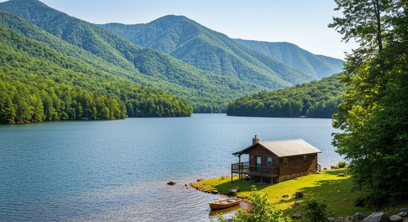
The Waterfall on the NC Side of the Smokies That Most Tourists Never Find

The Waterfall on the NC Side of the Smokies That Most Tourists Never Find

Mouse Creek Falls sits just over two miles up Big Creek Trail and sees a fraction of the foot traffic that Laurel Falls and Abrams Falls draw.

Read More →
Western NC Fishing Guides and Lodges Just Ranked Among the 10 Best in the Country

Western NC Fishing Guides and Lodges Just Ranked Among the 10 Best in the Country

The Tuckasegee, Nantahala, and Davidson rivers draw serious anglers from across the country — and the guides and lodges built around them just got national recognition.

Read More →
Franklin Is Redesigning Main Street and Wants Your Input Before It Happens

Franklin Is Redesigning Main Street and Wants Your Input Before It Happens

The Town of Franklin has two public meetings set for late May where residents can shape a major Main Street transformation plan.

Read More →

Posted in Community Guides
June 7, 2026

Living in Bryson City, NC: The Complete Guide (2026)

Living in Bryson City, NC: The Complete Guide (2026)

By Jon Tharp, Broker  ·  June 7, 2026

Quick Answer: Bryson City is the county seat of Swain County, North Carolina, a small, walkable railroad town of about 1,558 people sitting at roughly 1,752 feet where the Tuckasegee River meets Deep Creek, right at the southern doorstep of Great Smoky Mountains National Park. It is the affordable Smokies-gateway alternative to pricier Sylva and Waynesville: homes sold for a median around $287,500 over the past year, and the market is unusually land-heavy, with about six in ten active listings being raw land or lots. Bryson City is known for the Great Smoky Mountains Railroad, Deep Creek tubing and waterfalls, Nantahala Gorge whitewater, Fontana Lake, and being a self-styled "Fly Fishing Capital of the South," with most of the county locked up as national park and national forest.

Bryson City at a Glance

Population About 1,558 (2020 Census); a small, walkable county seat
Elevation ~1,752 feet, a mild low-valley setting at the edge of the Smokies
Median home price ~$287,500 sold over the past year (homes); active homes list near $425,000, land near $85,000 (as of June 2026)
Time on market Roughly 113 days, a patient, buyer-friendly market
Land market About 61% of active listings are raw land or lots, an unusually deep land/cabin market
Property tax Swain County $0.41 per $100 (2025-26); a town rate is added inside city limits
Drive to Cherokee / Asheville ~15-20 min to Cherokee; ~1 hr to Asheville
Locally famous for The Great Smoky Mountains Railroad, Deep Creek tubing, the Road to Nowhere, and fly fishing

What is it actually like to live in Bryson City?

Living in Bryson City means living in a small, walkable mountain town at the literal edge of Great Smoky Mountains National Park, with a real downtown, a working railroad, and immediate access to rivers, lakes, and wilderness that most towns only dream about. It is affordable, outdoorsy, and unhurried, and that is exactly its appeal.

Bryson City has what very few WNC towns can claim: a compact, genuinely walkable downtown, with a railroad depot, breweries, a river running through it, and a heritage museum, all wrapped around the Tuckasegee River and pointed straight into the Smokies. At about 1,752 feet, it sits in a mild low valley, warmer and less snowy than the high plateau towns to the south. The identity is pure outdoor-gateway: Deep Creek tubing and waterfalls in summer, the Polar Express at Christmas, fly fishing the Tuckasegee, whitewater on the Nantahala, and biking the Tsali trails on Fontana Lake. The market matches the personality, a roughly $287,500 median home sale with an unusually deep land-and-cabin inventory, and Swain County's tax rate is moderate by mountain standards.

This guide is written for the buyer Bryson City actually fits, the value-minded retiree, the second-home and cabin buyer, and the outdoor lover who wants to build or hold land: the affordable market, the land realities, the gateway lifestyle, the flood and rural-property diligence, and who Bryson City suits.

Table of Contents

- What kind of town is Bryson City? - What is the Bryson City real estate market like? - What are the areas and communities around Bryson City? - Why is Bryson City a Smokies and railroad town? - What outdoor recreation is around Bryson City? - How far is Bryson City from Cherokee, Asheville, and other towns? - What internet and utilities can you get in Bryson City? - How did Hurricane Helene affect Bryson City? - What should buyers know about property here? - What are the property taxes in Bryson City? - What are the schools and healthcare like? - How does Bryson City compare to nearby towns? - Is Bryson City right for you? - Frequently Asked Questions

What kind of town is Bryson City?

Bryson City is a small, walkable, working county seat at the southern gateway to Great Smoky Mountains National Park, not a manicured resort. That gateway position, hemmed in by park and national forest, is the single most important thing to understand about living here.

The town was originally laid out as Charleston, then renamed in 1889 to honor Colonel Thaddeus Dillard Bryson, and the Western North Carolina Railroad reached it in 1884, turning an isolated mountain settlement into a transportation and logging hub. That rail heritage survives today as the Great Smoky Mountains Railroad, whose downtown depot anchors the whole town. Just east of downtown along the Tuckasegee lies Kituwah, the Cherokee "Mother Town" and origin place, re-acquired by the Eastern Band of Cherokee Indians in 1996, a reminder that this is ancient Cherokee homeland. With about 1,558 residents (2020 Census) in a town of just over two square miles, Bryson City is genuinely small, but it serves a wider county and a large tourism economy.

Day to day, Bryson City is outdoorsy and tourism-flavored: a real downtown you can walk, a river and a railroad at its center, and the national park, Fontana Lake, and the Nantahala Gorge all within minutes. About a quarter of the housing in town is vacant or seasonal, a clear second-home and short-term-rental signal. It is the kind of place where you can have a compact-town lifestyle and national-park wilderness in the same afternoon.

See what is on the market in Bryson City

See Homes for Sale in Bryson City

What is the Bryson City real estate market like?

Bryson City is an affordable, land-heavy, patient market, the opposite of the tight luxury plateau to the south. Homes sold for a median around $287,500 over the past year, and an unusually large share of what is for sale is raw land and lots.

Over the past year roughly 188 properties sold in the Bryson City area, with homes (excluding land) at a median near $287,500 and land at a median around $70,250, while days on market ran about 113 (as of June 2026). The active market tells the real story: of about 399 listings, roughly 243, about 61%, are raw land or lots, with land asking a median near $85,000, while the 148 single-family homes ask a median near $425,000. More than half of everything that actually sold went for under $250,000, so the entry point is genuinely affordable by WNC standards. The gap between homes that sold (~$287,500) and homes now asking (~$425,000) means the newer, higher-end inventory is sitting, so patient buyers with cash have real leverage on the upper tiers and on land. The headline is simple: Bryson City is the affordable Smokies-gateway market with an exceptionally deep land-and-cabin selection, ideal for buyers who want to build, hold acreage, or own a rental cabin.

Looking in Bryson City? Homes under $300K or Land and acreage.

With this much land on the market and a wide range of cabins and homes, knowing the coves and the property types pays off. Start with current Bryson City listings, and if you want to weigh a slightly larger, year-round county seat, compare Sylva homes for sale to the east.

What are the areas and communities around Bryson City?

Beyond the walkable downtown, Bryson City is really a collection of river valleys and mountain coves, each with its own character, from the tubing-and-cabin country of Deep Creek to the quiet farmland of Alarka. Because so much of the county is national park and national forest, buildable private land is concentrated in these corridors. Here is a read on the main ones.

Area Direction Character Typical property Water
Downtown Bryson City central Walkable to the depot, shops, breweries, and the river Established homes, town lots, some condos Town water/sewer
Deep Creek north Tubing-and-cabin country at the park boundary Cabins, vacation rentals, land Town near the edge, wells up the cove
Lands Creek northwest Steep cove near the Road to Nowhere Cabins, vacation rentals, land Mostly private wells
Alarka south/southeast Quiet rural valley and farmland Homes, farms, acreage Predominantly wells
Whittier edge (Swain side) east Tuckasegee valley toward the Jackson County line Homes, land, river parcels Mix; verify per address

The pattern is consistent: downtown is the convenient, walkable choice near the depot and services on town water and sewer, Deep Creek and Lands Creek are cabin-and-vacation-rental coves at the park's edge where most homes outside the town line are on private wells, and Alarka and the Whittier edge are quieter rural-valley country with farmland, acreage, and river parcels. Bryson City does not have the gated golf communities of the resort towns; it is a town-and-rural-cove market with an unusually deep land selection. For land and acreage, browse land and lots around Bryson City.

Why is Bryson City a Smokies and railroad town?

Bryson City is a railroad town because the 1884 rail line built it, and a Smokies town because the national park, Fontana Lake, and the national forest surround it. Both identities are alive and marketable today, and together they define daily life here.

The Great Smoky Mountains Railroad runs scenic excursions from the downtown depot along the Nantahala Gorge and the Tuckasegee River, and each November and December it becomes THE POLAR EXPRESS, one of the region's biggest seasonal draws (the 2025 season sold out). Around the depot, downtown packs in an outsized food-and-drink scene for its size, with Nantahala Brewing, Mountain Layers Brewing and its rooftop deck, Bryson City Outdoors with its taproom, and more (confirm current names and hours, as small-town spots turn over). The Swain County Heritage Museum in the historic 1908 courthouse and the small Appalachian Rivers Aquarium round out a walkable downtown. The deeper story is the Road to Nowhere: when Fontana Dam flooded the North Shore communities in the 1940s, the government promised a replacement road that was never finished, a grievance settled only in 2010 with a $52 million payment to Swain County. That history still shapes local identity, and the unfinished Lakeview Drive tunnel is now a hiking destination.

What outdoor recreation is around Bryson City?

Bryson City is one of the best outdoor-recreation hubs in the entire region, anchored by Great Smoky Mountains National Park, Deep Creek, the Nantahala Gorge, and Fontana Lake. For hikers, tubers, anglers, paddlers, and bikers, the access is hard to beat.

Just north of downtown, Deep Creek is famous for summer tubing and a family-friendly three-waterfall loop, Juney Whank Falls, Tom Branch Falls, and Indian Creek Falls, all on an easy walk inside the park. The Great Smoky Mountains Railroad runs scenic excursions through the Nantahala Gorge, and the Nantahala Outdoor Center, about twenty minutes southwest, guides Class II-III whitewater rafting on the dam-released Nantahala River along with ziplining and biking. Fontana Lake offers boating, fishing, and boat access to the park's remote North Shore and Hazel Creek, while the Tsali Recreation Area on the lake is nationally ranked mountain-biking singletrack. The Road to Nowhere drives about six miles into the park to a walk-through tunnel and North Shore trails, and the Appalachian Trail crosses Fontana Dam to the southwest. Bryson City also bills itself the "Fly Fishing Capital of the South," with delayed-harvest trout water on the Tuckasegee near town and wild and stocked trout on Fontana feeder streams. It is a remarkable amount of access for a town this affordable.

How far is Bryson City from Cherokee, Asheville, and other towns?

Bryson City sits in the far-western corner of North Carolina, minutes from Cherokee and the national park, with Sylva and Waynesville a short hop east and the regional airports within reach. Mountain and park roads make some drives longer than the mileage suggests.

From Bryson City to Distance Drive time
Cherokee, NC ~10 mi ~15-20 min
Nantahala Gorge / NOC ~13 mi ~20-25 min
Dillsboro, NC ~14 mi ~20 min
Sylva, NC (Harris Regional Hospital) ~16 mi ~25 min
Waynesville, NC ~35 mi ~45 min
Gatlinburg, TN (via US-441 / park) ~40 mi ~1 hr 15 min (seasonal)
Asheville, NC (and AVL airport) ~65 mi ~1 hr
Greenville-Spartanburg, SC (GSP) ~110 mi ~2 hr 15 min
Atlanta, GA ~165 mi ~3 hr
Charlotte, NC ~165 mi ~3 hr

(Distances and times as of June 2026, via mapping calculators; some are approximate.) Asheville Regional is the nearest commercial airport at about an hour and fifteen minutes, with Greenville-Spartanburg and Atlanta as the big-hub options a couple hours out. The drive over the mountain to Gatlinburg through the park is spectacular but slow and seasonal, worth knowing for anyone who will make the trip often.

What internet and utilities can you get in Bryson City?

Internet in Bryson City is solid in town and thinner up the coves, where satellite often fills the gap, so confirm service at the exact address before counting on it for remote work.

Provider Type Coverage in Bryson City Top speed Notes (as of mid-2026)
Spectrum Cable broad in town high the main in-town wired option
Frontier DSL partial, thinner rural up to ~115 Mbps where available address-specific; fiber buildouts ongoing
Skyrunner Fixed wireless patchy pockets varies line-of-sight dependent
Starlink Satellite anywhere ~25-100 Mbps typical the realistic default for rural coves

(Coverage from broadband aggregators, mid-2026; treat as directional and re-check at the address.) In-town addresses generally have good Spectrum cable, while cove parcels in Deep Creek, Lands Creek, and Alarka often rely on DSL, fixed wireless, or satellite, so any remote-work buyer should verify the specific address and treat Starlink as the rural backstop. On utilities, in-town homes are typically on Bryson City municipal water and sewer, while properties outside the town limits are usually on private wells and septic, so budget for a well test and septic inspection on rural land. Cell coverage can drop in the coves and the gorge.

How did Hurricane Helene affect Bryson City?

Bryson City and Swain County fared comparatively well in Hurricane Helene (September 2024) versus the catastrophic damage to the east, with the worst impacts confined to the river and creek bottoms. The town's water and sewer infrastructure held, and lower elevation helped.

Helene pushed the Tuckasegee River to a crest near 14.9 feet in Bryson City, and downtown flooded near Island Street and along Everett Street on the north side of the bridge, with about two and a half feet of water in Town Hall's basement and a precautionary boil-water notice. Roughly three to four dozen households along the county's rivers were displaced, and creek-bottom areas took the brunt, but Swain County avoided the scale of destruction seen in Buncombe and the harder-hit counties to the east. The lasting buyer lesson is specific: the Tuckasegee, Deep Creek, and the creek bottoms can and do flood, so any river-front or creek-bottom lot or cabin deserves a careful flood-zone check (the FEMA Flood Map Service Center and the North Carolina flood maps are the tools) and a look at flood-insurance cost, while homes up off the water are a different profile. Bryson City's lower, milder valley setting is generally a year-round-living advantage.

What should buyers know about property here?

Six things shape a smart Bryson City purchase: the land-and-affordability advantage, flood risk on the rivers, well-and-septic on cove parcels, the short-term-rental factor, steep-slope and access realities, and the patient pace at the top of the market. Most are easy to navigate with the right help.

First, the upside: deep land inventory and a roughly 113-day market give buyers genuine room to choose and negotiate, which suits value-retiree, cabin, and build-it buyers well. Then the diligence items. River and creek parcels carry real flood exposure (see Helene above), so pull the flood map on any waterfront lot. Properties outside town are typically on private wells and septic, so budget for a well test, a septic inspection, and a recorded Road Maintenance Agreement on shared private roads, which lenders require. Because so much of the area is cabin and second-home stock, understand whether a property is a short-term rental, what its rental history and furnishings convey, and how local short-term-rental rules may apply. On steep cove and ridge land, check slope, driveway grade, buildability, and utility reach before you fall in love with a view lot. And at the upper tiers, where higher-end homes are sitting longer, patience and a sharp comparative read are your friends. In a land-heavy, affordable market like this, good guidance is what turns a deep menu into the right purchase.

What are the property taxes in Bryson City?

Bryson City sits in Swain County, where the property tax rate is $0.41 per $100 of assessed value for 2025-26, moderate by mountain standards, with a town rate added inside the city limits. A property outside town pays the county rate plus any fire district.

Swain County raised its rate to $0.41 per $100 in fiscal 2024-25, its first increase in eleven years, and held it for 2025-26, with the next revaluation cycle scheduled around 2029. Inside the Town of Bryson City you also pay a municipal rate on top of the county rate; confirm the current adopted town figure with the Town finance office, as the in-town total is county plus town. Properties in a county fire district pay a small fire levy as well. On a $287,500 home, the county rate alone works out to roughly $1,180 a year, with the town rate adding to that inside city limits, still affordable for a full-service gateway town.

On the state side, North Carolina is favorable for retirees: Social Security is not taxed, government and military pensions can be exempt under the Bailey settlement, and there is no estate tax. There is no special $35,000 senior exemption (that is a Georgia benefit, not North Carolina); other retirement income is taxed at the state's flat rate (3.99% in 2026). This is general information, not tax advice, so confirm the current town and fire-district figures with Swain County and the Town of Bryson City, and your situation with a CPA.

What are the schools and healthcare like?

Bryson City is served by Swain County Schools, a small district headquartered in town, and by Swain Community Hospital, a critical-access hospital with a 24/7 emergency room. For a town this size, having a hospital in town is a real advantage.

For schools, Swain County Schools runs the county's campuses, with Swain County High School on Fontana Road as the lone 9-12 high school, plus the county middle and Bryson City elementary schools (confirm the exact assigned schools for a specific address), and Southwestern Community College's Swain Center just outside town offers classes, meeting space, and an auditorium. For healthcare, Swain Community Hospital in Bryson City is a critical-access hospital and part of the Duke LifePoint network with a 24/7 emergency department, imaging, lab, and a range of outpatient services; for higher-acuity care, the larger Harris Regional Hospital is about sixteen miles east in Sylva, and Mission Hospital in Asheville is the regional referral center about an hour away. A modern in-town ER is a meaningful plus for retirees choosing Bryson City.

How does Bryson City compare to nearby towns?

Bryson City is the affordable, outdoor-gateway option with a deep land market, distinct from the larger year-round county seats to the east and the tribal town of Cherokee next door. Here is the honest head-to-head.

- Why buyers choose Bryson City over Sylva or Waynesville: Bryson City is more affordable, more of a true national-park gateway, and far deeper in land and cabin inventory, while Sylva and Waynesville are larger, more built-out year-round towns with more shopping, dining, and services. Choose Bryson City for the Smokies-gateway lifestyle, affordability, and land; choose Sylva or Waynesville for a bigger town with more amenities. - Why buyers choose Bryson City over Cherokee: Bryson City offers a conventional fee-simple housing market with a walkable downtown, whereas neighboring Cherokee is the capital of the Eastern Band of Cherokee Indians, where most land is held in trust and not sold on the open market. Buyers wanting to own a home or land near the casino-and-park economy generally look to Bryson City and the surrounding Swain County coves. - Why buyers choose Bryson City as a base: From Bryson City you are minutes from the national park, Fontana Lake, the Nantahala Gorge, and Cherokee, with a real downtown, a railroad, and a hospital, all at a lower price than the towns to the east. It is the outdoor-lover's value hub of far western North Carolina.

Is Bryson City right for you?

Bryson City is a strong fit for a value-minded retiree, a second-home or cabin buyer, or an outdoor lover who wants affordable mountain living at the edge of the Smokies, with a walkable downtown, a hospital in town, and unbeatable access to the park, the rivers, and Fontana Lake. If you want a full-time mountain home or a cabin you can actually afford, or land to build or hold, with the national park out your back door, Bryson City delivers more outdoor lifestyle per dollar than almost anywhere in the region.

It is not the right fit for someone seeking a prestige resort address with golf clubs and a designer Main Street (that is Highlands or Cashiers), a big-city level of shopping and dining (Sylva, Waynesville, or Asheville fit better), or a turnkey high-end home with no diligence (the market skews affordable, land-heavy, and patient). And river-floodplain, well-and-septic, and short-term-rental diligence is part of buying here.

If affordable, outdoor-first mountain living at the gateway to the Smokies is what you are after, reach out and I will help you sort the coves and property types, check flood and well-and-septic on rural parcels, weigh the land and cabin options, and find the right place in this walkable little railroad town.

Frequently Asked Questions

Is Bryson City, NC a good place to live? For an outdoor-minded, value buyer, yes. Bryson City is Swain County's affordable, walkable county seat at about 1,752 feet, with a real downtown, a railroad, a hospital, and unmatched access to Great Smoky Mountains National Park, Deep Creek, the Nantahala Gorge, and Fontana Lake. Homes sold for a median around $287,500 over the past year, and the market is unusually land-heavy, with about six in ten active listings being raw land or lots. It fits retirees, cabin and second-home buyers, and outdoor lovers far better than someone seeking a prestige resort address or big-city amenities.

How much does it cost to buy a home in Bryson City? It is affordable with a deep land selection. Over the past year about 188 properties sold, with homes at a median near $287,500 and land near $70,250, while days on market ran about 113 (as of June 2026). The active market is large and land-heavy, around 399 listings, roughly 61% of them raw land or lots, with land asking a median near $85,000 and the 148 single-family homes asking a median near $425,000. More than half of what sold went for under $250,000, so ask me for a current, area-specific read before making an offer.

What are the property taxes in Bryson City? Swain County's rate is $0.41 per $100 of assessed value for 2025-26, moderate for the mountains, and inside the Town of Bryson City you also pay a municipal rate on top of that (confirm the current town figure with the Town). A property outside town pays the county rate plus any fire district. On a $287,500 home, the county rate alone is roughly $1,180 a year. North Carolina does not tax Social Security and has a flat income tax (3.99% in 2026); there is no $35,000 senior exemption (that is Georgia), though government and military pensions can be exempt under the Bailey settlement.

What is Bryson City known for? Three things: the Great Smoky Mountains Railroad, being the gateway to the national park, and outdoor recreation. Bryson City is a walkable railroad town whose downtown depot runs scenic excursions and the seasonal Polar Express, and it sits right at the southern edge of Great Smoky Mountains National Park. From here you have Deep Creek tubing and waterfalls, Nantahala Gorge whitewater, Fontana Lake, the Tsali biking trails, and trout water that earns the town its "Fly Fishing Capital of the South" nickname, plus the Road to Nowhere and its North Shore history.

How far is Bryson City from Cherokee and Asheville? Cherokee is about 10 miles and 15 to 20 minutes northeast, and Asheville (with the region's main airport) is about 65 miles and an hour east. Sylva and its Harris Regional Hospital are about 16 miles and 25 minutes east, the Nantahala Outdoor Center is about 20 to 25 minutes southwest, and Gatlinburg, Tennessee, is roughly an hour and fifteen minutes over the mountain through the park (a seasonal, scenic, slow drive).

Does Bryson City flood? The river and creek bottoms can. Bryson City and Swain County fared comparatively well in Hurricane Helene (September 2024) versus areas to the east, but the Tuckasegee crested near 14.9 feet and downtown flooded near Island and Everett streets, with creek-bottom households displaced. For any river or creek-front property, pull the FEMA flood-zone determination and weigh flood-insurance cost; homes up off the water are a different profile. The town's water and sewer held through the storm, and the lower valley setting is generally a year-round-living advantage.

Why is so much of the Bryson City market land? Because most of Swain County is locked up as Great Smoky Mountains National Park and Nantahala National Forest, buildable private land is concentrated in the river valleys and coves, and a lot of it trades as raw land and cabin lots. About 61% of active listings are land or lots, an unusually deep selection. That makes Bryson City a standout market for buyers who want to build a mountain home, hold acreage, or buy a cabin to use or rent, just be sure to check slope, access, water, and flood zone on any parcel.

What healthcare and schools does Bryson City have? Bryson City has Swain Community Hospital, a critical-access hospital in the Duke LifePoint network with a 24/7 emergency room and outpatient services, plus the larger Harris Regional Hospital about 16 miles away in Sylva and Mission Hospital in Asheville about an hour out for higher-acuity care. For schools, Swain County Schools serves the area, with Swain County High School as the main high school and Southwestern Community College's Swain Center for two-year and career programs. An in-town ER is a meaningful plus for retirees.

Is Bryson City or Sylva better? They serve different buyers. Bryson City (Swain County) is smaller, more affordable, a truer national-park gateway, and far deeper in land and cabin inventory, with a compact walkable downtown and a railroad. Sylva (Jackson County) is a larger year-round town about 25 minutes east with a celebrated brewery-and-bookstore Main Street, Western Carolina University nearby, and Harris Regional Hospital. Choose Bryson City for the Smokies-gateway lifestyle, affordability, and land; choose Sylva for a bigger town with more services. Many buyers tour both.

About the Author

Jon Tharp is a licensed NC real estate broker with Keller Williams. He's helped buyers and sellers across Western North Carolina for over 10 years, specializing in mountain homes, land, and short-term rental investments, with offices throughout WNC covering all mountainous areas. If something in this post has you thinking about a move, he's easy to reach — (828) 347-9055 or smokymountainhomes4sale.com or Jon@jontharphomes.com.

Ready to Find Your Mountain Home Near Bryson City?

Whether you're looking to buy, considering a short-term rental investment, or ready to sell, the Jon Tharp Team brings deep local knowledge and marketing that puts your home in front of 50,000+ buyers in the first 30 days.

Search available homes across Western NC or call Jon directly at (828) 347-9055.

Talk to Jon

What Our Clients Say

43 five-star Google reviews  —  read them all on Google

★★★★★

"Jon is hands down the most dedicated and knowledgeable realtor that I have ever worked with. His expertise made the entire process of selling my home and finding a new one a smooth process."

Amy Davis  ·  2025

★★★★★

"Jon & his team are the greatest! Very professional, friendly like your neighbor, and always get back to your texts, phone calls & emails within minutes or same day, not days or weeks."

Cynthia Oelschlager  ·  2025

★★★★★

"I can’t say enough good things about Jon and his team. I was looking for investment properties and Jon spent time researching where would be a good place for an Airbnb — he found 2 beautiful properties."

Diane Cogswell  ·  2025

More from the Blog
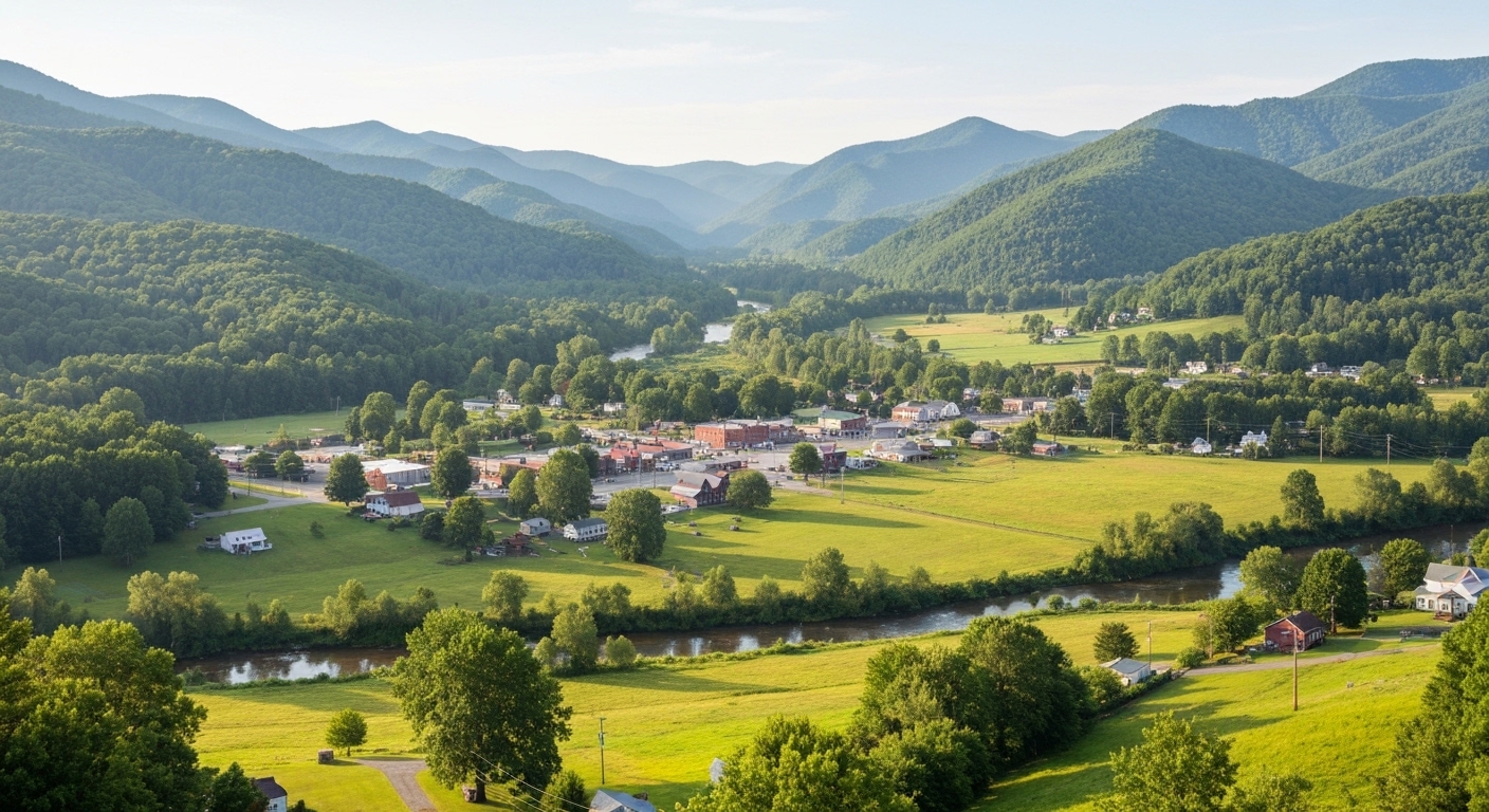
The Waterfall on the NC Side of the Smokies That Most Tourists Never Find

The Waterfall on the NC Side of the Smokies That Most Tourists Never Find

Mouse Creek Falls sits just over two miles up Big Creek Trail and sees a fraction of the foot traffic that Laurel Falls and Abrams Falls draw.

Read More →
Western NC Fishing Guides and Lodges Just Ranked Among the 10 Best in the Country

Western NC Fishing Guides and Lodges Just Ranked Among the 10 Best in the Country

The Tuckasegee, Nantahala, and Davidson rivers draw serious anglers from across the country — and the guides and lodges built around them just got national recognition.

Read More →
Franklin Is Redesigning Main Street and Wants Your Input Before It Happens

Franklin Is Redesigning Main Street and Wants Your Input Before It Happens

The Town of Franklin has two public meetings set for late May where residents can shape a major Main Street transformation plan.

Read More →

Posted in Community Guides
June 7, 2026

Living in Scaly Mountain, NC: The Complete Guide (2026)

Living in Scaly Mountain, NC: The Complete Guide (2026)

By Jon Tharp, Broker  ·  June 7, 2026

Quick Answer: Scaly Mountain is a small, high-elevation, unincorporated community in southern Macon County, North Carolina, strung along NC-106 (the Dillard Road) between Highlands and the Georgia line at roughly 3,500 to 3,800 feet. It is best understood as a cooler, quieter, generally more affordable foothold on the edge of the Highlands-Cashiers plateau, a short drive from Highlands' restaurants and shops. The market is thin and higher-end, with a wide range from buildable mountain land to luxury estates. Because Scaly Mountain is unincorporated, there is no town property tax, only the low Macon County rate plus a small fire-district levy.

Scaly Mountain at a Glance

Status Unincorporated community (a few hundred residents); ZIP 28775
Elevation Roughly 3,500 to 3,800 feet, genuinely cool and high
Setting NC-106 (Dillard Road) between Highlands, NC and Dillard, GA; adjacent to Sky Valley, GA
Market Thin and higher-end: recent sales centered in the mid-$500s with a wide range past $3M; land and estates both (as of June 2026)
Property tax Macon County $0.27 + Scaly Mountain fire district ~$0.04 = about $0.31 per $100; no town tax (unincorporated)
Drive to Highlands ~6-8 miles, ~15-20 min via NC-106
Notable Highlands Outpost (snow tubing, ice skating, the Scaly Mountain Screamer coaster) and the Bartram Trail
Locally famous for A high-elevation, plateau-adjacent value foothold near Highlands, with hiking and overlooks

What is it actually like to live in Scaly Mountain?

Living in Scaly Mountain means living high and cool on the edge of the Highlands-Cashiers plateau, with the quiet of a small mountain community and the amenities of Highlands a short drive away, usually at a lower price than Highlands itself. It is a plateau-adjacent value play for second-home buyers and retirees.

At roughly 3,500 to 3,800 feet, Scaly Mountain is genuinely cool in summer and sees real winter weather, strung along NC-106 between Highlands to the northeast and Dillard, Georgia, to the southwest, adjacent to Sky Valley, Georgia. The community is small, a few hundred residents, scenic, and heavily second-home and retiree in character, with a notably older median age. There is no town center; the draw is the setting and the proximity to Highlands' dining, shopping, and galleries. Because Scaly Mountain is unincorporated, there is no town property tax, only the low Macon County rate plus a small fire levy, so the total tax bill is very low. The honest pitch is simple: a high-elevation foothold near Highlands that generally costs less than comparable property inside Highlands.

This guide is written for the plateau-edge buyer: the thin, higher-end market and the value-versus-Highlands angle, the snow-and-hiking lifestyle, the NC-106 road realities, and who Scaly Mountain fits.

Table of Contents

- What kind of place is Scaly Mountain? - What is the Scaly Mountain real estate market like? - What is there to do in Scaly Mountain? - How far is Scaly Mountain from Highlands and other towns? - What internet and utilities can you get in Scaly Mountain? - How did Hurricane Helene affect Scaly Mountain? - What should buyers know about property here? - What are the property taxes in Scaly Mountain? - What are the schools and healthcare like? - How does Scaly Mountain compare to nearby towns? - Is Scaly Mountain right for you? - Frequently Asked Questions

What kind of place is Scaly Mountain?

Scaly Mountain is a small, high-elevation, unincorporated community, not a town, defined by its position on the edge of the Highlands-Cashiers plateau and its cooler, quieter, more affordable character relative to Highlands. It is scenic, seasonal, and retreat-oriented.

The community runs along NC-106 (the Dillard Road) in the south-central part of Macon County near the Georgia line, with a population of only a few hundred and a median age well above the state average, reflecting its retiree and second-home skew. There is no municipal government, so there is no town property tax. The peak itself, Scaly Mountain, is a hiking destination via the Bartram Trail, and the roadside Osage Mountain Overlook on NC-106 is a scenic landmark. The community's draw is precisely its plateau-edge location: a quieter, generally lower-cost place to own within a short drive of Highlands' restaurants, shops, and galleries, with the Georgia line and Sky Valley minutes away.

For someone who wants high-elevation cool, quiet, and proximity to Highlands without Highlands prices, Scaly Mountain is the value foothold.

See what is on the market in Scaly Mountain

See Homes for Sale in Scaly Mountain

What is the Scaly Mountain real estate market like?

Scaly Mountain is a thin, higher-end, luxury-skewed market with a wide range, from buildable mountain land to high-end estates, where a handful of sales can swing the numbers. The honest framing is value-relative-to-Highlands, not cheap.

Recent activity shows a small number of sales, roughly 42 over the past year, centered in the mid-$500,000s with a wide range running past $3 million, while the active market is similarly thin and skewed, with listings from buildable land up past $6 million (as of June 2026); because the market is so small, medians swing with whatever happens to sell. What buyers purchase here is mountain land, log cabins, mid-range mountain homes, and high-end estates, with longer days on market typical at the higher tier. The real value story is comparative: a high-elevation, plateau-adjacent property in Scaly Mountain generally costs less than comparable property inside Highlands, which is one of the priciest mountain markets in the Southeast. In a small market like this, current comparable sales matter more than any headline median.

Looking near the plateau? Scaly Mountain homes or Land and homesites.

Because the market is thin and luxury-skewed, careful pricing against real comps is essential. Start with current Scaly Mountain listings, and compare the plateau hub with Highlands homes for sale to see the value difference.

What is there to do in Scaly Mountain?

Scaly Mountain offers snow play, a mountain coaster, and excellent hiking, plus quick access to everything Highlands and the plateau provide. For a small community, the on-site recreation is a real perk.

The local landmark is Highlands Outpost (formerly Ski Scaly), which today runs snow tubing on a lighted multi-lane course with a magic-carpet lift and ice skating in winter, plus the year-round Scaly Mountain Screamer mountain coaster, gem mining, and trout fishing; note that downhill skiing ended in 2004, so this is a snow-tubing-and-coaster hill, not a ski resort. Nearby, Highlands Aerial Park offers ziplines and canopy tours. For hiking, the Bartram Trail climbs Scaly Mountain from the Osage Overlook with big views over the Blue Valley and Tessentee Valley, with Jones Knob and Whiterock Mountain offering rock outcrops, and Glen Falls and the Blue Valley area provide nearby waterfalls in Nantahala National Forest. Highlands' dining, shopping, and galleries are a short drive northeast, and Sky Valley's golf is just over the line.

How far is Scaly Mountain from Highlands and other towns?

Scaly Mountain sits just six to eight miles from Highlands and minutes from the Georgia line, which is the whole appeal: plateau access without plateau prices. Mountain roads make the drives longer than the mileage suggests.

From Scaly Mountain to Distance Drive time
Sky Valley, GA ~5-8 mi ~10-15 min
Dillard, GA ~6 mi ~12 min
Highlands, NC ~6-8 mi ~15-20 min
Clayton, GA ~15 mi ~20-25 min
Franklin, NC (county seat) ~25 mi ~35-40 min
Cashiers, NC ~18 mi ~35-40 min
Asheville, NC (and AVL airport) ~75 mi ~2 hr
Greenville-Spartanburg, SC (GSP) ~70 mi ~1 hr 45 min
Atlanta, GA ~130 mi ~2 hr 30 min

(Distances and times as of June 2026, via mapping calculators; some are approximate.) Highlands is the practical hub for upscale dining, shopping, and the nearest hospital, while Dillard and Sky Valley, Georgia, are minutes south. Atlanta is the major feeder metro about two and a half hours away, with Asheville and Greenville-Spartanburg the nearest airports about two hours out.

What internet and utilities can you get in Scaly Mountain?

Internet in Scaly Mountain has historically been a rural gap, though a fiber expansion is reaching parts of the area, so satellite remains a common answer and you should confirm service at the exact address before counting on it for remote work.

Provider Type Coverage in Scaly Mountain Notes (as of mid-2026)
BalsamWest fiber (expanding) Fiber targeted buildout (Otto/Scaly) grant-funded; reaching some addresses
DSL / fixed wireless DSL / wireless parts of the area where available
Starlink Satellite anywhere the realistic default for most mountain lots
Viasat / HughesNet Satellite available legacy fallback

(Coverage from broadband aggregators and local reporting, mid-2026; treat as directional.) A grant-funded BalsamWest fiber expansion has targeted hundreds of locations across Otto and Scaly Mountain, but availability is very address-specific in this steep terrain, so verify the exact parcel. On utilities, most properties are on private wells and septic rather than municipal service, so budget for a well test and septic inspection, and expect cell coverage to vary at elevation.

How did Hurricane Helene affect Scaly Mountain?

The biggest Helene impact on Scaly Mountain was to its lifeline road: NC-106 between Scaly Mountain and Highlands was severely damaged in September 2024 and closed for roughly three months before reopening, which underscores a real landslide and washout exposure on this corridor. That access reality is the key buyer takeaway.

A deep culvert and pipe failure plus a weakened slope below the road closed the NC-106 segment between the Blue Valley and Osage overlooks, with traffic detoured the long way around until the state rebuilt the roadway and reopened it around late December 2024. The episode is a clear demonstration that the Scaly-Highlands corridor is genuinely prone to landslides, rockslides, and washouts on its steep terrain and can close for months in a major storm. For a buyer, that is a real consideration rather than a dealbreaker: weigh a property's access and how dependent it is on NC-106, and confirm there are no current road restrictions before relying on a specific route. The broader area has otherwise recovered.

What should buyers know about property here?

Six things define a smart Scaly Mountain purchase: steep terrain, well-and-septic, the NC-106 storm-and-winter road exposure, seasonality, the thin luxury-skewed market, and the small fire levy. All reward preparation.

First, the land: many lots are steep, so evaluate driveway grade, buildability, and slope stability, ideally with a geotechnical or site review on raw land. Second, water and septic: most properties are not on municipal service, so budget for a well test and septic inspection or perc test. Third, the road: NC-106 can close for months in a major storm and brings ice and snow at elevation, so weigh how dependent a property is on that corridor. Fourth, seasonality: this is a second-home and seasonal market with thinner year-round services than Highlands. Fifth, the market: it is small and luxury-skewed, so comps are sparse and careful pricing matters. Sixth, taxes: the combined rate is very low (about $0.31 per $100), but it is the county rate plus the Scaly Mountain fire district, not just the county figure. I walk buyers through every piece, because on the plateau edge the homework done up front protects the value.

What are the property taxes in Scaly Mountain?

Scaly Mountain buyers pay only the Macon County rate of $0.27 per $100 plus a small Scaly Mountain fire-district levy of about $0.04, for a combined rate of roughly $0.31 per $100 (for 2025-26), with no town tax, because Scaly Mountain is unincorporated. That is genuinely low, even for a plateau-adjacent location.

Macon County has one of the lowest county rates in North Carolina, and its most recent revaluation took effect January 1, 2023 (values rose about 57.5% countywide), with the next reappraisal expected around 2027, so bills reflect the 2023 values. The Scaly Mountain fire district adds about $0.0418 per $100 on top of the county rate (confirm the current figure for a specific parcel), but there is no municipal layer at all. On a $550,000 home the combined rate works out to roughly $1,700 a year.

On the state side, North Carolina is favorable for retirees: Social Security is not taxed, government and military pensions can be exempt under the Bailey settlement, and there is no estate tax. There is no special $35,000 senior exemption in North Carolina (that is a Georgia benefit, relevant since Georgia is minutes away); other retirement income is taxed at the state's flat rate (3.99% in 2026). This is general information, not tax advice, so confirm current rates and the fire levy with Macon County and a CPA.

What are the schools and healthcare like?

Scaly Mountain is served by Macon County Schools through Highlands School, the K-12 campus up in Highlands, and by two nearby critical-access hospitals. For a small high-elevation community, both are within reach.

For schools, Scaly Mountain children attend Highlands School, a public K-12 campus in Highlands about ten miles away, part of Macon County Schools, so local students can attend a single school from kindergarten through graduation. For healthcare, Highlands-Cashiers Hospital is the nearest facility, a 24/7 critical-access hospital on US-64 between Highlands and Cashiers, with Angel Medical Center in Franklin (a fuller-service critical-access hospital, part of the Mission Health system) about 35 to 40 minutes north, and Mission Hospital in Asheville as the regional referral center about two hours away. Mountain Lakes Medical Center in Clayton, Georgia, is another nearby option across the line. Buyers should expect a drive for medical care, which is the trade-off at this elevation.

How does Scaly Mountain compare to nearby towns?

Scaly Mountain is the high-elevation value foothold near Highlands, distinct from Highlands itself, the Georgia resort of Sky Valley next door, and the affordable county seat of Franklin. Here is the honest head-to-head.

- Why buyers choose Scaly Mountain over Highlands: Scaly Mountain offers similar high-elevation cool and plateau access generally at a lower price than Highlands, which is one of the priciest mountain markets in the Southeast, while Highlands has the walkable luxury Main Street, the clubs, and the full resort scene. Choose Scaly Mountain for a quieter, more affordable plateau-edge foothold, Highlands for the full luxury-town experience a short drive away. - Why buyers choose Scaly Mountain over Sky Valley, GA: Both are small high-elevation communities near Highlands, but Scaly Mountain is in North Carolina (low county tax, no Social Security tax) while Sky Valley is in Georgia with its own gated golf community and Georgia's retirement-friendly tax rules. Choose based on which state's setup and community fit you; the two are minutes apart. - Why buyers choose Scaly Mountain over Franklin: Scaly Mountain is higher, cooler, and right next to the plateau and Highlands, while Franklin down the mountain is a far more affordable, year-round, full-service county seat at lower elevation. Choose Scaly Mountain for the high-elevation, plateau-edge setting, Franklin for value and everyday services.

Is Scaly Mountain right for you?

Scaly Mountain is a strong fit for a second-home buyer or retiree who wants high-elevation cool, a quiet setting, and quick access to Highlands, generally at a lower price than Highlands itself, and who is comfortable with steep terrain, well-and-septic, and the seasonal, road-dependent realities of plateau-edge living. If you want a cool mountain retreat near the plateau's amenities without paying full Highlands prices, Scaly Mountain is the value foothold.

It is not the right fit for someone who wants a walkable town with services at the doorstep (that is Highlands or Franklin), a year-round bustling community (this is seasonal and small), a turnkey selection in a deep market (it is thin and luxury-skewed), or a property whose access does not depend on a storm-prone mountain road. Steep-slope and road due diligence is part of buying here.

If a high-elevation, plateau-adjacent retreat is what you are after, reach out and I will help you weigh access and slope on specific properties, price against the thin comps, and find the right foothold near Highlands for how you want to live.

Frequently Asked Questions

Is Scaly Mountain, NC a good place to live? For a second-home buyer or retiree who wants high-elevation cool near Highlands, yes. Scaly Mountain is a small, quiet, unincorporated community at roughly 3,500 to 3,800 feet on NC-106 between Highlands and the Georgia line, offering a plateau-adjacent foothold generally more affordable than Highlands itself, with hiking, overlooks, and snow tubing on site. Because it is unincorporated, there is no town property tax, only the low Macon County rate plus a small fire levy, for a combined rate around $0.31 per $100. The trade-offs are steep terrain, a thin market, seasonal quiet, and a storm-prone access road, so it fits plateau-edge retreat buyers better than someone wanting town conveniences.

How much does it cost to buy in Scaly Mountain? It is a thin, higher-end market with a wide range, so a single median is misleading. Recent sales, roughly 42 over the past year, centered in the mid-$500,000s with a range running past $3 million, while active listings run from buildable land up past $6 million (as of June 2026), and because the market is so small the numbers swing with whatever sells. What buyers purchase is mountain land, cabins, mid-range homes, and high-end estates. The real value story is that comparable property here generally costs less than inside Highlands, so ask me for current comparable sales before making an offer.

Can you still ski at Scaly Mountain? No. Downhill skiing at the former Ski Scaly ended in 2004. The hill operates today as Highlands Outpost, offering snow tubing on a lighted multi-lane course and ice skating in winter, plus the year-round Scaly Mountain Screamer mountain coaster, gem mining, and trout fishing. So you can still enjoy winter snow play and a mountain coaster, just not lift-served skiing. Highlands Aerial Park nearby adds ziplines and canopy tours.

Does Scaly Mountain have a town property tax? No. Scaly Mountain is unincorporated, so buyers pay only the Macon County rate of $0.27 per $100 plus a small Scaly Mountain fire-district levy of about $0.04, for a combined rate of roughly $0.31 per $100 (2025-26), with no municipal tax on top, genuinely low even for a plateau location. Macon County's last revaluation was in 2023, with the next expected around 2027. North Carolina does not tax Social Security and has a flat income tax (3.99% in 2026); there is no $35,000 senior exemption in North Carolina (that is Georgia, which is minutes away), though government and military pensions can be exempt under the Bailey settlement.

How far is Scaly Mountain from Highlands? About six to eight miles and 15 to 20 minutes via NC-106, which is the whole appeal: you get plateau access and Highlands' restaurants, shops, and galleries without Highlands prices. Dillard and Sky Valley, Georgia, are minutes south, Clayton, Georgia, about 20 to 25 minutes, and Franklin (the county seat) about 35 to 40 minutes. Atlanta is the major feeder metro about two and a half hours away, with Asheville and Greenville-Spartanburg the nearest airports about two hours out.

Is the road to Scaly Mountain reliable? Mostly, but it has real storm exposure worth knowing. NC-106 between Scaly Mountain and Highlands was severely damaged by Hurricane Helene in September 2024 and closed for roughly three months before reopening around late December 2024, which shows the corridor is genuinely prone to landslides, rockslides, and washouts on its steep terrain, and it also gets ice and snow at elevation. For a buyer, the practical step is to weigh how dependent a specific property is on NC-106 and to confirm there are no current restrictions; it is a real consideration, not a dealbreaker.

What is the elevation and weather like? Scaly Mountain sits at roughly 3,500 to 3,800 feet, genuinely high and cool, with comfortable summers and real winters that bring snow and ice, which is why it has a snow-tubing hill. The cool-summer climate is a major draw for heat-averse buyers, while winter weather and the steep, sometimes ice-prone roads are a maintenance and access factor. It is a touch lower than Highlands but still firmly high-elevation mountain living.

Is Scaly Mountain or Sky Valley, GA better? They are similar small high-elevation communities minutes apart near Highlands, and the main difference is the state line. Scaly Mountain is in North Carolina, with a very low county tax, no state tax on Social Security, and Macon County services, while Sky Valley is an incorporated Georgia resort city with its own gated golf community and Georgia's retirement-friendly tax rules (a generous retirement-income exclusion). Choose based on which state's tax setup and which community feel fit you best; for the tax comparison specifically, it is worth a conversation with a CPA, and I can show you properties on both sides.

About the Author

Jon Tharp is a licensed NC real estate broker with Keller Williams. He's helped buyers and sellers across Western North Carolina for over 10 years, specializing in mountain homes, land, and short-term rental investments, with offices throughout WNC covering all mountainous areas. If something in this post has you thinking about a move, he's easy to reach — (828) 347-9055 or smokymountainhomes4sale.com or Jon@jontharphomes.com.

Ready to Make Western NC Your Home Base?

Whether you're looking to buy, considering a short-term rental investment, or ready to sell, the Jon Tharp Team brings deep local knowledge and marketing that puts your home in front of 50,000+ buyers in the first 30 days.

Search available homes across Western NC or call Jon directly at (828) 347-9055.

Talk to Jon

What Our Clients Say

43 five-star Google reviews  —  read them all on Google

★★★★★

"Jon is hands down the most dedicated and knowledgeable realtor that I have ever worked with. His expertise made the entire process of selling my home and finding a new one a smooth process."

Amy Davis  ·  2025

★★★★★

"Jon & his team are the greatest! Very professional, friendly like your neighbor, and always get back to your texts, phone calls & emails within minutes or same day, not days or weeks."

Cynthia Oelschlager  ·  2025

★★★★★

"I can’t say enough good things about Jon and his team. I was looking for investment properties and Jon spent time researching where would be a good place for an Airbnb — he found 2 beautiful properties."

Diane Cogswell  ·  2025

More from the Blog
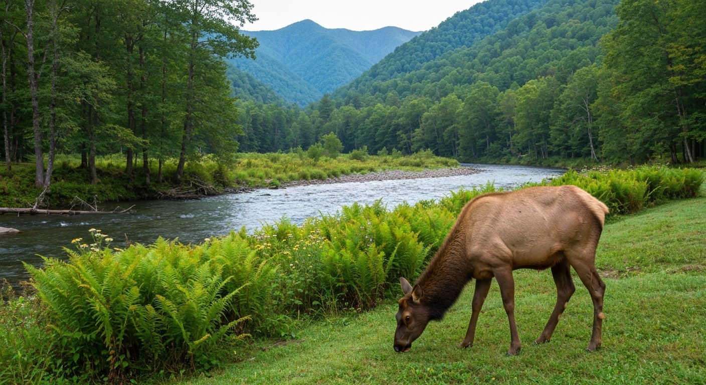
The Waterfall on the NC Side of the Smokies That Most Tourists Never Find

The Waterfall on the NC Side of the Smokies That Most Tourists Never Find

Mouse Creek Falls sits just over two miles up Big Creek Trail and sees a fraction of the foot traffic that Laurel Falls and Abrams Falls draw.

Read More →
Western NC Fishing Guides and Lodges Just Ranked Among the 10 Best in the Country

Western NC Fishing Guides and Lodges Just Ranked Among the 10 Best in the Country

The Tuckasegee, Nantahala, and Davidson rivers draw serious anglers from across the country — and the guides and lodges built around them just got national recognition.

Read More →
Franklin Is Redesigning Main Street and Wants Your Input Before It Happens

Franklin Is Redesigning Main Street and Wants Your Input Before It Happens

The Town of Franklin has two public meetings set for late May where residents can shape a major Main Street transformation plan.

Read More →

Posted in Community Guides
June 7, 2026

Living in Otto, NC: The Complete Guide (2026)

Living in Otto, NC: The Complete Guide (2026)

By Jon Tharp, Broker  ·  June 7, 2026

Quick Answer: Otto is a small, affordable, rural unincorporated community in far southern Macon County, North Carolina, strung along US-441 about eight miles south of Franklin and just north of the Georgia line at roughly 2,070 feet. It is a quiet, forested, value-minded place where buyers find land, cabins, and modest homes, with a thinner tier of higher-end mountain and creek-frontage properties. Because Otto is unincorporated, there is no town property tax, only the low Macon County rate plus a small fire-district levy, and many residents shop and dine just over the line in Dillard and Clayton, Georgia.

Otto at a Glance

Status Unincorporated rural community (no published population); ZIP 28763
Setting US-441 in far southern Macon County, ~8 miles south of Franklin, near the GA line, at ~2,070 ft
Market Affordable and small: median sale ~$209,000 (to ~$650K); active listings median ~$350,000, up to $2.9M (as of June 2026)
Property tax Macon County $0.27 per $100 (one of NC's lowest), no town tax (unincorporated), plus a small Otto fire-district levy
Drive to Franklin / Clayton GA ~13 miles, ~15 min to Franklin; ~11 miles to Clayton, GA
Notable Home to the Coweeta Hydrologic Laboratory, one of North America's oldest watershed research stations
Locally famous for Affordable rural mountain land, the Georgia-line lifestyle, and quiet forest living

What is it actually like to live in Otto?

Living in Otto means living in a quiet, rural, affordable corner of the mountains on the Georgia line, where the draw is land, forest, and low cost rather than town conveniences. It is one of the most value-minded places in this guide series, and that is exactly its appeal.

Otto sits along US-441 about eight miles south of Franklin, close enough to use Franklin's hospital, shopping, and gem-and-trail amenities, but with a true rural character and prices well below the resort towns to the northeast. There is no town center to speak of, just a community building, a volunteer fire station, and the surrounding Nantahala National Forest and Little Tennessee headwaters valley. A distinctive local institution, the Coweeta Hydrologic Laboratory, has studied these forests and streams since 1934. Because Otto is unincorporated, there is no town property tax, only the low Macon County rate and a small fire levy. And because the Georgia line is minutes away, many residents do their shopping and dining in Dillard and Clayton, Georgia.

This guide is written honestly for what Otto is: an affordable, rural, land-and-cabin market for value buyers, retirees, and people who want quiet and space, and how to buy here well, from well-and-septic to flood risk on the river.

Table of Contents

- What kind of place is Otto? - What is the Otto real estate market like? - What is there to do around Otto? - How far is Otto from Franklin, Georgia, and other towns? - What internet and utilities can you get in Otto? - How did Hurricane Helene affect Otto? - What should buyers know about property here? - What are the property taxes in Otto? - What are the schools and healthcare like? - How does Otto compare to nearby areas? - Is Otto right for you? - Frequently Asked Questions

What kind of place is Otto?

Otto is a rural, unincorporated community, not a town, defined by forest, the Little Tennessee headwaters, and its position right on the North Carolina-Georgia line. Its character is quiet, affordable, and self-reliant.

There is no official population count because Otto is an unincorporated community rather than a formal census place, and there is no town government, so there is no municipal tax. The community centers loosely on the intersection of Tessentee Road, Firehouse Road, and US-441, where the Otto Community Building and volunteer fire station serve as the local hub. A genuine point of distinction is the Coweeta Hydrologic Laboratory, a USDA Forest Service research station established in 1934 on Nantahala National Forest land, one of the oldest continuous watershed-research programs in North America. Day to day, Otto is land, cabins, and homes scattered through forested valleys, with the practical reality that the nearest shopping and dining are often across the line in Dillard or Clayton, Georgia, or up US-441 in Franklin.

For someone who wants quiet, space, and affordability over walkable convenience, Otto delivers, with Franklin's services a short drive north and Georgia minutes south.

See what is on the market in Otto

See Homes for Sale in Otto

What is the Otto real estate market like?

Otto is a small, affordable, rural market: mostly land, cabins, and modest homes at accessible prices, with a thinner tier of higher-end mountain and creek-frontage properties. It is one of the more budget-friendly entries in the area.

Over the past year roughly 41 properties sold with a median near $209,000 (up to about $650,000), while the active market shows about 49 listings with a median list near $350,000, an average around $472,000, and a high around $2.9 million (as of June 2026), with the higher active figures reflecting a handful of larger acreage and view properties. Days on market run in the 55-to-65-day range. What buyers actually purchase here is land and acreage, cabins, and modest homes, with some creek-frontage and view properties at the top, and the market draws value-minded retirees and second-home and cabin-rental buyers. Raw rural land can sit longer, as it does everywhere.

Looking in Otto? Homes under $300K or Land and acreage.

Because this is a land-heavy rural market, pricing and due diligence matter more than speed. Start with current Otto listings, and widen into nearby Franklin homes for sale for more inventory and services.

What is there to do around Otto?

Otto's appeal is the outdoors and its position between Franklin's amenities and Georgia's. The immediate draw is forest, river, and trails, with more to do a short drive in either direction.

Otto is wrapped in Nantahala National Forest, with the Little Tennessee River headwaters running through the valley and the Standing Indian Basin and the Appalachian Trail corridor in southern Macon County nearby. Just over the Georgia line, Black Rock Mountain State Park (Georgia's highest state park) sits near Dillard and Mountain City, and the town of Clayton offers shopping, dining, and lake recreation. North in Franklin you get gem mining, the river greenway, and more services, and the upscale dining and galleries of Highlands are within reach. It is a quiet base with genuine outdoor access and two directions' worth of amenities close by.

How far is Otto from Franklin, Georgia, and other towns?

Otto is centrally placed between Franklin and the Georgia line, with Clayton and Dillard just south and Franklin's full services a short drive north. Atlanta is the major metro straight down US-441.

From Otto to Distance Drive time
Dillard, GA ~7 mi ~10-12 min
Clayton, GA ~11 mi ~15-20 min
Franklin, NC (county seat, hospital) ~13 mi ~15-18 min
Highlands, NC ~20 mi ~40 min
Sylva, NC ~32 mi ~45 min
Asheville, NC (and AVL airport) ~75 mi ~1 hr 30 min
Greenville-Spartanburg, SC (GSP) ~95 mi ~1 hr 50 min
Atlanta, GA ~115 mi ~2 hr 30 min

(Distances and times as of June 2026, via mapping calculators; some are approximate.) Franklin to the north is the practical hub for the hospital, groceries, and shopping, while Dillard and Clayton, Georgia, just south are often the closest stops for everyday errands. Asheville Regional is the nearest commercial airport at about an hour and a half, with Atlanta the big-hub option about two and a half hours down US-441.

What internet and utilities can you get in Otto?

Internet in Otto is rural and uneven, with no universal fiber, so satellite is often the dependable answer, though a fiber expansion is reaching parts of the area. Confirm service at the exact address before counting on it for remote work.

Provider Type Coverage in Otto Notes (as of mid-2026)
DSL / fixed wireless DSL / wireless parts of the area the wired/tower options where available
BalsamWest fiber (expanding) Fiber targeted expansion in Otto/Scaly grant-funded buildout reaching some addresses
Starlink Satellite anywhere the realistic default for most rural lots
Viasat / HughesNet Satellite available legacy fallback

(Coverage from broadband aggregators and local reporting, mid-2026; treat as directional.) A grant-funded BalsamWest fiber expansion has been targeting locations across Otto and Scaly Mountain, with Otto connections beginning first, but availability is very address-specific, so verify the exact parcel. On utilities, essentially all property here is on private wells and septic rather than municipal service, so budget for a well test, a septic inspection, and perc tests on raw land. Cell coverage can drop in the valleys.

How did Hurricane Helene affect Otto?

Otto, in far southern Macon County, was affected by Hurricane Helene in September 2024 along with the rest of the county, with heavy rain, wind, and several days of lost cell and internet service, though Macon overall fared better than the hardest-hit areas to the east. River-floodplain parcels are the key flood consideration.

Macon County was among the North Carolina counties approved for federal individual assistance after Helene, with widespread outages and water rescues, and the county recorded storm-related losses. Otto-specific damage figures are not separately documented, but the community sits on the upper Little Tennessee headwaters, so it should be treated as flood-affected along the river and creeks. For a buyer, the takeaway is concrete: any riverfront or low-lying parcel deserves a careful flood-zone check (the FEMA and North Carolina flood maps are the tools) and a look at flood-insurance cost, while homes set up and away from the water are a different profile. The broader area has been in steady recovery since.

What should buyers know about property here?

Five things define a smart Otto purchase: the rural remoteness, well-and-septic on essentially every parcel, road access, flood risk on the river, and the Georgia-line lifestyle. All reward a little preparation.

First, remoteness: groceries, the hospital, and full retail are a drive to Franklin or across the line in Georgia, so plan your life around that. Second, water and septic: almost all property here is on private wells and septic, so budget for a well test, a septic inspection, and perc tests on land before counting on buildability. Third, access: mountain and gravel roads and easements are common on land tracts, so confirm legal road access and any recorded Road Maintenance Agreement, which lenders require. Fourth, flood: the Little Tennessee headwaters and creeks run through the area, so pull the flood map on any riverfront or creek-side parcel. Fifth, the Georgia-line reality: many residents shop, bank, and dine in Dillard or Clayton, Georgia, and it is worth understanding that Georgia and North Carolina differ on taxes (Georgia offers a senior retirement-income exclusion that North Carolina does not, while North Carolina has a very low county tax here and does not tax Social Security). I walk land and cabin buyers through all of it, because in a rural market the due diligence is the deal.

What are the property taxes in Otto?

Otto buyers pay only the Macon County rate of $0.27 per $100 (for 2025-26), one of the lowest county rates in North Carolina, plus a small Otto fire-district levy, with no town tax, because Otto is unincorporated. That keeps the total bill genuinely low.

Macon County's most recent revaluation took effect January 1, 2023 (values rose about 57.5% countywide), with the next reappraisal expected around 2027, so bills reflect the 2023 values. Otto is served by Otto Volunteer Fire and Rescue, so a small fire-district tax applies on top of the county rate (a new fire station broke ground in early 2025, funded by accumulated fire taxes); confirm the current fire-district figure for a specific parcel with the Macon County Tax Department, but there is no municipal layer at all. On a $250,000 home the county portion is roughly $675 a year, plus that small fire levy.

On the state side, North Carolina is favorable for retirees: Social Security is not taxed, government and military pensions can be exempt under the Bailey settlement, and there is no estate tax. There is no special $35,000 senior exemption in North Carolina (that is a Georgia benefit, relevant since Georgia is minutes away); other retirement income is taxed at the state's flat rate (3.99% in 2026). This is general information, not tax advice, so confirm current rates and the fire levy with Macon County and a CPA.

What are the schools and healthcare like?

Otto is served by Macon County Schools, with the county's high schoolers attending Franklin High School, and healthcare anchored by Angel Medical Center in Franklin, about 13 miles north. For a rural community, the essentials are a reasonable drive.

For schools, Otto-area students attend Macon County Schools, generally feeding the Franklin-area elementary and middle schools and Franklin High School; confirm the exact assigned schools for a specific address with the district, since rural zones can vary. Southwestern Community College's Macon Campus in Franklin offers two-year degrees and career programs. For healthcare, Angel Medical Center in Franklin is the nearest hospital (a critical-access facility, part of the Mission Health system, with a modern campus that opened in 2022), with Mission Hospital in Asheville as the regional referral center about an hour and a half away, and Mountain Lakes Medical Center in Clayton, Georgia, is another nearby option across the line. Buyers should expect to drive for medical care, which is the rural trade-off.

How does Otto compare to nearby areas?

Otto is the affordable, rural, Georgia-line option, distinct from the full-service county seat of Franklin to the north and the luxury plateau of Highlands to the northeast. Here is the honest head-to-head.

- Why buyers choose Otto over Franklin: Otto offers more rural privacy, more land for the money, and a quieter setting close to the Georgia line, while Franklin has the hospital, shopping, schools, and far more inventory. Most Otto buyers rely on Franklin for services; choose Otto for affordable rural land and quiet, Franklin for convenience and selection. - Why buyers choose Otto over Highlands: Otto is a small fraction of the cost of Highlands and far more rural, while Highlands is a high-end resort town about 40 minutes northeast. Choose Otto for affordable rural living, Highlands for the luxury-resort lifestyle. - Why buyers choose Otto for the Georgia-line lifestyle: Otto puts Dillard and Clayton, Georgia, minutes away for shopping and dining, with Black Rock Mountain State Park and Georgia's lakes close by, plus North Carolina's low county tax and no Social Security tax. For buyers who like straddling the state line, it is a practical, affordable base.

Is Otto right for you?

Otto is a strong fit for a value-minded buyer, a retiree on a budget, or someone who wants rural mountain land and quiet near the Georgia line, and who is comfortable driving for services and living on a well and septic. If your goal is affordable acreage, a cabin, or a modest mountain home with Franklin's amenities a short drive north and Georgia minutes south, Otto delivers more land and lower cost than most of the region.

It is not the right fit for someone who wants walkable conveniences (look to Franklin), a turnkey selection of move-in-ready homes (the market is land-heavy and small), reliable high-speed internet without checking the address, or a property on the river without taking flood risk seriously. Rural self-reliance and well-and-septic homework are part of the deal.

If affordable, rural, Georgia-line living is what you are after, reach out and I will help you sort buildable land from problem parcels, check flood and access, and find the right piece of this quiet corner of Macon County.

Frequently Asked Questions

Is Otto, NC a good place to live? For a value-minded, rural buyer, yes. Otto is an affordable, quiet, unincorporated community in far southern Macon County on US-441, about eight miles south of Franklin and minutes from the Georgia line, where buyers find land, cabins, and modest homes wrapped in Nantahala National Forest. Because it is unincorporated, there is no town property tax, only the low Macon County rate plus a small fire levy, and Franklin's hospital and shopping are a short drive north while Dillard and Clayton, Georgia, are minutes south. The trade-offs are real remoteness, well-and-septic property, and uneven internet, so it fits rural land-and-lifestyle buyers far better than someone wanting town conveniences.

How much does it cost to buy in Otto? It is one of the more affordable markets in the area. Over the past year about 41 properties sold with a median near $209,000 (up to about $650,000), while active listings show a median list near $350,000 and reach about $2.9 million for the rare large acreage or view property (as of June 2026). What most buyers purchase is land, cabins, and modest homes, with some creek-frontage and view properties at the top. Raw rural land can sit longer on the market, so ask me for a current, parcel-specific read before making an offer.

Does Otto have a town property tax? No. Otto is unincorporated, so buyers pay only the Macon County rate of $0.27 per $100 (2025-26), one of the lowest in North Carolina, plus a small Otto fire-district levy, with no municipal tax on top. Macon County's last revaluation was in 2023, with the next expected around 2027. North Carolina does not tax Social Security and has a flat income tax (3.99% in 2026); there is no $35,000 senior exemption in North Carolina (that is Georgia, which is minutes away), though government and military pensions can be exempt under the Bailey settlement. Confirm the fire-district figure for a specific parcel with Macon County.

How far is Otto from Franklin and Georgia? Otto is about 13 miles and 15 minutes north to Franklin (the county seat, with the hospital and shopping) and just 7 miles to Dillard, Georgia, with Clayton, Georgia, about 11 miles south. Highlands is about 40 minutes northeast, Asheville about an hour and a half north (with the nearest commercial airport), and Atlanta about two and a half hours straight down US-441. Many Otto residents do their everyday shopping and dining across the line in Georgia, since it is often the closest option.

What is the Coweeta Hydrologic Laboratory? It is a USDA Forest Service research station located in Otto (on Coweeta Lab Road), established in 1934 on Nantahala National Forest land, and it is one of the oldest continuous watershed and environmental research programs in North America, studying how forests affect streamflow in long-term partnership with the University of Georgia. It is a genuine local institution and a distinctive piece of Otto's identity, set in the forested Coweeta basin.

Did Otto flood during Hurricane Helene? Otto, like the rest of Macon County, was affected by Helene in September 2024 with heavy rain, wind, and several days without cell or internet service, and Macon was approved for federal individual assistance, though the county overall fared better than the hardest-hit areas to the east. Otto-specific damage is not separately documented, but the community sits on the upper Little Tennessee headwaters, so river and creek parcels carry real flood exposure. For any riverfront or low-lying property, pull the FEMA flood-zone determination and weigh flood-insurance cost; homes up off the water are a different profile.

What is the internet like in Otto? Rural and uneven, so verify it before buying. There is no universal fiber; parts of the area have DSL or fixed wireless, a grant-funded BalsamWest fiber expansion has been reaching some Otto addresses, and satellite (especially Starlink) is the dependable default for many rural parcels. Cell coverage can also drop in the valleys. If you plan to work from home, confirm service at the exact address rather than assuming it.

Is Otto better than living in Georgia next door? It depends on your priorities, and many Otto buyers like straddling the line. On the North Carolina side, Otto has a very low county tax and North Carolina does not tax Social Security; on the Georgia side, just minutes away, Georgia offers a generous retirement-income exclusion that North Carolina does not, plus shopping and dining in Dillard and Clayton. Property mechanics and rules differ by state, so for a retiree weighing the tax picture specifically, it is worth a conversation with a CPA. I can help you compare specific properties on both sides of the line.

About the Author

Jon Tharp is a licensed NC real estate broker with Keller Williams. He's helped buyers and sellers across Western North Carolina for over 10 years, specializing in mountain homes, land, and short-term rental investments, with offices throughout WNC covering all mountainous areas. If something in this post has you thinking about a move, he's easy to reach — (828) 347-9055 or smokymountainhomes4sale.com or Jon@jontharphomes.com.

Ready to Make Western NC Your Home Base?

Whether you're looking to buy, considering a short-term rental investment, or ready to sell, the Jon Tharp Team brings deep local knowledge and marketing that puts your home in front of 50,000+ buyers in the first 30 days.

Search available homes across Western NC or call Jon directly at (828) 347-9055.

Talk to Jon

What Our Clients Say

43 five-star Google reviews  —  read them all on Google

★★★★★

"Jon is hands down the most dedicated and knowledgeable realtor that I have ever worked with. His expertise made the entire process of selling my home and finding a new one a smooth process."

Amy Davis  ·  2025

★★★★★

"Jon & his team are the greatest! Very professional, friendly like your neighbor, and always get back to your texts, phone calls & emails within minutes or same day, not days or weeks."

Cynthia Oelschlager  ·  2025

★★★★★

"I can’t say enough good things about Jon and his team. I was looking for investment properties and Jon spent time researching where would be a good place for an Airbnb — he found 2 beautiful properties."

Diane Cogswell  ·  2025

More from the Blog
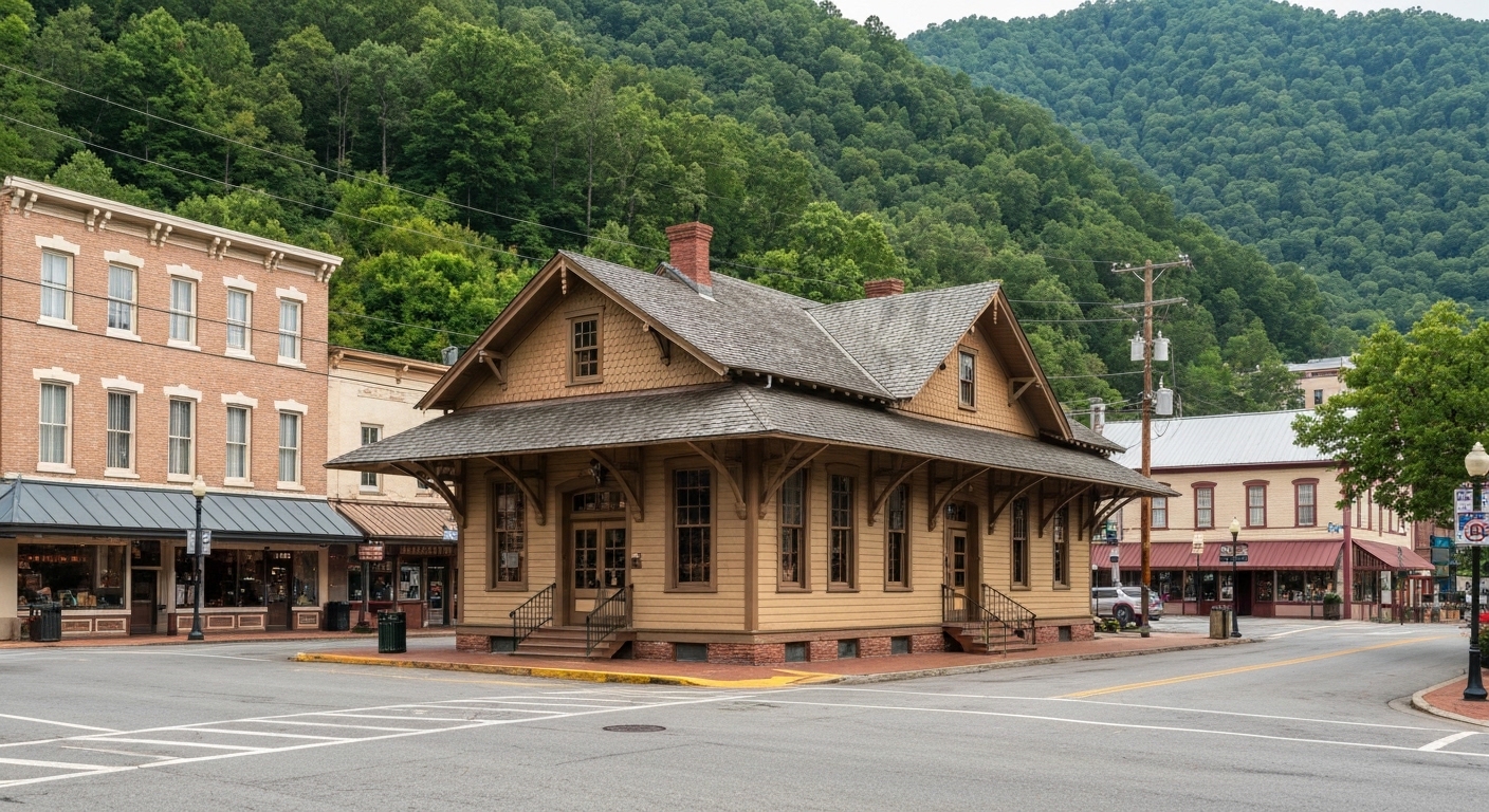
The Waterfall on the NC Side of the Smokies That Most Tourists Never Find

The Waterfall on the NC Side of the Smokies That Most Tourists Never Find

Mouse Creek Falls sits just over two miles up Big Creek Trail and sees a fraction of the foot traffic that Laurel Falls and Abrams Falls draw.

Read More →
Western NC Fishing Guides and Lodges Just Ranked Among the 10 Best in the Country

Western NC Fishing Guides and Lodges Just Ranked Among the 10 Best in the Country

The Tuckasegee, Nantahala, and Davidson rivers draw serious anglers from across the country — and the guides and lodges built around them just got national recognition.

Read More →
Franklin Is Redesigning Main Street and Wants Your Input Before It Happens

Franklin Is Redesigning Main Street and Wants Your Input Before It Happens

The Town of Franklin has two public meetings set for late May where residents can shape a major Main Street transformation plan.

Read More →

Posted in Community Guides
June 7, 2026

Living in Franklin, NC: The Complete Guide (2026)

Living in Franklin, NC: The Complete Guide (2026)

By Jon Tharp, Broker  ·  June 7, 2026

Quick Answer: Franklin is the county seat of Macon County, North Carolina, an affordable, year-round, full-service town of about 4,400 people sitting at roughly 2,113 feet on the Little Tennessee River, about 20 minutes down the mountain from luxury Highlands. It is the practical, value-minded alternative to the Highlands-Cashiers plateau: the median home sold for about $260,000 over the past year with a large, buyer-friendly inventory. Franklin is known as a gem-mining town, a major Appalachian Trail community, and a real working town with a hospital, shopping, and a riverside greenway, and Macon County has one of the lowest property tax rates in the state.

Franklin at a Glance

Population About 4,400 (2020 Census 4,175); a growing, year-round county seat
Elevation ~2,113 feet, roughly 2,000 feet lower than Highlands, so milder with far less snow
Median home price ~$260,000 sold over the past year; large active inventory, median list ~$212,000 (as of June 2026)
Time on market Roughly 90 days, a balanced, buyer-friendly market
Property tax Macon County $0.27 per $100 (one of NC's lowest); about $0.60 combined inside town limits
Drive to Highlands / Asheville ~20 min up the Cullasaja Gorge to Highlands; ~1 hr 25 min to Asheville
Anchor airport Asheville Regional (AVL) ~1.5 hr; Atlanta ~2.5 hr
Locally famous for Gem and ruby mining, the Appalachian Trail (the first AT Community), the Little Tennessee River Greenway, and the Nikwasi Mound

What is it actually like to live in Franklin?

Living in Franklin means living in an affordable, year-round mountain town with real services, an outdoor-and-gem-mining culture, and a fraction of the price tag of the resort towns just up the mountain. It is a working county seat, not a seasonal resort, and that is exactly its appeal.

Franklin has what the luxury plateau towns lack: a Walmart and grocery stores, a hospital, county offices, a community college campus, and a genuine downtown Main Street with shops and breweries, all in a town you can actually afford to live in full-time. At about 2,113 feet, roughly 2,000 feet lower than Highlands, it is milder and gets far less snow, a real year-round-living advantage. The identity is outdoorsy and down-to-earth: ruby and sapphire mining heritage, a major Appalachian Trail hiker culture, a riverside greenway, and the Cherokee history of the Nikwasi Mound downtown. The market matches the personality, a roughly $260,000 median sale with a large, buyer-friendly inventory (as of June 2026), and Macon County's tax rate is among the lowest in North Carolina.

This guide is written for the buyer Franklin actually fits, the primary-residence buyer, the value-minded retiree, and the outdoor lover: the affordable market, the low taxes, the gem-and-trail lifestyle, the flood and rural-property realities, and who Franklin suits.

Table of Contents

- What kind of town is Franklin? - What is the Franklin real estate market like? - What are the areas and communities around Franklin? - Why is Franklin called a gem-mining town? - What outdoor recreation is around Franklin? - How far is Franklin from Highlands, Asheville, and other towns? - What internet and utilities can you get in Franklin? - How did Hurricane Helene affect Franklin? - What should buyers know about property here? - What are the property taxes in Franklin? - What are the schools and healthcare like? - How does Franklin compare to nearby towns? - Is Franklin right for you? - Frequently Asked Questions

What kind of town is Franklin?

Franklin is a real, working, year-round county seat, the full-service hub of Macon County, not a seasonal resort. That distinction is the single most important thing to understand about living here.

Franklin was built on the site of the Cherokee town of Nikwasi ("Star Place"), one of the Cherokee Mother Towns, and the Nikwasi Mound, a platform mound dating to around 1000 CE, still stands downtown; in February 2026 it was deeded back to the Eastern Band of Cherokee Indians after more than two centuries, so it is now Cherokee-owned. The town was later named for Jesse Franklin, a North Carolina governor. Today the 2020 census count of 4,175 (now closer to 4,400) understates the area, since Macon County overall holds roughly 37,000 people. What you get is a town with everyday services, a hospital, big-box and local retail, county offices, and a community college, plus a genuine Main Street of shops, restaurants, and breweries.

Day to day, Franklin is practical and outdoorsy: people work, shop, and live here year-round, with gem mining, the Appalachian Trail, and the river greenway shaping the local culture. It is the kind of town where you can have mountain life and full-time affordability at once.

See what is on the market in Franklin

See Homes for Sale in Franklin

What is the Franklin real estate market like?

Franklin is an affordable, high-inventory, year-round market with a wide range and a buyer-friendly pace, the opposite of the luxury plateau just up the mountain. The median home sold for about $260,000 over the past year, and there is a lot to choose from.

Over the past year roughly 378 properties sold with a median near $260,000 and an average around $310,000 (up to about $2.8 million for the rare estate), while the active market is large, about 726 listings, with a median list near $212,000 and days on market around 90 (as of June 2026). That deep inventory and balanced pace mean buyers have room to choose and negotiate, unlike the tight, pricey plateau. The range is wide: the lower tiers include land, manufactured homes, and modest cottages, while the upper end has river-frontage and view homes and a handful of estates. The headline is simple, Franklin is the affordable alternative to Highlands and Cashiers, about 20 minutes down the Cullasaja Gorge, and buyers priced out of the plateau routinely look here.

Looking in Franklin? Homes under $300K or Land and acreage.

With this much inventory across such a wide range, knowing the areas and the property types pays off. Start with current Franklin listings, and if you also want to weigh the resort option, compare Highlands homes for sale up the mountain.

What are the areas and communities around Franklin?

Beyond downtown, Franklin is ringed by named valleys and rural communities, each with its own character, from the historic gem country of Cowee to the trail-and-forest west side. Here is a read on the main ones.

Area Direction Character Typical property
In-town Franklin central Walkable to Main Street, services, the greenway Established homes, town lots
Cowee Valley north Historic ruby/sapphire gem country, scenic Land, farms, river homes
Iotla Valley north Rural valley, farmland along the Little Tennessee Acreage, farms, homes
Cartoogechaye west Toward Wayah and the AT, forested Mountain homes, land, cabins
Holly Springs west/southwest Rural residential, valley and ridges Homes and land
Cullasaja east Along US-64 toward the gorge and Highlands Homes, land, river/creek parcels

The pattern: in-town Franklin is the convenient, walkable choice near services and the greenway, the northern valleys (Cowee, Iotla) are scenic farm-and-river country with the gem heritage, the western communities (Cartoogechaye, Holly Springs) lean toward forest, trail access, and mountain land, and Cullasaja stretches east toward the gorge and the Highlands drive. Franklin does not have the gated golf communities of the plateau; it is more a town-and-rural-valley market. For land and acreage, browse land and lots around Franklin.

Why is Franklin called a gem-mining town?

Franklin bills itself as a gem capital because Macon County's Cowee Valley is historic ruby and sapphire country, with commercial mining since around 1870 and dig-your-own mines that are a genuine year-round, family-friendly draw. It is a real and marketable part of local life.

The gem scene is active today: the Franklin Gem & Mineral Museum occupies the historic 1850 Macon County jail (free admission), Ruby City Gems is a large gem-and-mineral store and museum, and several dig-your-own mines operate, including the Cherokee Ruby & Sapphire Mine and Mason Mountain Ruby & Sapphire Mine in the Cowee Valley, where visitors sift native gravel for real stones. The signature event is the Leaf Lookers Gemboree each October, with additional wholesale gem-and-mineral showcases in the summer that draw collectors from around the country (confirm current dates with the Franklin Chamber). For a family or a hobbyist, this is a distinctive lifestyle perk you will not find in most mountain towns.

What outdoor recreation is around Franklin?

Franklin is an outdoor hub anchored by the Appalachian Trail, the Little Tennessee River, and the surrounding Nantahala National Forest. For hikers, anglers, and paddlers, the access is excellent and a core part of the town's identity.

Franklin was the first officially designated Appalachian Trail Community (2010), sits near AT mile 110, and the trail crosses US-64 at Winding Stair Gap about ten miles west, with Standing Indian, Albert Mountain, and the Wayah Bald CCC stone fire tower nearby, plus the Nantahala Outdoor Center to the northwest; each spring the town hosts Trail Days celebrating thru-hikers. In town, the Little Tennessee River Greenway is a roughly 4.5-mile paved riverside trail with fishing piers, canoe put-ins, and picnic areas, and the Little Tennessee River itself offers smallmouth bass and trout. Beyond that, the Bartram Trail passes through the area, Nantahala National Forest brings waterfalls (Cullasaja, Dry, and Bridal Veil Falls line the gorge toward Highlands) and endless trails, and Lake Emory in town plus Nantahala Lake about an hour west add fishing and paddling. It is a remarkable amount of outdoor access for an affordable town.

How far is Franklin from Highlands, Asheville, and other towns?

Franklin is centrally placed in far western North Carolina: about 20 minutes from Highlands up the Cullasaja Gorge, half an hour from Sylva, and within reach of Cherokee, Georgia, and the regional airports. Mountain roads make some drives longer than the mileage suggests.

From Franklin to Distance Drive time
Highlands, NC ~12 mi ~20 min (US-64 through the Cullasaja Gorge)
Sylva, NC ~19 mi ~30 min
Clayton, GA ~22 mi ~30 min
Bryson City, NC ~27 mi ~40-45 min
Cherokee, NC ~31 mi ~45 min
Cashiers, NC ~28 mi ~45 min
Murphy, NC ~48 mi ~1 hr
Asheville, NC (and AVL airport) ~68 mi ~1 hr 25 min
Greenville-Spartanburg, SC (GSP) ~114 mi ~2 hr 10 min
Atlanta, GA ~139 mi ~2 hr 30 min

(Distances and times as of June 2026, via mapping calculators; some are approximate.) Asheville Regional is the nearest commercial airport at about an hour and a half, with Greenville-Spartanburg and Atlanta as the big-hub options about two to two and a half hours out. The drive up to Highlands via the Cullasaja Gorge is scenic but winding, worth knowing for anyone who will use the plateau's amenities often.

What internet and utilities can you get in Franklin?

Internet in Franklin is solid in town, with cable and some fiber, and thinner in the rural valleys where satellite often fills the gap, so confirm service at the exact address before counting on it for remote work.

Provider Type Coverage in Franklin Top speed Notes (as of mid-2026)
Optimum / Vyve Cable broad in town high the main in-town option
Frontier Fiber / DSL partial fiber in town, DSL rural up to ~1 Gbps where fiber reaches address-specific
Comporium Cable / fiber parts of the area high additional local option
Starlink Satellite anywhere ~25-100 Mbps typical the realistic default for remote rural lots

(Coverage from broadband aggregators, mid-2026; treat as directional.) In-town addresses generally have good cable and some fiber, while rural parcels in the valleys often rely on DSL, fixed wireless, or satellite, so any remote-work buyer should verify the specific address. On utilities, in-town homes are typically on Franklin municipal water and sewer, while rural properties are usually on private wells and septic, so budget for a well test and septic inspection on rural land. Cell coverage can drop in the coves.

How did Hurricane Helene affect Franklin?

Franklin and Macon County fared comparatively well in Hurricane Helene (September 2024) versus the catastrophic damage to the east, with mostly moderate-to-minor damage in town, though river-floodplain parcels did flood and the county saw real losses. Lower elevation helped.

Helene dropped roughly 10 to 15 inches of rain across Macon County with strong winds, and the Little Tennessee River rose significantly, but the town of Franklin sustained mostly moderate-to-minor damage and cleared its roads relatively quickly, while the worst local impacts were up in the Highlands and Cullasaja areas. The county recorded two storm-related deaths and dozens of damaged structures, with utilities restored to the Franklin area fairly fast. The lasting buyer lesson is specific: riverfront and floodplain parcels along the Little Tennessee and area creeks can and did flood, so any river or creek-front property deserves a careful flood-zone check (the FEMA and North Carolina flood maps are the tools) and a look at flood-insurance cost, while homes up off the water are a different profile. Franklin's lower, milder valley setting is generally a year-round-living advantage.

What should buyers know about property here?

Six things shape a smart Franklin purchase: the affordability-and-inventory advantage, flood risk on the river, well-and-septic on rural parcels, manufactured homes in the lower tiers, old-mine land considerations, and the gorge drive to Highlands. The good news is most are easy to navigate with the right help.

First, the upside: large inventory and a roughly 90-day market give buyers genuine room to choose and negotiate, which suits primary-residence and value-retiree buyers well. Then the diligence items: river and creek parcels carry real flood exposure (see Helene above), so pull the flood map on any waterfront lot; rural properties are typically on private wells and septic, so budget for a well test, a septic inspection, and a recorded Road Maintenance Agreement on shared private roads, which lenders require. In the lower price tiers, manufactured and mobile homes are common, so understand the home-versus-land value, the home's age and HUD tag, and the financing and appraisal implications. On historic gem-and-mine ground in places like Cowee Valley, check for old workings, mineral rights, and slope stability. And if you plan to use Highlands' amenities, factor the winding 20-minute Cullasaja Gorge drive. I walk buyers through all of it, and in an affordable, high-inventory market like Franklin, good guidance is what turns choice into the right choice.

What are the property taxes in Franklin?

Franklin sits in Macon County, which has one of the lowest property tax rates in North Carolina at $0.27 per $100 (for 2025-26), and even with the Town of Franklin rate added in town, the total stays low by national standards. A property just outside town limits pays only the county rate plus any fire district.

The Town of Franklin municipal rate is $0.33 per $100, so inside town limits the combined county-plus-town rate is about $0.60 per $100 (a fire-district levy of about $0.07 applies in the fire-protection district; confirm with the Town finance office whether it stacks inside town limits or applies to the unincorporated district). A home outside town in a fire district typically pays roughly $0.33 to $0.37 combined. On a $260,000 home, the in-town rate works out to roughly $1,560 a year, genuinely affordable for a full-service town. Macon County's most recent revaluation took effect January 1, 2023 (values rose about 57.5% countywide), with the next reappraisal expected around 2027, so bills reflect the 2023 values.

On the state side, North Carolina is favorable for retirees: Social Security is not taxed, government and military pensions can be exempt under the Bailey settlement, and there is no estate tax. There is no special $35,000 senior exemption (that is a Georgia benefit, not North Carolina); other retirement income is taxed at the state's flat rate (3.99% in 2026). This is general information, not tax advice, so confirm the current town and fire-district figures with Macon County and the Town of Franklin, and your situation with a CPA.

What are the schools and healthcare like?

Franklin is served by Macon County Schools, including Franklin High School and a community college campus, and by Angel Medical Center, the county's hospital with a modern campus that opened in 2022. For an affordable town, the institutions are solid.

For schools, Franklin High School is Macon County's main high school, with Mountain View Intermediate and elementary and middle schools across the area (confirm the exact assigned schools for a specific address), and Southwestern Community College's Macon Campus offers transfer degrees, career and technical programs, and an early-college partnership. For healthcare, Angel Medical Center in Franklin is a critical-access hospital (part of the Mission Health system) whose new roughly $70 million campus opened in September 2022, with an emergency department and inpatient care; for higher-acuity or specialty care, Mission Hospital in Asheville is the regional referral center about an hour and a half away. Having a modern hospital in town is a meaningful advantage for retirees choosing Franklin.

How does Franklin compare to nearby towns?

Franklin is the affordable, year-round, full-service option, distinct from the luxury plateau resorts of Highlands and Cashiers, the county seat of Sylva over in Jackson County, and the smaller communities around it. Here is the honest head-to-head.

- Why buyers choose Franklin over Highlands or Cashiers: Franklin is a fraction of the cost, year-round, lower in elevation with far less snow, and full of everyday services, while Highlands and Cashiers are seasonal luxury resorts at much higher prices and elevations. Many buyers priced out of the plateau, or who simply want practical full-time living, choose Franklin and drive up the mountain for the resort amenities. Choose Franklin for value and year-round living, the plateau for the luxury-resort lifestyle. - Why buyers choose Franklin over Sylva: Both are affordable, year-round county seats with real downtowns and hospitals, about half an hour apart. Franklin (Macon) has the gem-mining and Appalachian Trail identity, the river greenway, and a slightly larger, more spread-out feel, while Sylva (Jackson) has a celebrated brewery-and-bookstore Main Street and Western Carolina University nearby. Choose based on which town and amenities fit; many buyers tour both. - Why buyers choose Franklin as a base: From Franklin you are within reach of Highlands, Cashiers, Cherokee, the Nantahala, and Georgia, with the area's services and the lowest-elevation, mildest year-round living of the bunch. It is the practical hub of far western North Carolina.

Is Franklin right for you?

Franklin is a strong fit for a primary-residence buyer, a value-minded retiree, or an outdoor lover who wants affordable, year-round mountain living with real services, low taxes, and great access to the Appalachian Trail, the river, and gem country. If you want a full-time mountain home you can actually afford, with a hospital and shopping in town and the resort plateau a short drive away, Franklin delivers more for the money than almost anywhere in the region.

It is not the right fit for someone seeking a prestige resort address with golf clubs and a designer Main Street (that is Highlands or Cashiers), a high-elevation cool-summer retreat (Franklin is warmer and lower), or a turnkey luxury home (the market skews affordable and practical). And river-floodplain and rural-property diligence is part of buying here.

If affordable, year-round mountain living is what you are after, reach out and I will help you sort the areas and property types, check flood and well-and-septic on rural parcels, and find the right home in this practical, welcoming town.

Frequently Asked Questions

Is Franklin, NC a good place to live? For a year-round, value-minded buyer, yes. Franklin is Macon County's affordable, full-service county seat at about 2,113 feet, with a hospital, shopping, a community college, a real downtown, and standout outdoor access (the Appalachian Trail, the Little Tennessee River Greenway, gem mining, and Nantahala National Forest), all about 20 minutes down the mountain from luxury Highlands. It has one of the lowest county tax rates in North Carolina and a large, buyer-friendly housing inventory. It fits primary-residence buyers, budget retirees, and outdoor lovers far better than someone seeking a prestige resort address.

How much does it cost to buy a home in Franklin? It is affordable with lots of choice. Over the past year about 378 properties sold with a median near $260,000 and an average around $310,000, while the active market is large, around 726 listings, with a median list near $212,000 and days on market around 90 (as of June 2026). The lower tiers include land, manufactured homes, and modest cottages; the upper end has river and view homes and a few estates. The deep inventory gives buyers real room to negotiate, so ask me for a current, area-specific read before making an offer.

Why are property taxes so low in Franklin? Because Macon County has one of the lowest county property tax rates in North Carolina at $0.27 per $100 (2025-26). Inside the Town of Franklin you also pay the town rate of $0.33, for about $0.60 combined, roughly $1,560 a year on a $260,000 home, with a small fire-district levy in the fire-protection district (confirm how it applies with the Town). A home outside town limits pays only the county rate plus any fire district. North Carolina does not tax Social Security and has a flat income tax (3.99% in 2026); there is no $35,000 senior exemption (that is Georgia), though government and military pensions can be exempt under the Bailey settlement.

What is Franklin known for? Three things: gems, the Appalachian Trail, and being an affordable, full-service mountain town. Franklin is historic ruby and sapphire country, with the Franklin Gem & Mineral Museum, Ruby City Gems, dig-your-own mines in the Cowee Valley, and the October Leaf Lookers Gemboree. It was the first officially designated Appalachian Trail Community and hosts an annual Trail Days celebration for thru-hikers. And it is the practical, affordable county seat of Macon County, with a hospital, shopping, and the Little Tennessee River Greenway running through town.

How far is Franklin from Highlands? About 12 miles and 20 minutes up US-64 through the scenic Cullasaja Gorge, past Bridal Veil and Dry Falls. Franklin is the affordable, year-round alternative to the Highlands-Cashiers plateau, so many buyers live in Franklin and drive up for the resort amenities. The gorge road is beautiful but winding, worth factoring in if you will make the trip often. Sylva is about 30 minutes north, Cherokee about 45 minutes, and Asheville about an hour and 25 minutes.

Does Franklin flood? The river floodplain can. Franklin and Macon County fared comparatively well in Hurricane Helene (September 2024) versus areas to the east, with mostly moderate-to-minor damage in town, but the Little Tennessee River rose significantly and floodplain parcels did flood. For any river or creek-front property, pull the FEMA flood-zone determination and weigh flood-insurance cost; homes up off the water are a different profile. Franklin's lower, milder valley setting is generally a year-round-living advantage, including far less snow than the Highlands plateau.

What is the elevation and weather in Franklin? Franklin sits at about 2,113 feet, roughly 2,000 feet lower than Highlands, so it is milder, warmer, and gets far less snow, which is a real advantage for full-time living. You still get four seasons and beautiful falls, but winters are gentler than on the high plateau. That lower elevation is a big part of why Franklin works as a year-round town while the plateau towns are more seasonal.

What healthcare and schools does Franklin have? Franklin has Angel Medical Center, a critical-access hospital (part of Mission Health) whose new roughly $70 million campus opened in September 2022, with an emergency department and inpatient care, plus Mission Hospital in Asheville about an hour and a half away for higher-acuity care. For schools, Macon County Schools serves the area, with Franklin High School as the main high school and Southwestern Community College's Macon Campus for two-year degrees and career programs. A modern in-town hospital is a meaningful plus for retirees.

Is Franklin or Sylva better? They are similar in the best way: both affordable, year-round county seats with real downtowns and hospitals, about half an hour apart. Franklin (Macon County) has the gem-mining and Appalachian Trail identity, the Little Tennessee River Greenway, and a slightly larger, more spread-out feel, while Sylva (Jackson County) has a celebrated brewery-and-bookstore Main Street and Western Carolina University nearby. Neither is objectively better; choose based on which town's feel and amenities fit you, and many buyers tour both before deciding.

About the Author

Jon Tharp is a licensed NC real estate broker with Keller Williams. He's helped buyers and sellers across Western North Carolina for over 10 years, specializing in mountain homes, land, and short-term rental investments, with offices throughout WNC covering all mountainous areas. If something in this post has you thinking about a move, he's easy to reach — (828) 347-9055 or smokymountainhomes4sale.com or Jon@jontharphomes.com.

Ready to Find Your Mountain Home Near Franklin?

Whether you're looking to buy, considering a short-term rental investment, or ready to sell, the Jon Tharp Team brings deep local knowledge and marketing that puts your home in front of 50,000+ buyers in the first 30 days.

Search available homes across Western NC or call Jon directly at (828) 347-9055.

Talk to Jon

What Our Clients Say

43 five-star Google reviews  —  read them all on Google

★★★★★

"Jon is hands down the most dedicated and knowledgeable realtor that I have ever worked with. His expertise made the entire process of selling my home and finding a new one a smooth process."

Amy Davis  ·  2025

★★★★★

"Jon & his team are the greatest! Very professional, friendly like your neighbor, and always get back to your texts, phone calls & emails within minutes or same day, not days or weeks."

Cynthia Oelschlager  ·  2025

★★★★★

"I can’t say enough good things about Jon and his team. I was looking for investment properties and Jon spent time researching where would be a good place for an Airbnb — he found 2 beautiful properties."

Diane Cogswell  ·  2025

More from the Blog
The Waterfall on the NC Side of the Smokies That Most Tourists Never Find

The Waterfall on the NC Side of the Smokies That Most Tourists Never Find

Mouse Creek Falls sits just over two miles up Big Creek Trail and sees a fraction of the foot traffic that Laurel Falls and Abrams Falls draw.

Read More →
Western NC Fishing Guides and Lodges Just Ranked Among the 10 Best in the Country

Western NC Fishing Guides and Lodges Just Ranked Among the 10 Best in the Country

The Tuckasegee, Nantahala, and Davidson rivers draw serious anglers from across the country — and the guides and lodges built around them just got national recognition.

Read More →
Franklin Is Redesigning Main Street and Wants Your Input Before It Happens

Franklin Is Redesigning Main Street and Wants Your Input Before It Happens

The Town of Franklin has two public meetings set for late May where residents can shape a major Main Street transformation plan.

Read More →

Posted in Community Guides
June 7, 2026

Living in Highlands, NC: The Complete Guide (2026)

Living in Highlands, NC: The Complete Guide (2026)

By Jon Tharp, Broker  ·  June 7, 2026

Quick Answer: Highlands is an incorporated resort town of about 1,014 year-round residents in Macon County, North Carolina, perched at roughly 4,118 feet, one of the highest incorporated towns in the eastern United States. It is among the Southeast's premier luxury mountain destinations, with a famously walkable upscale Main Street, the Old Edwards Inn, and a dense ring of private golf clubs. The market is ultra-high-end and second-home dominated: the median home sold for about $1 million over the past year, with listings reaching $32 million. Despite the prestige, Macon County has one of the lowest property tax rates in North Carolina.

Highlands at a Glance

Year-round population About 1,014 (2020 Census); the summer and fall peak is commonly estimated above 20,000
Elevation ~4,118 feet, one of the highest incorporated towns east of the Mississippi
Median home price ~$1,000,000 sold over the past year; active listings median ~$1,099,000, up to $32M (as of June 2026)
Time on market Roughly 95-103 days (a slow, cash-heavy luxury market)
Property tax Macon County $0.27 per $100 (one of NC's lowest) plus the Town of Highlands rate (~$0.18), about $0.45 combined in town, plus a small fire-district levy
Drive to Atlanta / GSP ~2.5 hr to Atlanta (a huge feeder market); ~1.5 hr to Greenville-Spartanburg
Climate ~100 inches of rain a year, a true temperate rainforest; cold, snowy, foggy winters
Locally famous for A walkable luxury Main Street, the Old Edwards Inn, private golf clubs, and the US-64 waterfall corridor

What is it actually like to live in Highlands?

Living in Highlands means living in a small, refined, high-elevation resort town with a genuinely walkable luxury downtown, a deep private-club culture, and a pronounced seasonal rhythm, and where most homes are second residences. It is upscale, cultured, and unmistakably a destination.

At about 4,118 feet, Highlands is one of the highest towns in the eastern United States, cool in summer when Atlanta and the Carolinas swelter, which is exactly why it became a resort more than a century ago and why so much of its second-home demand still comes from Atlanta. The compact downtown is the rare mountain Main Street you can actually stroll: designer shops, galleries, acclaimed restaurants, and the Old Edwards Inn anchoring it all, with the Bascom art center and a performing-arts center adding real culture for a town this size. The surrounding forest holds a dense cluster of private golf clubs, and the market reflects the prestige, a roughly $1 million median sale with listings into the tens of millions (as of June 2026). The pleasant surprise underneath all that: Macon County's tax rate is among the lowest in the state.

This guide is written for the buyer Highlands actually attracts, the affluent retiree or second-home owner: the market, the club scene and how access works, the Main Street and cultural life, the famously wet climate and quiet winters, the storm-access realities, and who Highlands fits.

Table of Contents

- What kind of town is Highlands? - What is the Highlands real estate market like? - What are the private clubs in Highlands? - How do club memberships work here? - What is downtown Highlands like? - What is there to do outdoors around Highlands? - What is the weather and seasonality like? - How far is Highlands from Atlanta, Cashiers, and the feeder cities? - What internet and utilities can you get in Highlands? - How did Hurricane Helene affect Highlands? - What should out-of-state buyers know about property here? - What are the property taxes in Highlands? - What are the schools and healthcare like? - How does Highlands compare to nearby towns? - Is Highlands right for you? - Frequently Asked Questions

What kind of town is Highlands?

Highlands is a small, incorporated, high-elevation resort town in Macon County, distinguished by a walkable luxury downtown and a strong cultural and club scene that punch far above its tiny population. It is refined, seasonal, and prestige-driven.

The 2020 census counted 1,014 year-round residents, but in summer and fall the town and surrounding area swell to an estimated 20,000-plus as seasonal residents and visitors arrive. Highlands was founded in 1875 by Samuel Kelsey and Clinton Hutchinson, who, as the local legend goes, drew two lines on a U.S. map (Chicago to Savannah, New Orleans to New York) and bet that the crossing point in these mountains would become a great trade center. It became something arguably better: a beloved cool-summer retreat. Today its identity is upscale hospitality and culture, a designer Main Street, the Old Edwards Inn, the Bascom art center, and a performing-arts scene, wrapped in Nantahala National Forest at the top of the Highlands-Cashiers plateau.

Day to day, life here runs on the seasons: a vibrant, social spring through fall of dining, shopping, golf, and culture, then a genuinely quiet winter when many shops and clubs cut back. It is a refined mountain town first and a year-round community second.

See what is on the market in Highlands

See Homes for Sale in Highlands

What is the Highlands real estate market like?

Highlands is one of the most expensive and second-home-dominated markets in the Southeast: the median home sold for about $1 million over the past year, the average sale was around $1.5 million, and active listings range from land into estates listed as high as $32 million. It is a slow, cash-heavy luxury market.

Over the past year roughly 361 homes sold with a median near $1 million, an average around $1.52 million, and a top sale around $12 million, while the active market shows about 339 listings with a median list near $1.099 million and a high around $32 million (as of June 2026). Days on market commonly run 95 to 103, normal for ultra-luxury and land, and a large share of buyers pay cash. Most buyers treat the Highlands-Cashiers plateau as one market and shop both towns, with Cashiers about ten to twelve miles northeast. As on the Cashiers side, the price range is enormous and tied to whether a property is in a club, on acreage, or in town, so what you are really shopping is a specific community and tier, not a single "Highlands price."

Shopping the plateau? Luxury homes ($1M+) or Land and homesites.

With this much price discovery and this many gated clubs, knowing which club is which, and how access really works, matters more here than almost anywhere. Start with current Highlands listings, or look at the sister market with Cashiers homes for sale just up US-64.

What are the private clubs in Highlands?

The private golf clubs ringing Highlands are central to the luxury market, and they are a real cluster, distinct from the Cashiers-side clubs people often confuse them with. Here is an honest map of the Highlands-side communities.

Club / community Type Access Character
Highlands Country Club Member-owned private golf Membership required Historic, in/adjacent to town; one of the area's oldest
Cullasaja Club Gated member-owned Membership/ownership ~4,200 ft; golf, six tennis courts, fitness, large heated pool
Wildcat Cliffs Country Club Private golf Membership required Large clubhouse, full dining; the only area club with an indoor pool
Highlands Falls Country Club Gated member-owned community Membership/ownership ~550 acres, ~350 homesites; par-70 course, tennis, croquet
Old Edwards Club (Highlands Cove) Private golf, Old Edwards-owned Members and Old Edwards Inn guests Tom Jackson course; members get Old Edwards Inn privileges

One honest clarification buyers always need: Wade Hampton, Mountaintop, and Trillium are Cashiers and Glenville clubs (Jackson County), not Highlands clubs, even though they are on the same plateau. The Highlands-side clubs above are where the in-town and immediate-area prestige inventory sits, and which one fits depends on the golf, the amenities, and how membership works, which is the next question.

How do club memberships work here?

As on the Cashiers side, most Highlands clubs are private and member-owned, membership is typically linked to property ownership within the community, and initiation and dues vary and are not published, so club costs come on top of the home price. Getting this clear before you fall for a house in a gated community is essential.

The practical reality: buying a home inside one of these clubs usually involves a club membership with its own initiation fee and annual dues, and the rules for membership transfer when a property changes hands vary by club. The Old Edwards Club is somewhat distinctive in that members also receive Old Edwards Inn privileges, and it is accessible to Old Edwards Inn guests, while the others are more traditional member-owned clubs. Because none of these figures are public, treat any number you hear secondhand with caution. The smart approach is to decide which amenities you actually want, then let me confirm the specific club's current membership path, costs, and transfer rules as part of evaluating a home, because in this market the club commitment is often as consequential as the house.

What is downtown Highlands like?

Downtown Highlands is the rare mountain Main Street that is genuinely walkable and genuinely upscale: a compact, strollable core of designer shops, galleries, fine dining, and culture anchored by the Old Edwards Inn. It is a big part of why Highlands commands the prices it does.

Main Street packs boutiques, home-goods and antique shops, and art galleries into a few blocks, enough that it has won national "best small town for shopping" recognition. The Old Edwards Inn & Spa is the marquee anchor, a Relais & Chateaux retreat (Forbes Four-Star) with a renowned spa, a heated mineral pool, and the Madison's restaurant, and its hospitality group operates several other plateau properties. For culture, The Bascom is a six-acre visual-arts center with free public galleries, a covered-bridge entrance, and working studios, and the Highlands Performing Arts Center hosts touring musicians plus live screenings of the Met Opera and London's National Theatre, with the resident Mountain Theatre Company running a professional season. For a town of about a thousand year-round residents, that concentration of dining, shopping, and arts is genuinely unusual, and it is open and lively spring through fall.

What is there to do outdoors around Highlands?

Highlands sits in the middle of one of the best waterfall-and-hiking areas in the mountains, with a famous string of falls right along US-64 and dramatic summits and forest all around. You do not need a club to enjoy the best of it.

The signature is the US-64 waterfall corridor west toward Franklin, part of the Mountain Waters Scenic Byway through the Cullasaja Gorge: Bridal Veil Falls (the famous drive-up falls), Dry Falls (where a paved walkway lets you walk behind the water), and Glen Falls (a three-tier set on a scenic trail). Whiteside Mountain, shared with Cashiers, offers a roughly two-mile loop to some of the highest cliffs in the eastern United States, and short hikes from town reach Sunset Rock and Sunrise Rock for panoramic views. The Highlands Botanical Garden and Highlands Biological Station (run by Western Carolina University) make up the highest public native-plant garden in the East, free and open year-round, and Lake Sequoyah, Nantahala National Forest, and the Highlands Aerial Park round out the options. It is a remarkable amount of public nature for such a small town.

What is the weather and seasonality like?

Highlands has a cool, famously wet climate and a very pronounced season: it is lush, lively, and full spring through fall, and cold, foggy, snowy, and quiet in winter, when many businesses close or cut hours. Understanding both is essential before you buy.

At 4,118 feet, Highlands receives roughly 100 inches of rain a year, among the wettest places in the eastern United States and ecologically a temperate rainforest, which is why the waterfalls roar and the forest is so green, but also means frequent fog and cloud immersion and real wear on exteriors and roads. Winters bring cold, snow, and ice, and the town genuinely quiets down: many Main Street shops and some restaurants reduce hours or close roughly January through March, and the clubs throttle back. The flip side is the glorious spring-through-fall season and a spectacular leaf season. For a summer-and-fall second-home owner that rhythm is the whole appeal; anyone considering Highlands as a full-time, year-round home should spend a February here first to feel the quiet and the weather.

How far is Highlands from Atlanta, Cashiers, and the feeder cities?

Highlands is about two and a half hours from Atlanta, its single biggest feeder market, ten to twelve miles from Cashiers, and reached from the north by the slow, scenic Cullasaja Gorge. Mountain roads make every drive longer than the mileage suggests.

From Highlands to Distance Drive time
Cashiers, NC ~10-12 mi ~20-25 min
Sky Valley, GA ~10-12 mi ~25 min
Clayton, GA ~20-25 mi ~30-40 min
Franklin, NC (county seat) ~20 mi ~45-60 min (via the Cullasaja Gorge)
Sylva, NC ~45-50 mi ~1 hr 15 min
Greenville-Spartanburg, SC (GSP) ~57 mi ~1 hr 30 min
Asheville, NC ~70 mi ~2 hr
Atlanta, GA (and ATL airport) ~125 mi ~2 hr 30 min

(Distances and times as of June 2026, via mapping calculators; some are approximate.) The single most important market fact here is that much of Highlands' second-home demand is Atlanta money, with Atlanta about two and a half hours south, while Greenville-Spartanburg is the closest major airport at about an hour and a half. The drive down the mountain to Franklin via the Cullasaja Gorge is beautiful but slow and winding, which is worth knowing for anyone who will make it often.

What internet and utilities can you get in Highlands?

Highlands is unusually well connected for a remote mountain town because the town contracted a fiber network, with gigabit-plus service in the core, though coverage thins quickly outside town, so confirm service at the exact address.

Provider Type Coverage in Highlands Top speed Notes (as of mid-2026)
Hotwire Communications Fiber town core (municipal network) up to ~10 Gbps the town's contracted fiber, plus TV and voice
Vyve / Northland Cable high in town high the cable option
Fixed wireless / 5G Wireless varies varies fills gaps outside the core
Starlink Satellite anywhere ~25-100 Mbps typical the fallback for remote forested lots

(Coverage from provider and broadband-aggregator data, mid-2026; treat as directional.) Fiber availability is strong townwide but not universal across the wider 28741 area, and it thins fast in the steep, forested communities, so any remote-work buyer should verify the specific parcel. On utilities, the town core is on Highlands municipal water and sewer, while many outlying and club properties are on private wells and septic, so confirm the system type per parcel and budget for a well test and septic inspection where applicable. Cell coverage varies in the coves, and power can be vulnerable in major storms.

How did Hurricane Helene affect Highlands?

Highlands was hit hard by Hurricane Helene's wind in September 2024, with downed trees, days-long power outages, and temporarily impassable roads, but the plateau was largely spared the catastrophic river flooding that devastated lower-elevation valley towns. The key buyer issue here is wind, trees, and road access, not the river.

When Helene came through (the area got nearly 15 inches of rain), high winds brought down trees and power lines across Highlands, and at the peak all roads in and out of town were temporarily blocked, with power out for days. Crucially, though, the high plateau avoided the river-channel destruction seen in places like the Asheville area and Hickory Nut Gorge, which are different, far-away gorges, and Highlands cleaned up and reopened within days, with roads cleared within about a week. There was a real tourism slump through the fall 2024 leaf season even after the town reopened. The lasting buyer lesson is about access and slopes: the approaches to the plateau, especially US-64 through the Cullasaja Gorge toward Franklin and NC-106 toward Scaly Mountain and Georgia, are narrow, cliff-cut roads prone to rockslides and weather closures, so weigh a property's access resilience and any steep-slope or landslide exposure during due diligence.

What should out-of-state buyers know about property here?

Five things shape a smart Highlands purchase: how club membership really works, the very wet climate and quiet winters, steep-slope and access-road due diligence, water systems, and the long, cash-heavy sales timeline. None are dealbreakers, but all reward preparation.

First, clubs: if you are buying inside a gated club, budget for the membership's initiation and dues on top of the home, and confirm the transfer rules (see the membership section above). Second, climate: plan for roughly 100 inches of rain a year, fog, and real winters, which affect maintenance, mold and exterior wear, and the town's seasonal quiet, so picture February, not just October. Third, the land: many lots are steep and forested, so evaluate the access road, driveway grade, building site, any recorded Road Maintenance Agreement on shared private roads (lenders require it), and, post-Helene, the landslide and steep-slope picture, often worth a geotechnical look.

Fourth, water: the town core has municipal water and sewer, but many outlying and club properties are on wells and septic, so confirm per parcel and inspect. Fifth, the timeline: this is a slow market, days on market commonly near 100, wide price discovery, and cash-heavy, so both buying and reselling move at a luxury-market pace. I walk buyers through every one of these, because in Highlands the homework done up front is what separates a great purchase from an expensive lesson.

What are the property taxes in Highlands?

Here is the pleasant surprise of an otherwise expensive market: Macon County has one of the lowest property tax rates in North Carolina at $0.27 per $100 (for 2025-26), and even with the Town of Highlands rate added in town, the combined rate is modest. The trade-off is that a property inside town limits pays the town levy on top of the county rate, while one just outside pays only the county rate.

The town rate is approximately $0.18 per $100 (confirm the current adopted figure with the Town of Highlands), making the combined in-town rate about $0.45 per $100, plus a small fire-district levy of roughly $0.03 where applicable. On a $1 million home that combined in-town rate is roughly $4,500 a year, genuinely low for a luxury resort market. Macon County's most recent revaluation took effect January 1, 2023 (values rose about 57.5% countywide), with the next reappraisal expected around 2027, so bills reflect the 2023 values.

On the state side, North Carolina is favorable for retirees: Social Security is not taxed, government and military pensions can be exempt under the Bailey settlement, and there is no estate tax. There is no special $35,000 senior exemption (that is a Georgia benefit, not North Carolina); other retirement income is taxed at the state's flat rate (3.99% in 2026). This is general information, not tax advice, so confirm the current town and fire-district figures and any exemptions with Macon County and a CPA.

What are the schools and healthcare like?

Highlands is served by Macon County Schools through Highlands School, an unusual K-12 campus right in town, and by Highlands-Cashiers Hospital just outside town on US-64. For a small mountain town, both are notable.

For schools, Highlands School is a public K-12 school in town (enrollment around 344), part of Macon County Schools, so local children can attend a single school from kindergarten through graduation, and the tuition-free Summit Charter School on the plateau (on the Cashiers/Jackson County side) is an alternative. For healthcare, Highlands-Cashiers Hospital sits on US-64 between Highlands and Cashiers, a 24/7 critical-access hospital (part of the Mission Health system) with emergency, acute inpatient, rehabilitation, and long-term care; the Mission-affiliated Angel Medical Center in Franklin is the other nearby critical-access option, and Mission Hospital in Asheville is the regional referral center for major or specialty care about two hours away. For an affluent buyer, a critical-access hospital minutes away plus larger facilities within reach is solid coverage at this elevation.

How does Highlands compare to nearby towns?

Highlands is the walkable luxury Main Street option on the plateau, distinct from its sister resort Cashiers, the affordable county seat of Franklin down the mountain, and the small Georgia-line satellites. Here is the honest head-to-head.

- Why buyers choose Highlands over Cashiers: The two are sister resorts ten to twelve miles apart, both upscale and seasonal, and many buyers tour both. Highlands has the more developed, walkable luxury Main Street, the Old Edwards Inn, more culture, and stronger Atlanta-money demand, while Cashiers feels a bit more low-key and club-and-lake oriented with Lake Glenville nearby. Choose Highlands for the town scene and walkability, Cashiers for a quieter club-and-lake plateau lifestyle. - Why buyers choose Highlands over Franklin: Highlands is the high-elevation luxury resort, while Franklin, the Macon county seat about twenty minutes down the Cullasaja Gorge, is a far more affordable, year-round, full-service town at lower elevation. Choose Highlands for the prestige resort setting, Franklin for value and everyday practicality (and many plateau owners shop Franklin for services). - Why buyers choose Highlands over Sky Valley or Scaly Mountain: Highlands is the marquee town, while Sky Valley (just over the Georgia line) and Scaly Mountain are smaller, quieter, generally more attainable satellites a short drive south. Choose Highlands for the full luxury-town experience, the satellites for a quieter, lower-cost foothold on the plateau.

Is Highlands right for you?

Highlands is a strong fit for an affluent retiree or second-home buyer who wants a refined, walkable luxury town, a deep club and cultural scene, cool summers, and a prestige plateau address, and who is comfortable with ultra-luxury pricing, a very wet climate, and quiet winters. If you want to walk to dinner and galleries, play at a great club, chase waterfalls, and enjoy a cultured mountain town from spring through fall, Highlands is one of the best addresses in the Southeast for it, with surprisingly low county taxes on top.

It is not the right fit for someone seeking an affordable year-round home (look down the mountain to Franklin), a lively winter town (Highlands quiets dramatically January through March), dry sunny mountain weather (this is a temperate rainforest), or club access without doing the membership homework. And steep-slope and storm-access due diligence is part of buying here.

If the Highlands lifestyle is what you are after, reach out and I will help you sort the clubs and their real membership terms, evaluate access and slope on specific properties, and find the right tier of this remarkable market for how you actually want to live.

Frequently Asked Questions

Is Highlands, NC a good place to live? For an affluent retiree or second-home buyer, it is one of the best resort towns in the Southeast. Highlands is a cool-summer luxury town at about 4,118 feet with a walkable upscale Main Street, the Old Edwards Inn, a dense ring of private golf clubs, world-class waterfalls and hiking, and surprisingly low Macon County taxes. The trade-offs are ultra-luxury pricing (a roughly $1 million median sale), a very wet climate (about 100 inches of rain a year), and a pronounced seasonal swing with a quiet winter, so it fits seasonal and second-home life far better than budget-minded year-round living.

How much does it cost to buy a home in Highlands? It is an ultra-high-end market. Over the past year about 361 homes sold with a median near $1 million, an average around $1.52 million, and a top sale around $12 million, while active listings show a median list near $1.099 million and reach as high as $32 million (as of June 2026). The range runs from land to club estates, and days on market commonly run near 100, with many buyers paying cash. What you pay depends heavily on which club or area and tier you choose, so ask me for a current, community-specific read before making an offer.

Why are property taxes low in Highlands if it is so expensive? Because Macon County has one of the lowest county property tax rates in North Carolina at $0.27 per $100 (2025-26). A property inside the Town of Highlands also pays the town rate (approximately $0.18) plus a small fire-district levy where applicable, for a combined in-town rate around $0.45 per $100, roughly $4,500 a year on a $1 million home, which is genuinely low for a luxury resort market. A property just outside town limits pays only the county rate. Confirm the current town and fire-district figures with the Town of Highlands and Macon County, and note Macon's last revaluation was in 2023.

Do you have to join a club to live in Highlands? No, you can live in Highlands without a club, and much of what makes it special (Main Street, the waterfalls, the Bascom, Whiteside Mountain, the botanical garden) is open to everyone. But if golf or club amenities matter, understand that most Highlands clubs are private and member-owned, with membership usually linked to property ownership inside the community, and initiation and dues that are not public. Buying a home in a gated club typically means taking on a membership with its own costs, so confirm the specific club's membership path, fees, and transfer rules before you buy.

Is Highlands or Cashiers better? They are sister resorts ten to twelve miles apart on the same plateau, and most buyers consider both. Highlands has the more developed, walkable luxury Main Street, the Old Edwards Inn, more culture, and stronger Atlanta-money demand, while Cashiers feels a bit more low-key and club-and-lake oriented with Lake Glenville nearby. Neither is objectively better; choose Highlands for the town scene and walkability, Cashiers for a quieter club-and-lake lifestyle. I can show you both and help you feel the difference.

What is the weather like in Highlands? Cool and very wet. At about 4,118 feet, Highlands has comfortable summers, brilliant falls, and cold, snowy, foggy winters, and it receives roughly 100 inches of rain a year, among the wettest places in the eastern United States and ecologically a temperate rainforest. That keeps the waterfalls roaring and the forest lush, but it also means frequent fog, real wear on homes and roads, and a town that quiets noticeably in winter. Anyone considering full-time living should experience a Highlands winter first.

How far is Highlands from Atlanta? Highlands is about 125 miles and two and a half hours from Atlanta, which is its single biggest feeder market, much of the town's second-home demand is Atlanta money. Greenville-Spartanburg is the closest major airport at about an hour and a half, Cashiers is ten to twelve miles away on the same plateau, and Franklin (the county seat, with everyday services) is about twenty minutes down the winding Cullasaja Gorge. Asheville is about two hours north.

Was Highlands badly damaged by Hurricane Helene? Highlands was hit hard by wind in September 2024, with downed trees, days-long power outages, and temporarily impassable roads, but the high plateau was largely spared the catastrophic river flooding that devastated lower-elevation valley towns elsewhere in the region. The town cleaned up and reopened within days, with roads cleared in about a week, though there was a real tourism slump through that fall. The lasting lesson for buyers is about access and slopes: the cliff-cut approach roads (US-64 through the Cullasaja Gorge and NC-106 toward Georgia) are prone to rockslides and weather closures, so weigh a property's access resilience and steep-slope exposure during due diligence.

Is downtown Highlands really walkable? Yes, unusually so for a mountain town. The compact Main Street core packs designer boutiques, galleries, antique and home-goods shops, and acclaimed restaurants into a few strollable blocks, anchored by the Old Edwards Inn & Spa, with the Bascom art center and the Highlands Performing Arts Center adding real culture. It is lively and walkable spring through fall, which is a major part of the town's appeal and its real estate value, though it quiets considerably in the winter off-season.

About the Author

Jon Tharp is a licensed NC real estate broker with Keller Williams. He's helped buyers and sellers across Western North Carolina for over 10 years, specializing in mountain homes, land, and short-term rental investments, with offices throughout WNC covering all mountainous areas. If something in this post has you thinking about a move, he's easy to reach — (828) 347-9055 or smokymountainhomes4sale.com or Jon@jontharphomes.com.

Ready to Find Your Mountain Home Near Highlands?

Whether you're looking to buy, considering a short-term rental investment, or ready to sell, the Jon Tharp Team brings deep local knowledge and marketing that puts your home in front of 50,000+ buyers in the first 30 days.

Search available homes across Western NC or call Jon directly at (828) 347-9055.

Talk to Jon

What Our Clients Say

43 five-star Google reviews  —  read them all on Google

★★★★★

"Jon is hands down the most dedicated and knowledgeable realtor that I have ever worked with. His expertise made the entire process of selling my home and finding a new one a smooth process."

Amy Davis  ·  2025

★★★★★

"Jon & his team are the greatest! Very professional, friendly like your neighbor, and always get back to your texts, phone calls & emails within minutes or same day, not days or weeks."

Cynthia Oelschlager  ·  2025

★★★★★

"I can’t say enough good things about Jon and his team. I was looking for investment properties and Jon spent time researching where would be a good place for an Airbnb — he found 2 beautiful properties."

Diane Cogswell  ·  2025

More from the Blog
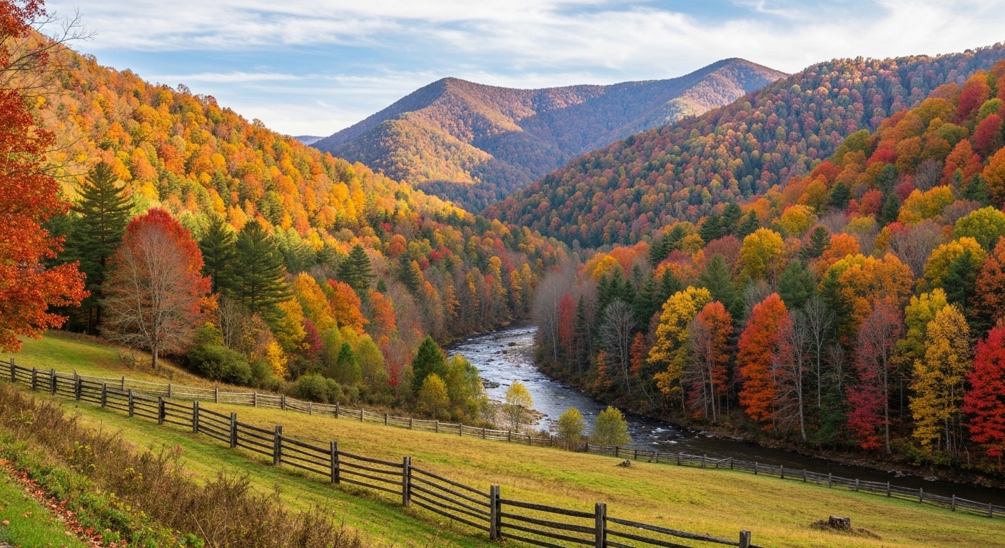
The Waterfall on the NC Side of the Smokies That Most Tourists Never Find

The Waterfall on the NC Side of the Smokies That Most Tourists Never Find

Mouse Creek Falls sits just over two miles up Big Creek Trail and sees a fraction of the foot traffic that Laurel Falls and Abrams Falls draw.

Read More →
Western NC Fishing Guides and Lodges Just Ranked Among the 10 Best in the Country

Western NC Fishing Guides and Lodges Just Ranked Among the 10 Best in the Country

The Tuckasegee, Nantahala, and Davidson rivers draw serious anglers from across the country — and the guides and lodges built around them just got national recognition.

Read More →
Franklin Is Redesigning Main Street and Wants Your Input Before It Happens

Franklin Is Redesigning Main Street and Wants Your Input Before It Happens

The Town of Franklin has two public meetings set for late May where residents can shape a major Main Street transformation plan.

Read More →

Posted in Community Guides
June 7, 2026

Living in Tuckasegee, NC: The Complete Guide (2026)

Living in Tuckasegee, NC: The Complete Guide (2026)

By Jon Tharp, Broker  ·  June 7, 2026

Quick Answer: Tuckasegee is a small, rural, unincorporated community in Jackson County, North Carolina, strung along NC-107 in the valley between Sylva and Cashiers at about 2,165 feet, where the East and West forks of the Tuckasegee River meet. It is known for some of the best trout fishing in Western North Carolina, a cluster of quiet high-elevation lakes, and mountain land, and it is a patient, rural market: lots of affordable land and cabins at one end, a handful of high-end river and lake estates at the other. Because Tuckasegee is unincorporated, buyers pay no town property tax, only the Jackson County rate plus a small fire-district levy.

Tuckasegee at a Glance

Status Unincorporated rural community (no published population); ZIP 28783
Setting The Tuckasegee River valley on NC-107, between Sylva and Cashiers, at ~2,165 ft
The water The Tuckasegee River (a premier trout river) plus the East Fork lakes (Bear, Cedar Cliff, Wolf, Tanasee)
Market Rural and bimodal: affordable land and cabins, a few high-end river/lake estates; slow (median sale ~$350K, DOM ~167) (as of June 2026)
Property tax Jackson County $0.31 per $100 (2025-26), no town tax (unincorporated), plus a small Cullowhee fire-district levy
Drive to Sylva ~6-7 miles, ~12 minutes to the county seat, services, and the hospital
Locally famous for Trout fishing on "the Tuck," quiet mountain lakes, and remote rural land

What is it actually like to live in Tuckasegee?

Living in Tuckasegee means living in a quiet, remote river valley surrounded by national forest, where the draw is fishing, land, water, and privacy rather than town conveniences. It is one of the most rural communities in this guide series, and that is exactly the appeal for the right buyer.

Tuckasegee sits in the valley where the two forks of the Tuckasegee River come together, with the river itself a marquee trout fishery and a string of small, lightly developed high-elevation lakes nearby. There is no real town center; general stores and gas stations stand in for retail, and everything else, groceries, pharmacy, the hospital, is a short drive to Sylva or Cullowhee. The market reflects the rural setting: mostly affordable land and cabins, with a handful of higher-end river and lakefront properties, and a slow pace where listings can sit (as of June 2026). Because Tuckasegee is unincorporated, there is no town property tax, only the Jackson County rate plus a small fire-district levy.

This guide is written honestly for what Tuckasegee is: a patient, land-and-lifestyle market for anglers, nature lovers, and privacy seekers, and how to buy here well, from flood risk on the river to well-and-septic realities and the rural-internet question.

Table of Contents

- What kind of place is Tuckasegee? - What is the fishing like on the Tuckasegee River? - What are the lakes near Tuckasegee? - What is the Tuckasegee real estate market like? - What is there to do in Tuckasegee? - How far is Tuckasegee from Sylva, Cashiers, and the feeder cities? - What internet and utilities can you get in Tuckasegee? - How did Hurricane Helene affect Tuckasegee? - What should out-of-state buyers know about property here? - What are the property taxes in Tuckasegee? - What are the schools and healthcare like? - How does Tuckasegee compare to nearby areas? - Is Tuckasegee right for you? - Frequently Asked Questions

What kind of place is Tuckasegee?

Tuckasegee is a rural, unincorporated mountain community, not a town, defined by the river, the surrounding Nantahala National Forest, and a quiet, neighborly valley culture. Its whole character is remote and land-oriented.

There is no official population count because Tuckasegee is an unincorporated community rather than a formal census place, and there is no town government, so there is no municipal tax, just Jackson County governance and a local volunteer fire district. The name carries deep history: it comes from a historic Cherokee town shown on maps as early as 1730. Today the valley is a string of homes, cabins, and land along NC-107 and its side roads, with general stores rather than chains, where, as locals put it, everyone knows their neighbors. The river runs through the heart of it, and the forest wraps everything.

Day to day, life here is rural and self-reliant: fishing and paddling the river, exploring the lakes and waterfalls, working land, and driving to Sylva or Cullowhee for shopping, schools, and services. For someone who wants quiet, space, and water access over walkable convenience, that trade is the entire point.

See what is on the market in Tuckasegee

See Homes for Sale in Tuckasegee

What is the fishing like on the Tuckasegee River?

The fishing is the headline: the Tuckasegee, "the Tuck," is one of the largest and most productive trout rivers in Western North Carolina and a marquee stop on the Western North Carolina Fly Fishing Trail. For an angler-buyer, it is a genuine draw.

The river is wade-friendly, larger and shallower than most mountain streams, and heavily stocked, with a popular roughly five-mile Delayed Harvest (catch-and-release, single-hook artificial flies only) section near Sylva that runs October through May, plus a second delayed-harvest stretch downriver near Bryson City. Brook, rainbow, and brown trout are all in play, and guide services and fly shops work the river year-round. Flows are influenced by Duke Energy dam releases on both forks, which anglers and paddlers learn to read. Beyond fly fishing, the river supports rafting and tubing, with riverside access points in the area. For someone whose dream is walking out the door to a great trout river, Tuckasegee is one of the best addresses in the region.

What are the lakes near Tuckasegee?

Tuckasegee sits near a cluster of small, high-elevation, lightly developed Duke Energy reservoirs on the East Fork, quiet alternatives to the bigger, busier Lake Glenville on the West Fork. They are a defining feature of the area.

Lake Size Character
Bear Creek (Bear) Lake ~476 acres (largest) Along NC-281; public boat ramp and ADA fishing dock; home to the gated Bear Lake Reserve resort community; Sols Creek Falls (~120 ft) nearby
Wolf Creek (Wolf) Lake ~183 acres East Fork system; boating, paddling, swimming, fishing
Cedar Cliff Lake ~100+ acres Closest to NC-107; paved boat ramp off Shook Cove Road (confirm current access, post-maintenance)
Tanasee Creek Lake ~40 acres (smallest) Secluded off NC-281; no motorboats, paddling and fishing only

These East Fork lakes are surrounded by national forest and are far less developed than Lake Glenville, so true private lakefront is scarce, with the gated Bear Lake Reserve community the notable developed exception. They are prized for quiet paddling, fishing, and scenery rather than a big boating scene. As with all the area's lakes, Duke Energy controls the shoreline, so any dock or shoreline use requires its permit. Note that Lake Glenville (the larger West Fork lake) is a separate, more developed market near Glenville and Cashiers, often confused with these East Fork lakes.

What is the Tuckasegee real estate market like?

Tuckasegee is a rural, patient, bimodal market: mostly affordable land and cabins, with a handful of higher-end river and lakefront estates, and long marketing times. It is a land-and-lifestyle market more than a move-in-ready-home market.

Over the past year roughly 51 properties sold with a median near $350,000 but an average around $512,000 and a high around $2.8 million, while the active market shows about 148 listings with a median list near $277,500 and a high around $4.6 million, with days on market running around 170 (as of June 2026). That long DOM and the gap between median and average tell the story: lots of raw mountain land, acreage, and rustic cabins at the lower end, a few river-frontage and high-end properties at the top, and a slow pace where both buying and reselling take patience. What most buyers actually purchase here is land, a cabin, or river frontage, not a conventional subdivision home.

Looking in Tuckasegee? Tuckasegee homes or Land and acreage.

Because this is a land-heavy rural market with long timelines, pricing and due diligence matter more than speed. Start with current Tuckasegee listings, and widen into the nearby Sylva and Cullowhee markets for more conventional inventory.

What is there to do in Tuckasegee?

Tuckasegee is about the outdoors: fishing, paddling, hiking, and waterfalls, with the broader plateau and Sylva a short drive for everything else. It is a base for water and forest more than for nightlife.

On and around the water you have the trout river, the East Fork lakes, and waterfalls like Sols Creek Falls near Bear Lake, plus paddling and tubing on the river. The community is wrapped in Nantahala National Forest, with hiking and backcountry access, and Panthertown Valley, the "Yosemite of the East," lies just to the south toward Cashiers. East LaPorte River Park is a local riverside gathering spot. For shopping, dining, breweries, and events, Sylva and Cullowhee are about fifteen minutes north, and the Cashiers village scene is to the south. The appeal here is genuinely the quiet and the access to water and forest, not a busy social calendar.

How far is Tuckasegee from Sylva, Cashiers, and the feeder cities?

Tuckasegee sits about fifteen minutes from both Sylva and Cullowhee and roughly twenty minutes from Cashiers, with Asheville and the feeder metros well beyond. Mountain roads make the drives longer than the mileage suggests.

From Tuckasegee to Distance Drive time
Sylva, NC (Harris Regional Hospital) ~6-7 mi ~12-13 min
Cullowhee / WCU ~7 mi ~13 min
Glenville / Lake Glenville ~9 mi ~15-20 min
Cashiers, NC ~15 mi ~22 min
Asheville, NC (and AVL airport) ~52 mi ~1 hr
Greenville-Spartanburg, SC (GSP) ~87 mi ~1 hr 50 min
Atlanta, GA ~160 mi ~3 hr
Charlotte, NC ~160 mi ~3 hr

(Distances and times as of June 2026, via mapping calculators; some are approximate.) Sylva, about fifteen minutes north, is the practical hub for groceries, the full-service hospital, and shopping, while the critical-access Highlands-Cashiers Hospital is to the south. Asheville Regional is the nearest commercial airport at about an hour, with Greenville-Spartanburg and Atlanta as the larger feeder metros.

What internet and utilities can you get in Tuckasegee?

Internet is the real rural challenge here: wired options are limited, and satellite is the dependable answer for most parcels, so anyone planning to work from home must confirm service at the exact address before buying.

Provider Type Coverage in Tuckasegee Top speed Notes (as of mid-2026)
Frontier DSL where copper reaches varies limited; no major rural investment planned
Fixed wireless Wireless some areas varies tower-dependent; a SkyFi tower has been planned for the area
Starlink Satellite anywhere ~25-100 Mbps typical the realistic default for most rural lots
Viasat / HughesNet Satellite available lower legacy fallback

(Coverage from broadband aggregators and local reporting, mid-2026.) Connectivity is a known pain point in this part of Jackson County, so treat strong internet as something to verify, not assume. On utilities, essentially all rural property here is on private wells and septic rather than municipal water and sewer, so budget for a well test, a septic inspection, and perc tests on raw land. And expect genuine cell and GPS dead zones in the valleys and on forest roads, so do not rely on phone navigation everywhere.

How did Hurricane Helene affect Tuckasegee?

The Tuckasegee-to-Cashiers corridor was among the hardest-hit parts of Jackson County during Hurricane Helene in September 2024, with major river flooding and road damage, even though the county overall fared better than areas to the east. River-adjacent property is the key flood consideration here.

During Helene the Tuckasegee River rose from a normal level of about 4.5 feet to over 17 feet, the area got more than eleven inches of rain in three days with wind gusts near 60 mph, and the central-and-southern county from Tuckasegee to Cashiers saw many rural roads left impassable. The county lost cell service and internet from Friday afternoon into late Monday, and some river-access points remained closed into 2025. Recovery has progressed, but the episode is a clear flood marker. For a buyer, the takeaway is concrete: any river-frontage or low-lying parcel deserves a careful flood-zone check (North Carolina's flood mapping at fris.nc.gov is the tool), along with a look at road and bridge access and the property's storm history, while homes set up and away from the river are a different profile.

What should out-of-state buyers know about property here?

Five things define a smart Tuckasegee purchase: the rural remoteness, well-and-septic on essentially every parcel, steep and shared access roads, flood risk on the river, and the slow market. All reward preparation, and none should surprise you at closing.

First, remoteness: groceries, pharmacy, full retail, and the hospital are all a drive to Sylva or Cullowhee, so plan your life around that. Second, water and septic: almost all rural property here is on private wells and septic, so budget for a well test, a septic inspection, and perc tests on land before you rely on buildability. Third, access: steep, gravel, and shared private roads are common, so confirm who maintains the road, the cost split, and that there is a recorded Road Maintenance Agreement, which lenders require. Fourth, flood: river and creek parcels carry real flood exposure (see Helene above), so pull the flood map and weigh elevation. Fifth, the market: with days on market around 170, both buying and reselling take patience, and pricing and timing should be set realistically up front. Add Duke Energy shoreline rules on any lakefront, and the small fire-district tax, and you have the homework. I walk land and cabin buyers through every piece, because in a rural market the due diligence is the deal.

What are the property taxes in Tuckasegee?

Tuckasegee buyers pay only the Jackson County rate of $0.31 per $100 (for 2025-26) plus a small Cullowhee fire-district levy, with no town tax, because Tuckasegee is unincorporated. That keeps the total bill low, a genuine plus for rural land and second-home buyers.

On the county side, Jackson County completed a revaluation effective January 1, 2025 that raised assessed values significantly and cut the county rate from $0.38 to $0.31 to partly offset it, so bills reflect the new values. Tuckasegee is served by the Cullowhee Volunteer Fire Department (Station 2 sits right on NC-107 in Tuckasegee), so a small fire-district tax applies on top of the county rate; confirm the current fire-district figure for a specific parcel, but there is no municipal layer at all.

On the state side, North Carolina is favorable for retirees: Social Security is not taxed, government and military pensions can be exempt under the Bailey settlement, and there is no estate tax. There is no special $35,000 senior exemption (that is a Georgia benefit, not North Carolina); other retirement income is taxed at the state's flat rate (3.99% in 2026). This is general information, not tax advice, so confirm current rates and the fire-district levy with the county and a CPA.

What are the schools and healthcare like?

Tuckasegee is served by Jackson County Public Schools, zoned to Cullowhee Valley School for K-8 and Smoky Mountain High in the Sylva area for high school, with healthcare anchored by Harris Regional Hospital about fifteen minutes away in Sylva. For a rural valley, the essentials are a reasonable drive.

For schools, Tuckasegee is zoned to Cullowhee Valley School (K-8), which serves Cullowhee plus the surrounding communities including Tuckasegee, and to Smoky Mountain High School in Sylva for grades 9-12; Western Carolina University in Cullowhee adds higher-education and cultural options nearby. For healthcare, Harris Regional Hospital in Sylva is the closest full-service hospital and ER, about fifteen minutes north, with the critical-access Highlands-Cashiers Hospital to the south and Mission Hospital in Asheville as the regional referral center about an hour away. Buyers should expect to drive for medical care, which is the rural trade-off, with a full hospital within about fifteen minutes.

How does Tuckasegee compare to nearby areas?

Tuckasegee is the rural, river-and-land option, distinct from the year-round towns of Sylva and Cullowhee to the north and the lake-and-resort markets of Glenville and Cashiers to the south. Here is the honest head-to-head.

- Why buyers choose Tuckasegee over Sylva or Cullowhee: Tuckasegee offers more privacy, more land, lower prices, and direct access to the trout river and the quiet East Fork lakes, while Sylva and Cullowhee have walkable services, more inventory, and shorter drives to everything. Choose Tuckasegee for rural quiet and water access, the Sylva area for convenience and selection. - Why buyers choose Tuckasegee over Glenville: Tuckasegee is more affordable and more rural, with the river and the lightly developed East Fork lakes, while Glenville is built around the much larger, more developed Lake Glenville with true lakefront estates. Choose Tuckasegee for land and the river, Glenville for big-lake living. - Why buyers choose Tuckasegee over Cashiers: Tuckasegee is a fraction of the cost of Cashiers and far more rural and private, while Cashiers is the high-end plateau resort with clubs and a village. Choose Tuckasegee for affordable rural land and fishing, Cashiers for the luxury resort lifestyle.

Is Tuckasegee right for you?

Tuckasegee is a strong fit for an angler, a land buyer, or a privacy seeker who wants a rural river valley with great trout fishing, quiet lakes, and mountain acreage, and who is comfortable driving fifteen minutes for services and being patient in a slow market. If your dream is a cabin on or near the Tuck, a piece of mountain land, or a quiet escape wrapped in national forest, Tuckasegee delivers it affordably and authentically.

It is not the right fit for someone who wants walkable conveniences (look to Sylva), a turnkey selection of move-in-ready homes (the market is land-heavy and slow), reliable high-speed internet without checking the address, or a property on the river without taking flood risk seriously. Rural self-reliance, well-and-septic, and access-road homework are part of the deal.

If a rural river-and-land lifestyle is what you are after, reach out and I will help you sort buildable land from problem parcels, check flood and access on river property, and find the right piece of this quiet valley for how you want to live.

Frequently Asked Questions

Is Tuckasegee, NC a good place to live? For an angler, land buyer, or privacy seeker, yes. Tuckasegee is a rural, unincorporated river valley in Jackson County, strung along NC-107 between Sylva and Cashiers, known for excellent trout fishing on the Tuckasegee River, a cluster of quiet high-elevation lakes, and affordable mountain land, all wrapped in national forest. Because it is unincorporated, there is no town property tax, only the Jackson County rate plus a small fire-district levy, and Sylva's services and hospital are about fifteen minutes away. The trade-offs are real remoteness, well-and-septic property, limited internet, and a slow market, so it fits rural land-and-lifestyle buyers far better than someone wanting town conveniences.

How much does it cost to buy in Tuckasegee? It is a rural, bimodal market. Over the past year about 51 properties sold with a median near $350,000 but an average around $512,000 and a high around $2.8 million, while active listings show a median list near $277,500 and reach about $4.6 million, with days on market around 170 (as of June 2026). The lower end is raw land, acreage, and rustic cabins; the higher end is river-frontage and a few high-end properties. Most buyers here purchase land, a cabin, or river frontage rather than a conventional home, so ask me for a current, parcel-specific read before making an offer.

How is the trout fishing on the Tuckasegee River? Excellent. The Tuckasegee, "the Tuck," is one of the largest and most productive trout rivers in Western North Carolina and a marquee stop on the WNC Fly Fishing Trail. It is wade-friendly and heavily stocked, with a popular roughly five-mile Delayed Harvest (catch-and-release, single-hook artificial flies) section that runs October through May, plus a second delayed-harvest stretch near Bryson City, holding brook, rainbow, and brown trout. Flows are affected by Duke Energy dam releases. For an angler who wants to live near a great river, Tuckasegee is one of the best addresses in the region.

What lakes are near Tuckasegee? Tuckasegee sits near four small, high-elevation, lightly developed Duke Energy reservoirs on the East Fork: Bear Creek Lake (the largest at about 476 acres, with a public ramp and the gated Bear Lake Reserve community), Wolf Creek Lake (about 183 acres), Cedar Cliff Lake (about 100-plus acres, closest to NC-107), and Tanasee Creek Lake (about 40 acres, paddling only, no motorboats). They are quiet, forest-surrounded alternatives to the bigger, more developed Lake Glenville on the West Fork. Because they sit in national forest and Duke controls the shoreline, true private lakefront is scarce.

Does Tuckasegee have a town property tax? No. Tuckasegee is unincorporated, so buyers pay only the Jackson County rate of $0.31 per $100 (2025-26) plus a small Cullowhee fire-district levy, with no municipal tax on top. Jackson County completed a 2025 revaluation that raised assessed values and cut the county rate from $0.38 to $0.31. Confirm the current fire-district figure for a specific parcel. North Carolina does not tax Social Security and has a flat income tax (3.99% in 2026); there is no $35,000 senior exemption (that is Georgia), though government and military pensions can be exempt under the Bailey settlement.

What is the internet like in Tuckasegee? Limited, and a real consideration. Wired options are sparse (Frontier DSL where copper reaches, with no major rural investment planned), some areas have fixed wireless, and satellite, especially Starlink, is the dependable default for most rural parcels. Connectivity is a known pain point in this part of Jackson County, so if you plan to work from home, verify service at the exact address before buying rather than assuming it.

Did Tuckasegee flood during Hurricane Helene? The river corridor did. The Tuckasegee-to-Cashiers area was among the hardest-hit parts of Jackson County during Helene in September 2024, when the river rose from about 4.5 feet to over 17 feet, more than eleven inches of rain fell in three days, and many rural roads were left impassable, with cell and internet out for several days. The county overall fared better than areas to the east, and recovery has progressed, but flood risk on river and creek parcels is real. For any river-frontage or low-lying property, pull the FEMA flood-zone determination (fris.nc.gov) and weigh elevation; homes set up away from the river are a different profile.

Is Tuckasegee too remote to live in full-time? It depends on your tolerance for rural life. Tuckasegee is genuinely rural, with general stores rather than chains and a fifteen-minute drive to Sylva or Cullowhee for groceries, the hospital, and shopping, plus well-and-septic property, limited internet, and cell dead zones. For someone who wants quiet, space, and water and forest access, that is the appeal, and many people live here full-time and love it. For someone who wants conveniences close at hand, a town like Sylva is a better fit. Spending real time here in different seasons before buying is the smart move.

About the Author

Jon Tharp is a licensed NC real estate broker with Keller Williams. He's helped buyers and sellers across Western North Carolina for over 10 years, specializing in mountain homes, land, and short-term rental investments, with offices throughout WNC covering all mountainous areas. If something in this post has you thinking about a move, he's easy to reach — (828) 347-9055 or smokymountainhomes4sale.com or Jon@jontharphomes.com.

Ready to Make Western NC Your Home Base?

Whether you're looking to buy, considering a short-term rental investment, or ready to sell, the Jon Tharp Team brings deep local knowledge and marketing that puts your home in front of 50,000+ buyers in the first 30 days.

Search available homes across Western NC or call Jon directly at (828) 347-9055.

Talk to Jon

What Our Clients Say

43 five-star Google reviews  —  read them all on Google

★★★★★

"Jon is hands down the most dedicated and knowledgeable realtor that I have ever worked with. His expertise made the entire process of selling my home and finding a new one a smooth process."

Amy Davis  ·  2025

★★★★★

"Jon & his team are the greatest! Very professional, friendly like your neighbor, and always get back to your texts, phone calls & emails within minutes or same day, not days or weeks."

Cynthia Oelschlager  ·  2025

★★★★★

"I can’t say enough good things about Jon and his team. I was looking for investment properties and Jon spent time researching where would be a good place for an Airbnb — he found 2 beautiful properties."

Diane Cogswell  ·  2025

More from the Blog
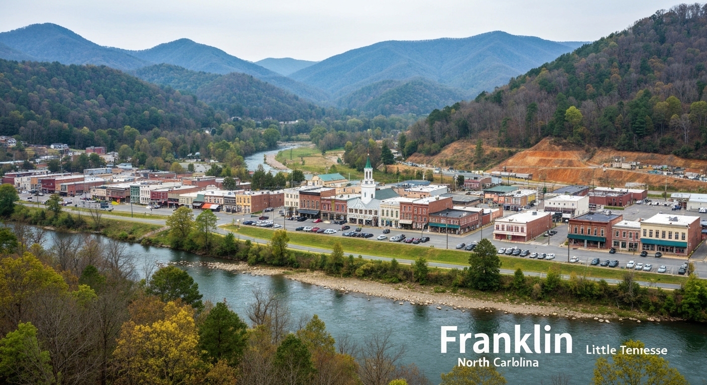
The Waterfall on the NC Side of the Smokies That Most Tourists Never Find

The Waterfall on the NC Side of the Smokies That Most Tourists Never Find

Mouse Creek Falls sits just over two miles up Big Creek Trail and sees a fraction of the foot traffic that Laurel Falls and Abrams Falls draw.

Read More →
Western NC Fishing Guides and Lodges Just Ranked Among the 10 Best in the Country

Western NC Fishing Guides and Lodges Just Ranked Among the 10 Best in the Country

The Tuckasegee, Nantahala, and Davidson rivers draw serious anglers from across the country — and the guides and lodges built around them just got national recognition.

Read More →
Franklin Is Redesigning Main Street and Wants Your Input Before It Happens

Franklin Is Redesigning Main Street and Wants Your Input Before It Happens

The Town of Franklin has two public meetings set for late May where residents can shape a major Main Street transformation plan.

Read More →

Posted in Community Guides