Asheville Mayor Esther Manheimer says a proposed Costco in West Asheville is back on track after she met with company representatives in June 2026. Costco withdrew its application in February over infrastructure requirements and cost concerns, but the city has worked with developers and state transportation officials to address them. The mayor cautions it is not a done deal, and several steps remain.
West Asheville's long-discussed Costco is back in the conversation, and this time the city's mayor sounds optimistic. Mayor Esther Manheimer said in June that the proposed warehouse store is back on track after she met with company representatives, a notable shift from where things stood just a few months ago. For a project that looked dead earlier this year, that is a real change in tone.
The site sits in Buncombe County, on the west side of Asheville, the busy stretch of town that locals reach off I-26 and I-40 and that sits only a few minutes from downtown. Anyone who has driven that corridor knows how quickly traffic stacks up, which is a big part of why this particular project has been complicated from the beginning.
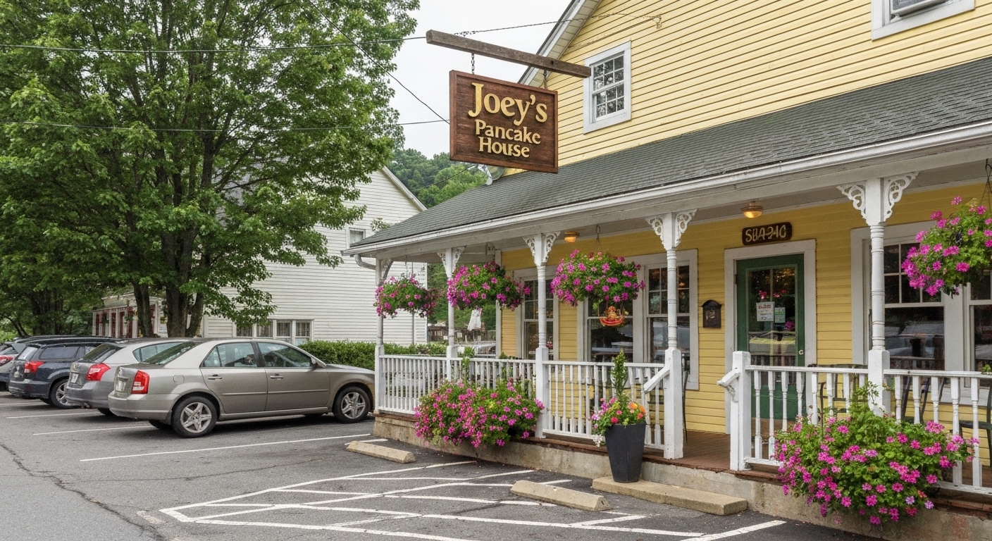
Joey's Pancake House in Maggie Valley celebrates 60 years on Wednesday, June 24, 2026, with breakfast service from 7 a.m. to 6 p.m., a pancake-eating contest at 2 p.m., hourly raffles, and live music from the Rich Manz Trio. Founded by Joey and Brenda O'Keefe in 1966, the Soco Road institution closed in 2016 after 50 years and reopened under new owners in 2018, keeping the original name and menu. The pancake-eating winner gets one free meal a month for a year; sign up at joeysmaggievalley@gmail.com.
For sixty years, breakfast in Maggie Valley has meant a stop at Joey's Pancake House, and on Wednesday, June 24, the Soco Road institution is throwing a party to mark the milestone. The day runs from 7 a.m. to 6 p.m. and includes a pancake-eating contest, hourly raffles, and live music. For a town that measures itself in seasons and return visits, it is a fitting way to celebrate one of its longest-running landmarks.
Joey's opened in 1966, after Joey and Brenda O'Keefe came through Maggie Valley on their way to Virginia to look at a small business, stopped to visit friends, and decided to stay. Joey had come up through the Fontainebleau Hotel in Miami Beach, where he met Brenda, and the two built something in this valley that outlasted them both. He became a local icon, and so did the pancakes.
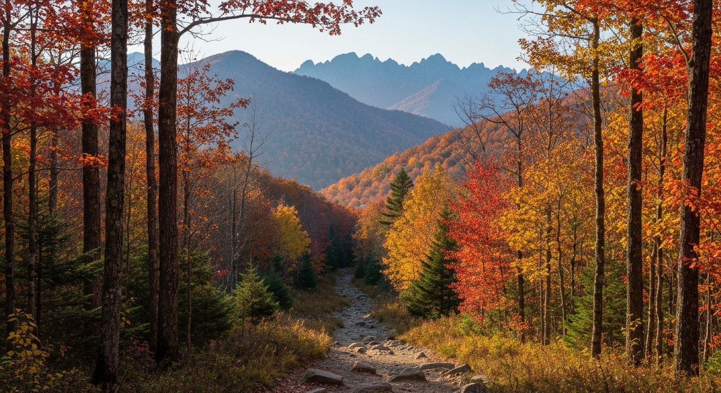
The Appalachian Trail Conservancy has updated its free interactive map, letting hikers locate shelters, viewpoints, parking, and Trail sections from a phone or computer before they leave home. The map now loads faster, works better on mobile, and aligns mileage with FarOut and ATC guidebooks. For Western North Carolina, that covers the well-loved stretch through Franklin and the Nantahala Mountains.
Planning a hike on the Appalachian Trail just got easier, and that matters here, because some of its most famous southern miles run straight through Macon County. The Appalachian Trail Conservancy has updated its free interactive map, letting anyone scout shelters, viewpoints, parking areas, and Trail sections from a phone or computer before lacing up.
If you live in Franklin, you already know the Trail is practically a neighbor. The A.T. crosses US-64 at Winding Stair Gap just west of town, and Franklin sits about 70 miles southwest of Asheville, a little over an hour by way of US-74 and US-441. For a stretch of footpath this close to home, a better map helps.
Slava is a new Ukrainian café opening in Asheville, in Buncombe County. It brings traditional Ukrainian food and coffee culture to the city, including dishes like varenyky, syrniki, and house pastries. The café reflects Asheville's growing reputation as one of the most diverse small food cities in the Southeast, and early previews have drawn strong local interest ahead of the full opening.
A Ukrainian café is about to give Asheville one more reason to brag about its food scene, and the early reaction suggests it is going to be popular. Slava is bringing traditional Ukrainian cooking, dumplings, soft cheese pancakes, pastries, and proper café coffee, to a city that already takes its independent restaurants seriously.
Asheville sits in Buncombe County right where Interstate 26 meets Interstate 40, which puts it within easy reach of nearly every mountain town in the region. If you are coming from Waynesville it is about a 35 minute drive east, and from Hendersonville you are looking at roughly 25 minutes north. For a café this specific, that central location matters, because people will travel for food they cannot get anywhere else nearby.
Downtown Asheville's best coffee shops range from Old Europe Pastries, a Hungarian bakery open since 1994, to specialty bars like The Rhu, Rowan Coffee, High Five, and Trade and Lore. French Broad Chocolate handles the affogato crowd, Bebette's and PennyCup round out the list, and Dobra Tea covers anyone skipping coffee. Park once near Pack Square or Lexington Avenue and walk the whole circuit.
Tom and I drink about as much coffee as the Gilmore Girls, and downtown Asheville is one of the few places where that habit feels less like a problem and more like a hobby. You can park once near Pack Square, walk a few blocks in any direction, and pass a Hungarian bakery that has been open since 1994, a chocolate shop pulling affogatos, and a handful of specialty espresso bars that take their single-origin beans as seriously as the city takes its breweries.
Asheville earned this reputation the slow way. The downtown core sat half-empty through the worst of the late twentieth century, then revitalized through the late 1980s and 2000s as independent shops, restaurants, and cafes moved into storefronts that had been dark for years. The same craft-and-independent streak that made the city a national beer destination gave specialty coffee a place to grow. Locals here have quietly resisted letting big chains take over the center of town, and that choice shows up in the cup.
The Blue Ridge Music Center is launching its first-ever Fiddle and Fork Festival, a new event pairing old-time and bluegrass music with regional mountain food at Milepost 213 on the Blue Ridge Parkway near Galax, Virginia. The venue sits near the North Carolina line and draws from the WNC and Southwest Virginia music corridor. Confirm dates, lineup, and tickets through the Blue Ridge Music Center and National Park Service before you go.
A new festival is coming to one of the most scenic music venues in the southern mountains, and it has a name built around two of the things this region does best. The Blue Ridge Music Center is launching its first-ever Fiddle and Fork Festival, pairing the old-time and bluegrass music the center is known for with the food traditions of the Appalachian highlands.
The setting tells you most of what you need to know. The Music Center sits at Milepost 213 on the Blue Ridge Parkway, perched at roughly 3,500 feet near Galax, Virginia, right up against the North Carolina line. For anyone in Western North Carolina who loves fiddle tunes and a good plate of mountain food, this is a festival worth circling on the calendar.
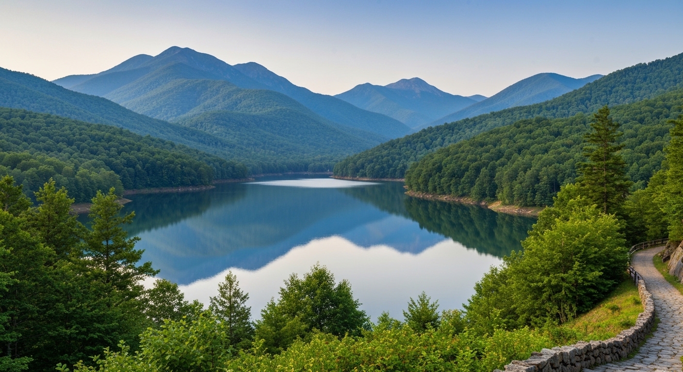
Lake Junaluska launched seven new swan paddle boats in June 2026, a gift from Carol Clark in honor of her parents and family. Called "Seven Swans a-Swimmin," the boats nod to a Clark family tradition of renting paddle boats during vacations more than 50 years ago. They rent for $30 an hour, hold up to five people, and honor the lake's real swans, introduced in 1989.
Seven swan paddle boats are now gliding across Lake Junaluska, and the story behind them is better than the photos.
The fleet is a gift from Carol Clark, who donated the boats in honor of her parents and other family members. She named them "Seven Swans a-Swimmin," which is exactly the kind of name you give something when it comes from the heart rather than a marketing meeting. The boats hit the water this June, and they are already drawing the kind of attention that calm mountain lakes rarely generate on their own.
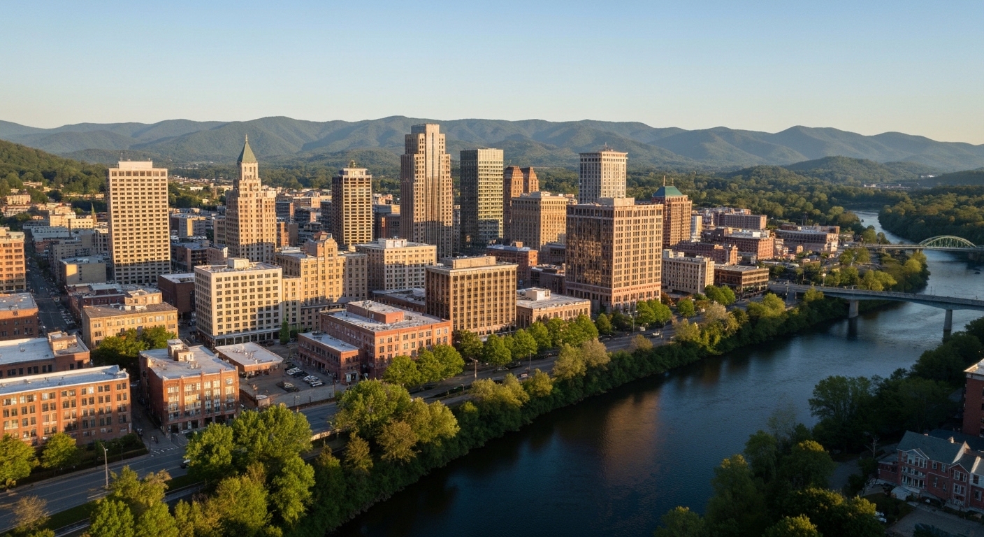
Quick Answer:Asheville is the county seat of Buncombe County and the cultural, medical, and economic capital of Western North Carolina, a real city of about 94,000 set at roughly 2,134 feet in a bowl of mountains. It is the one WNC market where you get genuine urban culture, a nationally known food and beer scene, the Biltmore, live music, a growing airport, and a Level I trauma hospital, alongside the mountains. That comes at a city price: homes sold for a median around $477,000 over the past year, far above the rural WNC towns, in a faster, more diverse market of historic homes, condos, and townhomes. Two things every Asheville buyer should understand: the city has distinct neighborhoods at very different price points, and Hurricane Helene reshaped specific river corridors in 2024, so flood geography matters block by block.
Asheville at a Glance
Population
About 94,000 in the city (2020 Census); ~270,000 in Buncombe County; the largest city in WNC
Elevation
~2,134 feet, a city in a bowl of mountains
Median home price
~$477,000 sold over the past year; active homes list near $575,000 (as of June 2026)
Time on market
Roughly 81 days, faster than the rural WNC towns
Market type
A true city market: historic homes, condos, townhomes; only ~21% of active listings are land
Property tax
Buncombe County ~$0.55 + City of Asheville ~$0.44 per $100 (plus city-school supplement); verify combined
Drive to Charlotte / GSP airport
~2 hr to Charlotte; ~1 hr to Greenville-Spartanburg; AVL airport is in town
Locally famous for
The Biltmore Estate, Beer City USA, Foodtopia, the River Arts District, and the Blue Ridge Parkway
What is it actually like to live in Asheville?
Living in Asheville means having a real city in the mountains: walkable historic neighborhoods, a nationally known food and beer scene, a growing airport, a major regional hospital, and the Blue Ridge Parkway and Pisgah forest at the edge of town. It is the one place in Western North Carolina where you do not have to trade city amenities for mountain life, and the trade-off is that it costs more and moves faster than anywhere else in the region.
Asheville is the Buncombe County seat and the capital of Western North Carolina, a city of about 94,000 that punches far above its size in culture. It is famous for the Biltmore Estate, for being Beer City USA with more than fifty breweries, for its Foodtopia restaurant scene, for the River Arts District, and for sitting at the hub of the Blue Ridge Parkway where Interstates 40 and 26 cross. The market reflects the city it is: a median sold home around $477,000, a faster 81-day pace, and a true urban mix of historic homes, condos, and townhomes rather than the land-heavy inventory of the rural towns. And Asheville carries the recent memory of Hurricane Helene, which in 2024 devastated specific river corridors while leaving most of the higher-ground city untouched, so understanding the flood geography is part of buying here.
This guide is written for the buyer Asheville actually fits, the retiree or relocation buyer who wants real urban culture with the mountains, who can meet a city price, and who wants the honest picture: the neighborhoods, the market, the Helene flood geography, the short-term-rental rules, and who Asheville suits.
Asheville is a real city, the cultural, medical, and educational capital of Western North Carolina, set in a bowl of mountains where the interstates cross. That makes it fundamentally different from every other town in this region: it has urban neighborhoods, urban prices, and urban amenities.
The settlement was renamed Asheville in 1797 for Governor Samuel Ashe, but it stayed a small crossroads until the railroad arrived in 1880 and touched off a Gilded Age boom, capped by George Vanderbilt's Biltmore Estate in 1895, still the largest privately owned home in the country. A 1920s building boom gave the city its Art Deco skyline, and then the Depression hit so hard that Asheville chose to repay its debts over roughly fifty years rather than default, a long stagnation that, almost by accident, preserved its historic downtown buildings from mid-century demolition. That intact core became the foundation of the modern arts-and-tourism renaissance. Today the city holds about 94,000 people in a county of roughly 270,000, with a genuine mix of mountain natives, retirees, remote workers, artists, and students.
Day to day, Asheville is urban and creative, with the central tension of a fast-growing, in-demand city: real culture and amenities on one hand, rising prices, traffic, and tourism crowds on the other. It is mountain living without giving up the city, at a price that reflects exactly that.
Unlike the rural WNC towns, Asheville has real, distinct neighborhoods with their own character and very different price points, and choosing the right one is the most important decision a buyer makes here. Here is a working map.
Neighborhood / Area
Character
Typical property
Price tier
Downtown / Central
Walkable urban core, historic and new
Condos, lofts, townhomes, some historic homes
Mid to high
Montford
Historic district just north of downtown
Restored Victorian and Arts-and-Crafts homes
High
West Asheville
Hip, walkable Haywood Road corridor
1920s bungalows and newer infill
Mid to high
North Asheville (Grove Park, Kimberly, Beaverdam)
Established, affluent, tree-lined
Stately older homes, larger lots
High to very high
Biltmore Forest
Separate wealthy incorporated town by the Biltmore
Large estates on wooded lots
Top of market
Kenilworth
Central, near Mission Hospital
1920s bungalows and older homes
Mid to high
Oakley / Haw Creek (East)
East-side residential valleys
Mid-century and newer homes
Mid
South Asheville / Biltmore Park
Newer master-planned, Town Square retail
Newer homes, townhomes, condos
Mid to high
River Arts District (RAD)
Riverfront arts and live-work corridor
Studios, lofts, mixed-use
Varies; flood-cautioned
The quick read: Montford and North Asheville (Grove Park, Kimberly, Beaverdam) sit at the top for walk-to-downtown historic charm and established affluence, with Biltmore Forest as the luxury outlier; West Asheville and Kenilworth are the desirable, walkable mid-to-high tier; Oakley and Haw Creek on the east side and outer South Asheville offer more attainable entry points; and Biltmore Park is the newer master-planned option near the airport. The River Arts District is creative and central but sits in a river corridor, so it carries flood considerations (see the Helene section). Beyond the city, the towns of Black Mountain (east), Weaverville (north), Fairview (southeast), and Arden and Fletcher (south, toward the airport) function as part of the Asheville decision set. I help buyers match the neighborhood to the life they want, since in a city this varied, the neighborhood is the decision.
What is the Asheville real estate market like?
Asheville is a true city market, pricier, faster, and far more diverse than anywhere else in Western North Carolina, with historic homes, condos, and townhomes rather than mostly land. Homes sold for a median around $477,000 over the past year.
Over the past year roughly 2,601 properties sold in the Asheville area, with homes (excluding land) at a median near $477,456, while days on market ran about 81 (as of June 2026), notably faster than the rural towns. The active market has about 1,596 listings, of which only roughly 329, about 21%, are land or lots, the lowest land share of any WNC market because Asheville is a city, with homes asking a median list near $575,000. The price spread is broad and deep: among active homes, about 26% are under $400,000, 28% are $400,000 to $600,000, 23% are $600,000 to $900,000, and 24% are above $900,000. That means Asheville serves entry buyers and a substantial luxury market at once, with the right price band depending heavily on the neighborhood. The headline for anyone coming from a cheaper WNC search is simple: Asheville is materially more expensive than the rest of the region, and you are buying the city.
With this much variety across neighborhoods and price tiers, knowing the areas and the flood geography pays off. Start with current Asheville listings, and if a smaller-town price is more your speed, compare nearby Waynesville to the west.
Why is Asheville famous for food, beer, and the Biltmore?
Because all three are genuinely world-class and central to daily life: a nationally recognized restaurant scene, the country's most celebrated beer city, and the largest private home in America at the edge of town. For a city its size, Asheville's cultural footprint is remarkable.
Asheville brands itself Foodtopia and has earned repeated James Beard recognition for its independent, farm-to-table restaurants, while its Beer City USA reputation rests on more than fifty breweries, from local anchors like Highland, Wicked Weed, and Burial to the East Coast homes of Sierra Nevada (in nearby Mills River) and New Belgium (in the River Arts District). The Biltmore Estate, George Vanderbilt's 250-room château on 8,000 acres, remains the marquee attraction and operates year-round, with the historic Biltmore Village at its gate. Downtown adds the 1929 Grove Arcade, the Flatiron and S&W Art Deco landmarks, a lively busker culture, and music venues like The Orange Peel, while the grand Grove Park Inn anchors the north side. The River Arts District, a former industrial riverfront full of working studios, is rebuilding after Helene but remains one of the country's notable arts districts (confirm current open businesses, as the RAD and Biltmore Village are still recovering).
What outdoor recreation is around Asheville?
Asheville is the hub of the Blue Ridge Parkway and surrounded by national forest, rivers, and the highest peaks in the East, so the outdoor access is exceptional even by mountain-town standards. For hikers, paddlers, and cyclists, it is hard to beat.
The Blue Ridge Parkway runs along the city's edge with scenic overlooks, fall color, and trailheads minutes away, and the French Broad River offers paddling, tubing, and the riverfront greenway through the River Arts District. Pisgah National Forest and Mount Pisgah rise to the southwest, Mount Mitchell, the highest peak east of the Mississippi, is about 40 minutes northeast in the Black Mountains, and DuPont State Recreational Forest, famous for its waterfalls, is about 45 minutes south. Closer in, the NC Arboretum and Bent Creek offer gardens, trails, and mountain biking, and the city's growing greenway system adds urban trails. Easy access to world-class hiking and biking is one of Asheville's core draws and pairs naturally with an active retirement.
How did Hurricane Helene affect Asheville?
Helene was catastrophic for specific parts of Asheville in September 2024, but it is important to be precise: the storm devastated identifiable river corridors while leaving most of the higher-ground city untouched. Asheville is not a "flooded city," it is a city with specific flood-exposed areas.
When Hurricane Helene struck on September 27, 2024, the French Broad and Swannanoa Rivers drove historic flooding, and the destruction concentrated in the river corridors and valleys: the River Arts District, Biltmore Village, and the Swannanoa River valley east toward Black Mountain, which was among the hardest-hit areas in the entire country, with 43 deaths in Buncombe County. The storm also knocked out the city's water system, and the boil-water advisory was not fully lifted until November 18, 2024, nearly two months later. But most of Asheville, the ridges and higher-elevation neighborhoods, did not flood: downtown sits on a hill, and North Asheville, much of West Asheville, Montford, and the higher residential areas were spared the river flooding even as the whole city lost water and power. As of 2026 the city is functioning normally, with clean water restored, downtown, the Biltmore, and the airport running, and most tourism reopened, while the hardest-hit corridors like the RAD and Biltmore Village continue to rebuild.
The buyer implications are concrete: pull the flood map on every property using the FEMA Flood Map Service Center and the NC Flood Risk Information System, treat the RAD, Biltmore Village, the Swannanoa valley, and any river-adjacent lot as elevated-risk until the map proves otherwise, budget flood insurance in those corridors, and remember that higher neighborhoods carry far lower river-flood risk, though steep terrain has its own slope-stability questions. A ridge home in North Asheville and a studio in the RAD are completely different flood risks, and knowing the difference is exactly where local guidance earns its keep.
How far is Asheville from Charlotte, Atlanta, and the airports?
As the regional hub where the interstates cross, Asheville is the best-connected place in Western North Carolina, with its own growing airport and the major metros within a few hours. Mountain and interstate drives are generally faster here than from the rural towns.
(Distances and times as of June 2026, via mapping calculators; some are approximate.) The big differentiator is Asheville Regional Airport (AVL), just south of the city near Fletcher and Arden, which is growing fast with expanding nonstop service and a major terminal expansion, a real advantage over the rest of WNC, which has no commercial airport nearby. Between AVL and the interstates, Asheville is the one mountain market with genuine connectivity.
What internet and utilities can you get in Asheville?
As a city, Asheville generally has strong wired and fiber internet, better than the rural WNC towns, though availability still varies block to block, so confirm service at the exact address.
Provider
Type
Coverage in Asheville
Top speed
Notes (as of mid-2026)
Spectrum
Cable
broad (~91% of the city)
up to ~1 Gbps
the dominant wired provider
AT&T Fiber
Fiber
roughly 46% and expanding
up to multi-gig symmetrical
the fastest option where available
French Broad EMC fiber
Fiber
parts of the broader region
up to ~1 Gbps
co-op fiber on the rural edges
Starlink
Satellite
anywhere
~25-100 Mbps typical
rarely needed in the city; a rural-fringe backstop
(Coverage from broadband aggregators, mid-2026; treat as directional and re-check at the address.) Most of Asheville has solid cable and growing fiber, so wired internet is rarely the obstacle it can be in the rural towns, but coverage maps still differ street by street, so check the exact address at the provider sites, especially for fiber. On utilities, city homes are on Asheville municipal water and sewer (the system the city is now hardening after Helene), while properties outside city limits may be on private wells and septic, so budget for a well test and septic inspection on rural-fringe parcels.
What should buyers know about property here?
Six things shape a smart Asheville purchase: the neighborhood-and-price reality, the flood geography, the short-term-rental rules, the city-versus-county lines for taxes and schools, the faster market pace, and the growth pressures. This is a city, so the diligence is different from the rural towns.
First, the neighborhood is the decision, and the price varies enormously by area, so get clear on what you can buy where before you fall for a listing. Second, the flood geography matters block by block after Helene, so pull the FEMA map on any property and treat river corridors as elevated-risk. Third, the short-term-rental rules are strict and surprise many buyers: Asheville effectively bans whole-home short-term vacation rentals in residential zones, allowing them only in the Resort district, while homestays are permitted but require the owner to live on-site full-time and rent no more than two bedrooms, so you generally cannot buy an Asheville house purely as a whole-home Airbnb. Fourth, whether a property is inside the city or in unincorporated Buncombe County changes both the tax bill and, often, the school assignment, so confirm by parcel. Fifth, the market moves faster here (about 81 days, and faster in desirable neighborhoods), so be ready to act with financing in hand. And factor the growth and traffic that come with a popular city. In a market this varied and fast, good local guidance, on neighborhood, flood, and the rules, is what protects your purchase.
What are the property taxes in Asheville?
A home inside Asheville pays both the Buncombe County rate and the City of Asheville rate (plus a city-school supplement in the city-school district), while a property in unincorporated Buncombe County pays the county rate plus any fire district. Confirm the exact combined figure by parcel, especially with a county reappraisal in progress.
For 2025-26, Buncombe County's rate is about $0.55 per $100 of assessed value and the City of Asheville's is about $0.44 per $100, with an Asheville City Schools supplemental rate of roughly $0.11 per $100 for properties in that district, so an in-city home carries a meaningfully higher combined rate than a county parcel. Because Buncombe County's 2026 reappraisal is underway and will reset assessed values, confirm the current combined rate and your property's assessment before you rely on a number. On a $477,000 home, the combined city rate works out to well over $5,000 a year, so taxes are a real line item here, higher than in the rural counties.
On the state side, North Carolina is favorable for retirees: Social Security is not taxed, government and military pensions can be exempt under the Bailey settlement, and there is no estate tax. There is no special $35,000 senior exemption (that is a Georgia benefit, not North Carolina); other retirement income is taxed at the state's flat rate (3.99% in 2026). This is general information, not tax advice, so confirm the current county, city, and any fire-district figures with Buncombe County and the City of Asheville, and your situation with a CPA.
What are the schools and healthcare like?
Asheville has two school districts and the region's largest hospital, so both schools and healthcare come down to which part of the area you are in, with abundant options overall.
For schools, the city is served by Asheville City Schools while the surrounding county is served by Buncombe County Schools, and a home's address determines which district and schools a family is assigned to, so confirm the line for any specific property, and note there are private options like Carolina Day School as well. Higher education is a genuine Asheville strength and a retiree draw, with UNC Asheville, AB Tech, Warren Wilson College in Swannanoa, and Montreat College nearby. For healthcare, Mission Hospital (part of HCA Healthcare) is the region's largest hospital and, as of December 2025, the sole Level I trauma center in Western North Carolina, making Asheville the medical hub for the entire region, and the Charles George VA Medical Center is a major draw for veteran retirees, with AdventHealth and Novant also expanding in the area. Having a Level I trauma center and a major VA hospital in town is a significant advantage for retirees choosing Asheville.
How does Asheville compare to nearby towns?
Asheville is the city, distinct from every smaller town around it, which is exactly the choice buyers weigh. Here is the honest read.
- Why buyers choose Asheville over the smaller WNC towns: Asheville offers genuine urban culture, a major airport, a Level I trauma hospital, and walkable neighborhoods that the rural towns cannot match, while towns like Waynesville and the far-western communities are quieter, far more affordable, and more land-rich. Choose Asheville for city amenities and culture; choose the smaller towns for value and quiet. - Why buyers choose nearby towns over Asheville: Black Mountain, Weaverville, Hendersonville, and Waynesville give you a smaller-town feel and lower prices within reach of Asheville's amenities, which is why many buyers who love Asheville actually buy in a satellite town and drive in. Choose a satellite town to trade some convenience for price and pace. - Why buyers choose Asheville as a base: Asheville is the regional hub, with the airport, the hospital, the arts, the food and beer, and the Parkway, plus the interstates that connect everything, all in one city in the mountains. For a buyer who wants the city and the mountains together and can meet the price, nothing else in WNC compares.
Is Asheville right for you?
Asheville is a strong fit for a retiree or relocation buyer who wants real urban culture, walkable neighborhoods, a major airport and hospital, and easy access to the mountains, and who can meet a city price and choose the right neighborhood. If you want arts, food, and beer, a Level I trauma center, a growing airport, and the Blue Ridge Parkway, all in one place, Asheville is the only WNC market that delivers it, and it delivers it well.
It is not the right fit for someone seeking rural quiet and low prices (the smaller WNC towns fit far better), a property to run as a whole-home Airbnb (that is effectively banned in residential zones), or a buyer who wants to avoid flood and growth questions entirely (the river corridors carry real Helene-era risk, and the city is busy and growing). And neighborhood choice, flood geography, the rental rules, and a faster market are all part of buying here.
If urban mountain living with real culture and amenities is what you are after, reach out and I will help you match the neighborhood to your life, read the flood maps corridor by corridor, navigate the rental and tax rules, and find the right home in this remarkable city.
Frequently Asked Questions
Is Asheville, NC a good place to live? For a buyer who wants real urban culture with the mountains and can meet a city price, yes. Asheville is the cultural and medical capital of Western North Carolina, with a nationally known food and beer scene, the Biltmore, walkable historic neighborhoods, a growing airport, and a Level I trauma hospital, all in a city of about 94,000 in a bowl of mountains. Homes sold for a median around $477,000, far above the rural WNC towns. It fits culture-and-amenity-minded retirees and relocation buyers far better than someone seeking rural quiet and low prices.
How much does it cost to buy a home in Asheville? It is a real city market, materially pricier than the rest of WNC. Over the past year about 2,601 properties sold, with homes at a median near $477,456 and an 81-day market, while active homes ask a median near $575,000, with a broad spread (about 26% of active homes under $400,000 and about 24% above $900,000). Price depends heavily on the neighborhood, so ask me for a current, neighborhood-specific read before making an offer.
Did Asheville flood during Hurricane Helene? Specific parts did, severely, but most of the city did not. Helene's catastrophic 2024 flooding concentrated in the river corridors, the River Arts District, Biltmore Village, and the Swannanoa River valley, with 43 deaths in Buncombe County, and the city's water was out for nearly two months. But the ridges and higher-elevation neighborhoods, including downtown, North Asheville, and much of West Asheville and Montford, did not flood. Asheville is not a "flooded city"; it is a city with specific flood-exposed corridors, so pull the FEMA flood map on any property and treat river-adjacent areas as elevated-risk.
Can you run an Airbnb in Asheville? Generally not as a whole-home short-term rental in residential zones. Asheville effectively bans whole-home short-term vacation rentals outside the Resort zoning district, so you cannot buy a typical Asheville house purely to run it as a whole-home Airbnb. Homestays are allowed in residential zones, but they require the owner to live on-site full-time as a primary residence and rent no more than two bedrooms, with a permit. Confirm the current ordinance with the City of Asheville before counting on any rental income.
What neighborhoods should I consider in Asheville? It depends on your budget and lifestyle. Montford and North Asheville (Grove Park, Kimberly, Beaverdam) lead for historic charm and established affluence, with Biltmore Forest as the luxury outlier; West Asheville and Kenilworth are the walkable mid-to-high tier; Oakley, Haw Creek, and outer South Asheville offer more attainable entry points; and Biltmore Park is the newer master-planned area near the airport. The River Arts District is creative and central but sits in a flood-cautioned river corridor. Nearby Black Mountain, Weaverville, and Arden round out the decision set.
What are the property taxes in Asheville? A home inside the city pays both the Buncombe County rate (about $0.55 per $100) and the City of Asheville rate (about $0.44 per $100), plus a city-school supplement of roughly $0.11 in that district, so the combined in-city rate is well above the rural counties (over $5,000 a year on a $477,000 home). A county parcel pays the county rate plus any fire district. A 2026 reappraisal is underway, so confirm the current combined rate and assessment by parcel. North Carolina does not tax Social Security and has a flat income tax (3.99% in 2026); there is no $35,000 senior exemption (that is Georgia), though government and military pensions can be exempt under the Bailey settlement.
Does Asheville have a good airport and hospital? Yes, and both are real differentiators versus the rest of WNC. Asheville Regional Airport (AVL), just south of the city near Fletcher and Arden, is growing fast with expanding nonstop service and a terminal expansion underway. Mission Hospital, the region's largest, became the sole Level I trauma center in Western North Carolina in December 2025, and the Charles George VA Medical Center serves veteran retirees. Having a growing airport and a Level I trauma center in town is a significant advantage for retirees.
Is Asheville too expensive compared to the rest of Western NC? It is materially more expensive, and that is the honest trade-off. Asheville's median sold home (~$477,000) runs far above the rural WNC towns, because you are buying a real city with urban culture, an airport, a major hospital, and walkable neighborhoods. Many buyers who love Asheville's amenities actually buy in a nearby satellite town, Black Mountain, Weaverville, Hendersonville, or Waynesville, to get a lower price and a smaller-town feel while staying within easy reach of the city. I can help you weigh living in Asheville against living near it.
About the Author
Jon Tharp is a licensed NC real estate broker with Keller Williams. He's helped buyers and sellers across Western North Carolina for over 10 years, specializing in mountain homes, land, and short-term rental investments, with offices throughout WNC covering all mountainous areas. If something in this post has you thinking about a move, he's easy to reach — (828) 347-9055 or smokymountainhomes4sale.com or Jon@jontharphomes.com.
"Jon is hands down the most dedicated and knowledgeable realtor that I have ever worked with. His expertise made the entire process of selling my home and finding a new one a smooth process."
Amy Davis · 2025
★★★★★
"Jon & his team are the greatest! Very professional, friendly like your neighbor, and always get back to your texts, phone calls & emails within minutes or same day, not days or weeks."
Cynthia Oelschlager · 2025
★★★★★
"I can’t say enough good things about Jon and his team. I was looking for investment properties and Jon spent time researching where would be a good place for an Airbnb — he found 2 beautiful properties."
The Tuckasegee, Nantahala, and Davidson rivers draw serious anglers from across the country — and the guides and lodges built around them just got national recognition.
Quick Answer: Balsam is a tiny, unincorporated high-elevation community at Balsam Gap, sitting on the Haywood/Jackson county line at about 3,300 feet on US-23/74 between Waynesville and Sylva. This is not a deep housing market; it is a small, scenic, cool-summer niche with a handful of homes, a historic 1908 inn, and Blue Ridge Parkway access right at the gap. Buyers here are second-home owners, retirees, and quiet-seekers who want cooler summers, big views, and privacy, and who are comfortable trading an in-town market for elevation and seclusion. Two things to know up front: the county line runs through the community and changes your taxes and schools by parcel, and many listings marketed as "Balsam" are actually in the separate gated Balsam Mountain Preserve.
Balsam at a Glance
What it is
A tiny unincorporated community at Balsam Gap on the Haywood/Jackson county line; no town government
Elevation
~3,300 feet at the gap; surrounding ridges climb higher, cool summers
Market
Tiny and niche: only about 9 sales in the past year; land is over half of active listings (as of June 2026)
County-line catch
Balsam village (28707) is on the Jackson side; parcels across the gap are Haywood; verify by parcel
Property tax
Depends on county: Jackson $0.31 or Haywood $0.55 per $100; unincorporated, no town rate
Drive to Waynesville / Sylva
~15 min to Waynesville; ~10-15 min to Sylva
Landmark
The historic Balsam Mountain Inn (1908), a quarter-mile from the Blue Ridge Parkway
Locally famous for
Blue Ridge Parkway access, Waterrock Knob, and the highest point on the old railroad
What is it actually like to live in Balsam?
Living in Balsam means high-elevation quiet: a cool-summer mountain gap with big views, Blue Ridge Parkway access out the door, and a historic inn as the social heart, all sitting between two real towns without being in either. It is a place you choose for the setting and the seclusion, not for amenities at your doorstep.
Balsam grew up as a railroad town at Balsam Gap, famous as the highest standard-gauge railroad point east of the Rockies at about 3,315 feet, and it flourished as a summer resort from the 1890s into the 1930s. The signature survivor of that era is the Balsam Mountain Inn, opened in 1908 and listed on the National Register, a quarter-mile from the Parkway. The community is tiny, the 2000 census counted just 49 residents, and it sits right on the Haywood/Jackson county line, with the village and post office (zip 28707) on the Jackson side and parcels across the gap in Haywood. At roughly 3,300 feet with ridges climbing higher, the draw is cool summers, quiet, big views, and the Parkway, with Waynesville and Sylva each a short drive for restaurants and services.
This guide is written honestly for the buyer Balsam actually fits, the second-home owner, the cool-summer retiree, and the quiet-seeker: the tiny niche market, the county-line catch, the Parkway-and-elevation lifestyle, the winter-weather and access realities, and who Balsam suits.
Balsam is a tiny, unincorporated, high-elevation community at Balsam Gap, straddling the Haywood/Jackson county line between Waynesville and Sylva. It has no town government and no real downtown; its identity is elevation, quiet, and the Parkway.
The community took shape as a railroad stop at Balsam Gap, the lowest crossing in the high range and so the route the Murphy Branch railroad took through the mountains in the 1880s, famous as the highest standard-gauge railroad point east of the Rockies. The rail era made Balsam a summer-resort and boarding destination from the 1890s into the 1930s, and its great survivor is the Balsam Mountain Inn, a rambling 1908 landmark on the National Register that still serves as the community's gathering spot. After the rail era and the building of the four-lane highway through the gap, Balsam settled into a quiet, very low-density community, largely a scenic bedroom area for Waynesville and Sylva, with just 49 residents at the 2000 census.
Who buys here are second-home and relocation buyers, retirees, and quiet-seekers who want cooler summers, big views, and Parkway access, and who are willing to trade an in-town market for privacy and elevation. Day to day, Balsam is high, cool, and quiet, a place you choose for the setting, with two towns a short drive away for everything else.
Balsam is a tiny, niche, high-elevation market, and honesty requires saying so plainly: only about nine properties sold in the past year, so the numbers are a snapshot, not a trend. Land is a big share of what little is for sale.
Over the past year only about 9 properties sold in the Balsam area, with homes (excluding land) at a median near $299,000 on a handful of sales, while days on market on those few ran about 54 (as of June 2026). The active market is just as small, about 9 listings, of which roughly 5, more than half, are land or lots, with homes asking a median list near $480,000 and land near $115,000. The wide gap between the modest sold-home median and the higher active-home median simply reflects the tiny, mixed sample, where one or two higher-end listings swing the number. The honest read: this is a small, scenic, high-elevation niche where inventory is thin and land is a real share of what trades, a build-your-own-mountain-home and quiet-second-home market rather than a deep, move-in-ready one. In a market this small, a sharp read on the specific property matters far more than any median.
With so little inventory and a county line running through the community, knowing the parcels, the county, and the difference between the village and the gated Preserve pays off. Start with current Balsam listings, and compare the nearby towns of Waynesville and Sylva.
Why does the county line matter in Balsam?
Because the Haywood/Jackson county line runs right through Balsam Gap, and which side your parcel sits on changes your property tax rate and your school assignment. Two otherwise-similar parcels can be in different counties.
The Balsam village core and post office (zip 28707) sit on the Jackson County side, where the county tax rate is $0.31 per $100 and children attend Jackson County Public Schools (historically Scotts Creek Elementary near Sylva). Parcels just across the gap fall into Haywood County, where the rate is $0.55 per $100 and children attend Haywood County Schools toward Waynesville. That is a real difference in both tax bill and schools, decided by which side of the line a property sits on. So before you commit to a Balsam parcel, confirm its county by the parcel record and confirm the assigned schools by address if that matters to your family. It is exactly the kind of detail a local agent checks for you up front.
What are the areas around Balsam (and what is Balsam Mountain Preserve)?
Balsam is genuinely small, so its "areas" are characterizations more than countable subdivisions. The most important thing to sort out is that the historic village and the gated Balsam Mountain Preserve are two different places that share a name.
Area
Character
Typical property
Water
Balsam village (Jackson side, 28707)
Historic core around the inn and post office; ~3,300 ft
Older cottages, a few full-time homes, scattered new builds
Wells / small lines; creek-adjacent near Scott Creek headwaters
High coves and ridges around the gap (both counties)
Scattered ridge and cove homes at 3,300-4,000+ ft, long views
Mountain homes and cabins, some second homes; steep driveways
A separate 4,400-acre gated golf community in Jackson County, its own gate and HOA
Luxury custom mountain homes and large estate homesites
Community water systems; large conservation easement
The key distinction: Balsam Mountain Preserve is not the same as Balsam village. It is a separate, gated, 4,400-acre golf community in the Plott Balsams with an Arnold Palmer Signature course, a maximum of 354 homes at roughly one residence per twelve acres, and a large conservation easement, and its homes are often addressed Sylva or Waynesville rather than Balsam. When a buyer says "Balsam," it is worth asking which they mean, the historic village and its scattered high-country homes, or the gated Preserve, because they are very different products. Most parcels in the village and the surrounding coves are on wells and springs with steep driveway access. The market is small enough that the right move is to evaluate the specific parcel for its county, water, access, and which "Balsam" it really is.
What outdoor recreation is around Balsam?
Balsam's headline amenity is the Blue Ridge Parkway right at the gap, with high-elevation hiking, huge views, and the national park close by. For hikers and scenery lovers, the setting is the whole draw.
The Parkway crosses Balsam Gap around milepost 443, and a few minutes south sits Waterrock Knob at milepost 451.2, the highest-elevation visitor center on the Parkway at 6,292 feet, with one of the broadest 360-degree views anywhere on the road, taking in the Great Balsams, the Great Smokies, and the Nantahalas. Hiking in the Plott Balsams is on the doorstep, and Great Smoky Mountains National Park is roughly 25 to 30 minutes away. Add trout and creek fishing on the Scott Creek and Richland Creek headwaters, a genuinely cool high-elevation summer climate (a top draw for heat-fleeing Southeast buyers), and standout fall color at elevation, and a tiny community offers an outsized outdoor setting.
How far is Balsam from Waynesville, Sylva, and Asheville?
Balsam's load-bearing fact is its mid-point location between two towns: Waynesville is about 15 minutes north and Sylva about 10 to 15 minutes south, with Asheville under an hour east. Mountain roads make some drives longer than the mileage suggests.
(Distances and times as of June 2026, via mapping calculators; some are approximate.) Sitting between Waynesville and Sylva is the practical appeal: you get high-elevation quiet and the Parkway while keeping two towns, two hospitals, and a college-town Main Street each a short drive away, with Asheville reachable for a day trip.
What internet and utilities can you get in Balsam?
Internet in Balsam is thin and high-elevation, and satellite is the realistic default at many ridge and cove parcels, so never assume wired service, check the exact address before counting on it for remote work.
Provider
Type
Coverage in Balsam
Top speed
Notes (as of mid-2026)
Frontier
DSL
patchy at elevation
varies
address-specific; limited up the coves
Starlink
Satellite
anywhere with sky view
~25-100 Mbps typical
the reliable default for many ridge and cove parcels
Fixed wireless
Wireless
limited pockets
varies
line-of-sight dependent
Viasat / HughesNet
Satellite
broad
~100 Mbps
legacy satellite backups
(Coverage from broadband aggregators, mid-2026; treat as directional and re-check at the address.) There is no confirmed fiber buildout in Balsam village, and high-elevation density makes wired service patchy, so plan on Starlink for many ridge and cove parcels and check the exact address before assuming you can work from home, with cell coverage also variable at elevation. On utilities, Balsam is unincorporated, so most properties are on private wells or springs and septic, with no municipal water or sewer, so budget for a well or spring test and a septic inspection, and confirm road and driveway access at elevation.
What about weather and flooding at this elevation?
At about 3,300 feet on a ridge-and-gap divide, Balsam's risk profile is more about winter weather and steep-slope access than river flooding. The cool summers are a feature; the winter conditions are the thing to plan for.
Because Balsam sits high and on a watershed divide rather than in a river bottom, the main realities are snow and ice on steep mountain roads and driveways and storm-water runoff on steep cut slopes, not floodplain inundation. The cool, high-elevation climate that makes summers so pleasant also means real winter weather, so factor in driveway grade, snow access, and a reliable vehicle. Hurricane Helene (September 2024) hit the broader Haywood and Jackson region hard in the lower valleys (Maggie Valley, Cataloochee, and creek areas saw severe flooding), while the high gap itself is a different profile, so for any creek-side or low-lying parcel, still check the FEMA Flood Map Service Center and the North Carolina flood maps by address, and weigh slope and access on steep land.
What should buyers know about property here?
Six things shape a smart Balsam purchase: the county-line catch, the village-versus-Preserve distinction, the tiny market, well-or-spring and septic, high-elevation access, and off-grid internet. None are dealbreakers for the right buyer, but all deserve attention.
First, confirm the county: the Haywood/Jackson line changes your tax rate and schools by parcel, so verify which side you are on. Second, sort out which "Balsam" a listing is, the historic village and its scattered homes, or the separate gated Balsam Mountain Preserve, which is a very different product with its own HOA and golf. Then set expectations: the market is tiny and land-heavy, so a single property's value and access matter more than any median, and patience helps. Most parcels are on wells or springs and septic, so budget for a well or spring test, a septic inspection, and a recorded Road Maintenance Agreement on shared private roads, which lenders require. At elevation, check driveway grade, snow access, and buildability on steep land, and plan for satellite internet and variable cell. In a small, high-country market like this, local guidance, starting with which county and which "Balsam" you are buying, is what protects your purchase.
What are the property taxes in Balsam?
It depends on your county. A Balsam parcel is taxed by either Jackson County at $0.31 per $100 of assessed value or Haywood County at $0.55 per $100 (both for 2025-26), depending on which side of the gap it sits, and Balsam is unincorporated, so there is no town rate. Rural parcels may carry a fire-district levy on top of the county rate.
The village core and most of the 28707 area sit on the Jackson side at the $0.31 rate, while parcels across the gap on the Haywood side carry the $0.55 rate, a meaningful difference, so confirm the county and any fire-district levy by the parcel before you rely on a number. On a $400,000 home, the county levy alone is roughly $1,240 a year on the Jackson side versus about $2,200 on the Haywood side, before any fire district.
On the state side, North Carolina is favorable for retirees: Social Security is not taxed, government and military pensions can be exempt under the Bailey settlement, and there is no estate tax. There is no special $35,000 senior exemption (that is a Georgia benefit, not North Carolina); other retirement income is taxed at the state's flat rate (3.99% in 2026). This is general information, not tax advice, so confirm the current county and fire-district figures with Jackson or Haywood County, and your situation with a CPA.
What are the schools and healthcare like?
Balsam's schools depend on the county line, and its healthcare is uncommonly well-positioned for a tiny community, with two hospitals close by, one on each side.
For schools, a Jackson-side address (the village and most of 28707) is served by Jackson County Public Schools, historically Scotts Creek Elementary near Sylva feeding into the Jackson County middle and high schools, while a Haywood-side parcel is served by Haywood County Schools toward Waynesville, so confirm the assigned schools by the exact address. For healthcare, Harris Regional Hospital in Sylva (an 86-bed acute-care hospital) is about 10 to 15 minutes south on the Jackson side, and Haywood Regional Medical Center in Clyde is about 20 minutes north on the Haywood side, with Mission Hospital in Asheville about an hour east for higher-acuity care. Being roughly equidistant from two hospitals is an uncommon advantage for a small high-country community and a real plus for retirees.
How does Balsam compare to nearby towns?
Balsam is the high-elevation, cool-summer, quiet niche between two real towns, distinct from both. Here is the honest read.
- Why buyers choose Balsam over Waynesville or Sylva: Balsam offers cooler summers, higher elevation, big views, Parkway access, and real quiet, while Waynesville (about 15 minutes north) and Sylva (about 10 to 15 minutes south) are deeper in-town markets with walkable downtowns, services, and far more inventory. Choose Balsam for elevation and seclusion; choose the towns for amenities and selection. - Why buyers choose Balsam for the climate: If a cool high-elevation summer is the goal, Balsam at about 3,300 feet, with ridges climbing higher, delivers it, along with Parkway access and standout fall color. It is purpose-built for heat-fleeing Southeast buyers who want quiet. - Why buyers choose Balsam as a base: From Balsam you sit between Waynesville and Sylva with two hospitals, a college-town Main Street, the Parkway, and the national park all close, while living in high-country quiet, as long as you accept the tiny market, the winter weather, and the need to confirm your county. It is the high, quiet seat between two towns.
Is Balsam right for you?
Balsam is a strong fit for a second-home owner, a cool-summer retiree, or a quiet-seeker who wants high elevation, big views, Parkway access, and seclusion, and who is comfortable with a tiny market, winter weather, and a short drive to town for amenities. If your ideal is a scenic high-country home or a wooded ridge lot with the Parkway minutes away and two towns a short drive in either direction, Balsam offers a setting that very few places can.
It is not the right fit for someone who wants an in-town market with lots of inventory and walkable amenities (Waynesville or Sylva fit better), a low-elevation, snow-free setting (Balsam is high and gets real winter weather), or a turnkey market with quick options (inventory is tiny and land-heavy). And the county-line catch, the village-versus-Preserve distinction, well-or-spring and septic, and high-elevation access are all part of buying here.
If high, cool, quiet mountain living between two towns is what you are after, reach out and I will help you confirm the county and schools by parcel, sort the village from the Preserve, check water, access, and buildability at elevation, and find the right place in this scenic gap community.
Frequently Asked Questions
Is Balsam, NC a good place to live? For a quiet-seeking, cool-summer buyer, yes, with realistic expectations. Balsam is a tiny, high-elevation community at Balsam Gap (about 3,300 feet) on the Haywood/Jackson county line, with Blue Ridge Parkway access, the historic 1908 Balsam Mountain Inn, and Waynesville and Sylva each a short drive away. It is a small, niche market, not a deep one, so it fits second-home owners, retirees, and quiet-seekers far better than someone wanting in-town amenities or lots of inventory.
What county is Balsam, NC in? Both, depending on the parcel. The Balsam village core and post office (zip 28707) are on the Jackson County side, but the community sits right on the Haywood/Jackson line at Balsam Gap, and parcels across the gap are in Haywood County. This matters: Jackson County taxes at $0.31 per $100 and Haywood at $0.55 per $100, and the school assignment differs too, so always confirm the county by the parcel record before buying.
What is the difference between Balsam and Balsam Mountain Preserve? They are two different places that share a name. Balsam village is the historic, low-density community around the 1908 inn and the post office. Balsam Mountain Preserve is a separate, gated, 4,400-acre golf community in Jackson County with an Arnold Palmer Signature course, a maximum of 354 luxury homes, and a large conservation easement, and its homes are often addressed Sylva or Waynesville. When you search "Balsam," ask which one a listing is, because they are very different products.
How much does it cost to buy a home in Balsam? It is a tiny market, so treat the numbers as a snapshot, not a trend. Only about 9 properties sold in the past year, with homes at a median near $299,000 on a handful of sales, while the active market of about 9 listings is more than half land, with homes asking a median near $480,000 and land near $115,000 (as of June 2026). Because inventory is so thin, a property-specific read matters far more than any median, so ask me before making an offer.
What is there to do around Balsam? The Blue Ridge Parkway is the headline, crossing right at Balsam Gap (around milepost 443), with Waterrock Knob (6,292 feet, the highest visitor center on the Parkway) a few minutes south for huge 360-degree views. Add Plott Balsams hiking, Great Smoky Mountains National Park about 25 to 30 minutes away, trout fishing on area creeks, a cool high-elevation summer climate, and standout fall color, and the setting is the whole appeal.
Does Balsam get a lot of snow? It gets real winter weather. At about 3,300 feet on a mountain gap, Balsam is cooler year-round than the valley towns, which makes summers wonderful but means snow, ice, and cold in winter, with steep mountain roads and driveways to manage. The risk profile here is more winter weather and steep-slope access than river flooding, so factor in driveway grade, snow access, and a capable vehicle when you consider a high-country parcel.
What are the property taxes in Balsam? It depends on the county. A Jackson-side parcel (the village and most of 28707) is taxed at $0.31 per $100 of assessed value, while a Haywood-side parcel is taxed at $0.55 per $100 (both 2025-26), so a $400,000 home runs roughly $1,240 a year on the Jackson side versus about $2,200 on the Haywood side, before any fire district. Balsam is unincorporated, so there is no town rate. North Carolina does not tax Social Security and has a flat income tax (3.99% in 2026); there is no $35,000 senior exemption (that is Georgia), though government and military pensions can be exempt under the Bailey settlement.
Is there healthcare near Balsam? Yes, and it is well-positioned for a small community: two hospitals are close, one on each side of the line. Harris Regional Hospital in Sylva is about 10 to 15 minutes south, and Haywood Regional Medical Center in Clyde is about 20 minutes north, with Mission Hospital in Asheville about an hour east for higher-acuity care. Being roughly equidistant from two hospitals is an uncommon advantage for a tiny high-country community and a real plus for retirees.
About the Author
Jon Tharp is a licensed NC real estate broker with Keller Williams. He's helped buyers and sellers across Western North Carolina for over 10 years, specializing in mountain homes, land, and short-term rental investments, with offices throughout WNC covering all mountainous areas. If something in this post has you thinking about a move, he's easy to reach — (828) 347-9055 or smokymountainhomes4sale.com or Jon@jontharphomes.com.
"Jon is hands down the most dedicated and knowledgeable realtor that I have ever worked with. His expertise made the entire process of selling my home and finding a new one a smooth process."
Amy Davis · 2025
★★★★★
"Jon & his team are the greatest! Very professional, friendly like your neighbor, and always get back to your texts, phone calls & emails within minutes or same day, not days or weeks."
Cynthia Oelschlager · 2025
★★★★★
"I can’t say enough good things about Jon and his team. I was looking for investment properties and Jon spent time researching where would be a good place for an Airbnb — he found 2 beautiful properties."
The Tuckasegee, Nantahala, and Davidson rivers draw serious anglers from across the country — and the guides and lodges built around them just got national recognition.
Quick Answer: Topton is a tiny, unincorporated community at a far-western highway junction where US-19, US-74, and US-129 meet, at about 2,654 feet on the edge of the Nantahala Gorge and Nantahala National Forest. This is not an everyday-housing market; it is a niche, land-heavy Nantahala-area market where about three-quarters of the active listings are raw land, and homes cluster in the low-to-mid $400,000s on a small number of sales. The single most important thing to know is that a "Topton 28781" address can fall in Cherokee, Macon, or even the Graham County fringe, and that determines your property taxes, schools, and county services, so you verify by parcel, never by ZIP. Buyers here are cabin owners, land buyers, and outdoor lovers drawn to Nantahala Lake, the gorge whitewater, and the Appalachian Trail.
Topton at a Glance
What it is
A tiny unincorporated highway-junction community in the far-western Nantahala area; no town government
Elevation
~2,654 feet, high and forested at the gateway to the Nantahala Gorge
Market
Niche and very land-heavy: ~73% of active listings are land; homes list near $425,000 on a small sample (as of June 2026)
County-line catch
A "28781" address can be in Cherokee, Macon, or Graham; verify the county by parcel
Property tax
Depends on county: Macon $0.27, Cherokee $0.61, Graham $0.59 per $100 (unincorporated, no town rate)
Drive to Andrews / Murphy
~7.5 mi to Andrews; ~25-30 min to Murphy
Internet
Thin; expect Starlink satellite at most remote lots
Locally famous for
Nantahala Lake, the Nantahala Gorge whitewater, and Nantahala National Forest
What is it actually like to live in Topton?
Living in Topton means owning land or a cabin in one of the most genuinely wild, off-grid corners of Western North Carolina, surrounded on nearly all sides by national forest, with a clear-water mountain lake and world-class whitewater minutes away. It is remote, land-rich, and quiet, and that is exactly the point for the buyers it fits.
Topton is not a town, a subdivision, or an everyday-housing market. It is a high, forested highway junction where US-19, US-74, and US-129 meet, historically called Red Marble Gap, where the railroad once climbed over the mountains toward Murphy. Today it is a scatter of cabins and raw-land tracts at the gateway to the Nantahala Gorge, with Nantahala Lake to the south and the Appalachian Trail and national forest all around. The one thing that defines buying here, beyond the remoteness, is the county-line confusion: the Topton post office serves parts of Cherokee, Macon, and the Graham fringe, so which county your parcel sits in sets your taxes, schools, and services. Get that right, and Topton offers acreage, privacy, and outdoor access that have nearly vanished elsewhere.
This guide is written honestly for the buyer Topton actually fits, the build-and-hold land buyer, the second-home and cabin owner, and the outdoor lover: the niche market, the county-line catch, the lake-and-whitewater lifestyle, the off-grid realities, and who Topton suits.
Topton is a tiny, unincorporated community at a far-western highway junction in the Nantahala area, high and forested at about 2,654 feet. It has no town government and no downtown; its identity is land, lake, and national forest.
The community grew at Red Marble Gap, where the Murphy Branch railroad, built with convict labor in the 1880s and 1890s, climbed over the mountains to reach Cherokee County, and where the short-line Graham County Railroad once interchanged. Topton was named by an early railroad commissary manager, and its post office opened in 1887. Beyond the railroad story the historical record is thin, which is normal for a junction community. What you get today is a remote, land-heavy place wrapped in Nantahala National Forest, where the Valley River begins, Nantahala Lake sits to the south, and the deep gorge country opens to the east.
Who lives and buys here are cabin owners, raw-land and build-and-hold buyers, second-home owners, and outdoor enthusiasts, not first-time everyday-housing buyers. Day to day, Topton is off-grid mountain quiet: expect satellite internet, weak cell signal, gravel access roads, and long drives to a hospital or a grocery store, in exchange for privacy, acreage, and the lake and the gorge at your back door.
Topton is a small, very land-heavy, higher-end Nantahala-area market, not a deep everyday-housing market, and it deserves an honest read. Land dominates the inventory, homes are fewer and pricier, and properties sit for months.
The numbers are small, so treat them as directional. Over the past year only about 49 properties sold in the Topton area, with homes (excluding land) at a median near $415,000, while days on market ran about 118 (as of June 2026). The active market tells the real story: of about 107 listings, roughly 78, about 73%, are raw land or lots, with land asking a median near $59,900, while the few single-family homes ask a median list near $424,900. This is a niche mountain-land and cabin market for build-and-hold and second-home buyers, where larger acreage and lake-access tracts push above the land median and lakefront or view homes pull the top. In a thin, slow market like this, a sharp read on any single property and a patient approach matter far more than the medians.
With a small, land-heavy market spread across a county line, knowing the parcels, the access, and above all the county pays off. Start with current Topton listings, and compare the larger far-western hub of Murphy to the west.
Why does the county line matter so much in Topton?
Because the Topton post office and the 28781 ZIP cover parts of three counties, and which county your parcel sits in changes your property taxes, your schools, and your county services. This catches buyers, and even some agents, off guard, so it is the first thing to check on any Topton property.
Topton proper sits in Cherokee County, but the shared post office also serves the Nantahala community, which is in Macon County (home to Nantahala Lake and Nantahala School), with Graham County immediately to the north. Because of the shared mailing address, homes and lots use "Topton" and "Nantahala" addresses interchangeably even though they straddle the line. The practical stakes are real: the county property tax rates are very different (Macon $0.27, Cherokee $0.61, Graham $0.59 per $100), the school assignment is different, and the county offices you deal with are different. So before you fall in love with a Topton parcel, confirm its county by the actual parcel record, not the ZIP, and confirm the assigned school by address if that matters to your family. This is exactly the kind of local detail a good agent checks for you up front.
What are the areas around Topton?
There are very few named subdivisions in Topton; most of the market is raw acreage, gated mountain-land tracts, and scattered cabins. The "areas" below are informal and the property mix is land-dominated.
The honest way to picture Topton is by access: rural roadside and forest-edge parcels near the junction on the Cherokee side, higher-end lake land on the Macon side around Nantahala Lake, cabins along the gorge toward the Nantahala Outdoor Center, and remote raw acreage in every direction up against the national forest. Most parcels are on wells and septic with gravel access. Because there are no confirmed large subdivisions here, the right move is to evaluate specific parcels for their county, water, access, and buildability. For land, browse land and lots around Topton.
What outdoor recreation is around Topton?
Outdoor recreation is Topton's entire identity, with a clear-water mountain lake, world-class whitewater, the Appalachian Trail, and national forest all at the doorstep. For anglers, boaters, paddlers, and hikers, few places in the state are this wild.
Nantahala Lake, a 1,605-acre Duke Energy lake at about 3,000 feet with more than 30 miles of mostly undeveloped shoreline, offers boating, swimming, and fishing, and it is the only place in the Southeast to catch freshwater Kokanee salmon, alongside bass, trout, and panfish, with public launches at Big Choga and Rocky Branch. To the east, the Nantahala River and Gorge deliver classic dam-released whitewater, with the Nantahala Outdoor Center at Wesser as the regional hub for rafting, kayaking, ziplining, and biking. The Appalachian Trail crosses the region and passes right by the NOC, and the Wayah Bald segment, with its stone observation tower at about 5,200 feet, is a popular day hike to the east. Add wild and stocked trout throughout the Nantahala National Forest and Cherohala Skyway access via Robbinsville, and a tiny community offers a remarkable amount to do.
How far is Topton from Murphy, Bryson City, and other towns?
Topton is remote by design: minutes from a few small towns and the gorge, but a real drive from larger services and airports. Mountain and gorge roads make some trips slower than the mileage suggests.
(Distances and times as of June 2026, via mapping calculators; some are approximate.) The trade is clear: Andrews is fifteen minutes for basics and Murphy about half an hour for a hospital and shopping, while the nearest emergency room, a real grocery run, and the airport are a genuine drive. For the buyers Topton fits, that remoteness is a feature.
What internet and utilities can you get in Topton?
Internet in Topton is thin and rural, and satellite is the realistic default at most remote and lake lots, so never assume wired service, check the exact address before counting on it for remote work.
Provider
Type
Coverage in Topton
Top speed
Notes (as of mid-2026)
Frontier
DSL / some fiber
patchy, expanding
varies; up to ~1 Gbps where fiber reaches
address-specific; grant-funded fiber extending in spots
Starlink
Satellite
anywhere with sky view
~25-100 Mbps typical
the practical default for most remote and lake lots
Viasat / HughesNet
Satellite
broad
~100 Mbps
legacy satellite backups
Fixed wireless
Wireless
limited pockets
varies
line-of-sight dependent
(Coverage from broadband aggregators, mid-2026; treat as directional and re-check at the address.) Broadband varies street by street here, and many parcels have no wired option at all, so plan on Starlink for remote and lake lots and check the exact address before assuming you can work from home, with cell coverage also spotty. On utilities, Topton is unincorporated, so properties are on private wells and septic with no municipal water or sewer, meaning a well test and septic inspection belong on every rural purchase, along with attention to gravel-road access and maintenance agreements.
How did Hurricane Helene affect the area?
The far-western and Nantahala area came through Hurricane Helene (September 2024) comparatively lightly versus the catastrophic damage in central and eastern Western North Carolina, though the Macon (Nantahala) side saw more impact than the Cherokee side. The storm's center veered east of the worst forecasts.
Cherokee, Graham, and Swain counties, initially expected to take the brunt, faced relatively minor impacts and were not part of the FEMA Individual Assistance declaration, while Macon County was included, so the Nantahala side of the Topton area saw more effect; Nantahala School resumed within days. Federal officials estimated Helene damaged roughly a fifth of the Nantahala and Pisgah National Forests, and the gorge and the Nantahala Outdoor Center reopened relatively quickly. The lasting buyer lesson is specific to mountain terrain: the risk here is creek, river, and steep-slope runoff, not coastal surge, so check any parcel near the Nantahala River, the lake, or a creek against the FEMA Flood Map Service Center and the North Carolina flood maps, and weigh access and slope on steep land.
What should buyers know about property here?
Six things shape a smart Topton purchase: the county-line catch, the niche land-heavy market, off-grid internet and access, well-and-septic, steep-terrain buildability, and the patient pace. None are dealbreakers for the right buyer, but all deserve diligence.
First and most important, confirm the county. A Topton parcel can be in Cherokee, Macon, or the Graham fringe, which changes taxes, schools, and services, so verify the county and the assigned schools by the actual parcel, never the ZIP. Then set expectations: this is a small, slow, land-dominated market, so a single property's access and value matter more than any median, and patient buyers do best. Plan for off-grid infrastructure, satellite internet, weak cell, gravel roads, well and septic, and budget for a well test, a septic inspection, and a recorded Road Maintenance Agreement on shared roads, which lenders require. On steep wooded land, check slope, driveway grade, buildability, and utility reach before you commit, since much of the inventory is raw acreage meant to be built on. In a market this specialized and remote, local guidance, starting with which county you are actually in, is what protects your purchase.
What are the property taxes in Topton?
It depends entirely on your county. Because a Topton parcel can be in Macon, Cherokee, or Graham County, your property tax rate is whichever county's rate applies, and the spread is large. Topton is unincorporated, so there is no separate town rate.
For 2025-26, the county rates are Macon at $0.27 per $100 of assessed value, Cherokee at $0.61, and Graham at $0.59, with a possible fire-district levy added on rural parcels. That means the same-value home can carry a very different tax bill depending only on which side of the county line it sits, on a $400,000 home, roughly $1,080 a year in Macon versus about $2,440 in Cherokee, before any fire district. This is one more reason the county is the first thing to confirm on any Topton property, by the parcel record.
On the state side, North Carolina is favorable for retirees: Social Security is not taxed, government and military pensions can be exempt under the Bailey settlement, and there is no estate tax. There is no special $35,000 senior exemption (that is a Georgia benefit, not North Carolina); other retirement income is taxed at the state's flat rate (3.99% in 2026). This is general information, not tax advice, so confirm the current county and fire-district figures with the relevant county, and your situation with a CPA.
What are the schools and healthcare like?
Topton's schools depend on the county, and its healthcare is the rural reality of the far west, with the nearest hospitals a real drive away.
For schools, a Macon-side (Nantahala) address is served by Nantahala School, a tiny K-12 public school of roughly 85 students with a very low student-teacher ratio, while Cherokee-side addresses fall under Cherokee County Schools (Andrews or Murphy areas) and any Graham-fringe parcels under Graham County Schools, so confirm the assigned school by the exact address. For healthcare, the nearest hospitals are Erlanger Western Carolina Hospital in Murphy (about 25 to 30 minutes west, the closest for the Cherokee side) and Angel Medical Center in Franklin (for the Macon side), with Mission Hospital in Asheville about two hours east for higher-acuity care. Plan on at least a 25-to-40-minute drive to the nearest ER, a genuine factor for retirees to weigh honestly.
How does Topton compare to nearby towns?
Topton is the remote, land-and-lake, outdoor-access alternative to the more built-up towns around it. Here is the honest read.
- Why buyers choose Topton over Murphy or Andrews: Topton offers more remoteness, more raw land, and more national-forest adjacency, while Murphy (about 25 to 30 minutes west) and nearby Andrews have the hospital, shopping, and everyday services. Choose Topton for privacy, acreage, and the lake; choose Murphy or Andrews for services. - Why buyers choose Topton for the outdoors: If Nantahala Lake, the gorge whitewater, and the Appalachian Trail are the reason you are moving, Topton puts you right among them, with national forest on nearly every side. It is purpose-built for land buyers and outdoor lovers. - Why buyers choose Topton as a land play: From Topton you are minutes from the lake and the gorge and within reach of Robbinsville, Murphy, Andrews, and Bryson City, making it a strong build-and-hold or second-home base for an outdoor-centered life, as long as you accept the off-grid trade-offs and confirm your county.
Is Topton right for you?
Topton is a strong fit for a build-and-hold land buyer, a second-home or cabin owner, or an outdoor lover who wants acreage, privacy, and lake-and-whitewater access and is comfortable with off-grid realities. If your ideal is a wooded tract or a cabin near a clear mountain lake with whitewater and the Appalachian Trail minutes away, Topton offers some of the wildest, most private land left in Western North Carolina.
It is not the right fit for someone who wants town convenience, walkability, or reliable wired internet (Murphy or Franklin fit better), an affordable everyday-housing market with lots of move-in-ready homes (Topton is small, land-heavy, and pricey per home), or quick access to a hospital and an airport. And the county-line catch, off-grid infrastructure, well-and-septic, and steep-terrain diligence are all part of buying here.
If a remote, land-rich, outdoor-first mountain life is what you are after, reach out and I will help you confirm the county and schools by parcel, evaluate the land and access, check well-and-septic and buildability, and find the right place in this genuinely wild corner of the state.
Frequently Asked Questions
Is Topton, NC a good place to live? For a land-minded, off-grid-comfortable buyer, yes. Topton is a tiny, remote Nantahala-area community at about 2,654 feet, surrounded by national forest, with Nantahala Lake, gorge whitewater, and the Appalachian Trail close by. It is a niche, very land-heavy market (about 73% of active listings are land), not an everyday-housing town, so it fits land buyers, second-home owners, and outdoor lovers far better than someone wanting town convenience or move-in-ready inventory.
What county is Topton, NC in? It depends on the parcel. Topton proper is in Cherokee County, but the Topton 28781 post office also serves the Nantahala community in Macon County, with Graham County on the fringe, so a "Topton" address can be in any of the three. This matters a lot: it changes your property tax rate (Macon $0.27, Cherokee $0.61, Graham $0.59 per $100), your schools, and your county services. Always confirm the county by the actual parcel record before buying.
How much does it cost to buy in Topton? It is a small, land-heavy, higher-end market, so treat the numbers as directional. Over the past year only about 49 properties sold, with homes at a median near $415,000, while the active market of about 107 listings is roughly 73% raw land, with land asking a median near $59,900 and homes near $424,900 (as of June 2026). Because the market is thin and slow, ask me for a property-specific read before making an offer.
What can you do outdoors near Topton? A lot. Nantahala Lake is a clear, 1,605-acre Duke Energy lake at about 3,000 feet, the only place in the Southeast to catch freshwater Kokanee salmon, with boating, swimming, and fishing. The Nantahala River and Gorge deliver world-class whitewater with the Nantahala Outdoor Center at Wesser, the Appalachian Trail crosses the area near Wayah Bald, and the Nantahala National Forest surrounds everything with hiking and trout fishing. It is one of the wildest outdoor corners of the state.
What internet can you get in Topton? Plan on satellite. Topton is remote, with patchy Frontier DSL and limited fiber, so Starlink is the practical default for most remote and lake lots, and cell service is spotty. Never assume wired internet here, check the exact address before buying, especially if you need to work from home. Many parcels have no wired option at all.
Does Topton have a hospital nearby? Not in Topton. The nearest hospitals are Erlanger Western Carolina in Murphy (about 25 to 30 minutes west, closest for the Cherokee side) and Angel Medical Center in Franklin (for the Macon side), with Mission Hospital in Asheville about two hours east for higher-acuity care. Plan on at least a 25-to-40-minute drive to the nearest ER, which is an important consideration for retirees.
Is Topton a good place to buy land? It can be, for the right buyer. About three-quarters of the active market is raw land, much of it wooded acreage up against the national forest, so it is genuinely a land buyer's market for those who want privacy, recreation, or a site to build a cabin. Just go in clear-eyed: confirm the county, check slope, access, water, and buildability, plan for off-grid infrastructure and satellite internet, and work with someone who knows the area's quirks.
About the Author
Jon Tharp is a licensed NC real estate broker with Keller Williams. He's helped buyers and sellers across Western North Carolina for over 10 years, specializing in mountain homes, land, and short-term rental investments, with offices throughout WNC covering all mountainous areas. If something in this post has you thinking about a move, he's easy to reach — (828) 347-9055 or smokymountainhomes4sale.com or Jon@jontharphomes.com.
"Jon is hands down the most dedicated and knowledgeable realtor that I have ever worked with. His expertise made the entire process of selling my home and finding a new one a smooth process."
Amy Davis · 2025
★★★★★
"Jon & his team are the greatest! Very professional, friendly like your neighbor, and always get back to your texts, phone calls & emails within minutes or same day, not days or weeks."
Cynthia Oelschlager · 2025
★★★★★
"I can’t say enough good things about Jon and his team. I was looking for investment properties and Jon spent time researching where would be a good place for an Airbnb — he found 2 beautiful properties."
The Tuckasegee, Nantahala, and Davidson rivers draw serious anglers from across the country — and the guides and lodges built around them just got national recognition.