By Jon Tharp, Broker · September 2, 2026
At a Glance
Pickens Nose is a roughly 1.5-mile out-and-back trail in Nantahala National Forest near Franklin, North Carolina, in Macon County. The trailhead sits on Ball Creek Road near the Coweeta Hydrologic Laboratory, close to the Georgia border. Hikers climb about a half mile before reaching a ridgeline that levels out to a rocky summit with panoramic views of North Georgia and southwestern North Carolina, including up to 11 visible mountain ridgelines. Late summer wildflowers and low mileage make it a good pick for evening hikes.
Pickens Nose, a short, rocky summit trail in the southern end of Nantahala National Forest, is a favorite late-summer hike in Macon County. The out-and-back trail runs roughly 1.5 miles round trip, with a trailhead on Ball Creek Road near the U.S. Forest Service's Coweeta Hydrologic Laboratory, just a short drive from Franklin and close to the Georgia border.
For hikers coming from Asheville, it's about an hour and a half southwest via US-23/74 and US-441, deep into forest where cell service disappears and the crowds thin out. That mix of a big payoff for a small time commitment is what makes it worth the drive.
The climb itself is gentle by mountain standards. Hikers face about a half mile of uphill before the trail flattens along a ridgeline, winding through rhododendron tunnels and mountain laurel thickets before opening onto the rocky outcropping that gives the trail its name. This time of year, black-eyed Susans and goldenrod line the path, and the forest canopy, thick with tulip poplars, oaks and mountain magnolias, turns a bright green after weeks of summer rain.
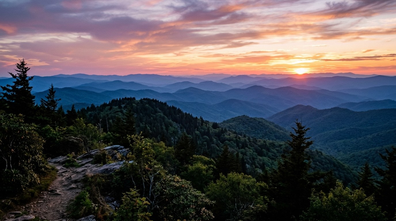
The view from the top is worth more than the short climb it takes to get there. From the summit, hikers get panoramic views stretching across North Georgia and southwestern North Carolina, with layer after layer of Blue Ridge ridgelines fading into the distance. On a clear evening, it's possible to count eleven separate ridgelines from the summit alone, including a clear view southwest toward 5,050-foot Ridgepole Mountain and the Coosa Bald, Little Bald and Courthouse Bald peaks to the north.
Because the trail is short and the views are big, Pickens Nose tends to draw a crowd during peak hours. Early morning or evening visits are the better bet, both for solitude and for the light. The hike back down is fast and entirely downhill, which makes it a natural choice for a sunset outing, with the trail's western exposure giving hikers a clear view as dusk settles over the ridgelines.
The Coweeta Hydrologic Laboratory near the trailhead adds context to the hike. Established in 1948, it's one of the oldest continuous environmental research sites in the world, studying how logging, rainfall and climate shape the surrounding forest. Walking past it on the way to a ridge that's been recovering for nearly eight decades is a reminder that generations of decisions shaped, and protected, this landscape.
Trails like Pickens Nose are part of what draws people to this corner of the mountains. Western North Carolina's remoteness is part of the draw, but it also means basic preparation matters. Sturdy footwear, a paper map, extra water and a first aid kit are worth carrying even on short trails, since cell service in this part of Nantahala National Forest is unreliable at best.
For those weighing a move to the area, the towns closest to hikes like this one, Franklin, Otto and the surrounding Macon County communities, tend to offer a quieter, more rural pace than places like Waynesville or Asheville, while still putting national forest land within a short drive. Waynesville itself, about an hour and a half northeast, strikes a different balance of small-town walkability paired with easier access to the Blue Ridge Parkway and Asheville's amenities. Both areas draw people for the same underlying reason, easy access to mountains that don't feel crowded.
If a hike like Pickens Nose has you thinking about what full-time mountain living might look like, Jon Tharp is happy to talk through what different pockets of Western North Carolina have to offer.
Frequently Asked Questions
Where is the Pickens Nose trailhead located?
The trailhead sits on Ball Creek Road between Reynolds Gap and Mooney Gap in the southern end of Nantahala National Forest, in Macon County near the Georgia border. It's just up the mountain from the U.S. Forest Service's Coweeta Hydrologic Laboratory, a research site that has studied rainfall and forest growth in the area since 1948. The nearest town is Franklin, and the drive in involves winding forest roads, so a paper map or downloaded offline map is worth having since cell service is unreliable throughout this section of the forest.
How difficult is the Pickens Nose hike?
Pickens Nose is considered low-effort and high-reward. The full round trip is roughly 1.5 miles, with about a half mile of uphill climbing before the trail levels out along a ridgeline leading to the rocky summit. The return trip is entirely downhill and moves quickly, which makes it a popular choice for evening or sunset hikes. It's a good option for hikers who want big mountain views without committing to a long or strenuous trek.
Is Waynesville NC a good place to live?
Waynesville is consistently ranked among the more desirable small towns in Western North Carolina, known for its walkable Main Street, easy access to the Blue Ridge Parkway and Great Smoky Mountains National Park, and a strong sense of community in Haywood County. It offers a mix of small-town character and proximity to Asheville's amenities without Asheville's price tag or crowds. For retirees, remote workers, and second-home buyers drawn to outdoor recreation, Waynesville tends to score well on quality of life, though buyers should factor in the region's growing popularity and rising home prices.
How far is Waynesville NC from Asheville?
Waynesville is about 30 miles west of Asheville, roughly a 35 to 40 minute drive via I-40 and US-23/74. It sits in Haywood County and serves as a gateway to both the Blue Ridge Parkway and the Great Smoky Mountains National Park, making it a popular home base for people who want mountain access without living directly in Asheville.
About the Author
Jon Tharp is a licensed NC real estate broker with Keller Williams. He's helped buyers and sellers across Western North Carolina for over 10 years, specializing in mountain homes, land, and short-term rental investments, with offices throughout WNC covering all mountainous areas. If something in this post has you thinking about a move, he's easy to reach — (828) 347-9055 or smokymountainhomes4sale.com or Jon@jontharphomes.com.
Ready to Find Your Mountain Home Near Franklin?
Whether you're looking to buy, considering a short-term rental investment, or ready to sell, the Jon Tharp Team brings deep local knowledge and marketing that puts your home in front of 50,000+ buyers in the first 30 days.
Search available homes across Western NC or call Jon directly at (828) 347-9055.
Talk to JonWhat Our Clients Say
43 five-star Google reviews — read them all on Google
"Jon is hands down the most dedicated and knowledgeable realtor that I have ever worked with. His expertise made the entire process of selling my home and finding a new one a smooth process."
Amy Davis · 2025
"Jon & his team are the greatest! Very professional, friendly like your neighbor, and always get back to your texts, phone calls & emails within minutes or same day, not days or weeks."
Cynthia Oelschlager · 2025
"I can’t say enough good things about Jon and his team. I was looking for investment properties and Jon spent time researching where would be a good place for an Airbnb — he found 2 beautiful properties."
Diane Cogswell · 2025
More from the Blog