By Jon Tharp, Broker · October 4, 2026
At a Glance
The Blue Ridge Parkway runs 469 miles from Shenandoah National Park to Cherokee, NC, with more than 200 overlooks and a 45 mph speed limit (sometimes 35). Peak fall color at 4,000 to 5,000 feet typically occurs in mid-October, with peak moving into the foothills from late October into early November. As of Oct. 4, the Park Service lists two Helene-related closures between Linville Falls and Mount Mitchell, mileposts 324.7 to 327.5 and 344.2 to 355.3, and the southern stretch across Balsam Gap and Soco Gap to U.S. 441 is listed as open.
The southern end of the Blue Ridge Parkway, the stretch that runs across Balsam Gap and Soco Gap and on to U.S. 441, is listed as open this fall.
That matters more than usual. A little over two years ago, Hurricane Helene shut down the entire 469-mile Parkway. Most of it has come back, but two pieces of the hard-hit stretch between Linville Falls and Mount Mitchell are still closed.
The Road That Wants You to Slow Down
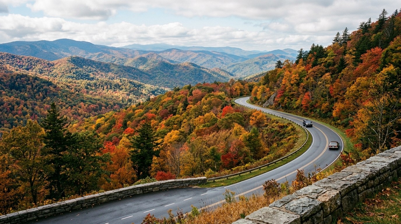
A travel writer at Yahoo Creators made the case for the Parkway's "America's Favorite Drive" nickname and for driving it in fall. The speed limit is 45 mph, sometimes 35, and there are more than 200 overlooks on a road that runs from Shenandoah National Park in Virginia to Cherokee, North Carolina, at the gateway to Great Smoky Mountains National Park. The point is to slow down. (creators.yahoo.com)
The elevation makes the season last. The Yahoo Creators article describes elevations from 650 feet at Otter Lake to 6,684 feet at Mount Mitchell, and those elevation changes create a staggered leaf season that lasts for weeks. The writer's advice is to build in flexibility: an icy patch in October forced a detour, and the detour ended up at Mount Mitchell with the scent of snow and pine in the air.
Temperatures can swing from 80 degrees to below freezing depending on elevation, so pack layers, and the piece recommends starting early for sunrise at Sleepy Gap or Walnut Cove. Big Ridge Overlook at milepost 403.6 also made the writer's list of favorites. (creators.yahoo.com)
What Helene Left Behind
The Park Service says the greatest concentration of Helene damage to the road ran from the Linville Falls area near milepost 317 south to Mount Mitchell State Park near milepost 355. At the highest elevations, wind gusts of 100 mph or more covered the road with trees, while torrential rains caused landslides both above and underneath the road. The Park Service counted 45 landslides between Mount Mitchell and Linville Falls. (yahoo.com)
The remote, mountainous terrain makes repairs more difficult. Contractors cannot easily reach some washed-out areas until others are made passable. The Park Service estimates all road-related Helene recovery projects will be complete by the end of 2026. (nps.gov)
The closure table, as of Oct. 4, shows two gaps rather than one long one. Milepost 324.7 to 327.5 is closed, and recreation of any kind is prohibited there. From 327.5 the road is open again through Gillespie Gap, Little Switzerland and Victor Crossing to NC Highway 80. Then 344.2 to 355.3 is closed up to Mount Mitchell State Park, again with recreation prohibited. Parkway access to the Orchard at Altapass is available from the south, and Mount Mitchell State Park is listed as open. (nps.gov)
A few facilities are still out, too. The Craggy Gardens picnic area and the Linville Falls campground and picnic area remain closed from Helene damage, and the Linn Cove Visitor Center is temporarily closed. (nps.gov)
Other Road Work
Separately from the Helene closures, the Park Service's table lists sporadic, short-duration single-lane closures in several stretches between milepost 261.2 and 283.0, and from 291.8 to 305.1 around Blowing Rock, several of them tied to ongoing Great American Outdoors Act projects. (nps.gov)
The Open Stretch to the South
South of Mount Mitchell State Park, the Park Service lists the road as open through the Craggy Gardens area, past the Pisgah Inn, through Graveyard Fields and Black Balsam, across Balsam Gap on U.S. 23/74, over Soco Gap and on to U.S. 441. Two short segments, from the Folk Art Center to Tunnel Road and from Park Headquarters to Highway 74, are marked "ungated" rather than "open." The Heintooga Spur Road is open as well. (nps.gov)
The table also notes a bridge project over I-26 in the segment between Hendersonville Road and Brevard Road, where the contractor may set up short-duration, daytime single-lane traffic control. (nps.gov)
When to Go This Year
NC State forestry professor Robert Bardon, who has forecast the state's foliage for over a decade, expects a patchwork of fall colors across North Carolina in 2026. In the mountains, temperatures have an equal chance of being above or below normal, and the biggest divide is drought. The Asheville area is largely drought-free and could therefore have better foliage conditions than other parts of the mountains, while much of the surrounding region remains in drought. Southern portions lean toward above-normal precipitation, which could help relieve drought. (cnr.ncsu.edu)
His general timeline: patchy color starts above 5,000 feet in late September. It becomes more noticeable and widespread above 4,000 feet in early to mid-October, and peak color typically occurs between 4,000 and 5,000 feet in mid-October. Peak then moves into the foothills and Piedmont from late October to early November. (cnr.ncsu.edu) The Yahoo writer puts peak color in the south from late October into early November. (creators.yahoo.com)
The recipe for good color is sunny days and cool, but not freezing, nights. Drought can stress trees into shedding leaves early and result in fewer reds and purples. Rainy, overcast weather can delay the onset of color and make yellows and oranges more prominent than reds. (cnr.ncsu.edu)
The Yahoo writer's last tip: the Parkway isn't about rushing.
Frequently Asked Questions
Is the Blue Ridge Parkway open for fall 2026?
Most of it is. As of Oct. 4, 2026, the Park Service lists two Helene-related closures in North Carolina: milepost 324.7 to 327.5 near Jacksontown, and milepost 344.2 to 355.3 from NC Highway 80 to Mount Mitchell State Park. The Park Service estimates all road-related Helene recovery projects will be complete by the end of 2026. The Park Service's closure table lists the road as open through the Craggy Gardens area, past the Pisgah Inn, through Graveyard Fields, across Balsam Gap and Soco Gap and on to U.S. 441, though two short segments, from the Folk Art Center to Tunnel Road and from Park Headquarters to Highway 74, are marked "ungated" rather than "open." Check nps.gov/blri before you go, since ice and closures can pop up unexpectedly.
When is peak fall color on the Blue Ridge Parkway in North Carolina?
Patchy color starts at the highest elevations, especially above 5,000 feet, in late September. It becomes more widespread above 4,000 feet in early to mid-October, and peak color typically occurs between 4,000 and 5,000 feet in mid-October. The Yahoo travel writer puts peak in the south from late October into early November.
Where does the Blue Ridge Parkway end?
The Parkway ends in Cherokee, North Carolina, at the gateway to Great Smoky Mountains National Park; the Park Service lists milepost 469.1 as U.S. Route 441 through the park. It begins at Rockfish Gap, the southern entrance to Shenandoah National Park in Virginia.
About the Author
Jon Tharp is a licensed NC real estate broker with Keller Williams. He's helped buyers and sellers across Western North Carolina for over 10 years, specializing in mountain homes, land, and short-term rental investments, with offices throughout WNC covering all mountainous areas. If something in this post has you thinking about a move, he's easy to reach — (828) 347-9055 or smokymountainhomes4sale.com or Jon@jontharphomes.com.
Ready to Find Your Mountain Home Near Blue Ridge?
Whether you're looking to buy, considering a short-term rental investment, or ready to sell, the Jon Tharp Team brings deep local knowledge and marketing that puts your home in front of 50,000+ buyers in the first 30 days.
Search available homes across Western NC or call Jon directly at (828) 347-9055.
Talk to JonWhat Our Clients Say
43 five-star Google reviews — read them all on Google
"Jon is hands down the most dedicated and knowledgeable realtor that I have ever worked with. His expertise made the entire process of selling my home and finding a new one a smooth process."
Amy Davis · 2025
"Jon & his team are the greatest! Very professional, friendly like your neighbor, and always get back to your texts, phone calls & emails within minutes or same day, not days or weeks."
Cynthia Oelschlager · 2025
"I can’t say enough good things about Jon and his team. I was looking for investment properties and Jon spent time researching where would be a good place for an Airbnb — he found 2 beautiful properties."
Diane Cogswell · 2025
More from the Blog