By Jon Tharp, Broker · July 2, 2026
At a Glance
Balsam Mountain is a high-elevation section of Great Smoky Mountains National Park in North Carolina, reachable by car off the Blue Ridge Parkway near Cherokee and Maggie Valley. At 5,335 feet, it runs 10 to 15 degrees cooler than the lowlands. Highlights include the Heintooga picnic area, 1930s stone tables, the park's highest vehicle campground, and a Masonic monument built from 687 stones.
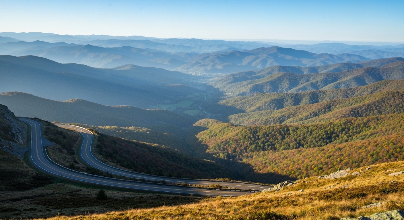
If summer heat has you looking for a way out, Balsam Mountain is the answer most Smokies visitors never find. This high-elevation corner of Great Smoky Mountains National Park sits more than a mile up in the mountains, and you can drive straight to it. No deep wilderness hike required.
The route runs off the Blue Ridge Parkway near the Haywood and Swain county line, close to Cherokee and Maggie Valley. From Asheville it is about a 90-minute drive, most of it along the Parkway itself. Turn onto Balsam Mountain Road, also marked Heintooga Ridge Road, roughly 11 miles from where the Parkway meets US-441 at the Oconaluftee Visitor Center.
Why is Balsam Mountain so much cooler than the rest of the Smokies?
At 5,335 feet, Balsam Mountain runs 10 to 15 degrees cooler than the lowlands. On a July afternoon when Franklin or Sylva is sitting in the mid-80s, the top of Balsam can feel like a crisp spring morning.
That elevation is the whole appeal. It is also why so few people make the trip. In 2025, around 50,000 people visited Balsam Mountain, less than half of one percent of the park's total visitors. You get the cool air and the views without the bumper-to-bumper crowds you find at Newfound Gap or Clingmans Dome.
What is there to do once you get there?
The paved road ends 8.8 miles in at the Heintooga Overlook and Picnic Area. You will find restrooms, picnic tables, and the trailhead for the Flat Creek Trail, one of the few trails in the Smokies with old-fashioned park benches along the way.
The picnic area itself holds a small piece of history. Walk up the hill past the modern tables and you reach stone-topped tables built by the Civilian Conservation Corps in the 1930s. These are almost certainly the only picnic tables in the park that have never been replaced since it opened. Sitting down to lunch on them feels like stepping back nearly a century.
Can you camp on Balsam Mountain?
You can, and it is the highest vehicle campground in the entire park at 5,310 feet. The turn is about half a mile before the picnic area.
Come prepared, though. The nearest stores are a 30 to 40 minute drive down in Cherokee and Maggie Valley, so pack everything you will need. Bring a flashlight too, because the bathrooms have no lights. Campers have been fumbling in the dark up here since at least July 1954, and not much has changed. One heads-up for 2026: Heintooga Round Bottom Road, the popular 15-mile one-way gravel route out of the cul-de-sac, is still closed from Hurricane Helene damage with no reopening date announced yet.
What makes the Masonic monument worth the stop?
Near the sign marking the boundary between the Parkway and the national park, a short path leads to a large Masonic marker built in 1938. It celebrates the creation of the park, and the way it was built is worth seeing.
Members of the organization sent stones from around the world. The finished monument holds 687 stones from 41 nations and every continent, Antarctica included. A few come from places you would never expect, including Plymouth Rock, the Rock of Gibraltar, the Alamo, and the White House. It is a strange and wonderful thing to find at the end of a mountain road.
On the way in and out, take your time with the overlooks. There are about nine along the Parkway between Oconaluftee and the Balsam Mountain turn, plus more on the road itself, including the Mile High Overlook and the Lake Junaluska Overlook.
Balsam Mountain is the kind of place that reminds you why people fall for these mountains in the first place. If a cool summer and a view like this have you daydreaming about a life closer to the Smokies, Jon Tharp is always glad to talk it through.
Frequently Asked Questions
How do you get to Balsam Mountain in the Smokies?
Take the Blue Ridge Parkway to the intersection with Balsam Mountain Road, also labeled Heintooga Ridge Road on many maps. That turn sits about 11 miles from where the Parkway ends at the Oconaluftee Visitor Center near Cherokee. The intersection is clearly marked with a sign for Balsam Mountain, Black Camp Gap, and the Masonic Marker. From there, follow the paved road 8.8 miles to the Heintooga Overlook and Picnic Area cul-de-sac. From Asheville, plan on roughly 90 minutes of driving, much of it along scenic Parkway overlooks.
How much cooler is Balsam Mountain than the rest of the Smokies?
At an elevation of 5,335 feet, Balsam Mountain typically runs 10 to 15 degrees cooler than the lower-elevation areas of Great Smoky Mountains National Park. That difference is significant on a hot summer day, when Cherokee or Maggie Valley might feel muggy and the mountaintop feels like early fall. There is no live weather station for Balsam Mountain online, but you can check the Newfound Gap webcam for a close comparison, since Newfound Gap sits at a similar 5,046 feet of elevation.
Is the Balsam Mountain Campground open, and what should I bring?
The Balsam Mountain Campground sits at 5,310 feet, making it by far the highest campground for vehicles in the Smokies. The turn is about half a mile before the Heintooga picnic area. Come fully stocked, because the nearest stores are a 30 to 40 minute drive in Cherokee and Maggie Valley. Bring a flashlight or headlamp too, since the bathrooms have no lights. Note that Heintooga Round Bottom Road, the gravel route many campers use, remains closed from Hurricane Helene damage with no reopening date set as of July 2026.
What is the Masonic monument on Balsam Mountain?
Near the boundary sign between the Blue Ridge Parkway and Great Smoky Mountains National Park, a short walking path leads to a large Masonic monument. Members of the fraternal organization sent stones from around the world to build it in 1938, celebrating the creation of the national park. The marker holds 687 stones from 41 nations and every continent, including Antarctica. Some come from famous landmarks, including Plymouth Rock, the Rock of Gibraltar, the Alamo, and even the White House. It is a quick, memorable stop worth the walk.
About the Author
Jon Tharp is a licensed NC real estate broker with Keller Williams. He's helped buyers and sellers across Western North Carolina for over 10 years, specializing in mountain homes, land, and short-term rental investments, with offices throughout WNC covering all mountainous areas. If something in this post has you thinking about a move, he's easy to reach — (828) 347-9055 or smokymountainhomes4sale.com or Jon@jontharphomes.com.
Ready to Make Western NC Your Home Base?
Whether you're looking to buy, considering a short-term rental investment, or ready to sell, the Jon Tharp Team brings deep local knowledge and marketing that puts your home in front of 50,000+ buyers in the first 30 days.
Search available homes across Western NC or call Jon directly at (828) 347-9055.
Talk to JonWhat Our Clients Say
43 five-star Google reviews — read them all on Google
"Jon is hands down the most dedicated and knowledgeable realtor that I have ever worked with. His expertise made the entire process of selling my home and finding a new one a smooth process."
Amy Davis · 2025
"Jon & his team are the greatest! Very professional, friendly like your neighbor, and always get back to your texts, phone calls & emails within minutes or same day, not days or weeks."
Cynthia Oelschlager · 2025
"I can’t say enough good things about Jon and his team. I was looking for investment properties and Jon spent time researching where would be a good place for an Airbnb — he found 2 beautiful properties."
Diane Cogswell · 2025
More from the Blog