By Jon Tharp, Broker · May 20, 2026
At a Glance
Western North Carolina hosts four of the most celebrated driving roads in North America: the Tail of the Dragon's 318 curves in 11 miles, the Cherohala Skyway's 43 miles of high-altitude scenery, NC 209 (The Rattler) from Lake Junaluska to Hot Springs, and the 103-mile Moonshiner 28 tracing moonshine country through the Cullasaja Gorge. This guide covers each road in depth with driving directions, what to expect, best seasons, and nearby stops.
The Car Enthusiast's Complete Guide to Driving Western North Carolina: Four Roads Every Driver Needs to Run
There is a reason people load their vehicles on trailers and haul them hundreds of miles to drive Western North Carolina. The roads here are not a byproduct of the landscape. They are the landscape. The ridgelines demanded specific alignments, the gorges forced specific grades, and the result is a network of mountain highways that reward skilled drivers the way few places in the country can match.
Four roads define what WNC has to offer for serious drivers. Each one has a different character, a different set of demands, and a different reason to make the trip. The Tail of the Dragon is the most famous driving road in North America. The Cherohala Skyway is the most dramatic. The Rattler is the local favorite that most visitors overlook. Moonshiner 28 is the longest, the most historically loaded, and the one that connects everything else.
If you have the time to run all four, plan three days minimum. If you only have one day, pick the one that matches your car and your driving style. This guide will help you do both.
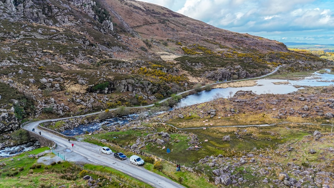
Photo by Dahlia E. Akhaine on Unsplash
Tail of the Dragon: 318 Curves, 11 Miles, No Intersections
The number is the legend. Three hundred and eighteen curves in eleven miles. Experienced drivers call it the most concentrated stretch of technical road in North America, and no one serious enough to have an opinion disagrees. The Tail of the Dragon runs along US Route 129 at Deals Gap, straddling the North Carolina and Tennessee border in the far southwestern corner of the state, roughly 45 minutes from Bryson City and two hours from Asheville.
The road was built in the 1930s following the natural contours of the terrain through what was then the proposed Great Smoky Mountains National Park boundary. The designers were not trying to create a driving attraction. They were following the path of least resistance through difficult mountain ground. The result, entirely by accident of geography, is the closest thing to a race circuit that exists on public roads in the United States.
The Dragon has no driveways, no intersections, and no cross streets for its entire eleven-mile run. Every curve is numbered. Regulars have names for the worst ones: Sunset Curve, Gravity Cavity, Copperhead Corner. The Tree of Shame at Deals Gap Resort sits at the TN/NC border and holds the twisted remnants of motorcycles and cars that did not negotiate the road correctly. It is part trophy, part warning sign.
What to expect on the road: The curves are tight and relentless but not technically extreme. The road is smooth and well-maintained. What catches inexperienced drivers is the rhythm. The Dragon does not give you time to settle between turns. You come out of one and immediately begin setting up for the next. Drivers who try to attack it the way they approach open-highway curves will find themselves running wide. The correct approach is disciplined: late apex, controlled throttle, no heroics in the first few runs. Elevation change is moderate through the Dragon section itself, but the climbs approaching from either direction can be steep.
Most serious drivers prefer to run the Dragon from the Tennessee side (Tapoco) toward Deals Gap on the North Carolina end, then turn around. The road has no significant directional advantage, but the NC approach from Robbinsville gives you a longer warm-up on mountain roads before you hit the core section.
Watch for motorcycles. The Dragon draws bikers from across the country, particularly on spring and fall weekends. Professional photographers set up at key corners and sell prints at Deals Gap Resort. If you see a camera, there is a corner ahead.
Driving directions from Bryson City: Take US 19 West to Topton, then pick up US 129 South toward Robbinsville. Continue on US 129 through Robbinsville and follow it northwest toward the Smokies. The Dragon begins approximately 20 miles northwest of Robbinsville at Deals Gap. The Deals Gap Motorcycle Resort sits right at the state line and serves as the traditional starting point for the north end of the loop. Total drive from Bryson City: 45 to 50 minutes.
From Asheville: Take I-40 West to US 74 West (Exit 27). Follow US 74 through Bryson City and continue west to Topton. Pick up US 129 South and follow directions above. Total drive: approximately 2 hours.
Best season: May through October. Spring offers the best road conditions and wildflower bloom in the national park forest surrounding the road. Fall foliage peaks in mid-October and draws the largest crowds. Summer is busy on weekends but weekday mornings are uncrowded. Avoid rainy days, not because the road is dangerous in light rain, but because wet leaves on mountain asphalt in October are a different conversation.
Stay nearby: Deals Gap Resort (basic cabins and amenities), or base yourself in Robbinsville at the Snowbird Mountain Lodge for something with more character. Bryson City is 45 minutes back and has the best dining options.
Cherohala Skyway: The $100 Million Road Nobody Expected
The Cherohala Skyway is unlike anything else in this guide. Where the Dragon is intimate and technical, the Skyway is vast and sweeping. It is a 43-mile National Scenic Byway that runs from Tellico Plains, Tennessee through the Cherokee and Nantahala National Forests to Robbinsville, North Carolina, climbing from 900 feet at the Tennessee end to over 5,400 feet at Haw Knob on the state line. The elevation gain alone puts it in a category by itself.
Planning began in 1958. The road took decades to complete. It opened October 12, 1996, at a final cost of approximately $100 million, making it the most expensive highway per mile ever built in North Carolina at the time, around $3 million per mile through some of the most rugged terrain in the southern Appalachians. Look at the road and you understand where the money went. There are no shortcuts in this alignment.
The name is a blend of the two national forests it passes through: Cherokee and Nantahala. The North Carolina section covers the eastern 18 miles, running from Santeetlah Gap at Mile 18 down to the state line at Unicoi Crest at Mile 0. The Tennessee section is 25 miles. Most drivers from WNC start on the NC side and run the full length into Tennessee, but the road rewards driving in either direction.
What makes it different: The Dragon is about density of curves. The Skyway is about what happens when you put a two-lane road at 5,000 feet with nothing but national forest on both sides for 43 miles. The curves are sweeping rather than tight. The grades are serious. The views from the ridgetop overlooks stop you in your tracks, which is the correct response.
Key stops on the North Carolina section: Huckleberry Knob at Mile 9 reaches 5,560 feet. Hooper Bald at Mile 8 is 5,429 feet with a pull-off for a short hike to one of the best panoramic views in Western North Carolina. Santeetlah Overlook at Mile 7 sits at 5,390 feet directly above Santeetlah Lake. On a clear day you can see four states.
One warning that applies to no other road in this guide: there are no gas stations anywhere on the Skyway. Not one. The 43 miles between Robbinsville and Tellico Plains have zero services. Gas in Robbinsville before you start, and confirm your tank can handle 43 miles of mountain driving plus the return. This is not a theoretical concern. People run out of gas on the Skyway every season.
Driving directions from Asheville: Take I-40 West to US 74 West at Exit 27. Follow US 74 through Bryson City past Topton. Take NC 143 toward Stecoah and then into Robbinsville. From Robbinsville, take NC 143 West. This is the Cherohala Skyway. The NC section begins immediately west of Robbinsville and climbs to the state line at Unicoi Crest. Total drive from Asheville: approximately 2 hours 15 minutes.
From Bryson City: Take US 19 West to US 74 West, then follow US 74 to the Robbinsville exit. Pick up NC 143 west. Total drive: 45 to 55 minutes.
Best season: The Skyway is one of the few roads on this list where season choice is critical for access, not just experience. At elevations above 5,000 feet, the road can close in winter due to snow and ice, sometimes as early as November and as late as March. Late spring (late April through May) is ideal: the road is clear, the forest is erupting in green, and the wildflowers at elevation are extraordinary. Fall foliage at 5,000 feet peaks two to three weeks earlier than the valleys below. In a normal year, that means late September to early October at the top of the Skyway while the lower elevations are still turning.
The Rattler: NC 209 from Lake Junaluska to Hot Springs
Most visitors to WNC never hear about The Rattler. That is the point, and it is also a loss. NC 209 runs from Lake Junaluska near Waynesville north through Haywood County, over the mountains, and down to Hot Springs on the French Broad River near the Tennessee border. Locals and regional riders know it as one of the best drives in the state. The rest of the world drives past the turnoff on I-40 and keeps going.
The road is named for the way it moves through the terrain. NC 209 does not run in long sweeping arcs. It coils and twists over two mountain ranges, crossing through some of the least-visited corners of Haywood County before descending into the Hot Springs valley where the Appalachian Trail crosses the French Broad. The elevation change from start to finish is dramatic, and the road earns its name.
What separates the Rattler from the Dragon is atmosphere. The Dragon is a destination, a pilgrimage, a circus on peak weekends. The Rattler is a drive. You are sharing it with local traffic, farm trucks, and the occasional hiker heading toward the AT trailhead at Hot Springs. There are small communities tucked into the hollows. There are pull-offs where locals fish creeks that nobody has put on a map. It feels like the WNC that existed before any of these roads became famous.
What to expect on the road: NC 209 is technical but not extreme. The grades are serious in several sections, particularly the climb over the first ridge out of Lake Junaluska. The curves are tight in the hollows and open up slightly on the higher ridgelines. The road surface is generally good but narrow in spots with limited shoulder. Passing opportunities are limited. The road is approximately 37 miles from Lake Junaluska to Hot Springs.
The stretch from the county seat area of Waynesville north through Crabtree and beyond is the most concentrated driving. Once you crest the main ridge, the road settles slightly before dropping toward Hot Springs in the final 10 miles, where the descent is steep and the French Broad River comes into view below you.
Driving directions from Waynesville: From the Waynesville town center, take US 276 North briefly, then pick up NC 209 North at the junction near Lake Junaluska. Follow NC 209 North through Trust, Luck, and Luck communities, continuing over the mountain toward Hot Springs. Total drive: approximately 50 minutes without stops. Hot Springs itself is worth a stop at the end. The town has several restaurants, the Hot Springs Spa and Resort where the French Broad runs warm mineral springs, and the AT crossing right through the middle of downtown.
From Asheville: Take I-40 West to Exit 37 (Crabtree Road) or Exit 40 (Clyde/Canton). Follow surface roads toward Waynesville to pick up NC 209 North, or take I-40 West to Exit 24 (US 25/70 to Hot Springs) and run the road south from the Tennessee end. The south-to-north approach (Lake Junaluska to Hot Springs) is the more dramatic direction for the descent into the Hot Springs valley.
Pairing it with the Dragon: The Rattler and the Dragon make a natural two-road day. From Waynesville, run NC 209 north to Hot Springs for breakfast or a midday stop, then backtrack or take US 25/70 west to reconnect with US 129 south to the Dragon at Deals Gap. Total drive time, including both roads and a Hot Springs stop, runs five to six hours. This is the loop that regional driving clubs favor because it covers two completely different road characters in one day.
Best season: The Rattler runs at lower overall elevation than the Cherohala, so it stays drivable from March through November. Spring and early fall are optimal. Hot Springs restaurants and the mineral spa operate year-round, which makes it a viable late-fall destination even when higher elevation roads are marginal.
Moonshiner 28: 103 Miles of History, Gorges, and Running From the Law
Route 28 is the longest road on this list and the hardest to summarize. It runs 103 miles from Deals Gap, where the Tail of the Dragon ends, southeast along the southern shore of Fontana Lake, through Bryson City, continuing south through Franklin and then east through Highlands and the Cullasaja Gorge, eventually crossing into South Carolina and ending in Walhalla. It connects more of WNC's terrain than any other single road, and it carries the most history.
The nickname Moonshiner 28 comes directly from the region's past. North Carolina enacted statewide Prohibition in 1908, twelve years before federal Prohibition began in 1920. The counties along this corridor became major moonshine production territory through that entire period and well beyond. The mountains offered cold clean water, dense cover, and road access that was good enough to move product but difficult enough to slow down revenue agents.
The original alignment, designated NC 288, was built around 1929. In the mid-1940s, the Tennessee Valley Authority completed Fontana Dam, the largest dam in the TVA system, and the rising waters of Fontana Lake swallowed the original road. The state rebuilt NC 28 on the southern edge of the lake, essentially recreating the route on higher ground. Every time you cross a bridge over a cove on the Fontana section, the original road is somewhere under the water below you.
The moonshine culture this road ran through was not abstract. Jim Tom Hedrick, who grew up in this corner of WNC and later became well known through Discovery Channel's Moonshiners series, operated in these hills. Popcorn Sutton, the most famous mountain moonshiner of his generation, based himself in Maggie Valley twenty miles north and ran product through roads connected to this corridor. Junior Johnson, the NASCAR legend, has said openly that the car control skills he developed running moonshine in the North Carolina mountains were directly responsible for his racing career. The roads these men drove are still here, mostly unchanged.
The Fontana section: Starting at Deals Gap and running east toward Bryson City, Route 28 follows the north shore of Fontana Lake through national park land. This section is remote. Services are minimal. The road is narrow, well-paved, and scenic in a way that is different from the high-elevation views of the Skyway: you are at lake level, surrounded by the forest wall of the national park, with water visible through the trees. Fontana Dam itself is accessible from a side road. At 480 feet high, it is the tallest dam east of the Rockies. The Appalachian Trail crosses the top of the dam, one of the more unusual AT crossings on the entire 2,190-mile route.
Fontana Village, a resort community that grew out of the construction camp TVA built for dam workers, sits just off NC 28 on this section. It has lodging, a marina, bike rentals, and one of the better bases for exploring this corner of Swain County.
The Bryson City connection: Route 28 comes into US 74 near Bryson City, where most drivers stop for fuel and food before continuing. Bryson City has become one of the better small towns in WNC for food in recent years. The Nantahala Brewing Company taproom is downtown. The train depot for the Great Smoky Mountains Railroad is here. This is a good midpoint stop for a full Moonshiner 28 run.
The Franklin section and the Cullasaja Gorge: South of Bryson City, Route 28 continues through Cherokee country (the Qualla Boundary boundary runs along this corridor) and eventually connects to Franklin in Macon County. This is where the road changes character completely.
From Franklin east to Highlands, US 64 East follows the Cullasaja River through the Cullasaja Gorge, and this section is the crown jewel of the Moonshiner 28 experience for drivers. The gorge is one of the most dramatic pieces of road in the entire southern Appalachians. The river drops 2,200 feet in 11 miles. The highway follows it, mostly clinging to cliff faces with the river visible directly below.
The waterfalls come in sequence on this section. Dry Falls sits 75 feet high and is one of the few waterfalls in North America where you can walk directly behind the curtain on a paved path. Bridal Veil Falls spills directly over the highway. Before the road was rerouted, drivers could pass behind it. Cullasaja Falls is the most dramatic, a 250-foot cascade visible from a pull-off. Quarry Falls, also known by the more honest local name Bust Your Butt Falls, is both a waterfall and a natural swimming hole where smooth rock channels water into a pool.
Drive the gorge slowly. The curves demand attention, the waterfalls demand stops, and the road is too narrow to do both at speed.
Highlands and the end of the run: The road climbs out of the gorge into Highlands, the highest town in the eastern United States at 4,118 feet. Highlands has become one of the more upscale destinations in WNC: good restaurants, galleries, a walkable downtown, and the kind of views that justify the real estate prices. From Highlands, Route 28 continues east into South Carolina and eventually ends in Walhalla. Most WNC drivers turn around in Highlands and run the gorge back toward Franklin, which is worth doing specifically to see the waterfalls from the opposite direction.
Driving directions for the full run from Deals Gap: From the Dragon's start at Deals Gap, take US 129 South briefly then pick up NC 28 East at the signed junction near the NC/TN border. Follow NC 28 East along Fontana Lake through the national park. Continue through Almond, past the Fontana Village turnoff, and into Bryson City. From Bryson City, take US 74 East briefly, then US 19 South toward Cherokee and Franklin. From Franklin, take US 64 East toward Highlands and through the Cullasaja Gorge. Total Deals Gap to Highlands: approximately 2.5 to 3 hours driving, longer with stops.
If you are running only the Cullasaja section: From Franklin, take US 64 East. The gorge begins approximately 6 miles east of downtown Franklin and runs 11 miles to the town of Highlands. This section alone takes 30 to 45 minutes with pull-offs.
Running All Four: A Three-Day WNC Driving Itinerary
If you want to cover all four roads properly, three days is the right allocation.
Day 1: Base yourself in Bryson City or Robbinsville. Run the Dragon in the morning before the crowds build. Drive NC 28 west to Deals Gap as your approach, run the Dragon from north to south, then return via NC 28 east to Bryson City. Afternoon: explore downtown Bryson City, dinner at Nantahala Brewing or River's End.
Day 2: Run the Cherohala Skyway. Leave Robbinsville early on NC 143, gas up before you go, and run the full 43 miles to Tellico Plains, Tennessee. Stop at Huckleberry Knob and Hooper Bald. Have lunch in Tellico Plains before returning. The return run is as good as the outbound. Afternoon drives remaining: add portions of Moonshiner 28 along the Fontana section if energy allows.
Day 3: The Rattler and the Moonshiner 28 Cullasaja section. Drive NC 209 north from Lake Junaluska to Hot Springs in the morning, have breakfast in Hot Springs, then backtrack to Waynesville or Asheville. Afternoon: drive south to Franklin and run US 64 East through the Cullasaja Gorge to Highlands. Have dinner in Highlands before the return.
What You Need to Know Before You Go
Fuel: The Cherohala Skyway has no services for 43 miles. The Dragon section is isolated. Moonshiner 28 along the Fontana section is remote. Fill up in Robbinsville before the Skyway, in Bryson City before the Fontana section of NC 28, and in Franklin before the Cullasaja Gorge. Running out of gas in any of these locations is possible and expensive.
Emergency services: These roads run through remote national forest and national park land. Cell service is spotty on all four. Deals Gap Resort at the Dragon has emergency services familiarity and is the best-known meeting point for incidents on US 129. For other roads, know your location relative to the nearest town before you depart.
Road conditions after storms: Mountain roads in WNC can develop debris, rockfall, and flooding after heavy rain. Check current conditions through NCDOT's 511 service before driving any of these routes following significant weather. The Cullasaja Gorge is particularly susceptible to rockfall given the cliff-face road alignment.
Traffic: The Dragon on a peak summer weekend draws hundreds of motorcycles and performance cars. If you want the road to yourself, weekday mornings in May or early September are the answer. The Cherohala Skyway sees moderate traffic year-round but nothing that disrupts the drive. The Rattler and the Moonshiner 28 sections away from Deals Gap are lightly traveled most days.
Respect the road: All four of these routes are public roads with local traffic, emergency vehicles, farm equipment, and hikers who use them daily. WNC residents live at the ends of these driveways. Passing zones are marked. Stay in your lane through blind curves. The Tree of Shame at Deals Gap documents what happens when drivers forget that and nobody who has seen it takes it lightly.
Western North Carolina rewards the people who come looking for it. The roads were not designed to attract drivers. They were built to cross mountain terrain that left no other options. The fact that the result is four of the best driving roads in the country is a side effect of geography. If you find yourself wanting a reason to spend more time in this part of the world than a weekend allows, Jon Tharp has spent years helping people figure out how to make that a permanent arrangement.
*Roads covered span Haywood, Swain, Macon, and Madison counties in Western North Carolina. Always verify current road conditions before driving, particularly following severe weather. NC 28 along Fontana Lake and the Cherohala Skyway have limited or no cell service.*
Ready to Make Western NC Your Home Base?
Whether you're looking to buy, considering a short-term rental investment, or ready to sell, the Jon Tharp Team brings deep local knowledge and marketing that puts your home in front of 50,000+ buyers in the first 30 days.
Search available homes across Western NC or call Jon directly at (828) 347-9055.
Talk to JonWhat Our Clients Say
43 five-star Google reviews — read them all on Google
"Jon is hands down the most dedicated and knowledgeable realtor that I have ever worked with. His expertise made the entire process of selling my home and finding a new one a smooth process."
Amy Davis · 2025
"Jon & his team are the greatest! Very professional, friendly like your neighbor, and always get back to your texts, phone calls & emails within minutes or same day, not days or weeks."
Cynthia Oelschlager · 2025
"I can’t say enough good things about Jon and his team. I was looking for investment properties and Jon spent time researching where would be a good place for an Airbnb — he found 2 beautiful properties."
Diane Cogswell · 2025