By Jon Tharp, Broker · October 22, 2026
At a Glance
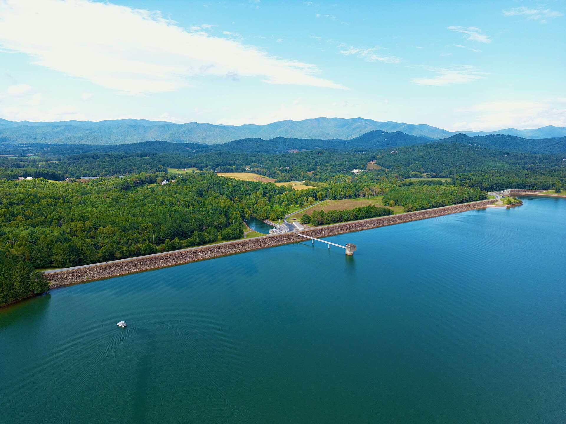
Lake Chatuge was created when TVA closed the gates of Chatuge Dam, upstream from Hayesville, on February 12, 1942. TVA's seasonal guide curve has a mid-February low of 1,915 feet and a high of 1,926 feet around Memorial Day, and in a normal rainfall year the level varies about 10 feet. TVA is planning spillway safety repairs expected to need two drawdowns during the off-season winter months. State testing in 2024 found very good water clarity and low nutrients. Docks on TVA shoreland require a TVA permit.
Congress authorized the dam on July 16, 1941. Work began the following day. Building the dam and reservoir required the purchase of 11,641 acres and the relocation of 278 families, 532 graves, and 40 miles of roads, including part of U.S. 64 and all of NC 69. The gates closed on February 12, 1942, creating Lake Chatuge.
The dam is also a gathering place for Clay County, home to the county's annual Fourth of July fireworks. Here is what you should know if you live on the lake, fish it, or are thinking about buying near it.
A Wartime Dam Built in a Hurry
The project was first called the Hayesville project. TVA had identified the site in a survey of the Hiwassee River, whose waters were a major contributor to flooding in Chattanooga. When World War II broke out in Europe, it brought an emergency demand for electricity, mainly to power aluminum production in East Tennessee, and TVA offered to meet it by building a series of dams on the Hiwassee and other Tennessee River tributaries.
TVA kept the design simple, using earth and rock to finish the dam as quickly as possible in hopes of letting the reservoir collect the 1941 to 1942 winter rains. The spillway was the only major part that required concrete. The whole project cost just over $9 million and took 1.5 million man-hours. One worker died after falling from a railroad car while unloading cement.
At the time it was built, Chatuge was the highest earthen dam in the world, until Egypt's Aswan Dam was built in 1964. The name comes from an 18th-century Cherokee village once situated near the site. One house moved out of the Elf community during clearing later served as the Clay County School District superintendent's office until 2005.
In 1954, the main dam and saddle dams were raised ten feet and flash boards were added to the spillway, and TVA added a single hydropower unit that year. The dam and its associated infrastructure were listed on the National Register of Historic Places in 2017.
Sources: https://en.wikipedia.org/wiki/Chatuge_Dam, https://www.tva.com/energy/our-power-system/hydroelectric/chatuge
The Lake by the Numbers
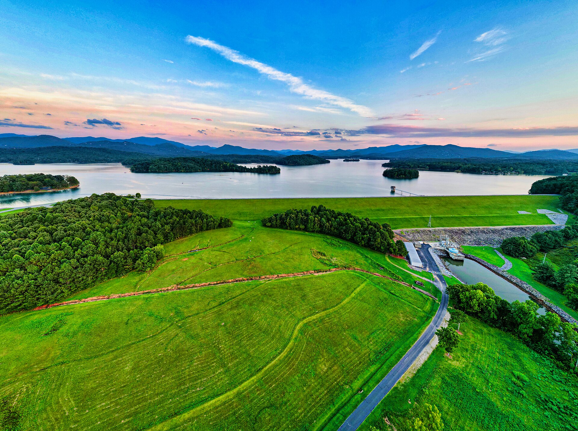
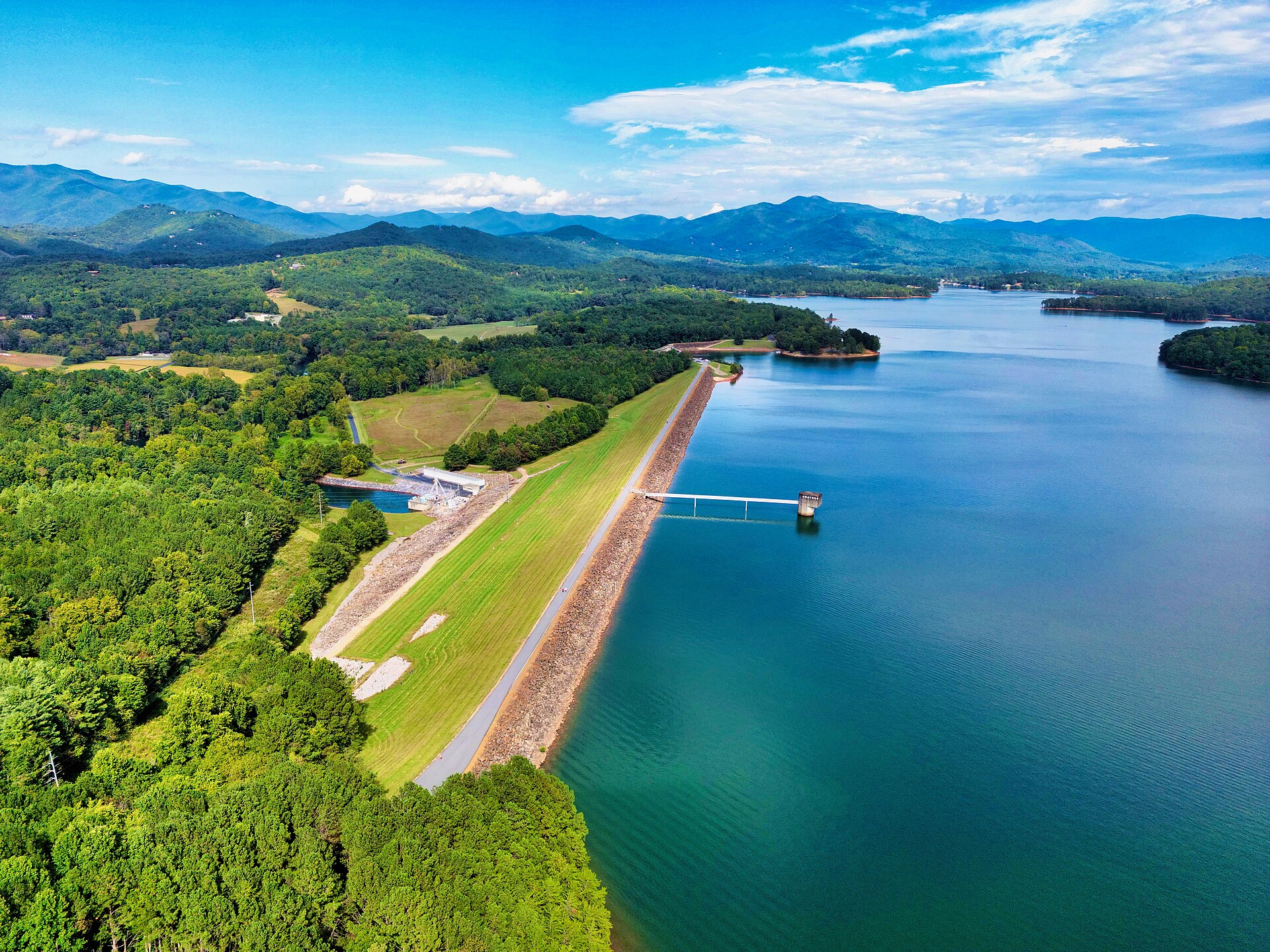
TVA lists the dam at 150 feet high and 3,336 feet across the Hiwassee, with a single generating unit that has a summer net dependable capacity of 14 megawatts. The reservoir runs about 13 miles from the dam southeast into Georgia, and extends roughly 6 miles east along Shooting Creek. Approximately half the lake lies in Georgia, and the Nantahala National Forest surrounds the dam and the North Carolina section of the reservoir.
Below the dam, a concrete weir provides a steady flow of water in the riverbed and helps oxygen levels for aquatic life. Fish are attracted to the weir, where food is abundant, which makes it a popular wade fishing spot for trout. The Chatuge Dam Reservation has a paved walking and biking trail of about three miles with views of the mountains and lake. Clay County Schools cross country teams practice and hold meets at the dam, and crossing the dam and back makes a one-mile walk.
Sources: https://www.tva.com/energy/our-power-system/hydroelectric/chatuge, https://www.tva.com/environment/environmental-stewardship/land-management/reservoir-land-management-plans/chatuge-reservoir-land-management-plan, https://en.wikipedia.org/wiki/Chatuge_Dam
Lake Levels and the Winter Drawdown
Chatuge's level is not fixed. TVA operates the dam on a seasonal guide curve, with a target low of 1,915 feet in mid-February, when flood risk is highest, and a high of 1,926 feet around Memorial Day. The flood guide varies from 1,918 feet in winter to 1,926 feet in summer, so in a normal rainfall year the water level varies about 10 feet from summer to winter to provide seasonal flood storage.
Chatuge's flood-storage capacity is 62,600 acre-feet between elevations 1,918 and 1,928. The drawdown also matters to shoreline owners for practical reasons. Construction of boat ramps and marine railways in the access corridor must occur during reservoir drawdown, and closed-loop heat exchangers for residential heat pumps may be approved if installed five feet below the minimum winter water elevation. TVA posts daily lake levels on its website.
Sources: https://unblock.federalregister.gov/, https://www.tva.com/environment/shoreline-construction-permits/section-26a-regulations, https://www.tva.com/energy/our-power-system/hydroelectric/chatuge
The Spillway Safety Project
Based on evaluations conducted between 2016 and 2022, TVA determined that the risk of uncontrolled releases due to spillway failure exceeds its risk tolerance for dam safety. TVA also concluded that the chute slab of the primary spillway is in poor condition. Extremely heavy rain could erode the spillway by lifting its concrete slabs. The spillway has undergone temporary measures to improve its slab joints while TVA studies long-term solutions.
In April 2025, TVA published a notice that it would prepare an environmental impact statement for proposed modifications to the spillway, the low-level outlet, and the dam embankment. Earlier drawdown estimates caused significant alarm, including one alternative that called for an eight-year drawdown. A 2026 TVA map showed that more than 700 structures would be flooded if the spillway were to fail, including about 360 in Clay County, 130 in Cherokee County, and around 250 in East Tennessee.
Sources: https://unblock.federalregister.gov/, https://en.wikipedia.org/wiki/Chatuge_Dam, https://gon.com/fishing/new-lake-chatuge-spillway-repair-projections-more-palatable-for-locals
What the Drawdown Timeline Looks Like Now
The eight-year option is gone. In June 2025, TVA narrowed the plan to three alternatives, none lasting longer than two years and none calling for a drawdown during the late spring and summer months. Alternative C, a concrete liner on the existing spillway, would need two years in the off-season, which might need to be consecutive. Alternatives D and E are projected to last two non-consecutive years.
Rainfall still matters. As GON reported, a dry fall is needed so the lake can get low enough for crews to work, and more spring rain helps it fill back up to recreational levels. "There are some of the summers that could be affected," TVA Senior Project Manager for Dam Safety Chris Saucier said at the Towns County Courthouse. "We just can't guarantee it. It depends on rainfall."
In April 2026, TVA said it is also looking at incorporating a permanent minimum flow pipe at the dam, which uses gravity to release water downstream without pumps and, once installed, will not affect the reservoir's ability to refill. That work adjusted TVA's schedule, and the draft environmental impact statement is now expected in fall/winter 2026. According to GON, nothing has changed in the projected timeline once the project begins, and TVA anticipates two drawdowns during the off-season winter months.
Sources: https://gon.com/fishing/new-lake-chatuge-spillway-repair-projections-more-palatable-for-locals, https://gon.com/news/beyond-the-spillway-new-improvements-planned-for-lake-chatuge
How Clean Is the Water?
Very clear, by the state's measure. North Carolina's Division of Water Resources sampled Chatuge monthly from June through November 2024, a season that included Hurricane Helene dropping on average 6 to 12 inches of rain on the Hiwassee River basin. Secchi depths, which indicate water clarity, ranged from 2.6 to 5.0 meters.
Total phosphorus, total Kjeldahl nitrogen, ammonia, and nitrite plus nitrate were below lab detection levels. The state determined the lake had mesotrophic conditions, or low biological productivity, after it had been designated oligotrophic since state monitoring began in 1981. The state notes that a more conservative scoring method adopted in 2023 may partly explain that change. A statewide fish consumption advisory for multiple species due to mercury includes lakes in the Hiwassee River Basin.
Source: https://www.deq.nc.gov/water-quality/water-sciences/2024-almp-hiwassee-report/open
Docks, Permits, and Shoreline Rules
Residential docks, piers, boathouses, retaining walls, and other structures on TVA-owned residential access shoreland require a TVA permit. TVA's Chatuge plan covers 1,765.1 acres of TVA land in 110 parcels, each assigned a single land use zone, and residential construction is allowed only on TVA land in certain classifications. A TVA permit conveys no property interest.
Residential water-use facilities are generally limited to a 1,000-square-foot footprint. In areas of preexisting development, such as a subdivision recorded before November 1, 1999 in which TVA permitted at least one water-use facility before that date, the limit is 1,800 square feet. Docks and walkways cannot extend more than 150 feet from shore or one-third of the distance to the opposite shoreline, whichever is less, and they attach to shore with a single walkway.
On the land side, owners can clear an access corridor up to 20 feet wide, running from the TVA property boundary to the water-use facility. TVA designates a 50-foot-deep shoreline management zone where no trees may be cut or vegetation removed except as preapproved within the access corridor, and the forest floor must be left undisturbed except as specified. Grass may be planted and mowed only within the access corridor.
Sources: https://www.tva.com/environment/shoreline-construction-permits/section-26a-regulations, https://www.tva.com/environment/shoreline-construction-permits/section-26a-jurisdiction, https://www.tva.com/environment/environmental-stewardship/land-management/reservoir-land-management-plans/chatuge-reservoir-land-management-plan
Buying Near Lake Chatuge
When land with a permitted facility changes hands, the new owner must notify TVA within 60 days and may keep using existing facilities while applying for reissuance. TVA reissues the permit upon determining that the facilities are in good repair and consistent with the standards in effect when the permit was first issued. Shoreline structures previously permitted by TVA are grandfathered, and TVA does not require modification to conform to new standards.
Sources: https://www.tva.com/environment/shoreline-construction-permits/section-26a-regulations
Keep Exploring
For the towns nearby, start with Hayesville homes for sale and Hayesville lake community homes. The wider Clay County listings cover the rest of the county.
You may also like more on the area.
Frequently Asked Questions
What lake is near Hayesville, NC?
Lake Chatuge. Chatuge Dam sits on the Hiwassee River about 4.5 miles upstream from Hayesville in Clay County, and the roughly 13-mile reservoir extends southeast from the dam into Towns County, Georgia.
Will Lake Chatuge be drawn down for the spillway repair?
Yes, TVA anticipates two drawdowns during the off-season winter months. The eight-year option was dropped in June 2025, and none of the three remaining alternatives calls for a drawdown during the late spring and summer months. TVA says it cannot guarantee that no summers will be affected, because the impact depends on rainfall.
Do I need a permit to build a dock on Lake Chatuge?
Yes, if the dock or other structure sits on TVA land or is an obstruction in or along the reservoir, it needs a Section 26a permit from TVA. Residential docks are generally capped at a 1,000-square-foot footprint, or 1,800 square feet in areas of preexisting development, and cannot extend more than 150 feet from shore or one-third of the distance to the opposite shoreline, whichever is less.
About the Author
Jon Tharp is a licensed NC real estate broker with Keller Williams. He's helped buyers and sellers across Western North Carolina for over 10 years, specializing in mountain homes, land, and short-term rental investments, with offices throughout WNC covering all mountainous areas. If something in this post has you thinking about a move, he's easy to reach, (828) 347-9055 or smokymountainhomes4sale.com or Jon@jontharphomes.com.
Ready to Make Western NC Your Home Base?
Whether you're looking to buy, considering a short-term rental investment, or ready to sell, the Jon Tharp Team brings deep local knowledge and marketing that puts your home in front of 50,000+ buyers in the first 30 days.
Search available homes across Western NC or call Jon directly at (828) 347-9055.
Talk to JonWhat Our Clients Say
43 five-star Google reviews · read them all on Google

"Jon is hands down the most dedicated and knowledgeable realtor that I have ever worked with. His expertise made the entire process of selling my home and finding a new one a smooth process."
Amy Davis · 2025
"Jon & his team are the greatest! Very professional, friendly like your neighbor, and always get back to your texts, phone calls & emails within minutes or same day, not days or weeks."
Cynthia Oelschlager · 2025
"I can't say enough good things about Jon and his team. I was looking for investment properties and Jon spent time researching where would be a good place for an Airbnb, he found 2 beautiful properties."
Diane Cogswell · 2025
More from the Blog