By Jon Tharp, Broker · October 22, 2026
At a Glance
Fontana Lake began filling behind TVA's Fontana Dam in November 1944, and TVA lists 10,230 acres of water surface. In a year with normal rainfall, the water level varies about 56 feet from summer to winter to provide seasonal flood storage. The lake flooded towns such as Proctor and Judson. Docks require TVA Section 26a permits and are generally capped at 1,000 square feet, and floating houses face a 2046 sunset.
A Lake That Gives Up Its Secrets Every Winter
In a year with normal rainfall, Fontana's water level varies about 56 feet from summer to winter. Some portions of the Lakeshore Trail follow old NC 288, where hikers may see abandoned automobiles from the 1920s and 1930s and a bridge at Lands Creek during the winter months, when lake levels are low.
TVA lists 238 miles of shoreline and 10,230 acres of water surface at Fontana Reservoir, and Great Smoky Mountains National Park borders the reservoir to the north.
Sources: TVA, Wikipedia: Lakeview Drive
Built Around the Clock for the War Effort
Fontana was built during World War II to provide electric power for the war effort. TVA acquired the site, formerly owned by the Aluminum Company of America, after prolonged negotiations. The site was so remote, about 60 miles from both Knoxville and Asheville, that highways, bridges, and rail lines had to be built to bring in construction equipment, supplies, and workers.
TVA built a community for 5,000 workers and their families, including dormitories, a 50-bed hospital, two racially segregated schools, movie theaters, and softball fields. Employees maintained three eight-hour shifts, around the clock, seven days a week. Military marches and big band music played over a public address system, bright floodlights illuminated the site, and the accelerated schedule cut construction time almost to half of what it would have been in peacetime.
The result is a gravity-type concrete dam 480 feet high and 2,365 feet long, which TVA calls the highest dam east of the Rocky Mountains. The project cost $74.7 million and consumed 2.8 million cubic yards of concrete. The powerhouse first produced electricity on January 20, 1945. TVA lists three generating units with a summer net dependable capacity of 304 megawatts.
The dam is off Highway 28 in Fontana, in Graham County. The Appalachian Trail crosses the dam, and the hot showers at the TVA-maintained trail shelter have led grateful hikers to dub it the "Fontana Hilton." What was once the construction village is now a resort offering boating, horseback riding, and crafts making.
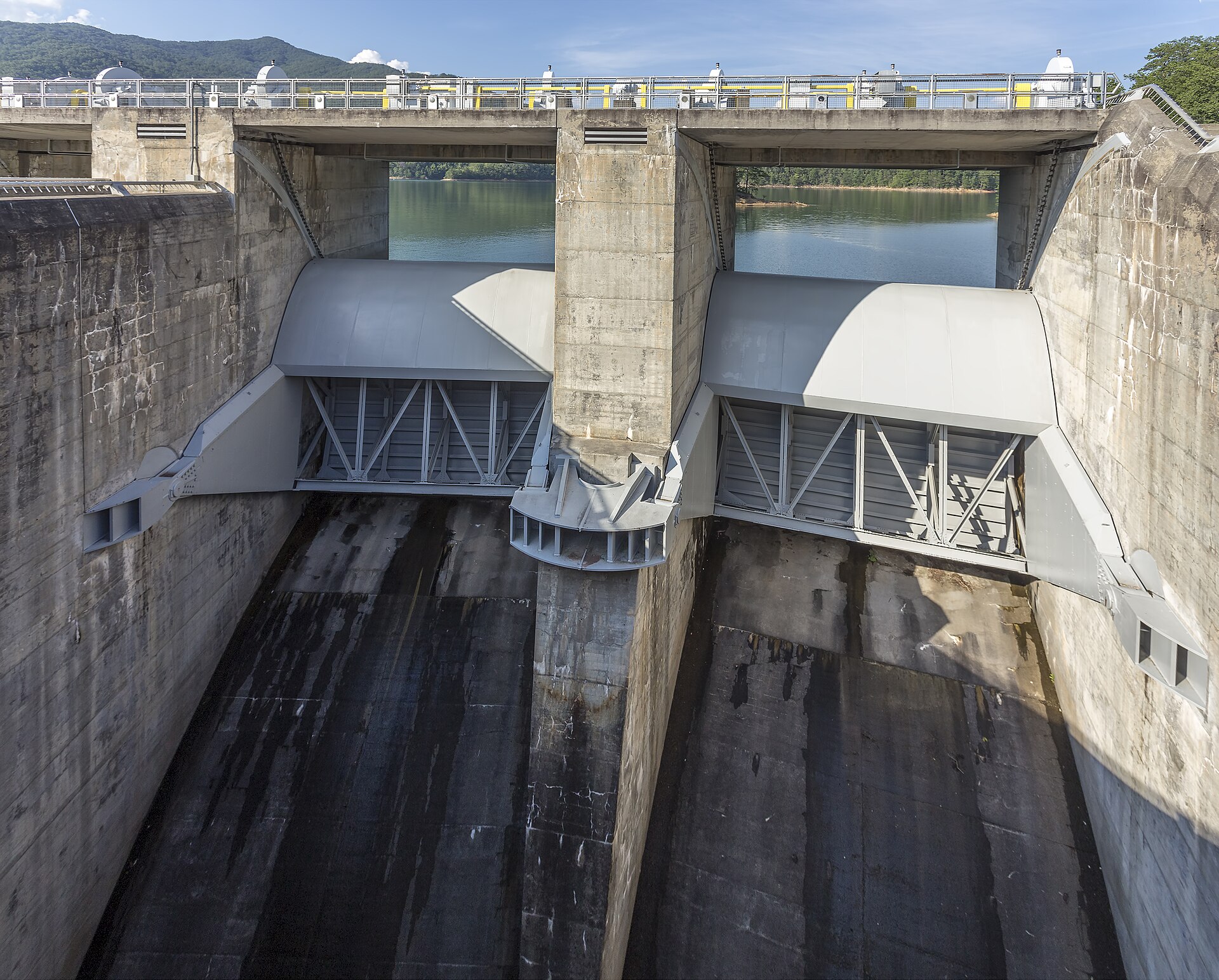
The Towns Under the Water
In November 1944, Fontana Lake began to fill, inundating and submerging small towns in the area including Proctor, Forney, Almond, and Japan. Judson was another town submerged by the lake.
Proctor sat on Hazel Creek and took its name from Moses Proctor, the first European-American settler to the area. The Proctor mine offices were flooded, but much of the town and its cemetery are above the water line. One home is left, along with the remains of the lumber mill. The former town became part of Great Smoky Mountains National Park, and its cemeteries are accessible only by trails.
On July 30, 1943, TVA, the state of North Carolina, Swain County, and the Department of the Interior entered into an agreement. It called for TVA to pay Swain County $400,000 as compensation for the flooding of NC 288, and to buy 44,000 acres, displacing the residents, and transfer the land to the National Park Service as an addition to the park. The Interior Department, contingent upon appropriation of all necessary funds, was to build a replacement park road around the north side of Fontana Lake. By 1944, TVA had fulfilled all its obligations under the agreement.
Sources: NCpedia, Wikipedia: Proctor, Wikipedia: Lakeview Drive
The Road to Nowhere
That road is Lakeview Drive, also known as North Shore Road and the Road to Nowhere, and it was never completed. After World War II, construction began on a 0.7-mile western segment at Fontana Dam, which was completed in 1948. Work on the eastern segment began in 1960, and crews quickly ran into unstable rock. Construction was halted by 1971, after the completion of the road tunnel and Noland Creek bridge. After $4.1 million had been spent on the road, environmental concerns became pressing because of exposed Anakeesta rock and the possibility that mild acid from the rock could leach into nearby streams, damaging plants and fish.
A group of Swain County residents sued to force the Park Service to resume construction. In 1983, the 4th Circuit concluded that the Interior Department had not breached the 1943 agreement because Congress had not appropriated funds for the completion of the road. After an environmental impact statement, the Park Service issued a record of decision on December 28, 2007, that a monetary settlement to Swain County, in lieu of further construction, was the alternative that would best protect the resources of the park. On February 6, 2010, all signatories met in Bryson City and executed an agreement calling for a $52 million cash settlement, paid to Swain County on or before December 31, 2020.
Lakeview Drive East, near Bryson City, runs 5.8 miles from Fontana Road to a parking area less than 1,000 feet from the tunnel. The 34.7-mile Lakeshore Trail connects both segments. In fall 2023, all of Lakeview Drive was closed to the public for a $15,681,860 reconstruction funded by the Great American Outdoors Act, so check with the Park Service on current access before you go.
Starting in the late 1970s, the Park Service began providing transportation for families to visit cemeteries to which access had been cut off, using a pontoon boat to cross Fontana Lake. The families started the North Shore Cemetery Association and continue to make occasional visits for "decoration days," when they clean up the cemeteries and hold services.
Source: Wikipedia: Lakeview Drive
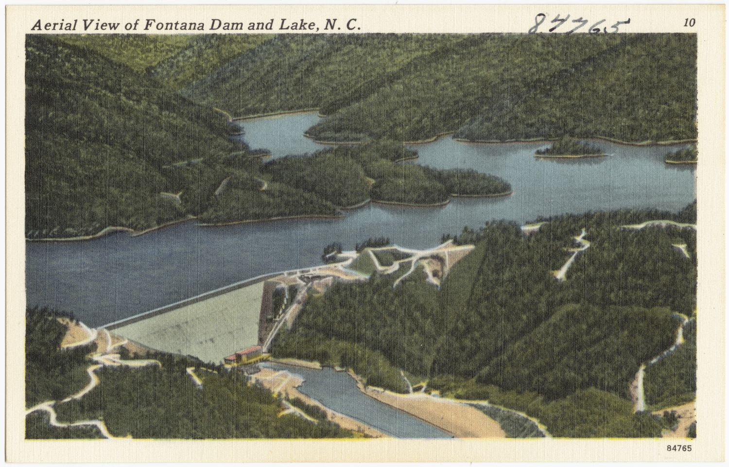
Why the Water Goes Up and Down
One of TVA's main purposes from the beginning was to prevent flooding, and Fontana has a flood-storage capacity of 514,000 acre-feet. TVA strives to keep as much water as possible in its reservoirs for recreation from June 1 to Labor Day. After Labor Day weekend, TVA releases water from tributary storage reservoirs at a faster rate, using it during the typically hot, dry months of September and October to generate electricity and supplement flows for water quality and navigation.
Reservoirs are typically lowered at least to winter flood-guide levels by January 1, making room to hold runoff from winter storms. Aggressive filling of tributary reservoirs begins in mid-March, when the chance of flood-producing storms begins to decline.
The drawdown is necessary every year, even when water levels are high. TVA balances releases across the ten major tributary reservoirs above Chickamauga Dam, including Fontana, so that one lake never has to bear the burden alone. TVA's James Everett notes that as Labor Day approaches, shallow areas grow shallower, and caution is needed. TVA posts the daily lake level at tva.com.
Sources: TVA: Understanding the Drawdown, TVA: The Annual Drawdown, TVA
Docks, Permits, and Section 26a
If you want a dock on Fontana, you'll be dealing with Section 26a of the TVA Act. Section 26a regulation covers the construction of obstructions affecting navigation, flood control, or public lands, and TVA's jurisdiction extends to the limits of the Tennessee River watershed. On TVA reservoirs, it typically applies to the limits of the 500-year floodplain or the upper limits of TVA flowage rights, whichever is higher.
On TVA-owned residential access shoreland, adjacent residential landowners must apply for and obtain a TVA permit before constructing facilities, clearing vegetation, or maintaining an access corridor. Vegetation may be cleared for an access corridor up to 20 feet wide, running from the common boundary between TVA and the adjacent landowner to the water-use facility. TVA also designates a 50-foot-deep shoreline management zone on its property, where no trees may be cut or vegetation removed except what TVA preapproves within the access corridor, with limited exceptions. The forest floor must be left undisturbed except as the rules specify, and mowing is allowed only within the access corridor.
Docks, piers, boathouses, and other residential water-use facilities are capped at a 1,000-square-foot total footprint unless they are in an area of "preexisting development." That means either a subdivision recorded before November 1, 1999, in which TVA permitted at least one water-use facility before that date, or, if there is no subdivision, a location within a quarter-mile radius of another water-use facility TVA permitted before November 1, 1999. In those areas, the cap is 1,800 square feet. Docks and walkways can't extend more than 150 feet from the shoreline or more than one-third the distance to the opposite shoreline, whichever is less, and they must attach to the shore with a single walkway that adjoins the access corridor. Concrete boat ramps must be built during reservoir drawdown, and asphalt is not permitted.
One detail every buyer should know: a TVA permit conveys no property interest. When ownership of the land with a permitted facility changes, the new owner must notify TVA within 60 days. Upon application by the new owner, TVA reissues the permit after determining the facilities are in good repair and consistent with the standards in effect when the permit was first issued. Existing structures previously permitted by TVA are grandfathered, and TVA does not require them to be modified to conform to new standards.
Sources: TVA Section 26a Jurisdiction, TVA Section 26a Regulations
Houseboats and the 2046 Sunset
The future of floating houses on Fontana has been contested. TVA stopped issuing houseboat permits in 1978 and grandfathered in the existing houseboats. In a May 5 decision, the TVA board gave houseboat owners on all its reservoirs 30 years to remove them, affecting more than 1,800 floating houses and giving compliant homeowners until 2046. The meeting where the board voted was held six hours away in Tennessee.
TVA President and CEO Bill Johnson said 223 houseboats on Fontana Lake were pre-1978 structures, while the remaining 134 were not permitted. Owners pushed back through an online petition and the Facebook group "Fontana Families For Floating Houses," and U.S. Rep. Mark Meadows, R-Cashiers, accused TVA of unlawfully expanding its authority under the TVA Act. Swain and Graham counties passed ordinances holding houseboat owners accountable for properly disposing of their sewage and secured more than $700,000 in grants for a fleet of pump boats to service the houseboats. Houseboats now collect their own sewage in tanks, which marina owners periodically pump out and haul ashore.
TVA's Section 26a regulations also address floating cabins. When a floating cabin changes ownership, the new owner must notify TVA within 60 days, and TVA reissues the permit upon determining, among other conditions, that the cabin is in good repair, has the same configuration and dimensions as previously permitted, and is moored in the same location or within the harbor limits of the same commercial marina. If you're shopping for a floating home, confirm its permit status and the current policy directly with TVA.
Sources: Smoky Mountain News, TVA Section 26a Regulations
Buying Near Fontana Lake
Great Smoky Mountains National Park borders the reservoir to the north. Johnson said TVA recognizes "the unique position of the counties" surrounding the reservoir, and Smoky Mountain News reported that Graham and Swain counties have a limited tax base because a majority of the land is owned by the national park.
Before you fall for a view, check the dock permit and plan to file your 60-day notice with TVA after closing. Confirm that the property qualifies: for a facility on TVA land, the applicant must own the fee interest in, or have an adequate leasehold or easement interest of sufficient tenure in, the land immediately adjoining the TVA land. Watch for an intervening strip of land between the upland boundary of a TVA flowage easement and the water. In some of those situations, TVA may exercise its discretion to permit a facility if the strip's fee owner doesn't object. Except as otherwise specifically provided, owners of only a fractional interest are not considered owners eligible to seek approval without the consent of the other co-owners. However, in subdivisions where TVA had an established practice before September 8, 2003, of permitting facilities on jointly owned lots without all co-owners' consent, TVA may continue that practice.
Sources: TVA, Smoky Mountain News, TVA Section 26a Regulations
The Fontana Lake Market Right Now
As of October 21, 2026, there were 60 active listings for homes and land in the named Fontana Lake communities (Fontana Lake Estates, Fontana Forest, Fontana Ridge, Fontana Trace, Fontana View), priced from $27,900 to $5,499,000 with a middle price around $250,000. The mix: 43 lots and land, 17 single-family homes.
Keep Exploring
To see what is on the market around Fontana Lake today, browse Fontana Lake area homes for sale. For the towns nearby, start with Bryson City homes for sale and Robbinsville homes for sale. The wider Swain County listings cover the rest of the county.
You may also like more on the area.
Frequently Asked Questions
How much does Fontana Lake drop in the winter?
In a year with normal rainfall, Fontana's water level varies about 56 feet from summer to winter. TVA strives to keep as much water as possible in its reservoirs from June 1 to Labor Day, releases water from tributary storage reservoirs at a faster rate after Labor Day weekend, and typically lowers reservoirs at least to winter flood-guide levels by January 1. Aggressive filling of tributary reservoirs begins in mid-March. TVA posts a daily lake level at tva.com/environment/lake-levels/fontana.
What towns are under Fontana Lake?
When the lake began filling in November 1944, it submerged small towns including Proctor, Forney, Almond, and Japan, and Judson was also submerged by Fontana Lake. In Proctor, the mine offices were flooded, but much of the town and its cemetery are above the water line. The former town became part of Great Smoky Mountains National Park, and its cemeteries are accessible only by trails.
Do you need a permit to build a dock on Fontana Lake?
Yes. Obstructions across, along, or in TVA reservoirs require a Section 26a permit. On TVA-owned residential access shoreland, residential water-use facilities are generally limited to a 1,000-square-foot total footprint (1,800 square feet in qualifying areas of preexisting development). Docks and walkways cannot extend more than 150 feet from the shoreline or more than one-third the distance to the opposite shoreline, whichever is less. They must be attached to the shore with a single walkway that adjoins the access corridor, which may be cleared up to 20 feet wide.
About the Author
Jon Tharp is a licensed NC real estate broker with Keller Williams. He's helped buyers and sellers across Western North Carolina for over 10 years, specializing in mountain homes, land, and short-term rental investments, with offices throughout WNC covering all mountainous areas. If something in this post has you thinking about a move, he's easy to reach, (828) 347-9055 or smokymountainhomes4sale.com or Jon@jontharphomes.com.
Ready to Find Your Mountain Home Near Bryson City?
Whether you're looking to buy, considering a short-term rental investment, or ready to sell, the Jon Tharp Team brings deep local knowledge and marketing that puts your home in front of 50,000+ buyers in the first 30 days.
Search available homes across Western NC or call Jon directly at (828) 347-9055.
Talk to JonWhat Our Clients Say
43 five-star Google reviews · read them all on Google

"Jon is hands down the most dedicated and knowledgeable realtor that I have ever worked with. His expertise made the entire process of selling my home and finding a new one a smooth process."
Amy Davis · 2025
"Jon & his team are the greatest! Very professional, friendly like your neighbor, and always get back to your texts, phone calls & emails within minutes or same day, not days or weeks."
Cynthia Oelschlager · 2025
"I can't say enough good things about Jon and his team. I was looking for investment properties and Jon spent time researching where would be a good place for an Airbnb, he found 2 beautiful properties."
Diane Cogswell · 2025
More from the Blog