By Jon Tharp, Broker · August 28, 2026
At a Glance
The Blue Ridge Parkway is a 469-mile scenic road connecting Shenandoah National Park in Virginia to Great Smoky Mountains National Park in North Carolina, built starting in 1935 as a Depression-era project that gave Asheville and other mountain towns a tourism lifeline. Hurricane Helene closed the entire parkway in September 2024 and caused 57 landslides, many concentrated between Mount Mitchell and Spruce Pine. The National Park Service now manages more than 93,000 acres along the route, and recovery work continues across western North Carolina.
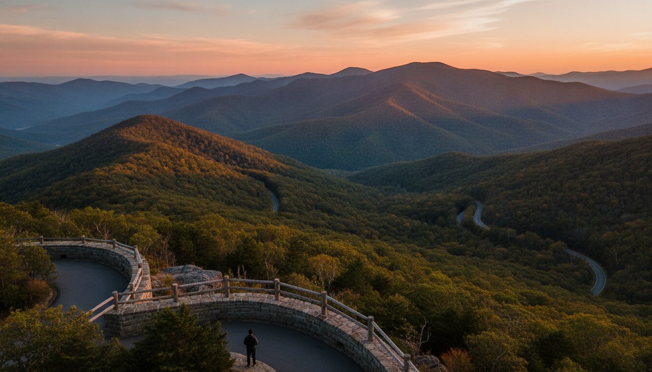
There is no other road in America quite like it. No billboards. No stoplights. No commercial trucks rumbling past at 70 miles an hour. Just 469 miles of ridgeline, laid out nearly a century ago so that anyone with a car and an afternoon could see the Appalachians the way they deserve to be seen.
The Blue Ridge Parkway runs from Shenandoah National Park in Virginia down through 29 counties in Virginia and North Carolina before ending at Great Smoky Mountains National Park near Cherokee. Along the way it threads through the backyard of Western North Carolina, past Boone, Blowing Rock, Linville, Asheville, Waynesville and Balsam, close enough to Franklin, Sylva and Brevard that locals treat it less like a national park and more like an extension of their own front porch.
It is one of the most visited units in the entire National Park System, and it has been that way for decades. But the story of how it got here, and what it took to get through the last two years, says as much about this region's resilience as it does about the road itself.
Built for the View, Not the Speed
"The Blue Ridge Parkway was created to be that quintessential drive along the spine of the Blue Ridge Mountains," said Carolyn Widner, CEO of the Blue Ridge Parkway Foundation. That description gets repeated often, but it is worth sitting with. This was never meant to be a way to get somewhere fast. Designers built it as the destination itself.
Every choice in the original design reflects that. Engineers kept signage to a minimum. They banned billboards entirely, a rarity for any American highway in the 20th century. Designers placed overlooks with intention, framing specific views of specific peaks rather than simply pulling drivers off the road wherever there was room. The speed limit stays around 45 miles per hour for most of the route, and in places it drops lower, not because the road can't handle more, but because the whole point is to slow down.
Locals know the landmarks by name the way other places know street corners. Craggy Gardens and its rhododendron blooms in June. Waterrock Knob near Maggie Valley, with its wraparound view toward the Plott Balsams. Devil's Courthouse, a short but steep hike to one of the best 360-degree panoramas in the Southern Appalachians. Richland Balsam, the highest point on the entire parkway at just over a mile above sea level. These are not roadside attractions. They are part of how people in this region measure the seasons.
A Depression-Era Lifeline for Asheville
Construction began in 1935, in the depths of the Great Depression, as part of a broader effort to put people to work and connect two of the country's newest national park landscapes. But in Western North Carolina, the parkway meant something more specific.
Asheville had spent decades building a reputation as a mountain resort town, drawing wealthy visitors north from Charleston and south from the industrial Northeast. By the 1930s, that identity was under threat. The economy had collapsed, and the city needed a reason for people to keep coming.
"There were people, especially in Asheville, who really were eager for something like this to happen," said Dr. Anne Mitchell Whisnant, a historian at Duke University who has written extensively on the parkway's origins. The road offered exactly what the region needed: a reason for travelers to return to the mountains, and a construction project that put local labor to work building it.
That dynamic, a scenic road doubling as an economic engine, has never really gone away. It just changed shape. What started as Depression-relief infrastructure became, over the following decades, the backbone of a tourism economy that towns from Blowing Rock to Cherokee still depend on.
Nearly Two Decades to Connect
The Blue Ridge Parkway did not open all at once. Construction happened in segments, county by county, through some of the most difficult terrain east of the Mississippi. Crews blasted through granite, built retaining walls by hand in places too steep for heavy equipment, and routed the road around private land the government had not yet acquired.
By the mid-to-late 1950s, most of the major sections had finally connected into something resembling the continuous drive people know today. Even then, one piece remained unfinished for decades. Crews did not finish the final stretch, around Grandfather Mountain, until 1987, when engineers built the Linn Cove Viaduct, a curving concrete bridge that wraps around the mountainside without disturbing the slope beneath it. It remains one of the most photographed stretches of road in the country and a genuine feat of engineering restraint, built to protect the mountain rather than cut through it.
That patience, doing it right instead of doing it fast, is baked into the parkway's identity. It took the better part of 52 years to finish a single road. Nobody involved seemed to think that was unreasonable.
When Helene Shut It All Down
In September 2024, Hurricane Helene brought a kind of destruction Western North Carolina had never seen. The storm forced the entire Blue Ridge Parkway to close, all 469 miles, cutting off the road that so many mountain towns rely on during their busiest season.
"When Helene hit, the entire parkway shut down," Widner said. "For a lot of our mountain towns, their economic lifeline is the parkway." That is not an exaggeration. Fall leaf season alone drives a significant share of annual visitor spending in towns like Waynesville, Blowing Rock and Cherokee, and a closed parkway in October meant empty overlooks during the weeks that usually bring the heaviest traffic of the year.
The physical damage was extensive. Helene triggered 57 landslides along the parkway, with the heaviest concentration between Mount Mitchell and Spruce Pine, an area already known for steep, unstable slopes even in calm weather. Culverts washed out. Sections of roadbed sheared away entirely. In some spots, the storm didn't just damage the parkway, it erased stretches of it.
A Slow, Deliberate Recovery
Recovery on a road like this does not happen quickly, and nobody involved has pretended otherwise. The National Park Service now manages more than 93,000 acres along the parkway corridor, and rebuilding a mountainside road means more than repaving. It means stabilizing slopes, rebuilding drainage systems, and, in the worst-hit sections, essentially re-engineering pieces of roadway from the ground up.
Since the storm, crews have worked section by section to reopen what can be safely reopened while the more severely damaged stretches, particularly around Mount Mitchell and Spruce Pine, remain under repair. It is the kind of work crews measure in seasons, not weeks. Anyone planning a drive along the parkway right now should expect a mix of open corridor and active construction zones, and should check current conditions before heading out, especially in the higher-elevation sections north and east of Asheville.
For the small businesses that sit along or near parkway access points, from Waynesville to Little Switzerland, this recovery is not an abstraction. Restaurants, galleries, overlooks with parking for tour buses, all of it depends on a functioning road. The Blue Ridge Parkway Foundation and the Park Service have both leaned into that reality, treating the rebuild as economic recovery as much as infrastructure repair.
More Than a Scenic Drive
For Dr. Whisnant, the parkway represents something larger than a scenic road. It shows how this region has repeatedly reinvented its relationship with the land, from Depression-era relief project to postwar road-trip icon to, now, a case study in disaster recovery. Ninety years in, it is still doing the same basic job it was built for: giving people a reason to slow down and look at these mountains.
That is easy to take for granted if you live here. It is less easy once you have watched a season pass with the overlooks empty. Western North Carolina's identity, the small-town character, the outdoor access, the sense that the mountains are always right there, ties to this road in a way that is hard to separate out. When people talk about why they wanted to live near Franklin or Sylva or Waynesville in the first place, the parkway is often part of the answer even when they don't say its name.
If you have spent any time driving the parkway lately, whether it was a full afternoon out toward Waterrock Knob or just a quick stop at an overlook on the way through town, you already understand part of why so many people end up wanting to put down roots somewhere near it.
Frequently Asked Questions
FAQ_1_Q: Is the Blue Ridge Parkway open in North Carolina right now? FAQ_1_A: Recovery from Hurricane Helene is ongoing, and conditions vary by section. Many portions of the parkway have reopened since the storm forced a full closure in September 2024, while stretches with the heaviest landslide damage, particularly between Mount Mitchell and Spruce Pine, remain closed or under active repair. Drivers should check the National Park Service's official parkway status page or the Blue Ridge Parkway Foundation before planning a trip, since closures can shift with weather and ongoing construction. Local visitor centers in towns like Asheville and Waynesville also keep updated information on which access points and overlooks are currently reachable.
FAQ_2_Q: How long is the Blue Ridge Parkway and where does it start and end? FAQ_2_A: The Blue Ridge Parkway runs 469 miles, starting at Shenandoah National Park in Virginia and ending at Great Smoky Mountains National Park near Cherokee, North Carolina. It passes through 29 counties across the two states, following the crest of the Blue Ridge Mountains for most of its length. In North Carolina, it runs near Boone, Blowing Rock, Asheville, and Waynesville before crossing into the Smokies region. The full drive typically takes multiple days if you plan to stop at overlooks and trails along the way, rather than driving straight through.
FAQ_3_Q: What caused the Blue Ridge Parkway to close after Hurricane Helene? FAQ_3_A: Hurricane Helene struck Western North Carolina in September 2024, causing 57 landslides along the parkway corridor, with the largest concentration between Mount Mitchell and Spruce Pine. The storm washed out culverts, undermined sections of roadbed, and destabilized steep slopes that the parkway was built along, forcing the National Park Service to close the entire 469-mile route for safety. Repairs have continued in phases since then, with less-damaged sections reopening first while the most severely affected stretches require more extensive rebuilding.
FAQ_4_Q: When was the Blue Ridge Parkway built and why? FAQ_4_A: Construction on the Blue Ridge Parkway began in 1935 during the Great Depression, as part of a federal effort to connect Shenandoah National Park and Great Smoky Mountains National Park while creating jobs in the rural mountain communities along the route. Asheville business leaders were especially eager for the project, since the city's tourism-based economy had been hit hard by the Depression and needed a new draw to bring visitors back to the mountains. Most of the parkway was connected by the mid-to-late 1950s, though the final section near Grandfather Mountain, including the Linn Cove Viaduct, was not completed until 1987.
FAQ_5_Q: What are the best towns to visit along the Blue Ridge Parkway in North Carolina? FAQ_5_A: In North Carolina, popular parkway-adjacent towns include Blowing Rock and Linville near the northern sections, Asheville around the midpoint, and Waynesville, Maggie Valley, Sylva and Cherokee closer to the southern end near Great Smoky Mountains National Park. Each offers different access points, from Waterrock Knob near Sylva to Craggy Gardens outside Asheville, with distinct dining, lodging and hiking options. Franklin and Brevard, while a short drive off the parkway itself, are also popular bases for visitors who want mountain scenery with easier access to town amenities.
About the Author
Jon Tharp is a licensed NC real estate broker with Keller Williams. He's helped buyers and sellers across Western North Carolina for over 10 years, specializing in mountain homes, land, and short-term rental investments, with offices throughout WNC covering all mountainous areas. If something in this post has you thinking about a move, he's easy to reach — (828) 347-9055 or smokymountainhomes4sale.com or Jon@jontharphomes.com.
Ready to Find Your Mountain Home Near Blue Ridge?
Whether you're looking to buy, considering a short-term rental investment, or ready to sell, the Jon Tharp Team brings deep local knowledge and marketing that puts your home in front of 50,000+ buyers in the first 30 days.
Search available homes across Western NC or call Jon directly at (828) 347-9055.
Talk to JonWhat Our Clients Say
43 five-star Google reviews — read them all on Google
"Jon is hands down the most dedicated and knowledgeable realtor that I have ever worked with. His expertise made the entire process of selling my home and finding a new one a smooth process."
Amy Davis · 2025
"Jon & his team are the greatest! Very professional, friendly like your neighbor, and always get back to your texts, phone calls & emails within minutes or same day, not days or weeks."
Cynthia Oelschlager · 2025
"I can’t say enough good things about Jon and his team. I was looking for investment properties and Jon spent time researching where would be a good place for an Airbnb — he found 2 beautiful properties."
Diane Cogswell · 2025
More from the Blog