By Jon Tharp, Broker · August 21, 2026
At a Glance
Blowing Rock, North Carolina, is nicknamed the Crown of the Blue Ridge for its perch near 3,500 feet in the High Country. The town centers on a compact, walkable Main Street, the cliff attraction that gave it its name, and Tweetsie Railroad, a 1917 narrow gauge steam engine that became North Carolina's first theme park in 1957. The Blue Ridge Parkway runs along its edge.
Throw a hat over the edge at The Blowing Rock and, on the right day, it comes back to you.
Nobody invented that story to sell tickets. The cliff sits roughly 4,000 feet above sea level, and the walls of the Johns River Gorge fall away some 3,000 feet below it. The gorge funnels wind straight up the rock face, and the updraft is strong enough to return light objects tossed over the edge. People have watched snow appear to fall upward there. Ripley's Believe It or Not took note of it decades ago, and the town has been living with the story ever since.
Travel + Leisure has put Blowing Rock back in front of a national audience, calling it the Crown of the Blue Ridge. The nickname is not new, and no marketing firm wrote it. The town has used it for generations, and it fits for reasons that come down to geography. Blowing Rock sits at about 3,500 feet on the eastern edge of the Blue Ridge escarpment, the exact line where the mountains stop and the Piedmont begins in one long drop.
The Rock That Named the Town
The attraction itself opened to the public in 1933, which makes it the oldest travel attraction in North Carolina. That predates the Blue Ridge Parkway. It predates most of what people now think of as mountain tourism in this state.
The Cherokee story attached to the place involves a Cherokee man and a Chickasaw woman, a leap from the cliff, and a wind that carried him back to her. Whether you take that as history or as legend, it explains something real about the site. The updraft is the point. It is what makes standing there different from standing at any other overlook in the mountains.
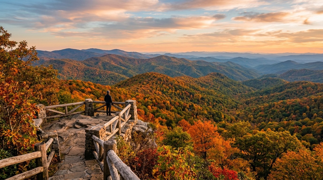
What visitors notice first, though, is not the wind. It is the distance. From the observation deck you look east over Hawksbill and Table Rock, down the gorge, and out across country that keeps going until it stops being mountains at all. On clear days the view runs so far east that it is hard to hold all of it at once.
Those of us on the western side of the state are used to being surrounded by ridgelines. Standing in Franklin or Cullowhee, the mountains are on every side of you. Blowing Rock is different. It sits on the rim looking out, with nothing between the rock and the flatlands but air. That single fact shapes the weather, the property values, and the way photographers have framed the town for the past century.
A Downtown You Can Walk End to End
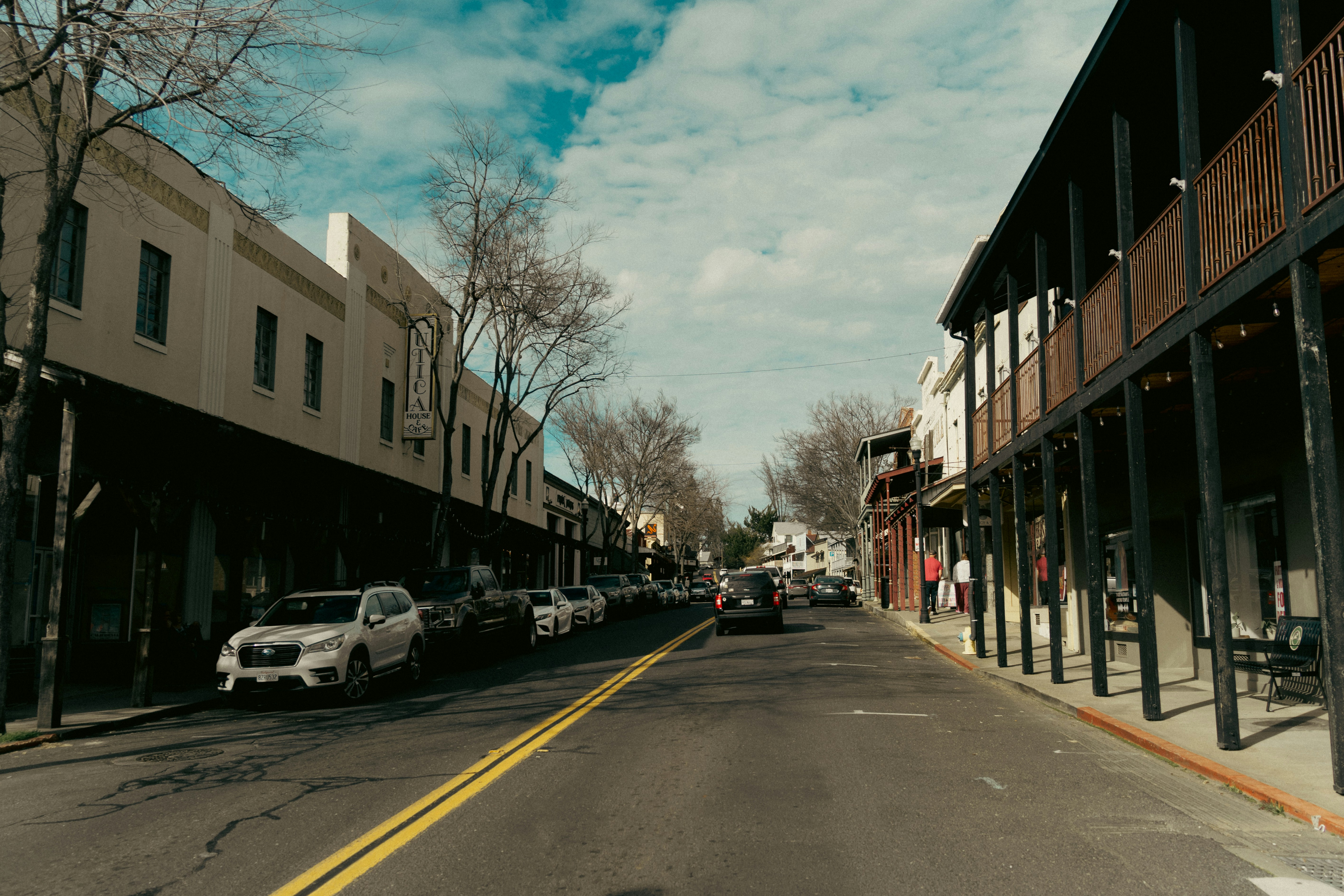
Blowing Rock's Main Street is short enough to walk in fifteen minutes and dense enough that it takes most people three hours. Shops, galleries, restaurants, and inns run along both sides, with Memorial Park sitting in the middle as a genuine town green rather than a decorative one. Concerts happen there. Art shows fill it. People eat lunch on the benches.
The Blowing Rock Art and History Museum anchors the north end and does a better job than most small-town museums at treating regional history as something worth serious attention. Art in the Park has drawn crowds to Memorial Park on scheduled Saturdays for decades. The Blowing Rock Charity Horse Show is one of the oldest continuously running horse shows in the country and has run on the summer calendar since the 1920s.
The Green Park Inn dates to 1891 and sits at the south edge of town on the Eastern Continental Divide. Water falling on one side of that building eventually reaches the Atlantic. Water on the other side works its way to the Gulf. The inn has a painted line marking it, and yes, people stand on it.
Novelist Jan Karon lived here, and readers of the Mitford books have been recognizing Blowing Rock in those pages for years. That is a specific kind of fame for a small town, and it brings a specific kind of visitor: people who arrive already fond of the place and half expecting to know it.
What keeps the downtown working is that it never got too big for itself. The year-round population sits somewhere around 1,200 to 1,400. The town swells in summer and again in October, then quiets down. Anyone who has watched Highlands or Cashiers move through the same cycle will recognize the rhythm immediately.
Tweetsie, and the Railroad That Would Not Stay Dead
Crews laid the East Tennessee and Western North Carolina Railroad in the 1880s as a three foot narrow gauge line to move iron ore and timber out of the mountains. It ran between Johnson City, Tennessee, and eventually reached Boone. Crews and townspeople called it Tweetsie for the sound of the whistle carrying down the valleys.
It was working infrastructure first and a curiosity second. It hauled freight, mail, and passengers through country that had no other reliable way out. For the communities along the Doe River Gorge and up toward Watauga County, the railroad was the difference between isolation and a connection to the wider economy.
Then the flood of 1940 tore out long stretches of track along the Doe River. Rebuilding a narrow gauge mountain line in that era, against highway competition, did not make financial sense. The Boone segment shut down by 1950, and the equipment scattered.
Engine No. 12, a 1917 Baldwin locomotive, survived. It passed through several hands, including a period when Gene Autry owned it, before Grover Robbins brought it back to Watauga County. In 1957 Robbins put it on a loop of track around Roundhouse Mountain between Blowing Rock and Boone and opened Tweetsie Railroad, the first theme park in North Carolina.
The three mile ride is still the center of the park. A second narrow gauge engine, No. 190, came from the White Pass and Yukon route in Alaska and runs there as well. In the fall the whole operation converts to the Ghost Train, which has become its own regional tradition for families across the High Country.
That history has a pattern worth noticing. A piece of industrial infrastructure built to extract ore and timber outlived its economic purpose, nearly disappeared, and came back as the reason people drive here. That is not unique to Blowing Rock, but it is a clear example of it.
The Parkway Runs Through the Backyard
The Blue Ridge Parkway passes directly alongside Blowing Rock, and the stretch near town holds some of the best-used land on the entire route.
Moses H. Cone Memorial Park sits just north of downtown. Textile magnate Moses Cone built Flat Top Manor, the white house that shows up in every photograph of the place, at the turn of the twentieth century. The estate came to the Park Service with roughly 25 miles of carriage roads still intact, and those trails are the reason the property gets used so heavily. They are graded, wide, and forgiving, which makes them accessible to people who have no interest in scrambling up a ridge.
Bass Lake sits at the bottom of the property with an easy loop around it. It is the kind of walk you can do with grandchildren, with a dog, or with a knee that has opinions. That matters more than trail guides usually admit.
A few miles south, Julian Price Memorial Park opens onto Price Lake, where canoes and kayaks go out all summer and the campground fills early. Between the two parks, Blowing Rock has more accessible public land at its doorstep than almost any town its size in the state.
For something steeper, the Glen Burney Trail leaves from near downtown and drops down New Years Creek to Glen Burney Falls and Glen Marie Falls. The distance is modest. The elevation change on the way back up is not, and hikers routinely underestimate it.
Grandfather Mountain and its mile high swinging bridge are a short drive down the Parkway toward Linville, and Boone is eight miles north with everything an Appalachian State college town provides. Blowing Rock ends up as the quiet base for a busy corner of the state.
Living at 3,500 Feet
Elevation is not a detail here. You feel it every day.
Summer highs in Blowing Rock often sit fifteen to twenty degrees below what Charlotte and Hickory are dealing with, which is exactly why the town became a summer refuge in the first place. Wealthy families from the Piedmont and the Lowcountry started coming up in the 1800s for the same reason people still come now.
Winter runs the other direction. Snow arrives earlier and stays longer than most newcomers expect, and the escarpment position means the town catches northwest flow snow that never reaches the towns below. Ice on the steep residential streets is a real consideration for anyone thinking about a full-time move rather than a seasonal one.
Fog is the other constant. Sitting on the rim means clouds move through town rather than over it. Some mornings the view that people drove four hours to see is a wall of white, and by eleven it has burned off entirely.
The housing market reflects all of this. Blowing Rock skews high, with a large share of second homes and short-term rentals and a limited amount of buildable land inside town. Neighboring Boone absorbs much of the year-round population, the workforce, and the rental demand.
Anyone in Franklin, Sylva, or Waynesville who has watched Highlands price itself into a different category will find the pattern familiar. Small town, limited inventory, national attention, strong second-home demand. The mechanics are the same regardless of which end of the mountains you are standing on.
What Blowing Rock Shares With Our Side of the Mountains
Read the Travel + Leisure description again and it could describe a half dozen towns west of Asheville. Charming downtown. Historic railroad. Stunning views. That is Bryson City. It is Dillsboro. With adjustments, it is Andrews and Murphy.
Bryson City has the Great Smoky Mountains Railroad, which runs excursions through the Nantahala Gorge and out toward Dillsboro on track that crews laid for the same reasons the Tweetsie line went in: timber, freight, and getting mountain communities connected to the rest of the economy. The Polar Express fills those cars every December the way the Ghost Train fills Tweetsie every October.
Sylva has the courthouse steps and a Main Street that has come further in the last fifteen years than most people expected. Waynesville has a downtown that anchors all of Haywood County. Franklin has the Little Tennessee, the gem mines, and a stretch of the Appalachian Trail that brings thru-hikers through town every spring.
The shared history is the railroad. Nearly every one of these towns exists in its current form because a line came through, hauled out what it could haul out, and left behind a depot, a grid of streets, and a reason for people to gather in one place. When the extraction economy faded, the infrastructure stayed. Tourism grew into the space it left.
That is worth remembering when a national magazine picks one town and calls it the crown. The crown is a nice piece of writing, but the pattern belongs to the whole region.
Making the Drive
From Franklin or Sylva, Blowing Rock is a three hour drive at minimum, and the honest version is three and a half once you account for the climb up US 321 from Lenoir. From Waynesville it is a little shorter. From Asheville it is about two hours.
That distance makes it an overnight rather than a day trip. The upside is that once you are up there, Boone, Banner Elk, Grandfather Mountain, Linville Falls, and a long stretch of the Parkway are all inside a thirty minute radius.
October is the obvious month and the most crowded one. Book lodging well ahead, expect Main Street parking to be a project, and consider arriving on a weekday. Late September has most of the color at higher elevations with a fraction of the traffic. May and June are underrated, with rhododendron blooming and the summer crowds still a few weeks out.
Winter has its own case. The town does not shut down, several inns stay open, and Main Street on a snowy weekday in February is about as pleasant as small-town North Carolina gets. Just watch the forecast and respect the grades on those side streets.
What most people take away from a weekend up there is not the wind at the cliff or the whistle at Tweetsie. It is the realization that a town of 1,300 people can hold that much and still feel like it belongs to itself. Anyone who catches that feeling usually starts running numbers on what it would cost to be there more often, and I will say this: those numbers look considerably different in Macon or Jackson County than they do in Watauga. If you ever want to talk through how our side of the mountains compares, my door is open.
Frequently Asked Questions
Why is Blowing Rock called the Crown of the Blue Ridge?
The nickname comes from where the town sits. Blowing Rock is perched at roughly 3,500 feet on the eastern edge of the Blue Ridge escarpment, the point where the mountains end and the land drops away toward the Piedmont in one long fall. That position gives the town long eastward views over the Johns River Gorge and puts it above most of the surrounding terrain rather than tucked into a valley. The name has been in use locally for generations and predates any modern tourism campaign. Travel writers have adopted it because it describes the geography accurately, not just because it sounds good.
How far is Blowing Rock from Asheville and the far western NC mountains?
Blowing Rock is about 90 miles from Asheville, which works out to roughly two hours by way of I-40 east and US 321 north through Hickory and Lenoir. From Franklin, Sylva, or Waynesville, plan on three to three and a half hours depending on where you start and how the Parkway is behaving. It is a long day trip from the far western counties and a much easier overnight. Many people from our side of the mountains pair it with Boone, Banner Elk, and Grandfather Mountain rather than driving up and back in a single stretch.
Is Tweetsie Railroad an actual historic railroad or just a theme park ride?
Both. The locomotive is real. Engine No. 12 was built by Baldwin in 1917 and ran on the East Tennessee and Western North Carolina Railroad, a three foot narrow gauge line that hauled iron ore, timber, freight, and passengers between Johnson City, Tennessee and Boone. Railroaders nicknamed the line Tweetsie for the sound of its whistle in the valleys. Flooding in 1940 destroyed long stretches of track and the Boone segment was abandoned by 1950. Grover Robbins brought the engine back to Watauga County and opened Tweetsie Railroad in 1957, making it North Carolina's first theme park.
What is there to do in Blowing Rock besides walk Main Street?
The Blue Ridge Parkway runs right along the town, which puts Moses H. Cone Memorial Park and its roughly 25 miles of carriage trails within a few minutes of downtown. Bass Lake has an easy loop that suits almost anyone. Julian Price Memorial Park and Price Lake sit a little farther south for canoeing and camping. The Glen Burney Trail drops from town down to a series of waterfalls and climbs back out, which is more work than the mileage suggests. Grandfather Mountain and its swinging bridge are a short drive away, and Boone is about eight miles north.
How does Tweetsie compare to the Great Smoky Mountains Railroad in Bryson City?
They serve different purposes. Tweetsie is a theme park built around a three mile loop, with rides, shows, and a heavy family focus, and the train ride is one part of a day there. The Great Smoky Mountains Railroad in Bryson City is an excursion line that runs real distance on historic track, including the Nantahala Gorge route along the Little Tennessee and Nantahala rivers and the Tuckasegee route toward Dillsboro. Trips run several hours. If you want the train itself to be the experience, Bryson City delivers that. If you have children under ten, Tweetsie is the easier day.
About the Author
Jon Tharp is a licensed NC real estate broker with Keller Williams. He's helped buyers and sellers across Western North Carolina for over 10 years, specializing in mountain homes, land, and short-term rental investments, with offices throughout WNC covering all mountainous areas. If something in this post has you thinking about a move, he's easy to reach — (828) 347-9055 or smokymountainhomes4sale.com or Jon@jontharphomes.com.
Ready to Find Your Mountain Home Near Blue Ridge?
Whether you're looking to buy, considering a short-term rental investment, or ready to sell, the Jon Tharp Team brings deep local knowledge and marketing that puts your home in front of 50,000+ buyers in the first 30 days.
Search available homes across Western NC or call Jon directly at (828) 347-9055.
Talk to JonWhat Our Clients Say
43 five-star Google reviews — read them all on Google
"Jon is hands down the most dedicated and knowledgeable realtor that I have ever worked with. His expertise made the entire process of selling my home and finding a new one a smooth process."
Amy Davis · 2025
"Jon & his team are the greatest! Very professional, friendly like your neighbor, and always get back to your texts, phone calls & emails within minutes or same day, not days or weeks."
Cynthia Oelschlager · 2025
"I can’t say enough good things about Jon and his team. I was looking for investment properties and Jon spent time researching where would be a good place for an Airbnb — he found 2 beautiful properties."
Diane Cogswell · 2025
More from the Blog